November 1st, 2018 Tornadoes
Event Summary
By the evening of Halloween on Wednesday, October 31st, strong trough was diving down towards the region. This system would bring increasing wind shear, lift, and moisture across the region. This would interact with a stalled front to gradually help a low pressure develop over southeast Arkansas and quickly lift northeast through the Mid-South. In response, this strong low pressure would help dew points increase into the low-mid 60s through the overnight hours of Thursday, November 1st across the area. Due to the strong cold front, plenty of wind shear and somewhat increasingly unstable environment overnight, widespread thunderstorms began to off to the west by Wednesday evening and quickly progressing eastward along the cold front. A strong squall line would move into the area by near or just after midnight on November 1st and move eastward through the overnight hours. Some of this line began to bow out and these storms had enough favorable parameters to produce widespread reports of damaging winds and tornadoes, especially across northeast Louisiana and central to southern Mississippi.
In total, 17 tornadoes touched down across the ArkLaMiss region, with 1 EF2 (strong), 12 EF1s and 4 EF0s. These tornadoes produced widespread damage across the region, with the strongest one causing widespread damage in the city of Natchez in Adams County in Mississippi. There were two injuries and one fatality in this event. Sadly, the fatality occurred when a driver of a vehicle struck a tree falling from a tornado crossing Highway 62 north of Port Gibson in Claiborne County. Also, some higher moisture produced some higher rainfall totals over southeast Mississippi in the Pine Belt to produce some localized flash flooding issues. The line of severe storms would move out of the region by mid-morning on Thursday, November 1st, before the cold front would move completely through into late that afternoon.
Tornado Damage Map

Local Storm Reports
Click on the map for additional details.
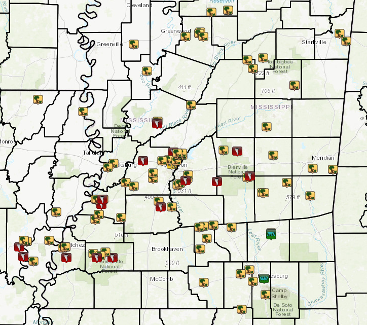

Click on the location in the table for additional maps and details
| Location | Start/ End Time |
Event Type | Fatalities/ Injuries |
Path Length | Path Width |
| Catahoula/Concordia Parish 4 SSW Jonesville to 4 E Jonesville |
1:23 AM - 1:33 AM |
EF-1 Tornado 110 mph |
1 injury | 7.7 miles | 900 yards |
| Concordia/Catahoula Parish 8 NNE Larto to 9 NE Larto |
1:30 AM - 1:32 AM |
EF-1 Tornado 90 mph |
none | 1.1 miles | 150 yards |
| Adams County 4 NNW Sibley |
2:04 AM - 2:11 AM |
EF-1 Tornado 105 mph |
none | 5.2 miles | 250 yards |
| Adams County 1 W Morgantown to Morgantown |
2:09 AM - 2:10 AM |
EF-2 Tornado 115 mph |
none | 1 mile | 200 yards |
| Claiborne County 1 N Port Gibson to 1 NNE Port Gibson |
2:30 AM - 2:32 AM |
EF-1 Tornado 105 mph |
none | 1.1 miles | 200 yards |
| Claiborne County 4 N Port Gibson to 5 NE Port Gibson |
2:31 AM - 2:36 AM |
EF-1 Tornado 107 mph |
1 fatality, 2 injuries |
3.3 miles | 200 yards |
| Franklin County 4 SE Roxie to 7 N Bude |
2:39 AM - 3:01 AM |
EF-1 Tornado 100 mph |
none | 13.7 miles | 400 yards |
| Hinds County 4 W Bolton to 4 WNW Bolton |
3:00 AM - 3:02 AM |
EF-0 Tornado 74 mph |
none | 0.9 miles | 150 yards |
| Yazoo County 5 N Bentonia to 6 NNE Bentonia |
3:02 AM - 3:07 AM |
EF-1 Tornado 95 mph |
none | 4.0 miles | 560 yards |
| Franklin County 9 SSE Union Church to 7 SE Union Church |
3:10 AM - 3:14 AM |
EF-1 Tornado 95 mph |
none | 3.0 miles | 500 yards |
| Copiah County 3 S Crystal Springs to 4 SE Crystal Springs |
3:29 AM - 3:32 AM |
EF-0 Tornado 75 mph |
none | 2.5 miles | 200 yards |
| Madison County 4 WNW Ridgeland to 3 WNW Ridgeland |
3:33 AM - 3:35 AM |
EF-1 Tornado 88 mph |
none | 1.3 miles | 300 yards |
| Rankin County 4 ENE Florence to 6 SSW Brandon |
3:53 AM - 3:57 AM |
EF-0 Tornado 75 mph |
none | 2.8 miles | 200 yards |
| Scott County 7 NNE Morton to 10 NNE Forest |
4:20 AM - 4:32 AM |
EF-1 Tornado 95 mph |
none | 9.45 miles | 550 yards |
| Scott County 3 SW Polkville to 1 ENE Polkville |
4:28 AM - 4:34 AM |
EF-1 Tornado 100 mph |
none | 4.5 miles | 300 yards |
| Smith County 14 NE Raleigh |
4:59 AM | Straight line winds 62 mph |
none | none | none |
| Smith/Scott County 15 NE Raleigh to 11 NW Forest |
5:01 AM - 5:06 AM |
EF-1 Tornado 88 mph |
none | 4.09 miles | 150 yards |
| Winston County 11 ESE Louisville |
5:22 AM - 5:25 AM |
EF-0 Tornado 80 mph |
none | 2 miles | 75 yards |
Catahoula/Concordia Parish EF-1 Tornado
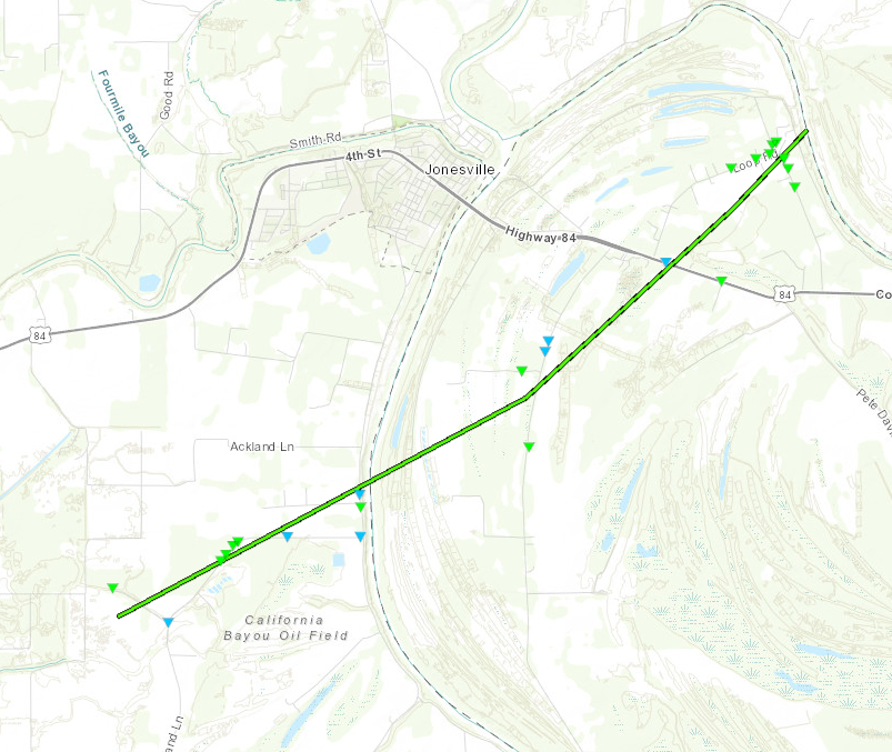
Click on map above to see entire damage point notation and damage pictures at select points.
|
Track Summary This tornado touched down near the intersection of Lana Lane and Peachland Lane where numerous hardwood trees were snapped or uprooted resulting in minor damage to a single family home and large shed/carport. As the tornado tracked northeastward along Peachland lane, it caused widespread major damage to a pecan orchard and a few large farm buildings. The owner of the orchard is facing significant losses to his pecan crop and has had to hire temporary help to salvage as much as he can before the rainy season begins. From there the tornado continued northeastward through mostly open farmland, eventually crossing Highways 124, 565, and 84 where additional hardwood tree damage was sustained along with a couple of snapped wooden power poles. The most significant damage occurred with a cluster of homes located north of Highway 84 in the Chevey Chase community, along Loop Road and at the intersection of Gregory and Grisby Roads. In this area, two mobile homes sustained significant damage with one well-anchored home being shifted off its foundation while another well-anchored home was lifted up and then rolled over on its side. A family was inside the latter home, and one member interviewed by the survey team described a harrowing experience that resulted in another family member fracturing their arm. Other injuries were limited to minor scrapes and bruises. Other single family homes in the area had minor roof damage and significant damage to sheds. The highest rating of high-end EF-1 with an estimated maximum wind speed of 110 mph was based on the mobile home damage, and this was generally consistent with the degree of tree damage along the entire track. While the wooden power poles could technically fit EF-2 strength, their age and integrity did not impress the survey team. |
|
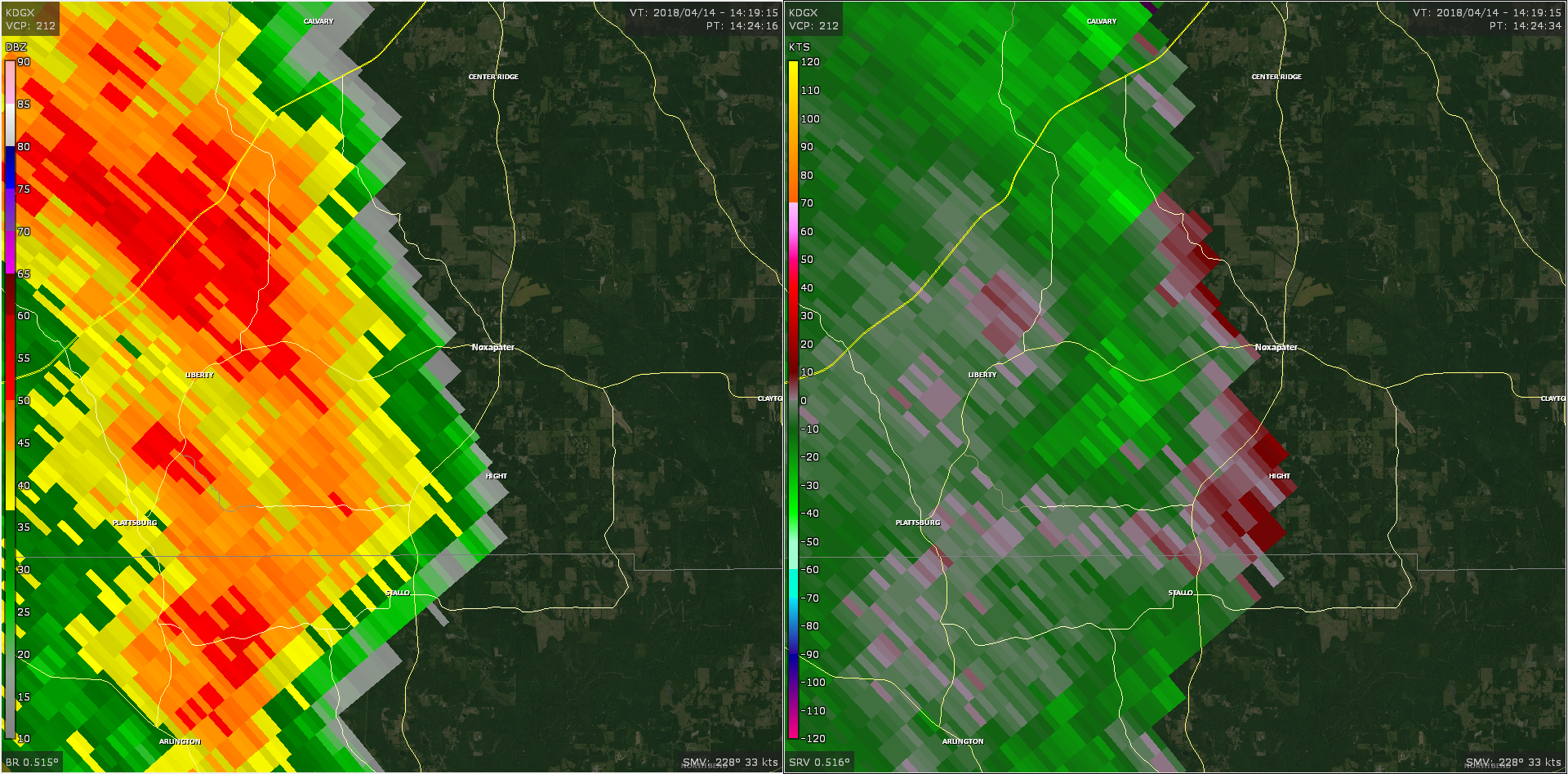
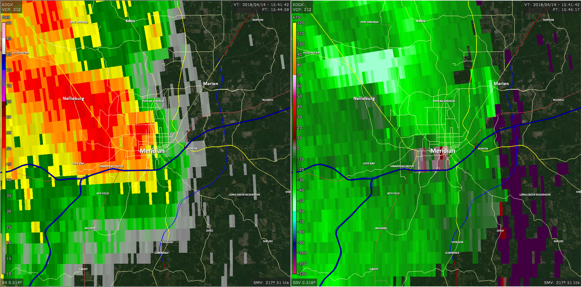
Radar Imagery
These images from the Fort Polk, LA Doppler radar show the storm at 1:30 am as the tornado crossed US Hwy 84. The image on the left shows 0.5° base reflectivity data, and the image on the right shows 0.5° storm relative velocity data. Click on the thumbnail below for a higher resolution image.

Concordia/Catahoula Parish EF-1 Tornado
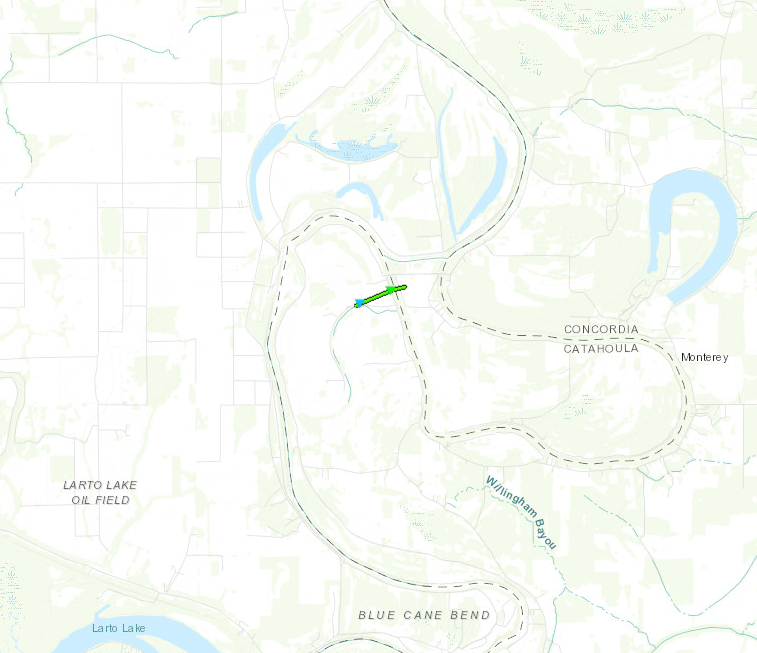
Click on map above to see entire damage point notation and damage pictures at select points.
|
Track Summary This brief, weak tornado touched down along Herbert Crouch Road where it brought down large limbs. It uprooted a few hardwood trees as it tracked east-northeast across Highway 3203 and into Catahoula Parish, and this is where it is estimated that the maximum winds of 90 mph occurred resulting in an EF-1 rating. The tornado finally crossed Buddy Tims Road and produced roof damage to a single family home along with additional tree damage before lifting. |
|
Click on map above to see entire damage point notation and damage pictures at select points.
|
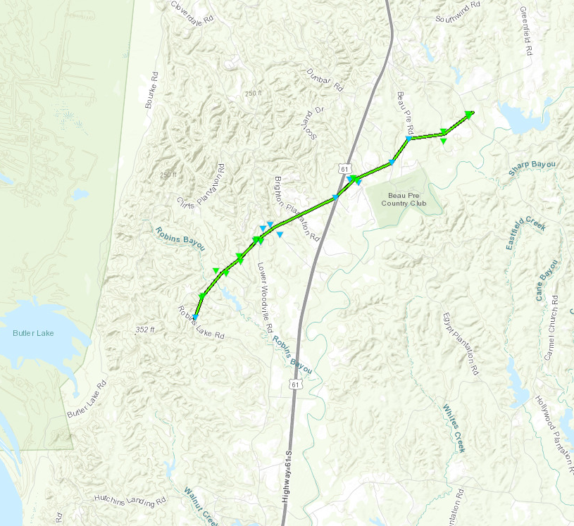
Track Summary This tornado developed along Robins Lake Rd and moved northeastward across Deer Lake Rd, Timberlake Rd, Lower Woodville Rd, and Grove Acres Rd before crossing US Highway 61. It continued through the Meadows subdivision and passed north of the Beau Pre Country Club before crossing Cherry Grove Plantation Road and ending just beyond Kingston Rd. Along the path, numerous trees were snapped or uprooted. About 3/4 of the roof of a home was removed along Robins Lake Rd. On Lower Woodville Rd, a mobile home was shifted off its foundation, had multiple windows broken, and had some walls removed with debris blown downwind. There was another home with roofing material removed at this location. |
|
Click on map above to see entire damage point notation and damage pictures at select points.
|
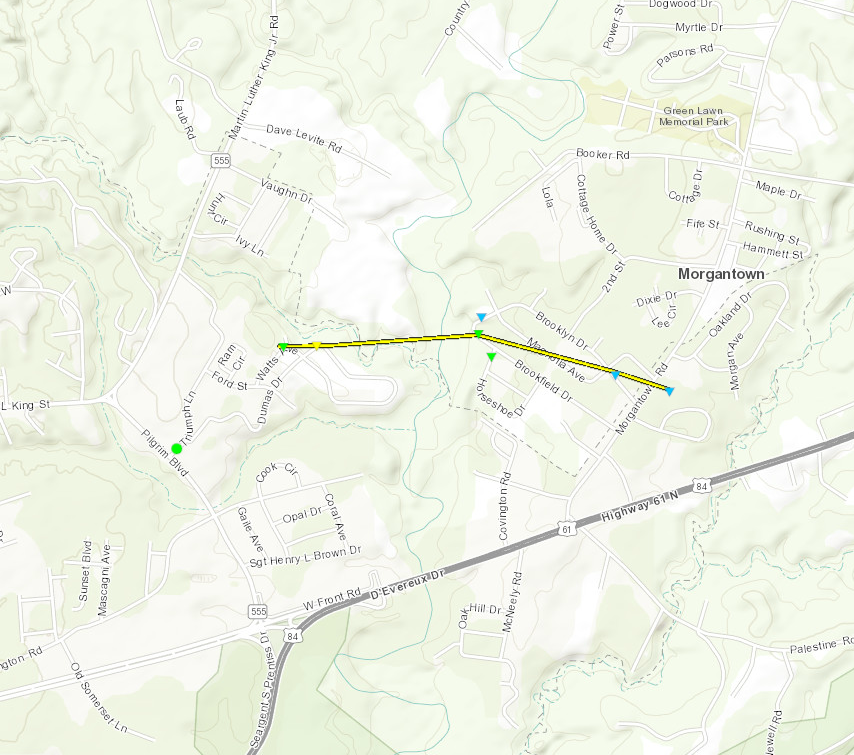
Track Summary This tornado developed along a line of severe thunderstorms that progressed from southwest to northeast across Adams County during the early morning hours. The tornadic damage was mainly seen between Highway 61 and Morgantown Road, along the north side of Natchez, Mississippi. Only a few shingles were removed from the majority of homes, however downed power lines, snapped utility poles and snapped trees bore strong characteristics of tornado damage. Additionally, it was the loss of over 50 percent of a roof of a single home that led to the EF-2 rating. |
|
Click on map above to see entire damage point notation and damage pictures at select points.
|
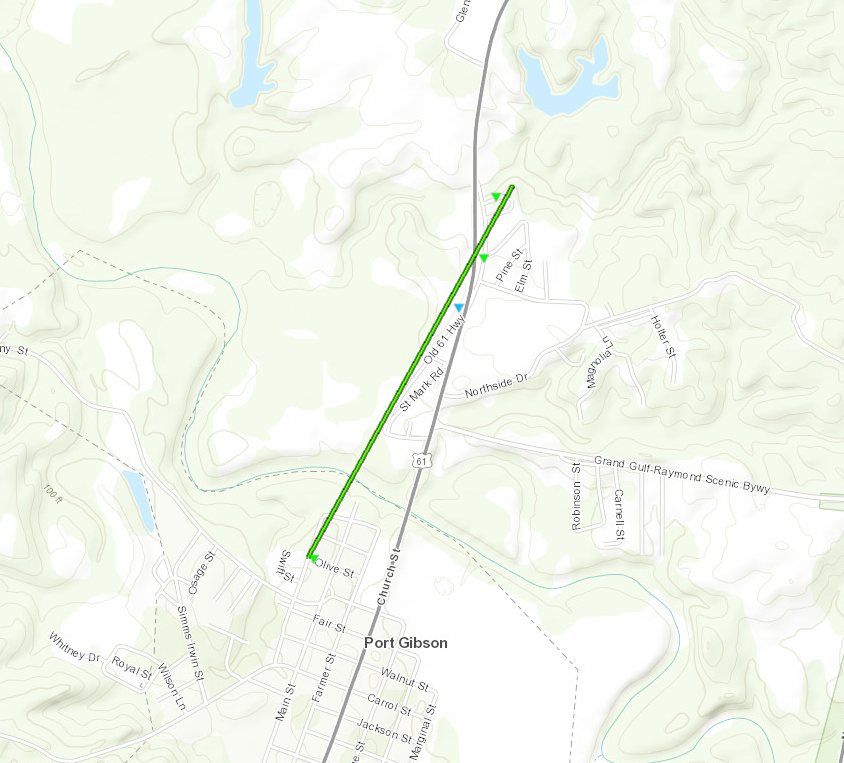
Track Summary This tornado developed along a line of severe thunderstorms that progressed from southwest to northeast across Claiborne County during the early morning hours. This particular tornado track to the north-northeast along Highway 61 after starting on the northern fringe of downtown Port Gibson. Some minor to moderate structural damage occurred in the confines of the city, but otherwise damage was limited to snapped hardwood trees. |
|
Click on map above to see entire damage point notation and damage pictures at select points.
|
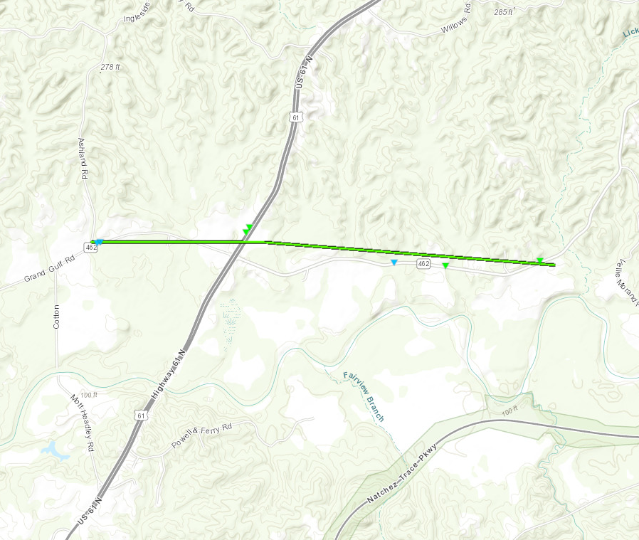
Track Summary This tornado developed along a line of severe thunderstorms that progressed from west to east across Claiborne County during the early morning hours. A fatality involving a vehicle occupant occurred as the vehicle ran into a tree falling in front of their car as the tornado crossed Highway 61. Otherwise, damage was mainly limited to hardwood and softwood trees as the tornado traveled from west to east near and parallel to County Road 462 and crossing Highway 61 about a mile into its path. |
|
Click on map above to see entire damage point notation and damage pictures at select points.
|
Track Summary The tornado began along Knoxville Rd and traveled northeast through a very forested area. It did mostly tree damage along its entire path. A mobile home was blown off of its blocks on Bedford Rd. It was in this area that the tornado was its strongest and caused lots of tree damage in the area. The tornado continued northeast for a few miles before dissipating near New Hope Rd. |
|
Radar Imagery
These images from the Brandon, MS Doppler radar show the storm at 2:50 am as the tornado moved across Bedford Rd. The image on the left shows 0.5° base reflectivity data, and the image on the right shows 0.5° storm relative velocity data. Click on the thumbnail below for a higher resolution image.

Click on map above to see entire damage point notation and damage pictures at select points.
|
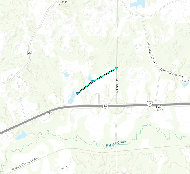
Track Summary This brief and weak tornado began just north of Interstate Twenty on Clover Hill Circle where the metal roof was blown off an outbuilding. The tornado continued northeast to South Farr Road but no evidence of tornadic damage was found after this point. Aside from the mentioned structural damage most of the damage was limited to trees mainly in the form of downed large limbs. |
|
Click on map above to see entire damage point notation and damage pictures at select points.
|
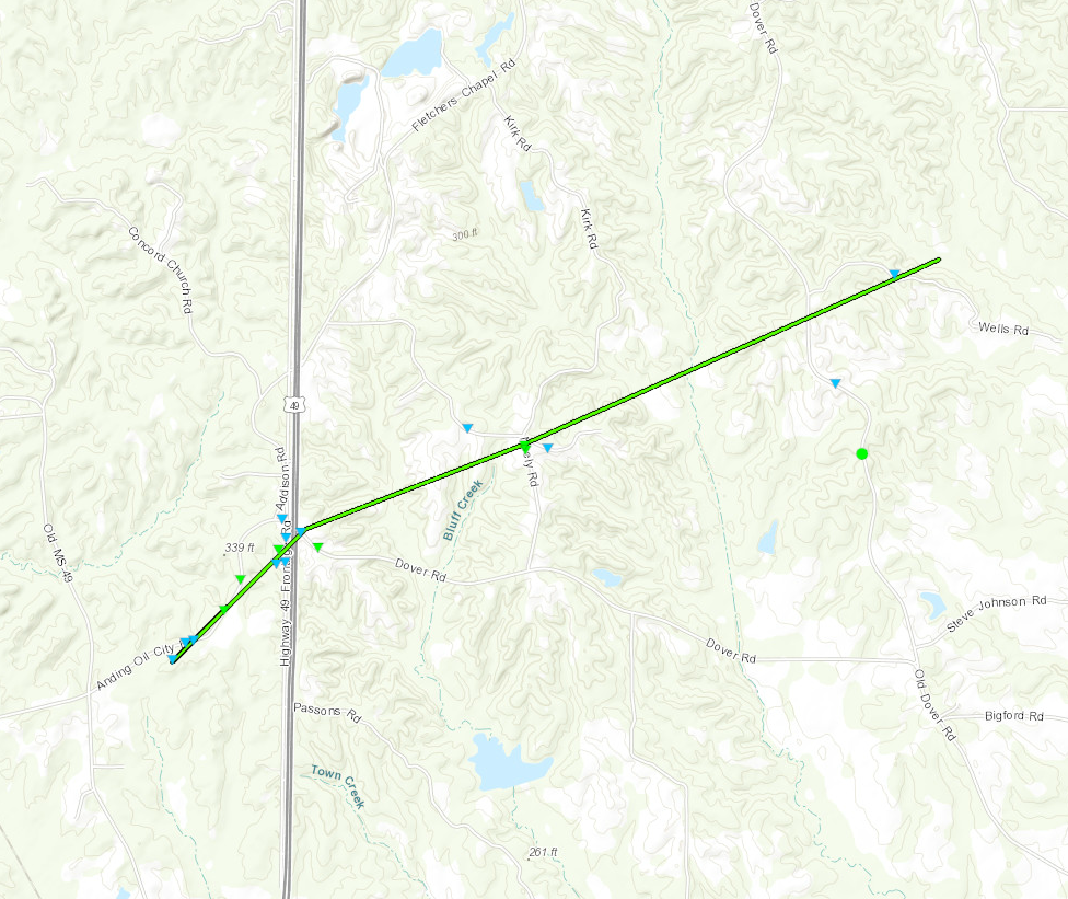
Track Summary This tornado touched down just south of Anding Oil City Road. It traveled east-northeast while crossing Anding Oil City Road a couple of times while snapping tree limbs and a few tree trunks. When the tornado reached Highway 49, it did minor damage to a few businesses and a church, along with uprooting several large trees in the area. It continued northeast from there and did more tree damage before dissipating just past Wells Road. |
|
Radar Imagery
These images from the Brandon, MS Doppler radar show the storm at 3:05 am as the tornado moved across Neely Rd. The image on the left shows 0.5° base reflectivity data, and the image on the right shows 0.5° storm relative velocity data. Click on the thumbnail below for a higher resolution image.

Northeast Franklin County EF-1 Tornado
Click on map above to see entire damage point notation and damage pictures at select points.
|
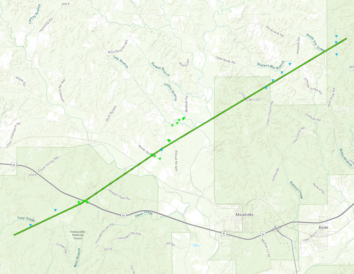
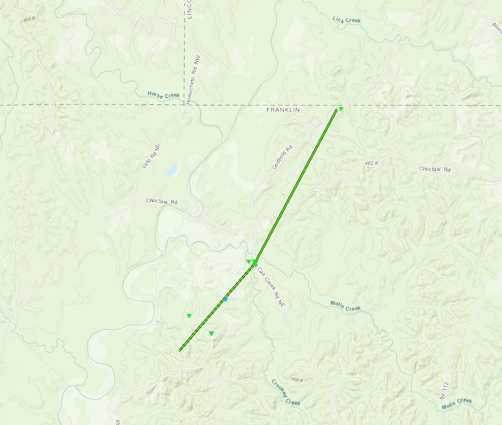
Track Summary The tornado touched down between the Homochitto River and Neal Posey Road and moved northeast toward the intersection with McCall Creek Road. There, several trees were snapped or uprooted, including one large tree which partially destroyed a chicken coop. The tornado continued to produce intermittent tree damage before lifting near the Franklin-Lincoln county line. |
|
Click on map above to see entire damage point notation and damage pictures at select points.
|
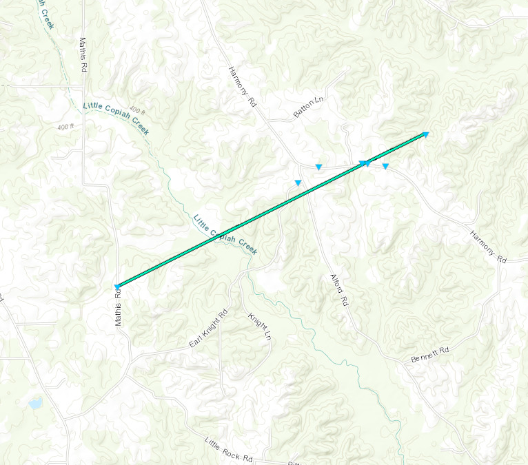
Track Summary This tornado developed along a line of severe thunderstorms that progressed from southwest to northeast across Copiah County during the early morning hours. The tornado touched down along Mathis Road south of Crystal Springs where it blew several small tree limbs down. It moved northeast toward the intersection of Alford and Harmony Roads where damage included large tree limbs downed and several trees uprooted and snapped. One tree fell onto a home along Harmony Road. The tornado lifted just east of Harmony Road. |
|
Radar Imagery
These images from the Brandon, MS Doppler radar show the storm at 3:30 am as the tornado moved across Harmony Rd. The image on the left shows 0.5° base reflectivity data, and the image on the right shows 0.5° storm relative velocity data. Click on the thumbnail below for a higher resolution image.

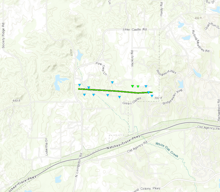
Click on map above to see entire damage point notation and damage pictures at select points.
|
Track Summary This brief and weak tornado occurred between North Livingston Road and Bridgewater subdivision. A few dozen trees were snapped and uprooted with numerous large limbs broken. Peak intensity was noted at the south end of Hickory Road where several hardwood trees were snapped. The tornado moved to the east and a large majority of the trees were downed to the north and northeast. |
|
Click on map above to see entire damage point notation and damage pictures at select points.
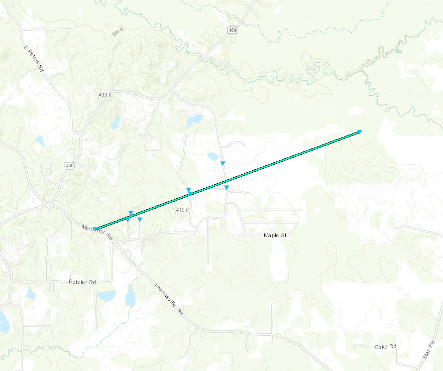
|
Track Summary This weak tornado developed along a line of severe thunderstorms that progressed from west to east across Rankin County during the early morning hours. The tornadic damage was mainly limited to large limbs and branches torn from various hardwood and softwood trees along the path. The path began in the Monterey community along Monterey Road and then continued east northeast before ending half a mile short of Dry Creek. |
|
Radar Imagery
These images from the Brandon, MS Doppler radar show the storm at 3:53 am as the tornado crossed Grandview Dr. The image on the left shows 0.5° base reflectivity data, and the image on the right shows 0.5° storm relative velocity data. Click on the thumbnail below for a higher resolution image.

Click on map above to see entire damage point notation and damage pictures at select points.
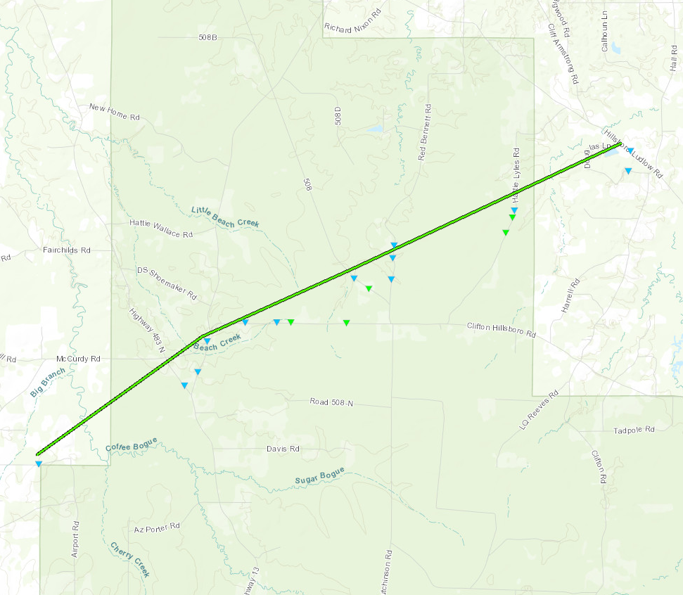
|
Track Summary A tornado developed along a line of severe thunderstorms, where it moved northeast across northwest Scott county, and caused numerous broken snapped pine tree limbs. This debris was initially noted along Gordon Road or west of US 13. However, as it began to track east-northeast, tornadic signatures became more prevalent with both softwood and hardwood tree trunks being snapped along Clifton Hillsboro Road, east of US 13. Thereafter, it commenced to track northeast and cross Hattie Lyles Road where additional snapped hardwood trees were noted. As it reached Hillsboro Ludlow Road, well west of Highway 35, it weakened considerable as it snapped only a few softwood tree limbs. |
|
Radar Imagery
These images from the Brandon, MS Doppler radar show the storm at 4:25 am as the tornado moved across Clifton Hillsboro Rd. The image on the left shows 0.5° base reflectivity data, and the image on the right shows 0.5° storm relative velocity data. Click on the thumbnail below for a higher resolution image.
Click on map above to see entire damage point notation and damage pictures at select points.
|
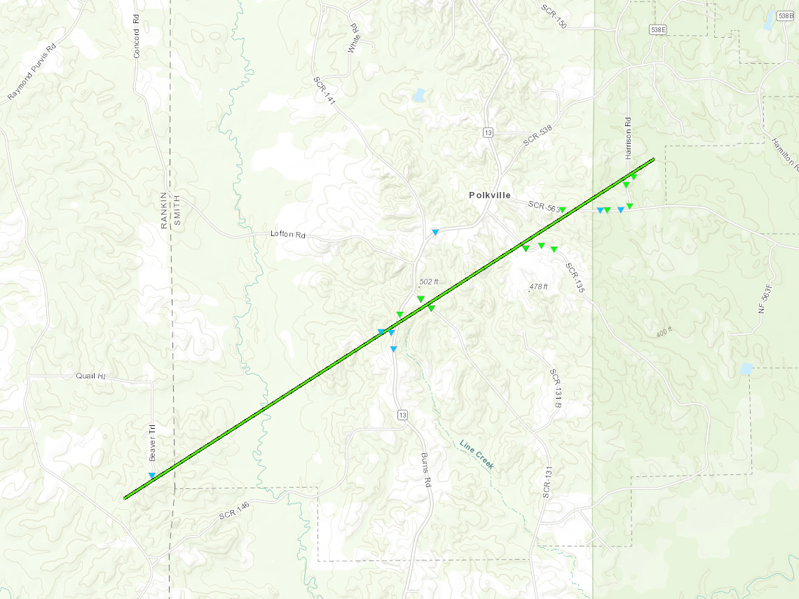
Track Summary The tornado began in the forest just west of the Rankin/Smith County line where it snapped some small pines in half along Beaver Trail. The tornado traveled northeast into Smith County and snapped some large limbs along Hwy 13 just south of Polkville. One of the limbs there fell on part of a mobile home and did some minor roof damage. As it traveled northeast, it tore the roof off of a metal shed on County Road 563 along with doing some more tree damage. It continued past Harrison Rd before dissipating back in the woods. |
|
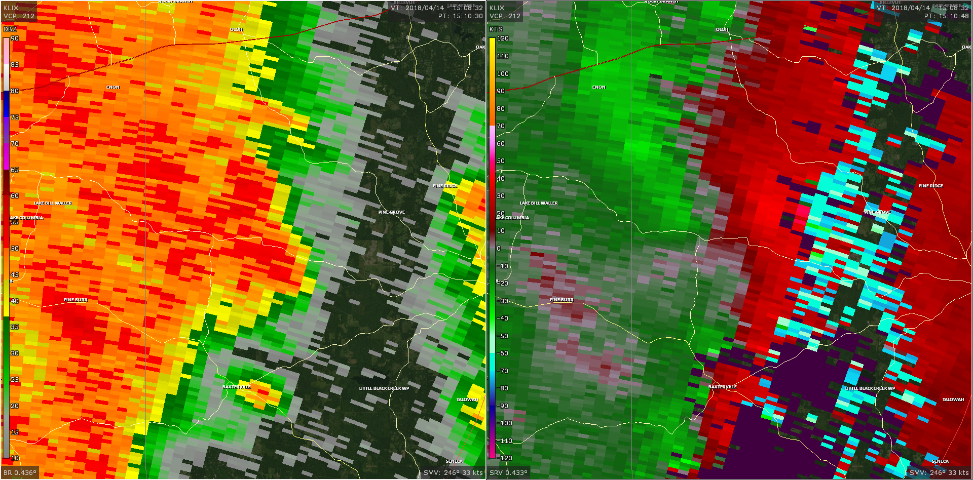
Radar Imagery
These images from the Brandon, MS Doppler radar show the storm at 4:30 am as the tornado moved towards Polkville. The image on the left shows 0.5° base reflectivity data, and the image on the right shows 0.5° storm relative velocity data. Click on the thumbnail below for a higher resolution image.
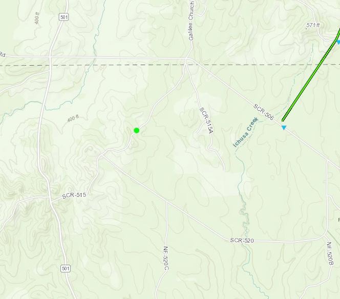
Smith County Straight-Line Winds

Click on map above to see entire damage point notation and damage pictures at select points.
|
Track Summary A line of severe thunderstorms were moving southwest to northeast across Smith county. Its associated wind gust resulted in several snapped softwood trees mainly along Country Road 515. |
|
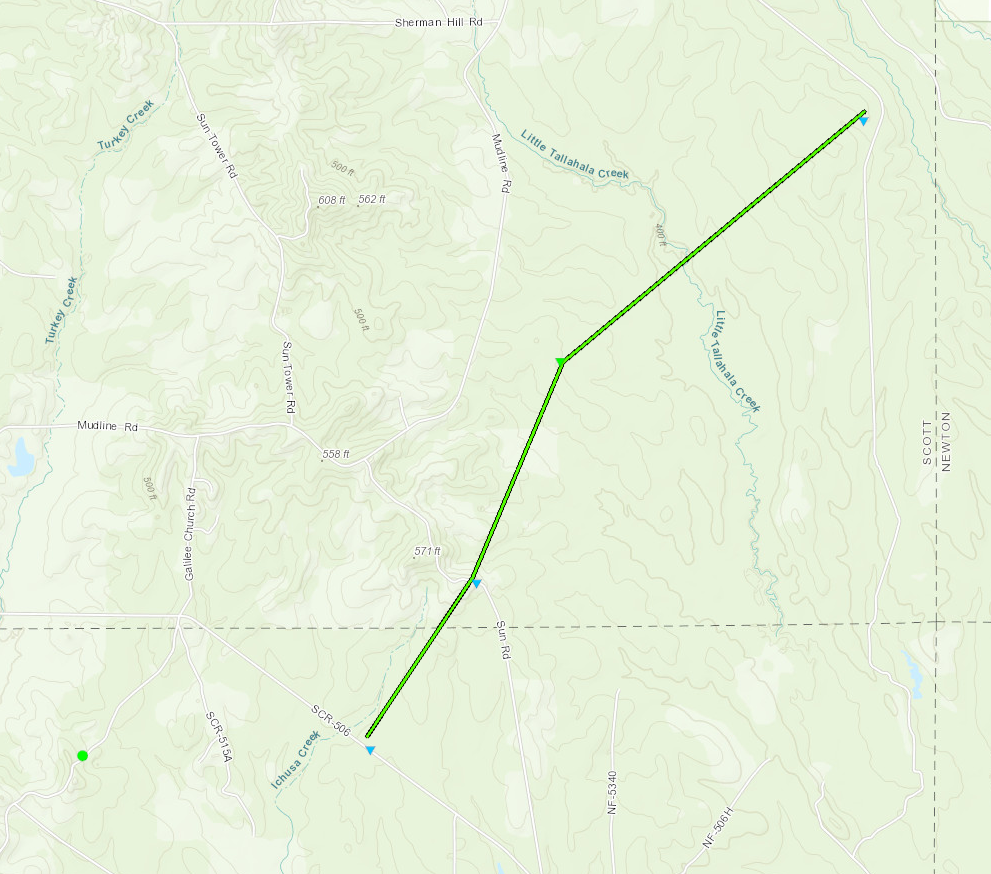
Smith/Scott County EF-1 Tornado
Click on map above to see entire damage point notation and damage pictures at select points.
|
Track Summary A line of severe thunderstorms produced a tornado, that moved from southwest to northeast, across rural northeast Smith County to across rural southeast Scott County. This tornado caused large tree limbs and trunks to snap. A large pine tree that snapped near its base, fell across County Road 551C and completely blocked the roadway. |
|
Radar Imagery
These images from the Brandon, MS Doppler radar show the storm at 5:04 am as the tornado moved through southeast Scott County. The image on the left shows 0.5° base reflectivity data, and the image on the right shows 0.5° storm relative velocity data. Click on the thumbnail below for a higher resolution image.
Click on map above to see entire damage point notation and damage pictures at select points.
|
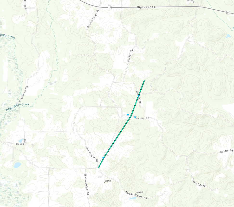
Track Summary This tornado began near the intersection of Ellison Ridge Rd and Moody Nance Rd and tracked north- northeastward paralleling Ellison Ridge Rd, then crossing Sardis Rd and Hemphill Rd before ending in an open field of recently harvested trees. Along the path, trees were uprooted and there was minor damage to an outbuilding and the roof and front exterior of a house. |
|

