February 7, 2018 Severe Weather Event
Tornado Track Map

Local Storm Reports
Click on the map for additional details.


Click on the location in the table for additional maps and details below.
| Location | Start/ End Time |
Event Type | Fatalities/ Injuries |
Path Length | Path Width |
| Lauderdale County 6 SW of Suqualena to 3 SE of Suqualena |
04:15 AM - 04:26 AM |
EF-1 Tornado 110 mph |
none | 8.0 miles | 300 yards |
Lauderdale County EF-1 Tornado
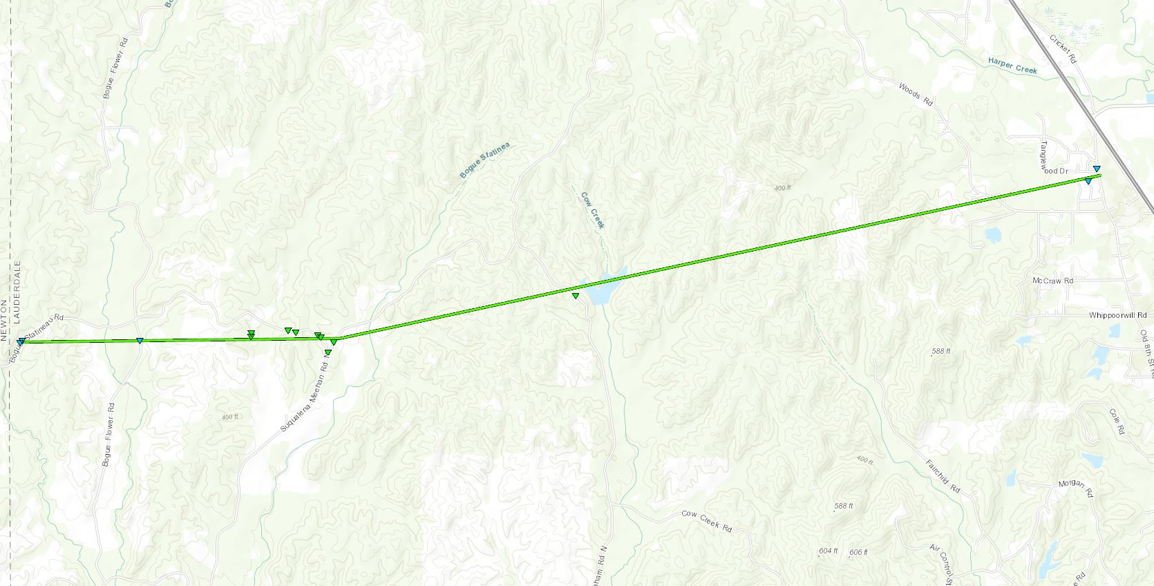
Click on map above to see entire damage point notation and damage pictures at select points.
|
Track Summary This tornado touched down along Bogue Statinea Road and tracked east-northeast for roughly 8 miles. The initial damage was a few uprooted and snapped pine trees from touchdown and as it crossed Bogue Flower Road. The intensity increased as the tornado crossed some private property just west of the intersection of Bogue Statinea Road and Suqualena Meehan Road. Here part of a roof of a metal barn was removed with a large metal truss thrown onto a framed house. Roof damage was sustained to this home along with portions of the shed heavily damaged. Heavier tree damage was also noted here as the tornado crossed a pasture. The most intense damage occurred in and around the intersection of Bogue Statinea Road and Suqualena Meehan Road. Here numerous trees were snapped and uprooted along with several power lines and poles downed. A travel trailer was rolled and small shed was destroyed. A few other structures sustained minor damage here as well. The tornado continued to the east-northeast and weakened a fair amount as it crossed Suqualena Graham and Woods Roads. In the Tanglewood neighborhood, minor damage occurred from a few downed trees and snapped limbs to homes and a trampoline was thrown. The tornado dissipated just at Highway 19. |
|

