Jackson, Mississippi
Weather Forecast Office
January 22, 2018 Severe Weather Event
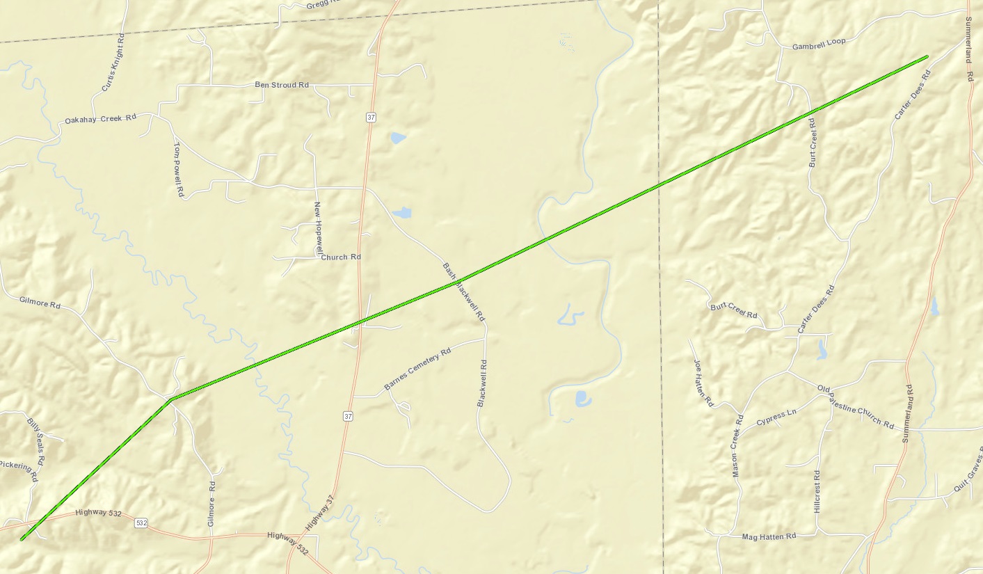
Tornado Track Map

Local Storm Reports
Click on the map for additional details.


Click on the location in the table for additional maps and details below.
| Location | Start/ End Time |
Event Type | Fatalities/ Injuries |
Path Length | Path Width |
| Covington-Jones County 7 SSW of Taylorsville to 5 SE of Taylorsville |
09:16 AM - 09:30 AM |
EF-1 Tornado 100 mph |
Injuries: 1 | 7.51 miles | 250 yards |
Covington-Jones County EF-1 Tornado
Click on map above to see entire damage point notation and damage pictures at select points.
|
Track Summary An EF-1 tornado touched down in northeast Covington County along Highway 532 causing minor tree damage as it tracked northeast towards Gilmore Road. As the tornado continued its northeast track, it became its strongest as it approached Hwy 37 near J. Nelson Drive and Jewel Owens Lane. At this location the tornado uprooted and snapped several large trees and damaged a few structures, including homes. The tornado continued into northwest Jones County where a double wide mobile home was pushed off of its foundation and 3 sheds and a barn was destroyed on Carter Dees Road. An occupant of the mobile home suffered a minor injury. The tornado lifted just after this damage occurred. |
|
US Dept of Commerce
National Oceanic and Atmospheric Administration
National Weather Service
Jackson, Mississippi
234 Weather Service Dr.
Flowood, MS 39232
601-936-2189
Comments? Questions? Please Contact Us.

