Banner image courtesy Mark Anderton
Louisville (Leake/Neshoba/Attala/Winston County) EF-4 Tornado

Click on map above to see entire damage point notation and damage pictures at select points.
|
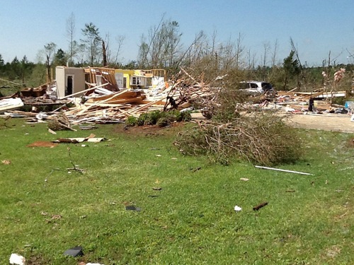
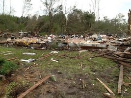
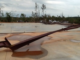
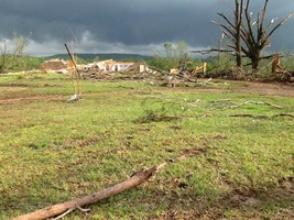
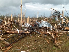
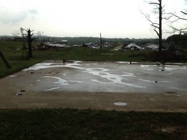
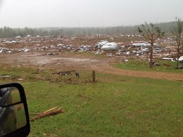
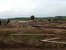
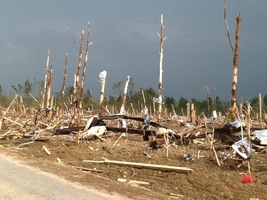
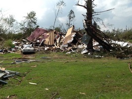
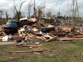
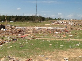
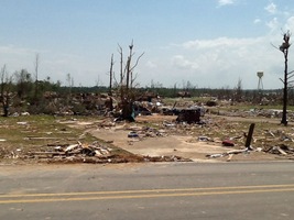
Event Summary At this point, the tornado made a turn to a more northerly course and continued to cause EF2 and EF3 damage just south of Louisville. The tornado entered the city of Louisville on the south side along Highway 15 and continued north-northeast through the east side of the city. Widespread EF3 and EF4 damage occurred in this area. Of particular note, several industrial buildings were destroyed and an area of homes and apartments was destroyed, a few of them being completely taken down to the slab. The tornado continued through the east side of Louisville causing mainly EF3 damage. Of particular note, the Winston Medical Center received heavy damage and became incapable of use. The tornado continued moving north-northeast roughly along McCullough Road causing EF3 and EF4 damage. Numerous homes had their roofs and walls removed and some were reduced to slabs. Near the intersection with Louisville-Brooksville Road, two particularly well built homes were very heavily damaged and received EF4 ratings. From this point, the tornado began to weaken, causing mainly EF2 and EF3 damage along North Columbus Avenue. As it approached a second intersection with Highway 25, the tornado lifted after traveling on the ground for over 34 miles. |
|
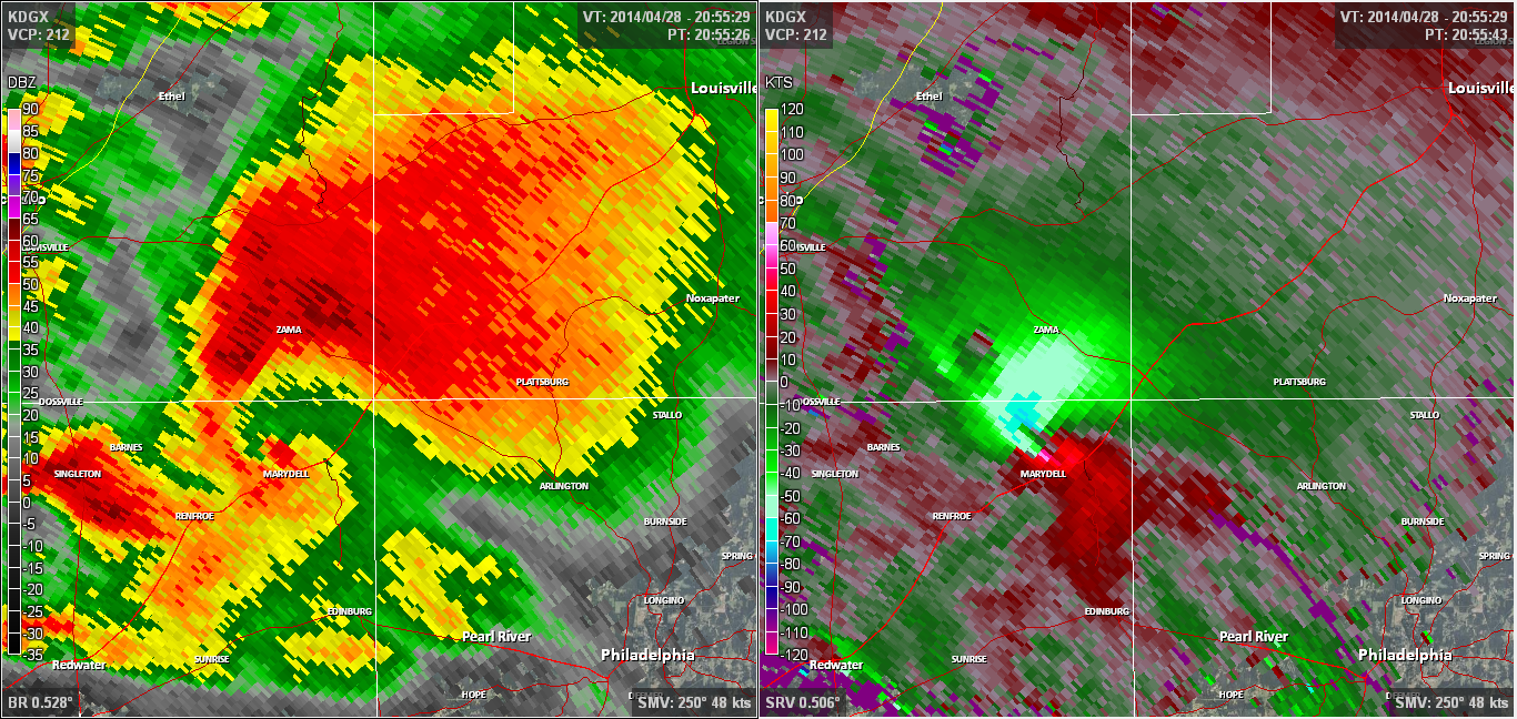
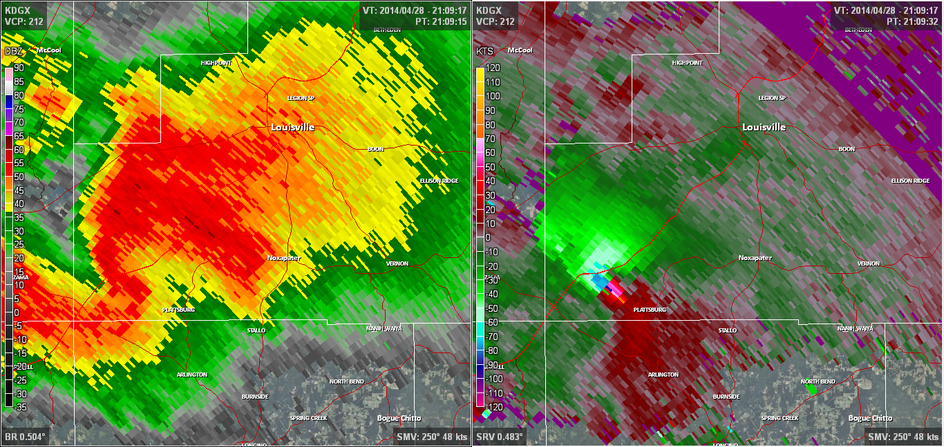
Radar Imagery

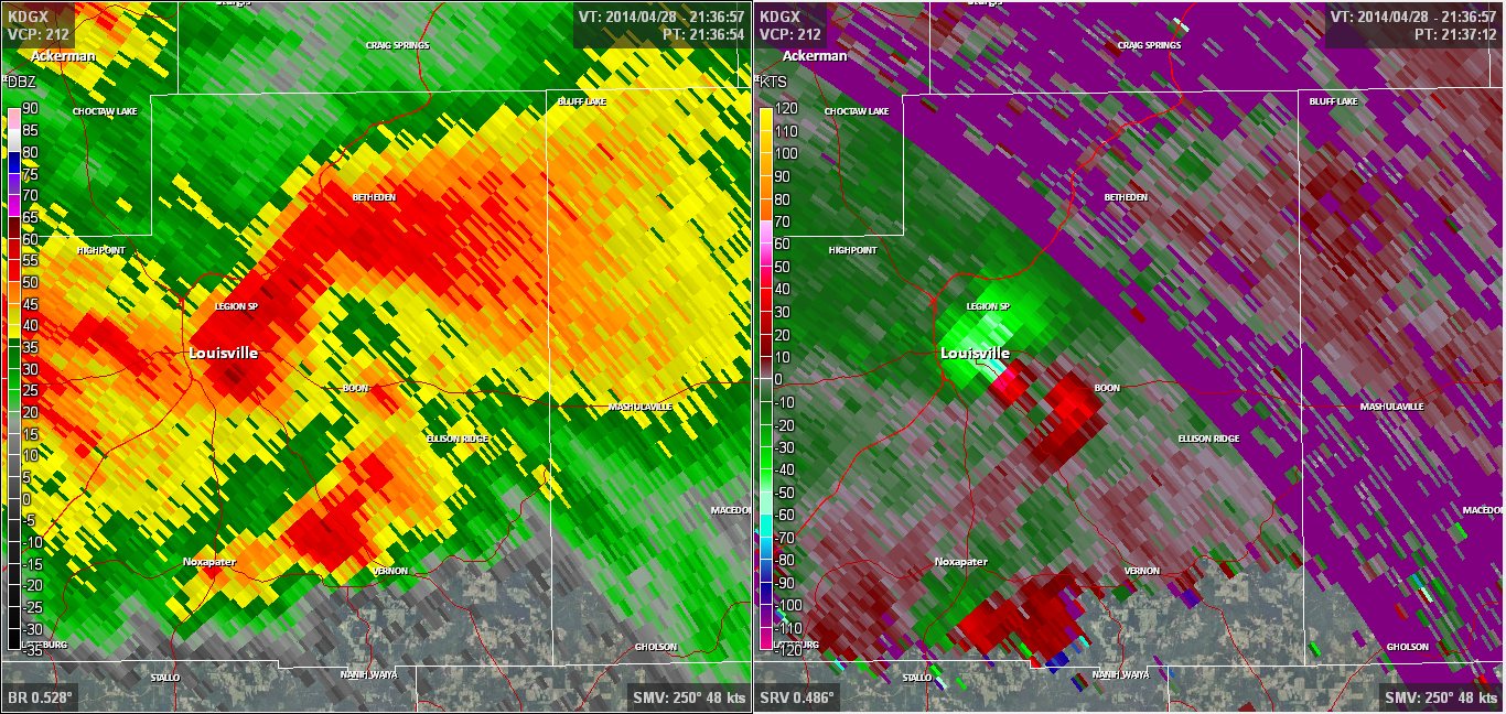
These images from the Brandon, MS Doppler radar show the storm at 3:55 pm. The image on the left shows 0.5° base reflectivity data, and the image on the right shows 0.5° storm relative velocity data. Click on the thumbnail below for a higher resolution image.
These images from the Brandon, MS Doppler radar show the storm at 4:09 pm. The image on the left shows 0.5° base reflectivity data, and the image on the right shows 0.5° storm relative velocity data. Click on the thumbnail below for a higher resolution image.
These images from the Brandon, MS Doppler radar show the storm at 4:23 pm. The image on the left shows 0.5° base reflectivity data, and the image on the right shows 0.5° storm relative velocity data. Click on the thumbnail below for a higher resolution image.

These images from the Brandon, MS Doppler radar show the storm at 4:36 pm, just before the tornado began. The image on the left shows 0.5° base reflectivity data, and the image on the right shows 0.5° storm relative velocity data. Click on the thumbnail below for a higher resolution image.
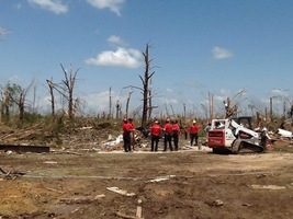
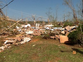
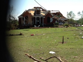
Damage Photos
|
Before |
After |
|
|
 |
 |
 |
 |
 |
 |
 |
 |
 |
 |
 |
 |
 |
 |