Banner image courtesy Mark Anderton
Richland-Pearl-Brandon-Pelahatchie (Hinds/Rankin/Scott County) EF-3 Tornado
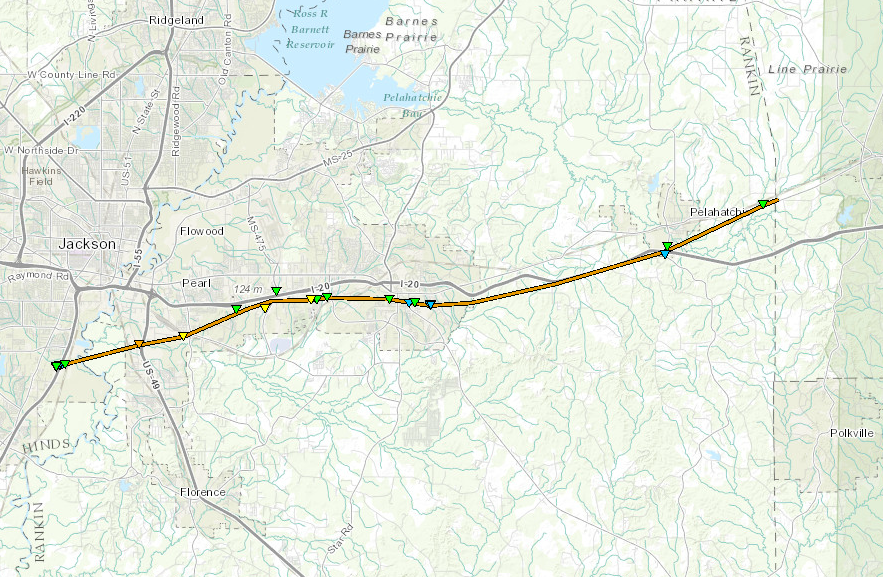
Click on map above to see entire damage point notation and damage pictures at select points.
|
Event Summary
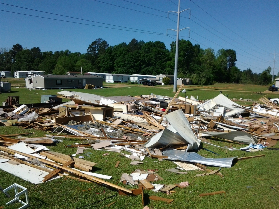
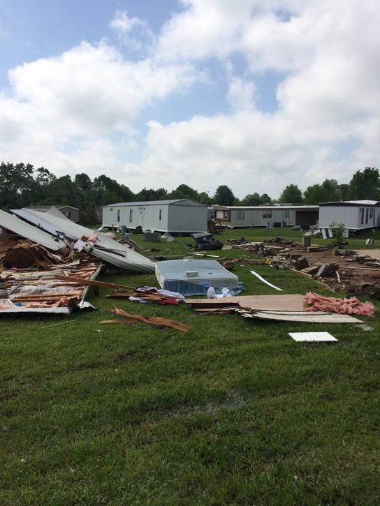
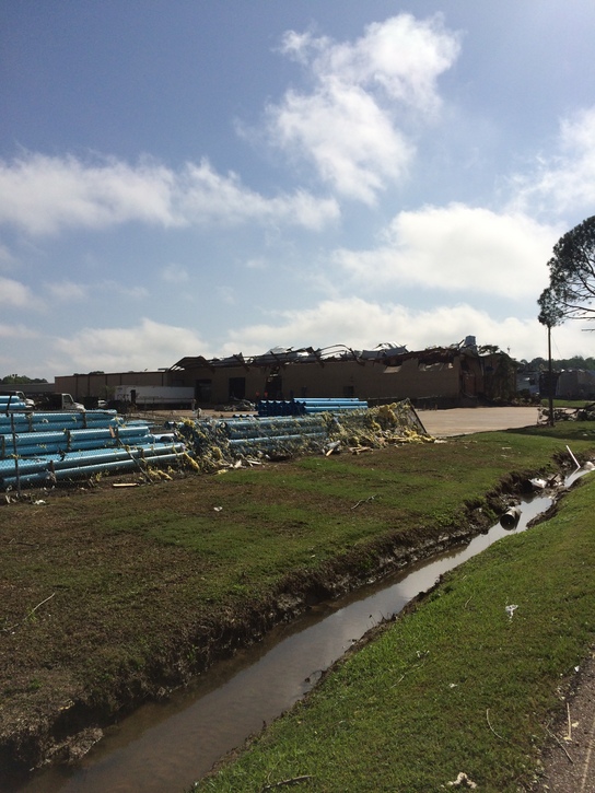
This tornado initially developed just inside Hinds County along I-55 north of the Elton Road exit, where it caused some damage to a business and some trees. The tornado became intense just after crossing the Pearl River and moving into Rankin County, where it caused heavy damage to a number of commercial and industrial buildings in Richland and Pearl. EF-3 damage occurred in this area. One person was killed when the tornado picked up and threw her car when it crossed US Highway 49 in Richland. The tornado continued across more residential areas of Pearl, snapping and uprooting many trees and damaging some homes. Much of this damage was of an EF-1 intensity. As the tornado approached the Brandon city limits, it reintensified and caused high end EF-2 damage in a mobile home park near the border between Brandon and Pearl. It also caused significant roof damage to an auto dealership in Brandon and lesser damage to several other businesses. The tornado then moved across central areas of Brandon, snapping and downing a number of trees and causing some damage at the Brandon Middle School campus. The tornado continued east-northeast, passing just north of Shiloh Park, downing and snapping a number of trees in a residential area there. Most of this damage was EF-1 in nature. The tornado continued across more rural areas of Rankin County. It then crossed I-20 and caused significant damage to a gas station at the Pelahatchie exit. It passed just south of Pelahatchie and dissipated shortly after crossing into Scott County.
|
Rating:
(Click for EF Scale) |
EF-3 |
| Estimated Maximum Wind: |
155 mph |
| Fatalities/Injuries: |
1 fatality and 20 injuries |
| Damage Path Length: |
30.1 miles |
| Maximum Path Width: |
400 yards |
| Approximate Start Point/Time: |
3 W Richland
6:27 pm
|
| Approximate End Point/Time: |
4.5 E Pelahatchie
7:15 pm
|
|
Radar Imagery
These images from the Brandon, MS Doppler radar show the storm at 6:32 pm. The image on the left shows 0.5° base reflectivity data, and the image on the right shows 0.5° storm relative velocity data. Click on the thumbnail below for a higher resolution image.

These images from the Brandon, MS Doppler radar show the storm at 6:45 pm. The image on the left shows 0.5° base reflectivity data, and the image on the right shows 0.5° storm relative velocity data. Click on the thumbnail below for a higher resolution image.

Damage Photos