National Weather Service United States Department of Commerce

April 6, 2014

Neshoba County Tornado

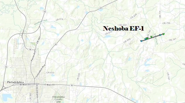
Click on map above to see entire damage point notation and damage pictures at select points.

Event Summary
This tornado first touched along County Road 610, then tracked across County Road 743 and lifted east of County Road 761. A roof was torn off a single family home, the roofs were torn off several mobile homes, several metal outbuildings were heavily damaged and numerous trees were snapped and uprooted. The damage pattern was convergent in nature and several objects were thrown in the opposite direction of the storm’s path.

Rating:
(Click for EF Scale)
EF-1
Estimated Maximum Wind: 95 mph
Fatalities/Injuries: None
Damage Path Length: 1.25 miles
Maximum Path Width: 150 yards
Approximate Start Point/Time:

4 miles WNW Forestdale
7:41 pm

Approximate End Point/Time:

4 miles NW Forestdale
7:43 pm