Jackson, Mississippi
Weather Forecast Office

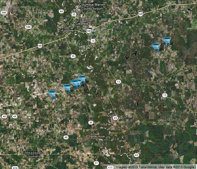
Marion and Lamar County Tornado
Click on Map Above to see entire event tracks and damage point notation
|
Event Summary This tornado started just inside Marion County on New Hope Road. Here a few outbuildings were destroyed. On the east side of the road...a home had a good portion of the roof torn off. The tornado then crossed Hurricane Creek Road then approached Mt Carmel Church Road. Here is where the most intense damage occurred. Three mobile homes were totally destroyed with just the undercarriage left (3 injuries here). Further northeast...the tornado crossed Regan Road where 2 to 4 homes sustained significant roof damage. Numerous trees were snapped or uprooted in this area as well. The tornado weakened as it crossed Hwy 35...but continued to produce low end tree damage across Hwy 13S and Game Reserve Road. Additional damage to structures occurred near the Lamar County line along Columbia-Purvis Road and Powell Lane and Culdesac Drive. The tornado entered Lamar County and caused additional damage to structures with one home off Wiley Lott Road having the roof removed. A number of power poles were snapped in this area as well along with significant tree damage. The tornado dissipated shortly after producing this damage. |
|
US Dept of Commerce
National Oceanic and Atmospheric Administration
National Weather Service
Jackson, Mississippi
234 Weather Service Dr.
Flowood, MS 39232
601-936-2189
Comments? Questions? Please Contact Us.

