Jackson, Mississippi
Weather Forecast Office

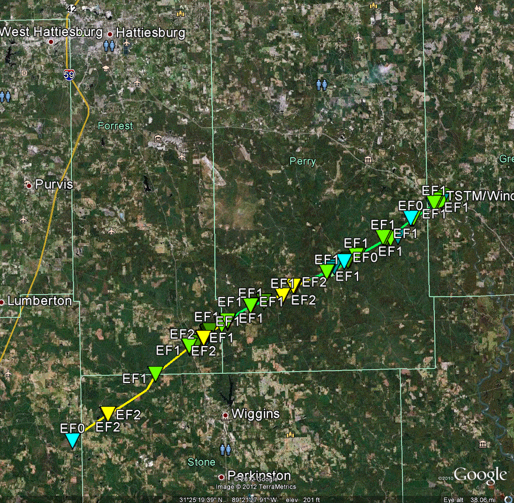
December 25, 2012 Forrest County Tornado
Click on Map Below to View Storm Damage Information
|
Event Summary This is a continuation of a tornado track that began in Pearl River County near McNeill and continued through northwestern Stone County before moving into Forrest County. After passing through Forrest County this tornado continued to produce damage into Perry County. The statistics above pertain to only the portion of the track in Forrest County. For further information please visit: https://www.srh.noaa.gov/lix/past_wx_events and https://www.srh.noaa.gov/mob/events |
|
US Dept of Commerce
National Oceanic and Atmospheric Administration
National Weather Service
Jackson, Mississippi
234 Weather Service Dr.
Flowood, MS 39232
601-936-2189
Comments? Questions? Please Contact Us.

