Jackson, Mississippi
Weather Forecast Office

Bolivar/Sunflower Counties tornado

|
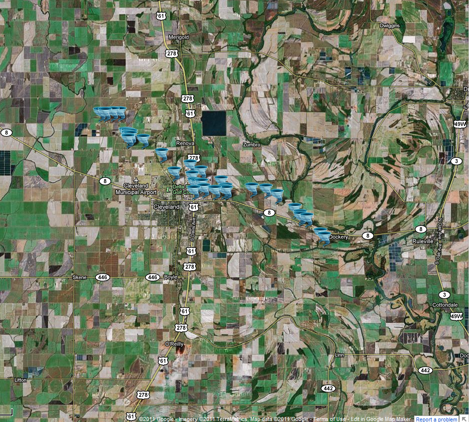
Event Summary The tornado started out producing a relatively narrow path of tree damage along Township Road. It moved southeast through the Stanton subdivision, heavily damaging four trailer homes and caused minor to moderate damage to several other homes and outbuildings. It continued to move southeast causing tree damage, and widened as it moved into the northwest side of the city of Cleveland. As the tornado moved through the north side of Cleveland, it snapped and uprooted numerous trees, blew the signs out of several restaurants and stores, blew the doors out of the automotive area of a department store, and blew out a wall and a large part of a roof of another commercial building. Several homes suffered shingle damage and powerlines were downed. The tornado then turned more eastward, continuing to cause tree damage as it moved along and just north of State Highway 8 east of Cleveland. Additional powerlines were downed and a few more homes suffered minor roof damage due to wind or branches falling on them. As the tornado crossed into Sunflower County it moved more southeast again. It snapped several wooden powerpoles along and just south of Highway 8 along Mallette-Jones Road, along with destroying a greenhouse type structure and causing some roof damage to a frame home. The tornado continued to cause tree damage in a relatively narrow path as it crossed Walker Road, and then dissipated before reaching Lusk Road. |
|
US Dept of Commerce
National Oceanic and Atmospheric Administration
National Weather Service
Jackson, Mississippi
234 Weather Service Dr.
Flowood, MS 39232
601-936-2189
Comments? Questions? Please Contact Us.

