Jackson, Mississippi
Weather Forecast Office

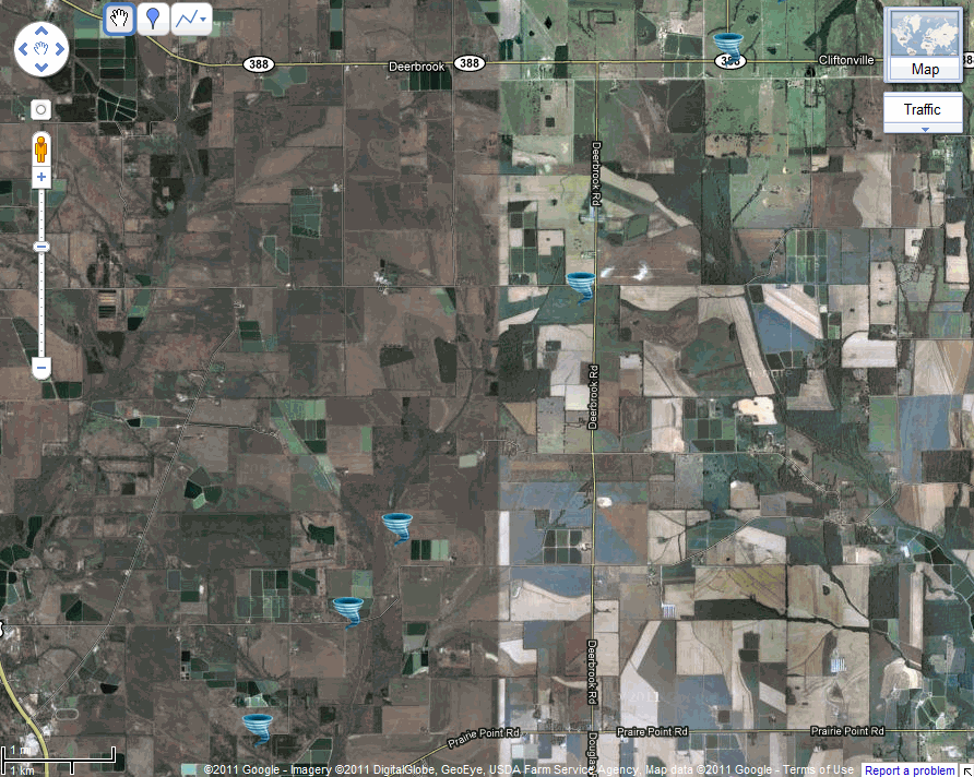
Noxubee County Tornado
|
Event Summary This tornado touched down off Macedonia Cemetery Road and downed a couple of trees and snapped some limbs off others. It then moved across an open field and turned over an irrigation pivot system. The tornado then crossed Buggs Ferry Road and tore down a small grain bin and downed several trees. It then remained over mostly open fields, but continued to down/snap trees. Several of these fields had young corn growing and where the tornado passed, the corn plants had the leaves shredded. Another irrigation system was turned over off Buggs Ferry Road. West of Deerbrook Road, a tall grain silo was damaged. Just before the tornado crossed Deerbrook, a farm was damaged. Two large empty grain bins were destroyed along with a few smaller ones damaged. Four metal sheds sustained minor damage to the doors and roof. A radio tower collapsed as well along with a few trees snapped. The tornado continued northeast and crossed Highway 388 at the intersection of Highway 792 and downed several more trees before dissipating north of Highway 388. |
|
US Dept of Commerce
National Oceanic and Atmospheric Administration
National Weather Service
Jackson, Mississippi
234 Weather Service Dr.
Flowood, MS 39232
601-936-2189
Comments? Questions? Please Contact Us.

