Jackson, Mississippi
Weather Forecast Office

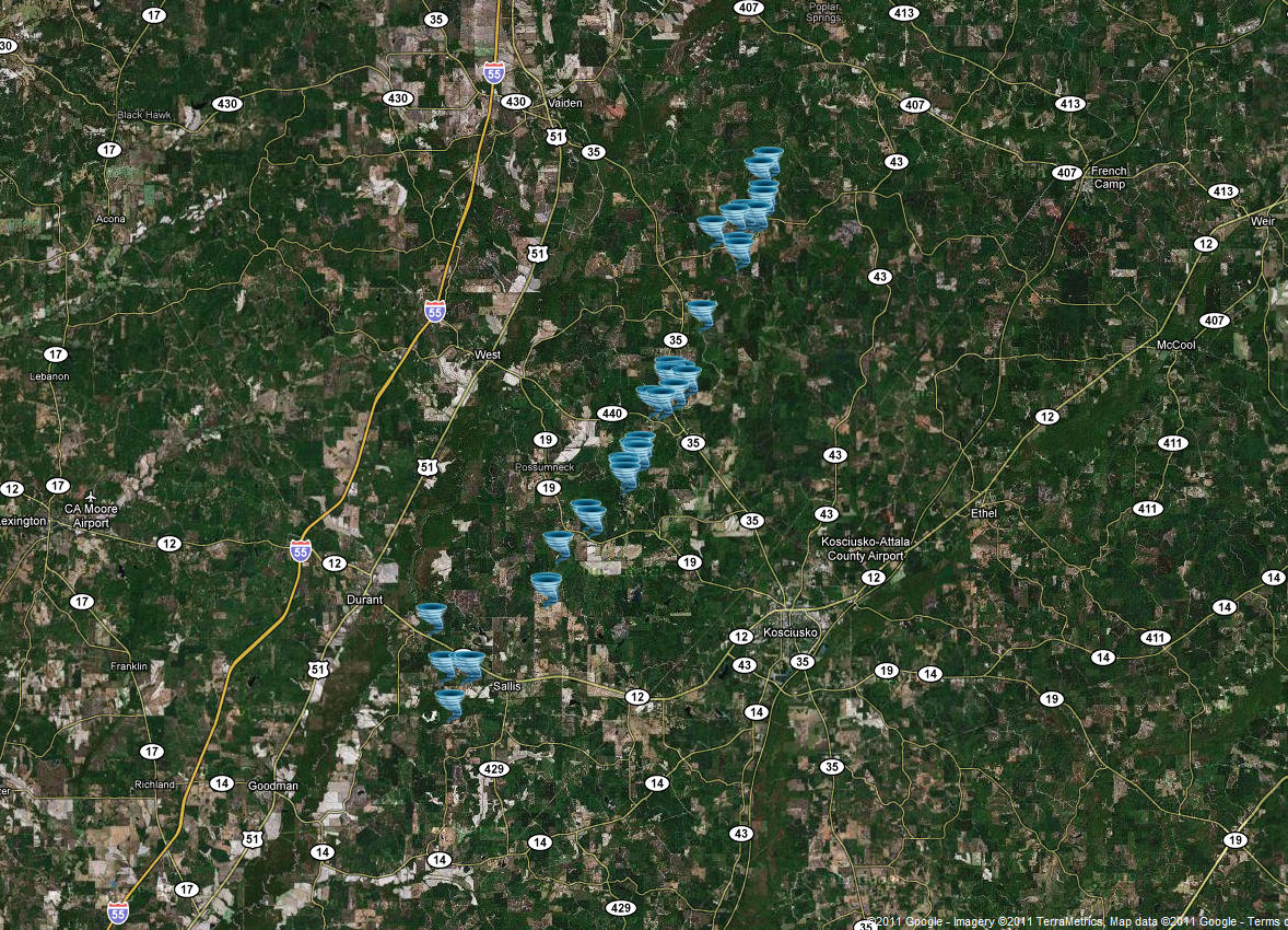
Attala/Montgomery Counties Tornado
Click on Map Below to Zoom In/Out and View Damage Notation
|
Event Summary The tornado started southwest of Sallis near County Road 4106 where a large tree was uprooted and a few small trees were snapped. Two power poles were also snapped. The tornado continued north-northeast to County Highway 4110 where a couple of trees were snapped along with a few power poles. The tornado was rated an EF-2 at this point. The tornado continued north-northeast and a home was pushed off its blocks off of Highway 19. Tin was completely torn off a roof at a church camp off of County Highway 4227. Several power poles were snapped along with hundreds of trees snapped and uprooted. The tornado was rated an EF-2 at this point as well. A mobile home and a shed was destroyed off of Highway 440 as the tornado continued on its north-northeast track. Part of the roof was torn off of a home on Highway 35. The tornado continued to snap and uproot trees until it crossed over into Montgomery County near County Highway 3205. The tornado ended in Montgomery County near Tom Mans Road where a few trees were snapped before it merged with another tornadic thunderstorm that moved into Poplar Creek. |
|
US Dept of Commerce
National Oceanic and Atmospheric Administration
National Weather Service
Jackson, Mississippi
234 Weather Service Dr.
Flowood, MS 39232
601-936-2189
Comments? Questions? Please Contact Us.

