
Updated 6/9/2015 11:00 pm EDT
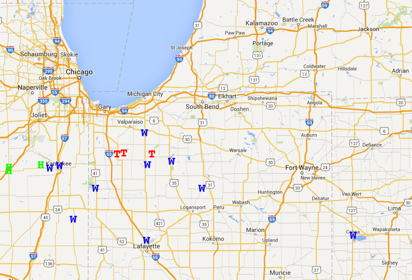
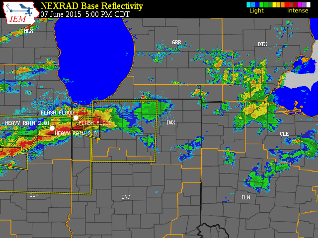
Severe storms moved across northwest Indiana during the late afternoon and evening of June 7th, 2015. A majority of the damage occurred in southern Starke County and Northern Pulaski County, Indiana. A survey team found evidence of a tornado northwest of North Judson, on the north end of the storm.
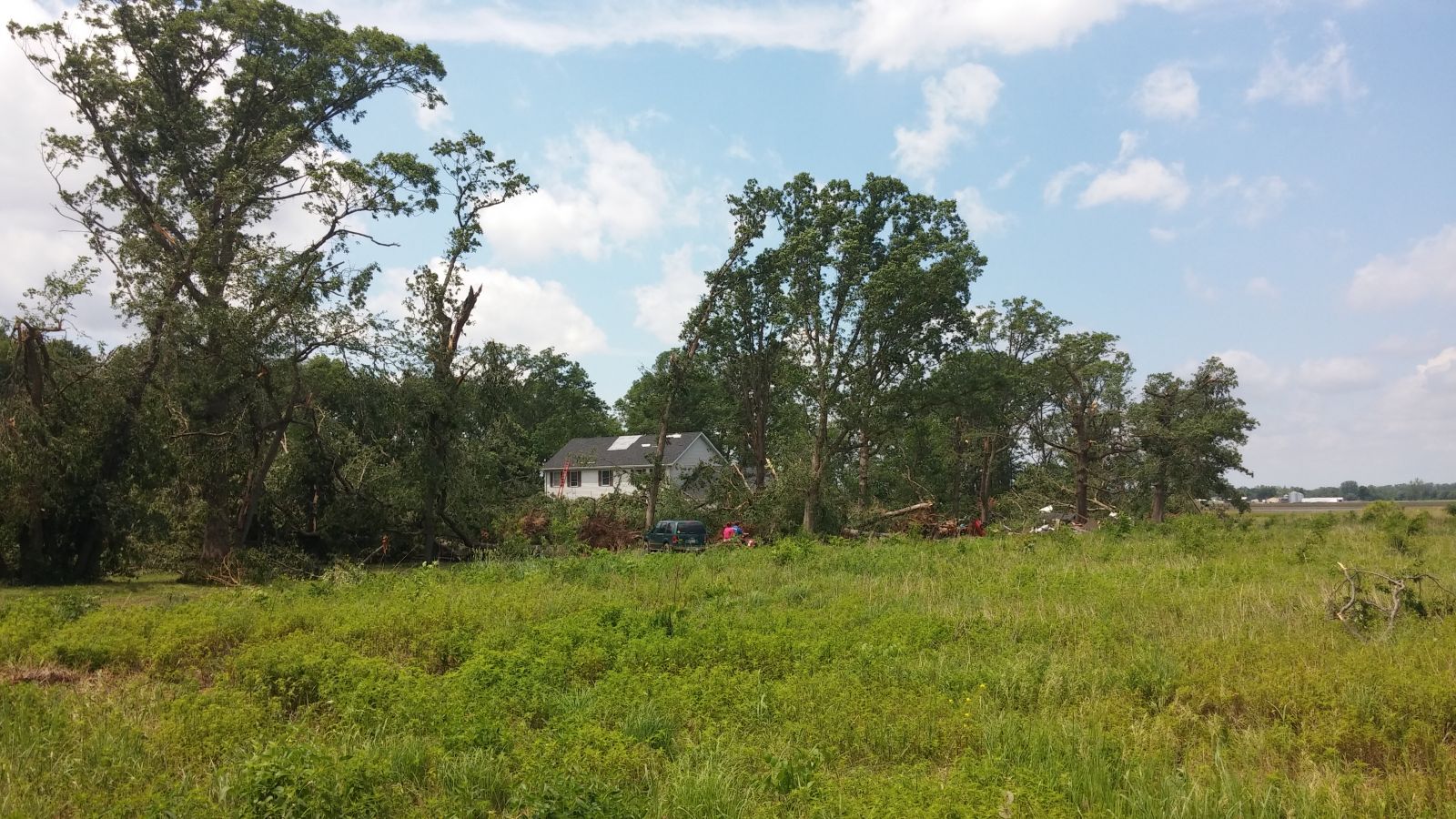
In coordination with Starke County Emergency Management, a storm survey was conducted in the areas hardest hit by the storm. The worst damage occurred northwest of North Judson on the northern portion of the storm, where a garage was shifted off it's foundation and numerous trees were downed. Additional wind damage was observed near Medaryville, Clarks, Bass Lake, and Wanatah Indiana in the form of downed trees and powerlines. An overview of the damage reports is below.
On Monday June 8, a National Weather Service survey team examined the extensive storm damage in western Starke County. The results and details from the damage survey are shown in the map below.
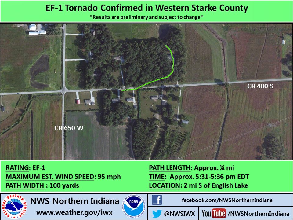
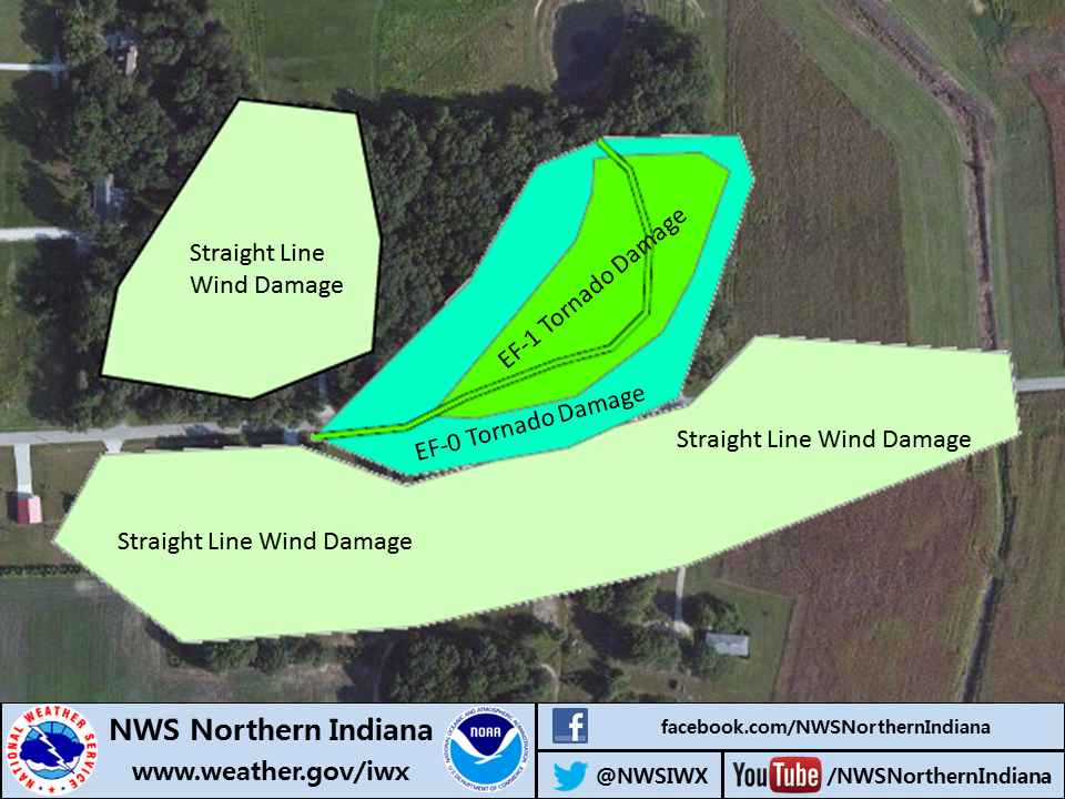
Click here for an overview of the damage survey.
Daytime clouds and rain showers kept temperatures cool for most of the day, but breaks in the clouds later in the day allowed temperatures to quickly rise into the 80s in the SW portion of our forecast area. These warmer temperatures combined with a humid atmosphere provided the energy necessary for severe storms to develop during hte evening hours. Specific meteorological variables from this event can be seen in the table below.
 |
 |
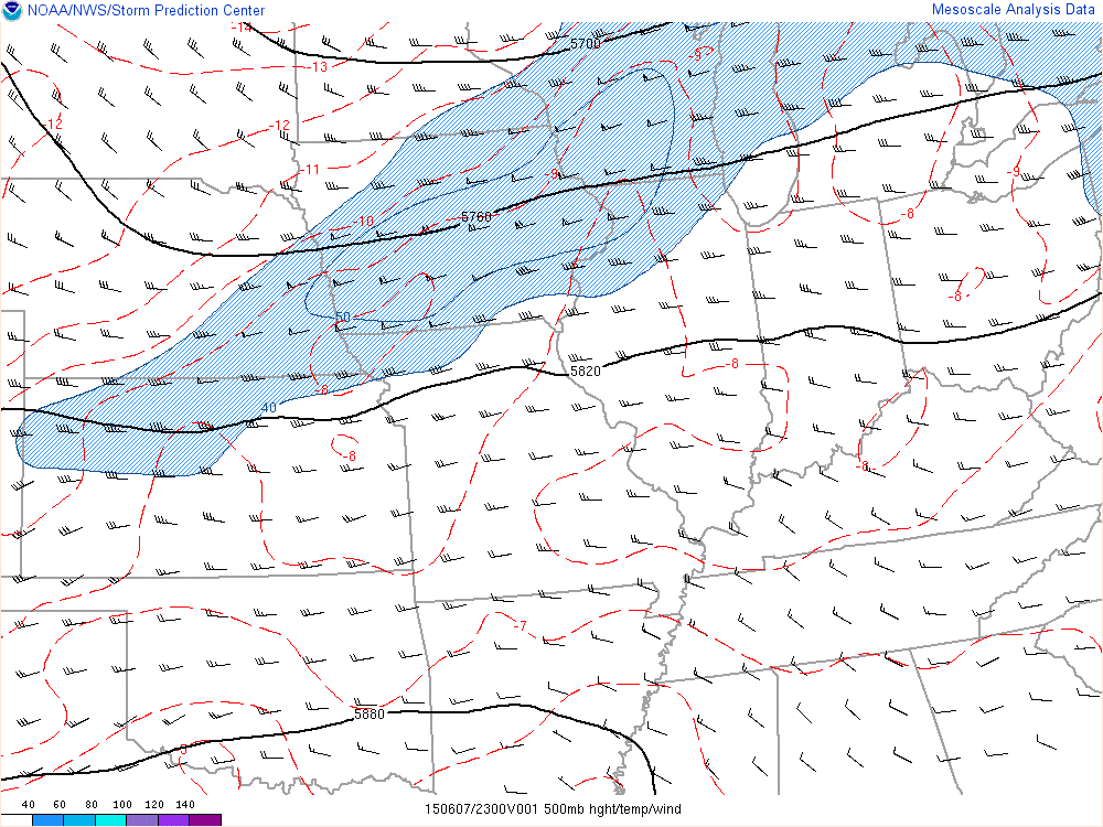 |
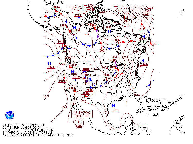
| Surface analysis (21Z) Shows a warm front just to the north of where the storms occurred, with a cold front to the west. | 850 mb analysis shows warm air/moisture being transported into the region. This helped to fuel and sustain thunderstorms as they developed in northern IL and moved into the local area. | 500 mb analysis shows a mid-level trough of low pressure, just to the west of the local area. This provided forcing for the thunderstorms to fire to the west before moving into the local area. |
 |
 |
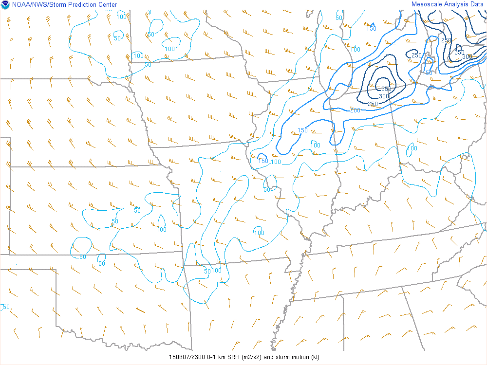 |
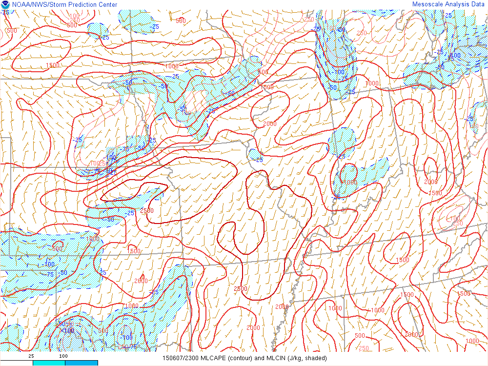
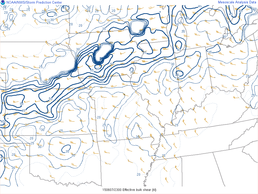
| MLCAPE Shows a warm front just to the north of where the storms occurred, with a cold front to the west. | Effective Bulk Shear shows warm air/moisture being transported into the region. This helped to fuel and sustain thunderstorms as they developed in northern IL and moved into the local area. | 0-1km SRH shows a mid-level trough of low pressure, just to the west of the local area. This provided forcing for the thunderstorms to fire to the west before moving into the local area. |
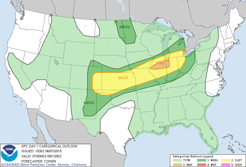
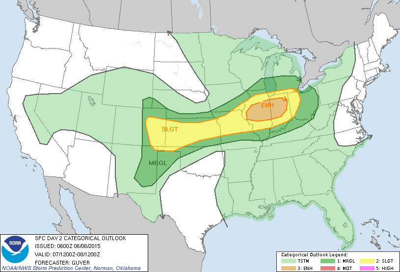
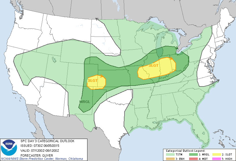
Below are the Storm Prediction Center Outlooks for the 3 days prior to this event.
| Storm Prediction Center Day 1 Outlook Issued 6/07/15 |
 |
|
Storm Prediction Center Day 2 Outlook |
Storm Prediction Center Day 3 Outlook |
||
 |
 |
||


Updated 6/8/2015 1:32 PM EDT
MCD/Bentley/NG

