Damaging wind from thunderstorms is much more common than damage from tornadoes. In fact, many confuse damage produced by straight-line winds and often erroneously attribute it to tornadoes. Given recent severe weather with both damaging straight-line winds and a few weak tornadoes across the local area, we decided to share a little "science" to explain the difference and common misconceptions!
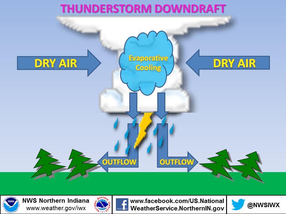
The source for damaging winds is well understood and it begins with the downdraft. As air rises, it will cool to the point of condensation where water vapor forms tiny water droplets, comprising the cumulus cloud we see. As the air continues to rise further condensation occurs and the cloud grows. Near the center of the updraft, the particle begin to collide and coalescence forming larger droplets. This continues until the rising air can no longer support the ever increasing size of water drops.Cold air begins to descend from the middle and upper levels of a thunderstorm (falling at speeds of less than 20 miles an hour).
As the colder air strikes the Earth's surface, it begins to "roll" - much like water as a boat moves through it
As the colder air "rolls" out, it is compressed, causing winds to increase dramatically - at times even stronger than tornado winds!
Downbursts are defined as strong winds produced by a downdraft over a horizontal area up to 6 miles (10 kilometers). Downbursts are further subdivided into microbursts and macrobursts.
Below is a very simple diagram of a downburst.

A tornado is a narrow, violently rotating column of air that extends from the base of a thunderstorm to the ground. Because wind is invisible, it is hard to see a tornado unless it forms a condensation funnel made up of water droplets, dust and debris. How do tornadoes form? The truth is that we don't fully understand. The most destructive and deadly tornadoes occur from supercells, which are rotating thunderstorms with a well-defined radar circulation called a mesocyclone. Tornado formation is believed to be dictated mainly by things which happen on the storm scale, in and around the mesocyclone.
Below is a simple diagram of a tornado.
The key difference is in two words - IN and OUT!
IN - all wind flows INTO a tornado. Debris is often laying at angles due to the curving of the inflow winds

OUT - all wind flows OUT from a downburst. Debris is often laying in straight lines (hence the term "straight line winds") parallel to the outward wind flow

When extensive damage is noted, the National Weather Service may dispatch a damage survey team to determine the cause and nature of wind damage. Survey teams look for evidence of a circulation in debris fields to determine if the damage is straight-line winds or a tornado. Based on the degree of damage and damage indicators, a maximum wind speed is assigned to either the downburst or tornado.
Page created by CEO
7/13/2013