National Weather Service United States Department of Commerce
An active weather pattern is expected to set up across the area this week which will result in several rounds of thunderstorms. 2 to 8 inches of rain will be common with locally higher amounts possible. This could lead to flooding issue from mid to late week, especially across portions of southeast Oklahoma and west central Arkansas.
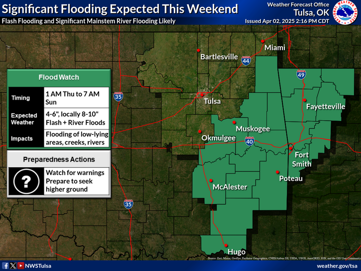
Significant flash flooding and mainstem river flooding are likely this weekend due to multiple rounds of heavy rain and thunderstorms. Expect widespread totals from 4 to 6 inches with localized totals of 8 to 10 inches. Remain alert for warnings and remember to turn around, don't drown!
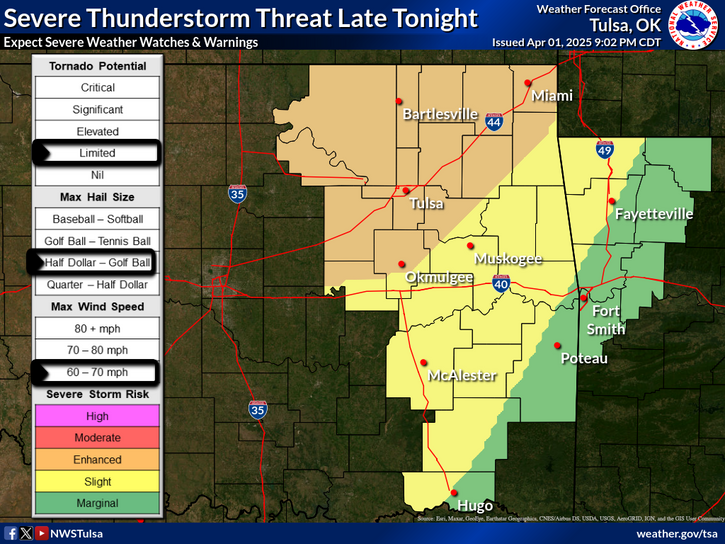
Multiple rounds of severe thunderstorms could occur today through tonight. Very large hail is the main threat, with damaging winds and a limited tornado threat also.
Widespread showers and thunderstorms will spread across the region during the daytime hours today. The risk of a few severe storms will be highest across southeast Oklahoma into northwest Arkansas from early morning through mid afternoon. Additional storms will develop across the region late tonight into the day Friday.
Ft Smith Radar (Ft Smith, Ar - KSRX)
Latest Text Product Selector (Selected product opens in a new window)

Decision Support Winter Hazards Observations Climate Hydrology
 
 
Social Media Satellite Fire Weather Weather Radio Spotter Training Text Products
 
 
Models