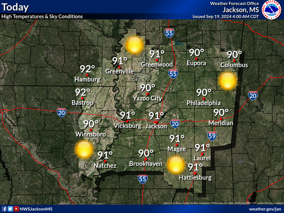
Dangerous heat stress continues across the forecast area today. Peak heat index values for the area could range from 105 to 115 degrees. Remember to stay hydrated and avoid strenuous outdoor activities, and make sure neighbors, relatives and pets have a cool place to spend the day.
Dangerous heat stress will continue to affect portions of the forecast area tomorrow and into this weekend. Peak heat index values for Thursday and Friday could range from near 105 to 110 degrees. Remember to stay hydrated and avoid strenuous outdoor activities, and make sure neighbors, relatives and pets have a cool place to spend the day.
Tropical Storm Bertha and its impacts are expected to remain well south of the Jackson, MS forecast area. Those traveling to the Gulf Coast should continue to monitor forecast updates as Tropical Storm Bertha moves westward.


 Local Radar
 Weather Map