|
Hurricane Irma was a classic Cape Verde hurricane, forming in the heart of peak season just west of the Cape Verde islands, off Africa’s west coast, on August 30, 2017. The storm moved westward across the Atlantic basin as a long-lived major hurricane, and spent a remarkable period of time as a Category 5 with peak sustained winds of 185 mph and gusts into the 200s. Irma inflicted devastating damage on the northernmost Leeward Islands, and US/British Virgin Islands as the eye and eyewall cut a path through the group of islands. The islands of Puerto Rico and Hispaniola were spared a direct impact from Irma’s eyewall, though its large wind field still brought damaging winds and surf, along with flooding rains. As Irma continued to move toward the west-northwest, the southern portion of the Bahamas and North Central Cuba were directly impacted by Irma’s Category 5 eyewall winds, with strong winds, storm surge, and tropical rains extending across the larger region. Unfortunately, dozens of deaths occurred during the storm across the Caribbean islands. The storm’s intensity was briefly interrupted due to land interaction with Cuba, and Irma fell to Category 3 status; however, the storm was still a major hurricane. During the nighttime hours of September 9th, Irma finally made the long forecast northward turn toward the U.S. mainland. As the storm approached South Florida, it re-intensified to a Category 4 with winds of 130 mph/higher gusts and made landfall on Cudjoe Key (lower Florida Keys) during the morning of September 10th. Irma made another landfall at Marco Island later in the day. Peak measured wind gusts of 120-142 mph occurred from the lower Florida Keys north to the southwestern coastline of Florida. Life threatening and highly damaging storm surge impacted the Keys and both coastlines of Florida. Additionally, Irma’s broad wind field coupled with her track also brought coastal flooding, due to storm surge, to portions of Georgia and South Carolina. After hitting South Florida, Irma quickly moved north into Northern Florida, and then northwest into Georgia and Alabama on September 11th as a tropical storm. During her path as a storm of hurricane turned tropical storm strength, widespread hurricane and tropical storm force winds took place across much of the Florida peninsula, along with heavy tropical rains. Tropical rains and gusty winds then arrived to a larger portion of the Southeastern United States. Several storm-related deaths occurred.
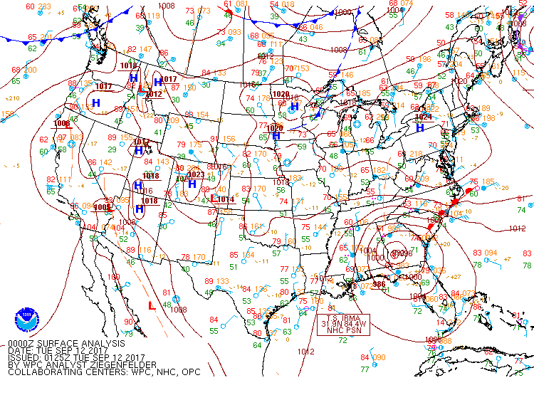
Here in Central Alabama, tropical storm warnings were issued on Sunday, September 10th for counties east of Interstate 65, in anticipation of tropical storm force conditions. The following day, steady rains overspread the region by early morning, with breezy and gusty winds arriving south to north through the day. The highest impacts, including gustiest winds and highest rain totals, occurred east of Interstate 65, with less breezy winds and less rainfall west of Interstate 65. Peak wind gusts of 30 to 45 mph knocked down trees, some of which blocked roadways, fell onto homes, and took out power lines. Due to the track of Irma’s center, there was no tornado threat, unlike the passage of Cindy and Harvey earlier in the season. By the nighttime hours, winds were easing though periods of rain continued, as Irma was downgraded to a tropical depression. The National Hurricane Center issued its final advisory at 10 PM CDT on Monday, September 11th, plotting the center 5 miles south of Columbus Georgia. From there, the Weather Prediction Center in College Park, Maryland issued post tropical cyclone advisories on Irma until 4 PM CDT on Tuesday, September 12th, plotting the final location of Irma 65 miles northeast of Tupelo, Mississippi.
A few records set by Hurricane Irma (courtesy Philip Klotzbach, Colorado State):
- 185 mph lifetime max winds – tied with Florida Keys (1935), Gilbert (1988) and Wilma (2005) for second strongest max winds of all time in Atlantic hurricane. Allen had max winds of 190 mph in 1980.
- 185 mph max winds for 37 hours – the longest any cyclone around the globe has maintained that intensity on record. The previous record was Haiyan in the Northwest Pacific at 24 hours.
- 3.25 day lifetime as a Category 5 hurricane – tied with Cuba (1932) for longest lifetime as Category 5.
- Leeward Islands: Strongest storm on record to impact the Leeward Islands defined as 15-19°N, 65-60°W for this calculation, with max winds of 185 mph.
|