National Weather Service United States Department of Commerce


Flash Flooding on June 7-8, 2022

Overview
 

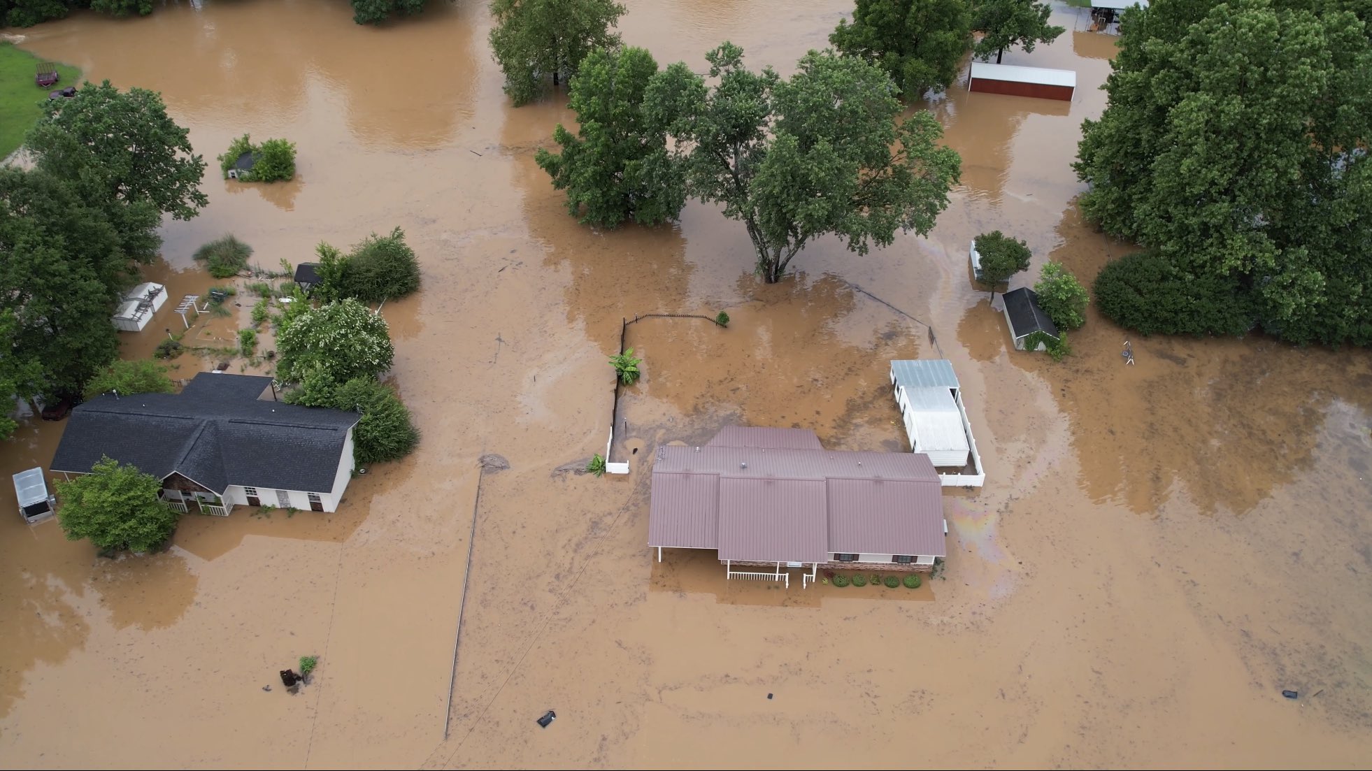
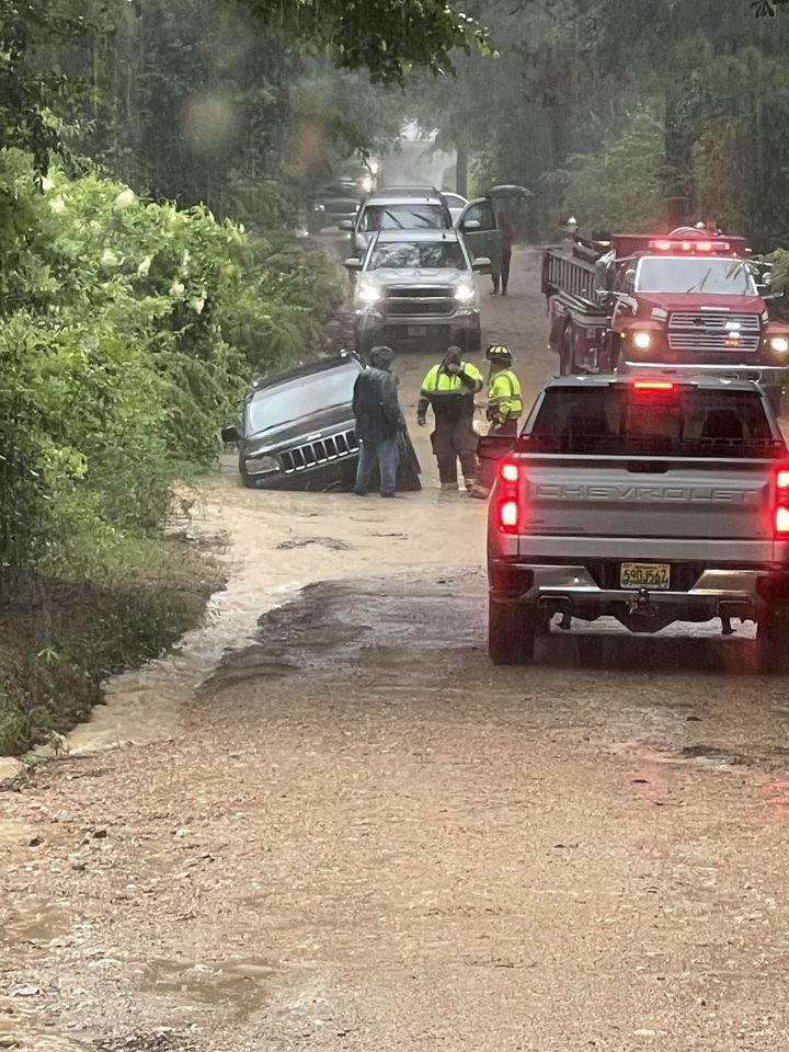
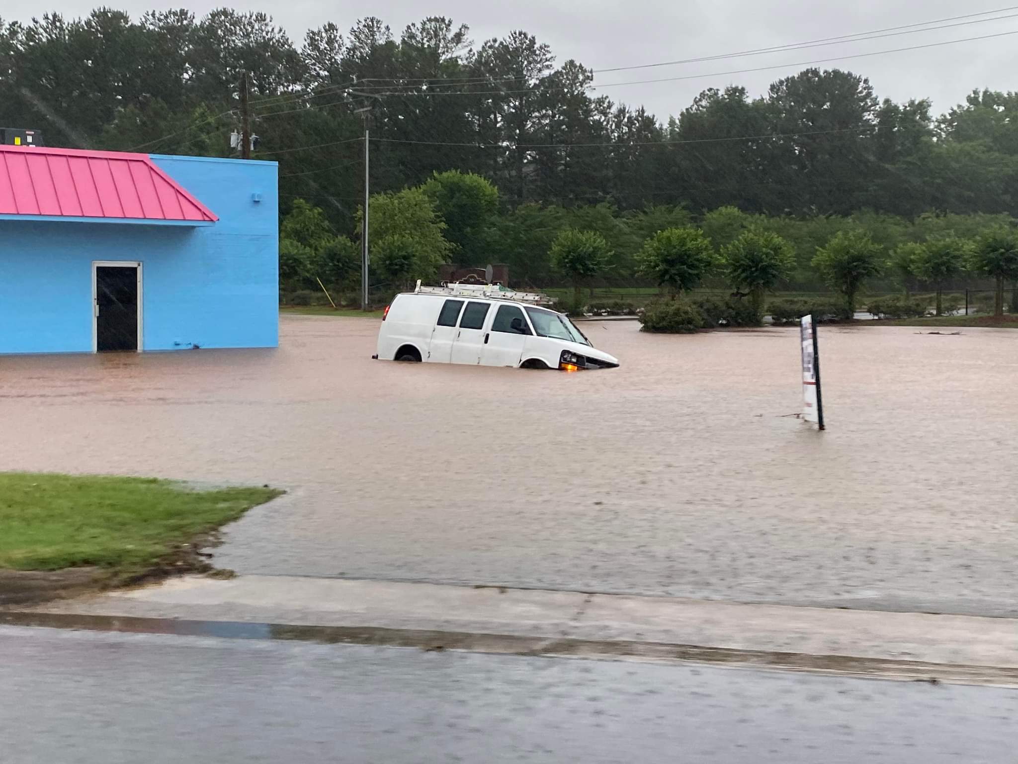
Several rounds of showers and thunderstorms occurred across Central Alabama from the afternoon of June 7th through the evening of June 8th. These showers and thunderstorms were a result of a moist and unstable airmass, as well as from various upper-level disturbances travelling near a slow moving surface front. Some storms were strong to severe at times with damaging wind gusts, as well as large hail. Many of these thunderstorms went on to evolve into clusters that were slow moving, or nearly stationary at times. The slow moving or "training" nature of these thunderstorms, and the torrential rainfall rates, led to locally heavy rainfall. Some areas received several inches of rainfall in a very short period of time (6 hours or less). This led to flash flooding, which became significant in areas of Etowah County, such as Gadsden and Glencoe, on the evening of June 7th. Additional flash flooding occurred across portions of Jefferson, Shelby, and Talladega Counties during the early morning hours of June 8th. Slow moving thunderstorms dumped upwards of 6" of rain which led to significant flash flooding in areas such as Birmingham and Sylacauga. Some additional flash flooding occurred on the evening of June 8th across portions of Birmingham. In total, the Birmingham International Airport measured 6.97" of rainfall on June 8th, breaking the daily rainfall record and placing this as the 6th highest daily rainfall ever recorded at Birmingham.


Radar Loop for Etowah County
Radar Loop centered over Etowah County
June 7th, 4pm - 930pm

Radar Loop for Jefferson/Shelby Counties
Radar Loop Centered over Jefferson & Shelby Counties
June 8th, 230am - 7am

 
Rainfall Totals


48 Hr Rainfall Plot

Flooding Reports
 
Click on the map below for an interactive map.
 

Local Storm Reports


Flooding Photos
 

Flood Photo
Sylacauga
Courtesy Chris Mann (via FOX6)

Flood Photo
Columbiana
Courtesy Travis Braden

Flood Photo
Dorothy Spears Park
Courtesy CorDarrius Bowe (via ABC33/40)

Flood Photo
Hokes Bluff
Courtesy Tammy Franklin (via ABC33/40)

Flood Photo
Homewood
Courtesy Al Radcliffe (via CBS42)

Flood Photo
Memorial Park in Leeds
Courtesy Keith Davis

Flood Photo
Messer Airport Hwy in Birmingham
Courtesy Ashley Gann CBS42

Flood Photo
Sylacauga
Courtesy Rhonda Brewer

Flood Photo
Vincent
Courtesy Brandon Knox (via FOX6)

Flood Photo
Sylacauga
Courtesy Brett Adair

Flood Photo
Tallapoosa St in Birmingham
Courtesy Bill Castle ABC33/40

Flood Photo
Tallapoosa St in Birmingham
Courtesy Bill Castle ABC33/40

Flood Photo
Calera
Courtesy Cole Bice (via ABC33/40)

Flood Photo
31st St in Birmingham
Courtesy Tiffany Williams (via ABC33/40)

Flood Photo
East Lake
Courtesy Josh Brewer (via ABC33/40)

Flood Photo
Gadsden
Courtesy James Williams (via FOX6)

Flood Photo
Glencoe
Courtesy Jenny Crotts (via ABC33/40)

Flood Photo
Hwy 119 in Birmingham
Courtesy Ashley Gann CBS42

Flood Photo
Tarrant
Courtesy Haley Jernigan (ABC33/40)

Flood Photo
Vincent
Courtesy Kevin Walkup (via FOX)

Flood Photo
Atlantic East at Birmingham Airport
Courtesy Seth Steele

Flood Photo
Sylacauga
Courtesy Angela Pearson

Flood Photo
Sylacauga
Courtesy Angela Pearson

 
Surface Charts
 

Surface Chart
Surface Analysis
 Jun 7 at 7 pm

Surface Chart
Surface Analysis
Jun 8 at 1 am

Surface Chart
Surface Analysis
Jun 8 at 7 am

Surface Chart
Surface Analysis
Jun 8 at 1 pm


Upper Air Charts
 

250 mb Chart
250 mb Analysis
Jun 7 at 7 pm

500 mb Chart
500 mb Analysis
Jun 7 at 7 pm

850 mb Chart
850 mb Analysis
Jun 7 at 7 pm

250 mb Chart
250 mb Analysis
Jun 8 at 7 am

500 mb Chart
500 mb Analysis
Jun 8 at 7 am

850 mb Chart
850 mb Analysis
Jun 8 at 7 am

KBMX Sounding
KBMX Sounding
Jun 7 at 7 pm

KBMX Sounding
KBMX Sounding
Jun 8 at 7 am