|
Event Summary
|
|
EF-0
|
|
Estimated Maximum Wind:
|
65 mph
|
|
Injuries/Fatalities:
|
None |
|
Damage Path Length:
|
2.58 miles
|
|
Maximum Path Width:
|
115 yards
|
|
Approximate Start Point/Time:
|
2 NW Allgood
33.9256/-86.5439
at 504 pm
|
|
Approximate End Point/Time:
|
2 W Oneonta
33.9478/-86.5077
at 509 pm
|
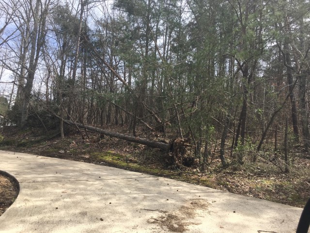
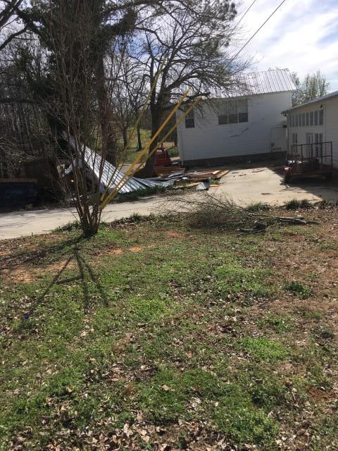
NWS Meteorologists surveyed damage in central Blount County north of Allgood and determined it was the result of a tornado.
The tornado touched down along and parallel to Tim King Road with mainly damage to soft and hardwood trees. Some trees were uprooted northeast entering into Sand Valley. Many locations through the valley were inaccessible due to the terrain. The tornado moved into slightly higher ground as it began to lift along Sawyer Mountain Road damaging several additional trees and a porch structure on a well-built single family home.
Special thanks to the Blount County EMA for their assistance in the survey.
|