September usually brings tranquil weather to Indiana. Not so on September 20, 2002, when several tornadoes struck the state. The biggest tornado rampaged through rural and urban parts of Indiana for 112 miles, becoming the longest tornado track in Indiana history. The long track tornado reached F3 intensity in Ellettsville, Martinsville, and Greenwood, with winds of at least 160 mph. The tornado began in Ellettsville at 12:59 PM EST and roared northeast through Martinsville, the south and east sides of metropolitan Indianapolis, Anderson, and finally lifted near Hartford City, 2 hours and 21 minutes later at 3:20 PM EST.
No deaths occurred, despite $156 million in property damage and 130 injuries. The tornado was enshrouded in rain for much of its life.
The same thunderstorm that produced the long track tornado also produced other tornadoes. One of them was an F2 rated tornado that struck near Poseyville, and another was also rated F2 and struck near Monroe City.
The tornado warning issued for the Indianapolis area contained "Tornado Emergency" wording.
Continue below for more information on this event. The Storm Prediction Center's archive has additional information as well.
| Tornado Track Map | Weather Setup | Radar Images | Tornado Warning Example | Damage Picture Links |
Click the image for a larger version. A zoomed in map for central Indiana is available at this link.

The Fujita Scale
| F Scale | Wind | Damage |
| F0 | 40-72 MPH | Light |
| F1 | 73-112 MPH | Moderate |
| F2 | 113-157 MPH | Considerable |
| F3 | 158-206 MPH | Severe |
| F4 | 207-260 MPH | Devastating |
| F5 | 261-318 MPH | Incredible |

Atmospheric Setup valid at 7:00 AM September 20. Click to enlarge.
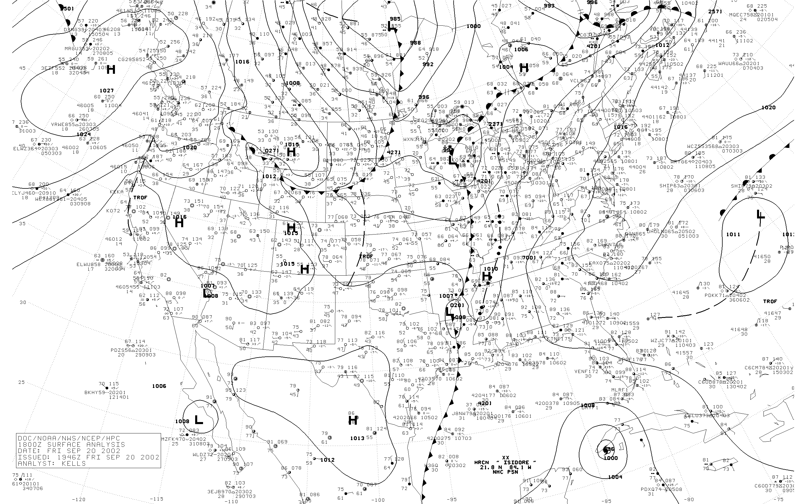
Surface Map valid at 1:00 PM EST September 20. Click to enlarge.
A strong upper trough and a surface cold front provided strong forcing to produce widespread showers and thunderstorms. Surface dewpoints were in the 70s, and shear values were high. These ingredients combined to produce the severe weather and tornadoes.
 |
 |
 |
 |
| Radar at 12:04 PM EST. Click to enlarge. | Radar at 1:04 PM EST. Click to enlarge. | Radar at 2:04 PM EST. Click to enlarge. | Radar at 2:58 PM EST. Click to enlarge. |
Click any image for a larger version.
 |
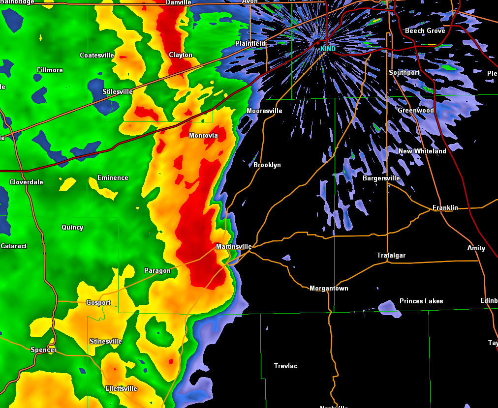 |
| Radar image of storm as the tornado nears Ellettsville. | Radar image of storm as the tornado nears Martinsville. |
 |
 |
| Radar image of storm as the tornado moves into Johnson County. | Velocity image of the Johnson County storm. Radar is at circle labeled KIND. Green is motion toward the radar, red is motion away. |
 |
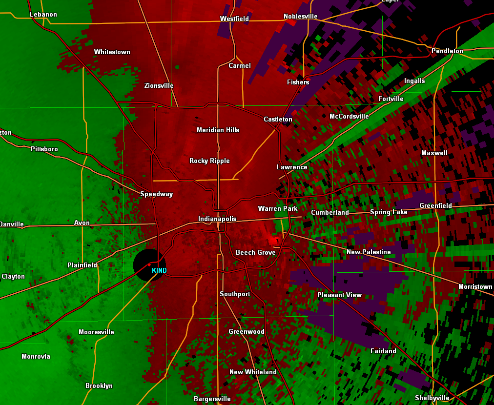 |
| Radar image of storm as the tornado moves into the east side of Indianapolis. | Velocity image of the Indianapolis storm. Radar is at circle labeled KIND. Green is motion toward the radar, red is motion away. |
 |
|
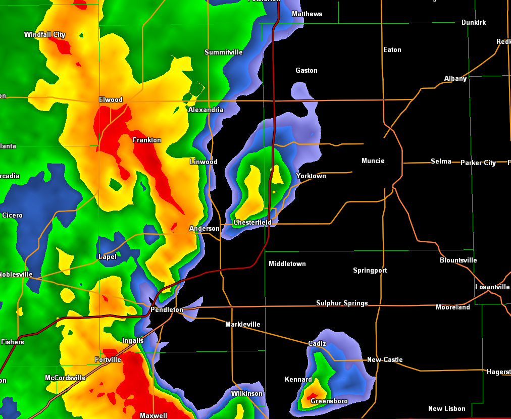
| Radar image of storm as the tornado moves through Madison County. | |
|

