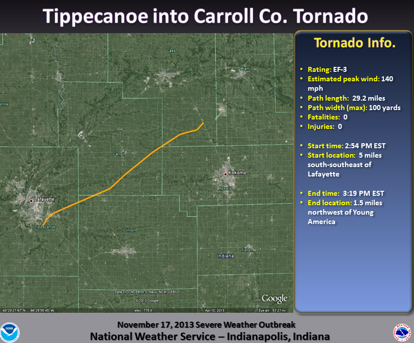
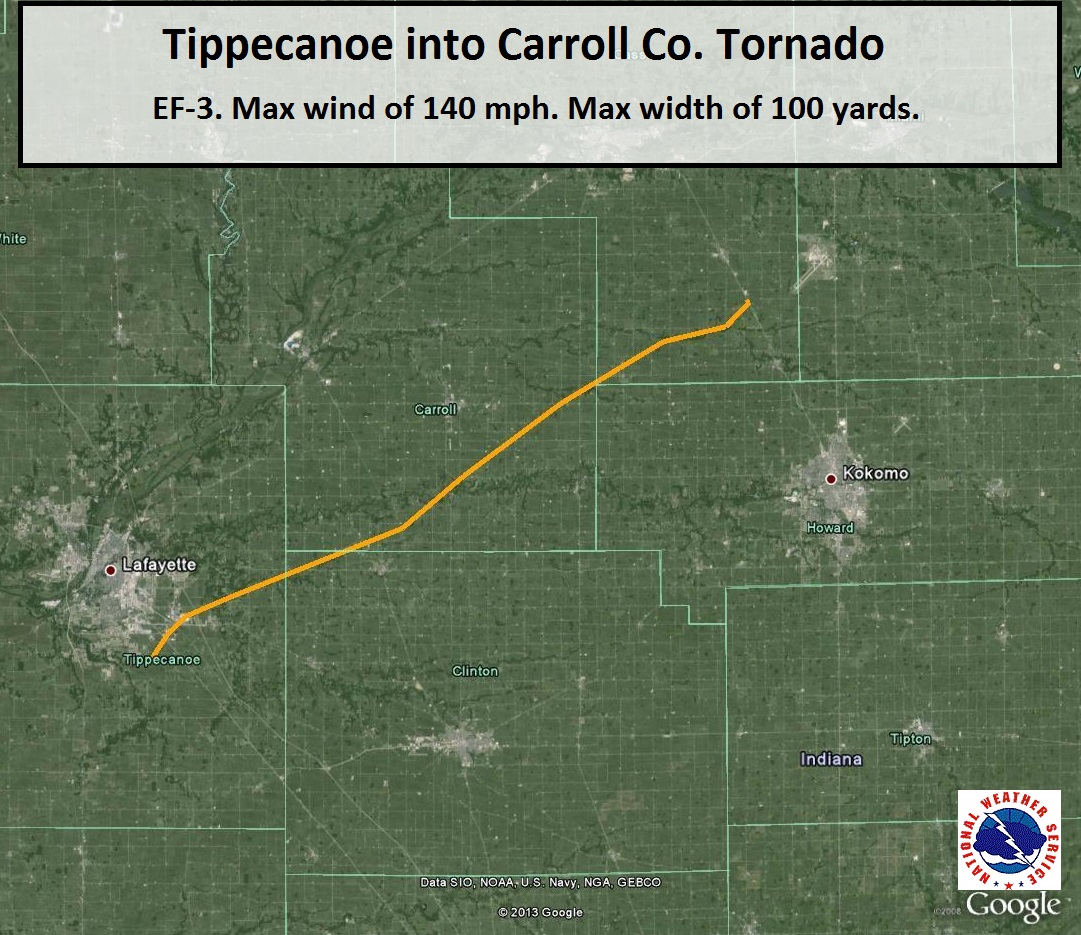
Damage Path (Click to enlarge):
Tornado Information:
RATING: EF-3 ESTIMATED PEAK WIND: 140 MPH PATH LENGTH /STATUTE/: 29.2 MILES PATH WIDTH: 100 YARDS FATALITIES: 0 INJURIES: 0 START DATE: NOVEMBER 17 2013 START TIME: 254 PM EST START LOCATION: 5 MILES SOUTH-SOUTHEAST OF LAFAYETTE START LAT/LON: 40.3462/-86.8342 END DATE: NOVEMBER 17 2013 END TIME: 319 PM EST END LOCATION: 1.5 MILES NORTHWEST OF YOUNG AMERICA END LAT/LON: 40.5675/-86.3742 THE SUBARU AND VOEST ALPINE PLANTS SOUTHEAST OF LAFAYETTE BOTH SUSTAINED SIGNIFICANT DAMAGE CONSISTENT WITH A LOW END EF-3 RATING. PROPERTY AND TREE DAMAGE THEN CONTINUED NORTHEAST TO THE NORTH OF DAYTON...NORTHWEST OF ROSSVILE AND ACROSS SOUTHERN AND EASTERN CARROLL COUNTIES. A HOG FARM SUSTAINED DAMAGE TO SEVERAL OUTBUILDINGS IN EXTREME SOUTHWEST CARROLL COUNTY. ADDITIONAL DAMAGE WAS FOUND IN CUTLER. MUCH OF THE DAMAGE ACROSS CARROLL COUNTY RANGED BETWEEN EF-0 AND EF-1. THIS TORNADO CROSSED INTO CASS COUNTY NEAR STATE ROUTE 18...CONTINUING FOR NEARLY AN ADDITIONAL 10 MILES. THE TOTAL PATH LENGTH INCLUDING CASS COUNTY IS 39 MILES. |
Radar Imagery:(Click to enlarge)
 |
 |
| Radar image from 2:56 PM centered on eastern Tippecanoe County. | Storm Relative Motion image from 2:56 PM for the same area. Radar is off to the south east of this location. Green indicates winds toward the radar while reds indicate winds away from the radar. |
 |
 |
| Radar image from 3:16 PM centered on Carroll County and western Howard County. | Storm Relative Motion image from 3:16 PM for the same area. Radar is off to the south east of this location. Green indicates winds toward the radar while reds indicate winds away from the radar. |
Damage Pictures: (click to enlarge)
 |
 |
|
|
|
||
For more information on the Cass County part of the tornado, please see WFO Northern Indiana's website


