Indianapolis, IN
Weather Forecast Office
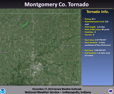
Damage Path (Click to enlarge):
Tornado Information:
RATING: EF-1 ESTIMATED PEAK WIND: 110 MPH PATH LENGTH /STATUTE/: 1.8 MILES PATH WIDTH /MAXIMUM/: 40 YARDS FATALITIES: 0 INJURIES: 0 START DATE: NOVEMBER 17 2013 START TIME: 247 PM EST START LOCATION: 3 MILES SOUTHEAST OF NEW RICHMOND START LAT/LON: 40.1717/-86.9571 END DATE: NOVEMBER 17 2013 END TIME: 250 PM EST END LOCATION: 1.5 MILES WEST OF LINDEN END LAT/LON: 40.1860/-86.9291 THE TORNADO HIT TWO METAL BUILDINGS NEAR THE WEAVER POPCORN PLANT. METAL DEBRIS...INSULATION...AND 2X4S FROM THE BULDINGS WERE SCATTERED TO THE NORTHEAST ALONG A PATH JUST UNDER 2 MILES LONG. |
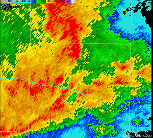
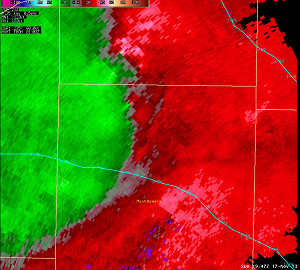
Radar Imagery:
Hazards
Drought Information
NOAA All Hazards Radio
Graphical Hazards Outlook
Spotter Information
Outdoor Event Watcher
Hazardous Weather Outlook
Local forecasts
Local Area
Aviation
Computer Model Forecasts
Fire Weather
Graphical
Precipitation
Air Quality
Text River Forecasts
Area Forecast Discussion
Central Indiana Weather Brief
US Dept of Commerce
National Oceanic and Atmospheric Administration
National Weather Service
Indianapolis, IN
6900 West Hanna Avenue
Indianapolis, IN 46241-9526
317-856-0664
Comments? Questions? Please Contact Us.


