Overview
A brief landspout tornado produced some property damage in Jackson County on May 6.
Tornadoes
Tornado - 4 SSW Jonesville
Jackson County
| Date |
May 6, 2022 |
| Time (Local) |
5:44 PM EDT |
| EF Rating |
EF-0 |
| Est. Peak Winds |
65 MPH |
| Path Length |
0.06 Miles |
| Max Width |
20 Yards |
| Injuries/Deaths |
0/0 |
|
Summary:
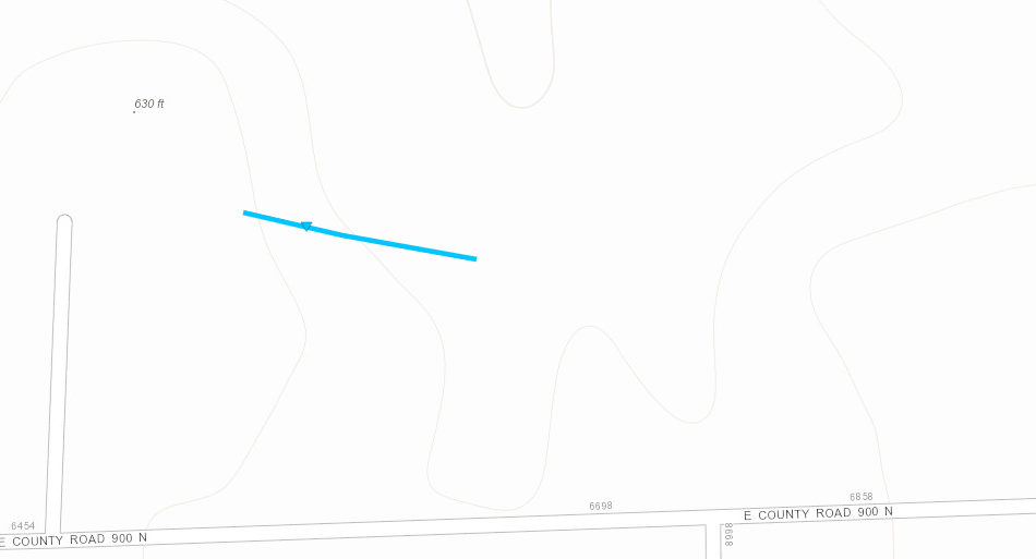
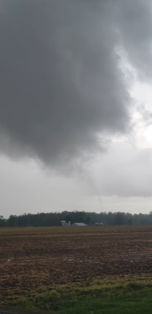
After consultation with the Jackson County Emergency Management and seeing video evidence, the NWS has determined that a brief landspout tornado occurred during the evening hours of May 6th. The weak tornado touched down and within a minute lifted in nearly the same location.
A picnic table was blown to the west, and a nearby barn had its roof lifted and blown to the east and south. Some of these metal panels damaged a fence downwind. Grass nearby showed convergence.
We thank Jackson County Emergency Management for their assistance In conducting this damage survey.
|
Track Map
 
|
 |
 |
Screen Capture from Video Showing the Landspout.
[Credit: Jackson Co. Emergency Management] |
Radar Image/Storm Relative Velocity Image from 5:44 PM EDT May 6. |
|
The Enhanced Fujita (EF) Scale classifies tornadoes into the following categories:
EF0
Weak
65-85 mph |
EF1
Moderate
86-110 mph |
EF2
Significant
111-135 mph |
EF3
Severe
136-165 mph |
EF4
Extreme
166-200 mph |
EF5
Catastrophic
200+ mph |
 |


