Overview
|
Multiple waves of severe weather moved across central Indiana on May 30, 2004. Fifteen tornadoes struck central Indiana, with an additional 8 more across the remainder of the state. Damage estimates in central Indiana were over $13 million dollars. At the time, this event ranked as the second largest tornado outbreak in Indiana. In addition to the tornadoes, the multiple rounds of storms lead to flooding issues across central Indiana into the night. |
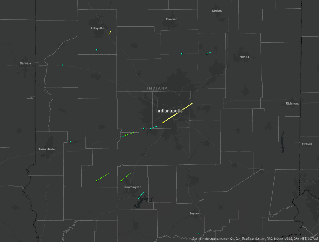 Overview of Central Indiana Tornado Tracks (link to image) |
Tornadoes
Please note that all track maps are approximate.
|
Tornado - Near Freedom
Track Map 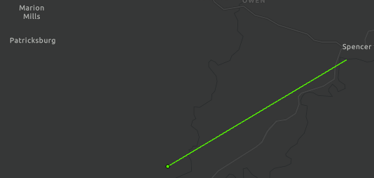 
|
||||||||||||||||
|
Tornado - Near Veedersburg
Track Map 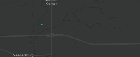
|
||||||||||||||||
|
Tornado - Near Ellettsville
Track Map 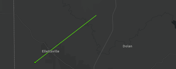
|
||||||||||||||||
|
Tornado - Near Brazil
Track Map 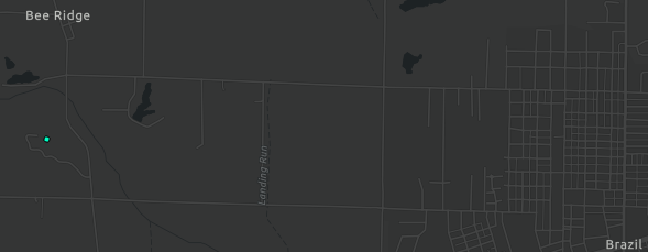
|
||||||||||||||||
|
Tornado - Near Little Point
Track Map 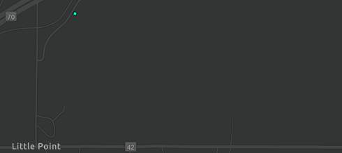
|
||||||||||||||||
|
Tornado - Near Little Point
Track Map 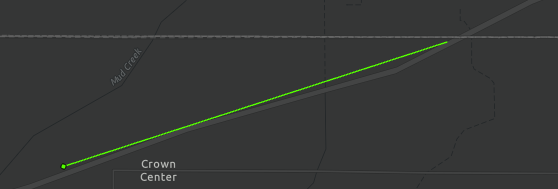
|
||||||||||||||||
|
Tornado - Near Joppa
Track Map 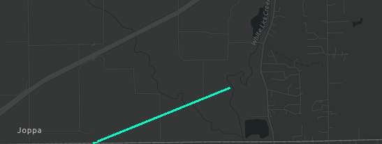
|
||||||||||||||||
|
Tornado - Near Friendswood
Track Map 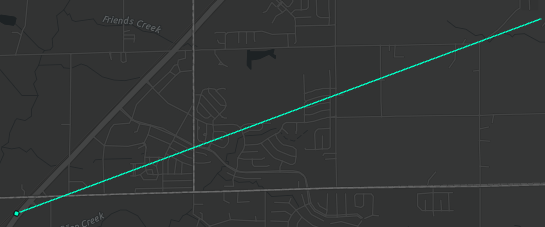
|
||||||||||||||||
|
Tornado - Southeast Indianapolis
Track Map 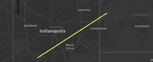
|
||||||||||||||||
|
Tornado - Near Romney
Track Map 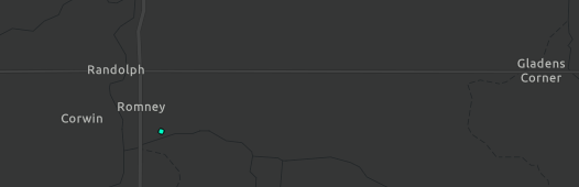
|
||||||||||||||||
|
Tornado - Near Dayton
Track Map 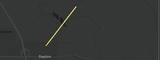
|
||||||||||||||||
|
Tornado - Near Atlanta
Track Map 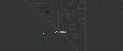
|
||||||||||||||||
|
Tornado - Near Frankton
Track Map 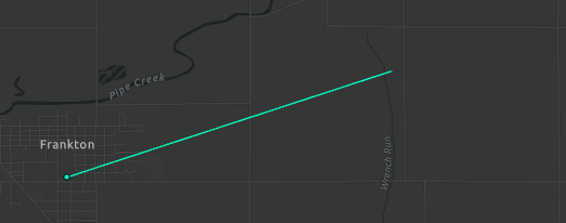
|
||||||||||||||||
|
Tornado - Near Lake Monroe
Track Map 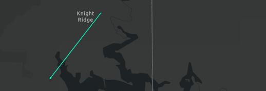
|
||||||||||||||||
|
Tornado - Near Crothersville
Track Map 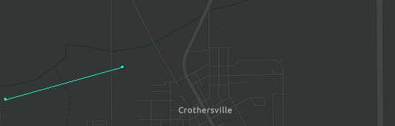
|
||||||||||||||||
Photos
Click on the links below to see more photos from those areas
 |
 |
| Tornado near Monrovia. (Brett and Rebecca Everett) More photos of Marion, Hendricks, and Morgan Counties Tornadoes |
Tornado Near Dayton (Ross Ellet) More photos of Dayton Tornado |
Environment
 |
 |
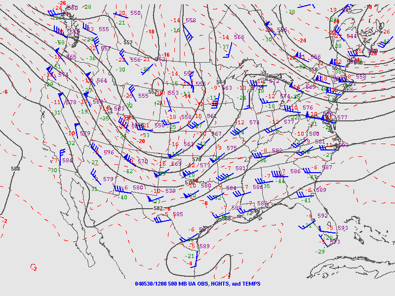 |
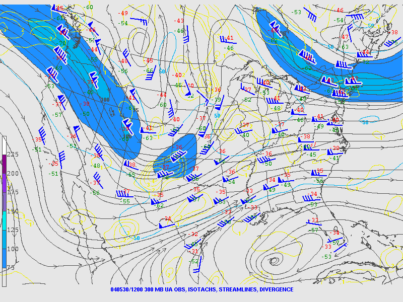
| Figure 1: 300mb Analysis, 7 AM EST May 30 | Figure 2: 300mb Analysis, 7 PM EST May 30 | Figure 3: 500mb Analysis, 7 AM EST May 30 |
|
 |
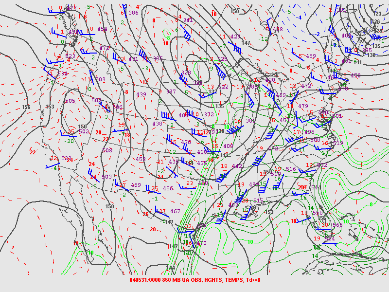 |
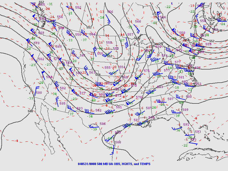
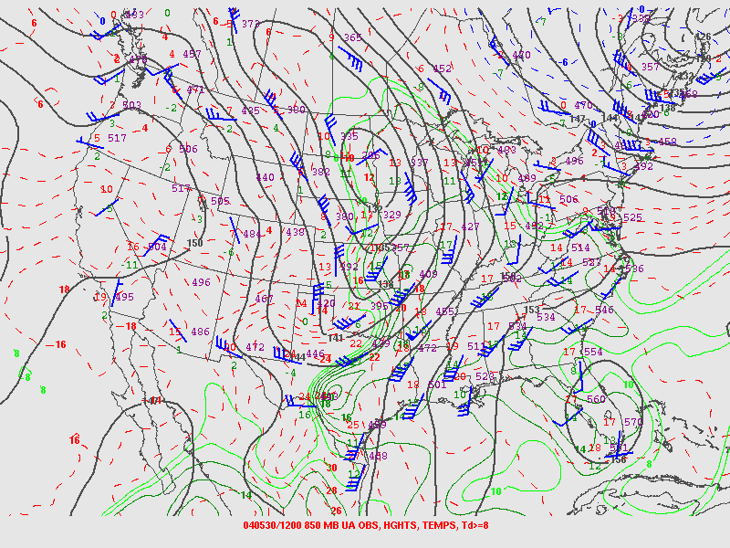
| Figure 4: 500mb Analysis, 7 PM EST May 30 | Figure 5: 850mb Analysis, 7 AM EST May 30 | Figure 6: 850mb Analysis, 7 AM EST May 30 |
 |
 |
 |
| Figure 7: Hand Analyzed Surface Map for 3 PM EST (Click for a Larger Scale 4 PM Map) |
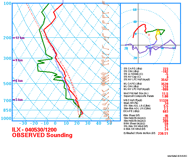
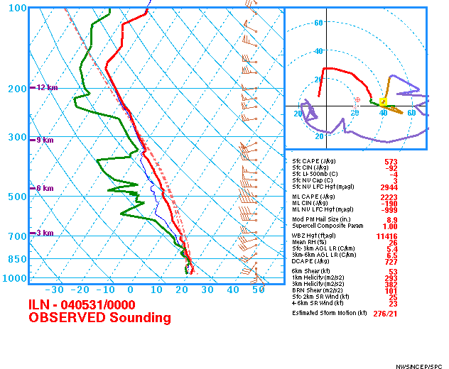
Figure 8: Lincoln, IL (ILX) Sounding at 7 AM EST | Figure 9: Wilmington, OH (ILN) Sounding at 7 PM EST |
 |
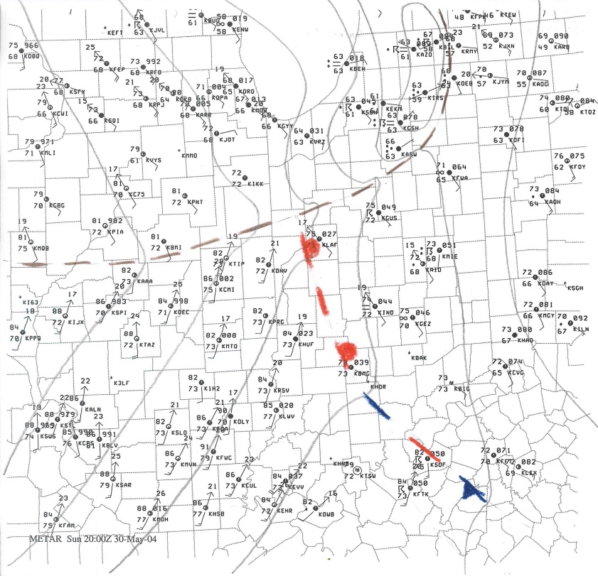
| Figure 10: Radar at 6:30 PM EST (Radar data for this day is limited) |
Additional Information
 |
 |
 |
 |
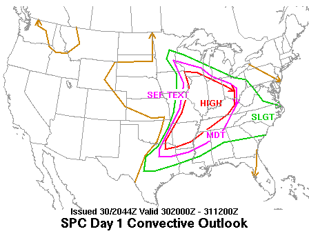
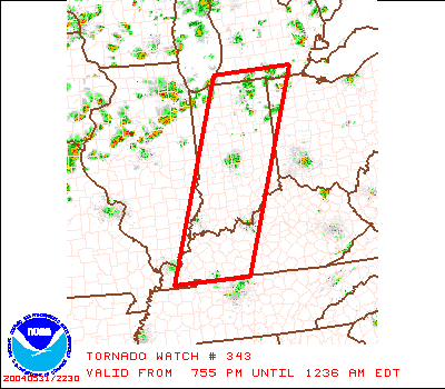
| SPC Day 1 Outlook from 3 PM EST | Example of a Tornado Watch from the Event |
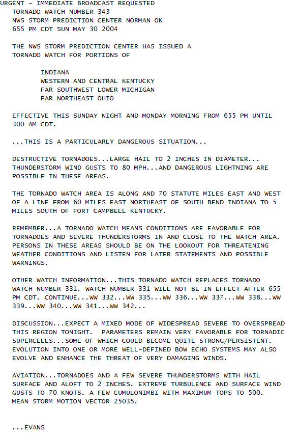
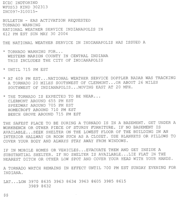
Text of the Watch Image. This was a PDS Tornado Watch | Tornado Warning for Marion County. This included areas around Speedway, which had people exiting the Indianapolis 500 Race. The actual tornado occurred less than 10 miles away from Speedway |
Summaries from other NWS Offices
 |
Media use of NWS Web News Stories is encouraged! Please acknowledge the NWS as the source of any news information accessed from this site. |
|

