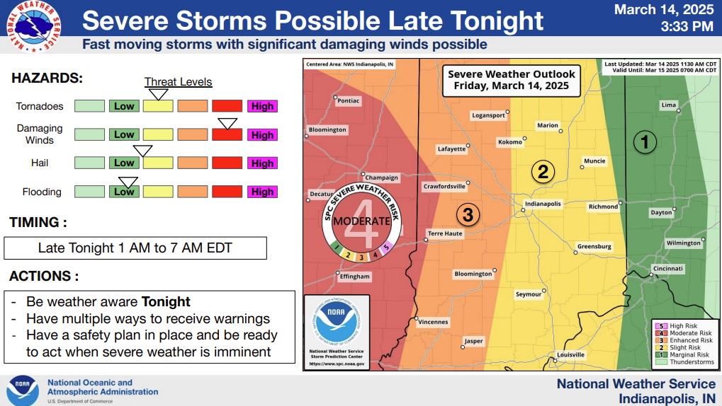
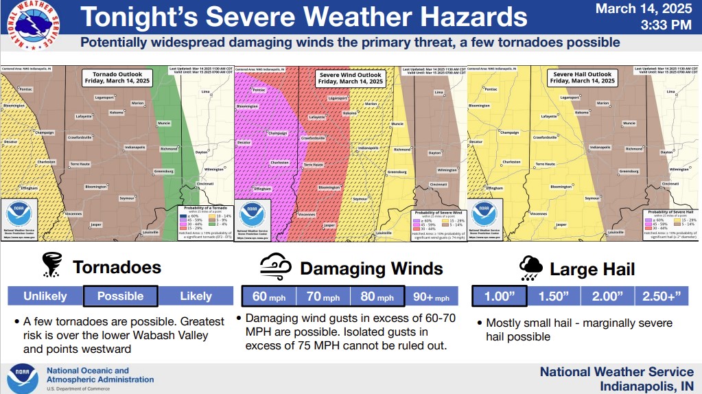
Overview
A potent low pressure system generated a line of strong to severe thunderstorms that moved across central Indiana. Storms ahead of the line also become severe. Widespread wind damage along with a few tornadoes occurred. Tens of thousands of people were without power.Tornadoes
|
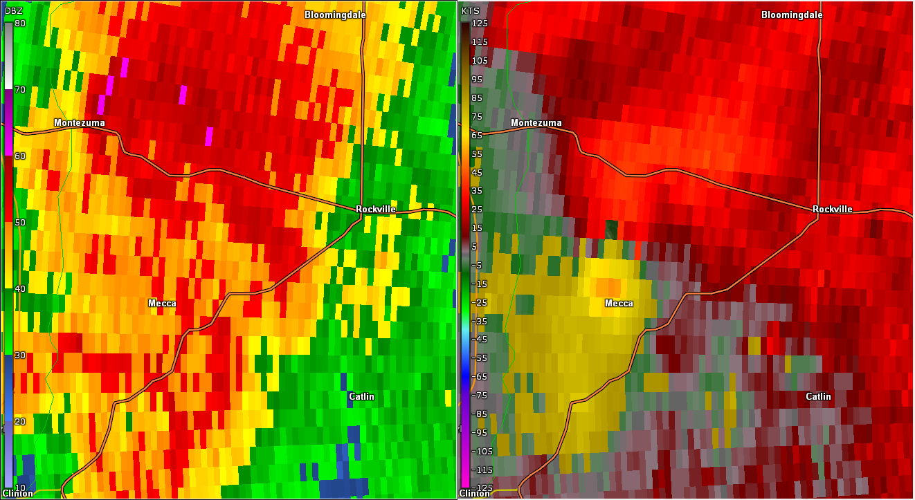
Tornado - Near Mecca
Track Map 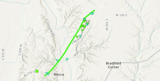 
|
||||||||||||||||
|
||||||||||||||||
|
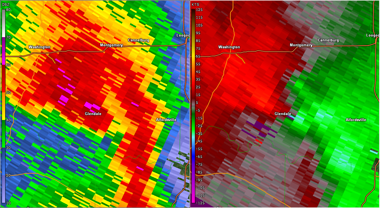
Tornado - West of Loogootee
Track Map 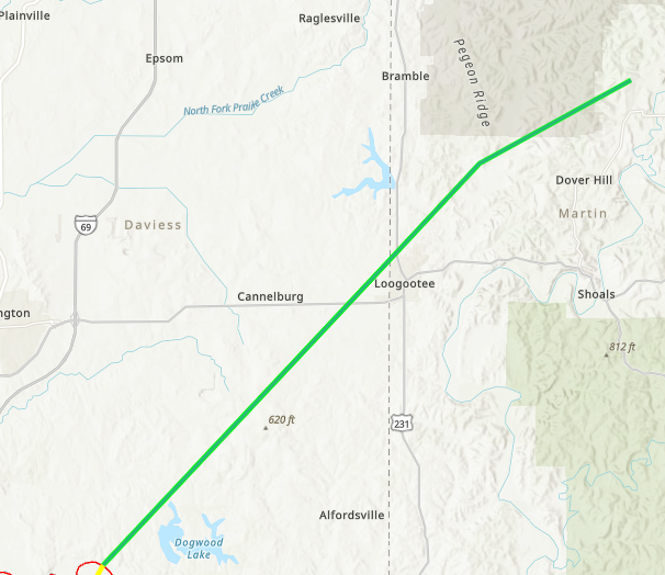
|
||||||||||||||||
|
||||||||||||||||
|
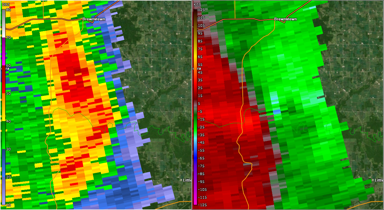
Tornado - South of Brownstown
Track Map 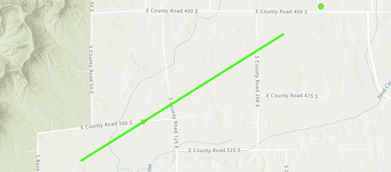
|
||||||||||||||||
|
||||||||||||||||
|
Tornado - Near Fayetteville
Track Map 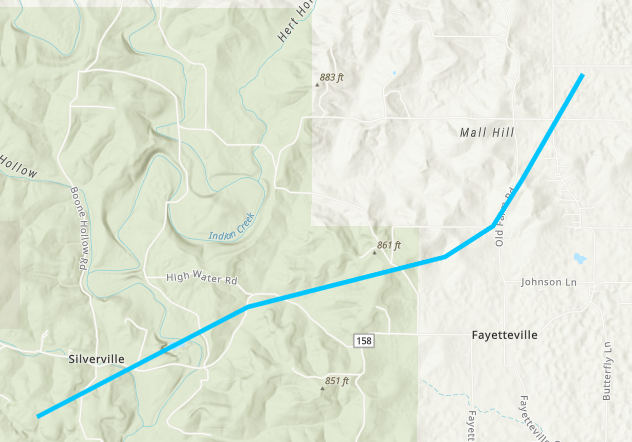
|
||||||||||||||||
|
||||||||||||||||
|
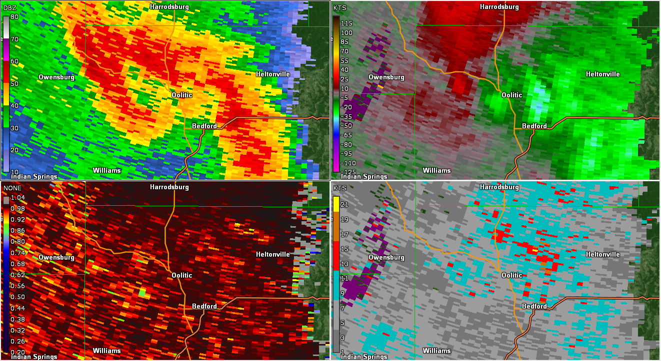
Tornado - Needmore
Track Map 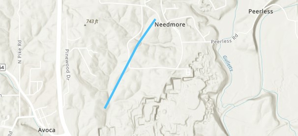
|
||||||||||||||||
|
||||||||||||||||
The Enhanced Fujita (EF) Scale classifies tornadoes into the following categories:
| EF0 Weak 65-85 mph |
EF1 Moderate 86-110 mph |
EF2 Significant 111-135 mph |
EF3 Severe 136-165 mph |
EF4 Extreme 166-200 mph |
EF5 Catastrophic 200+ mph |
 |
|||||
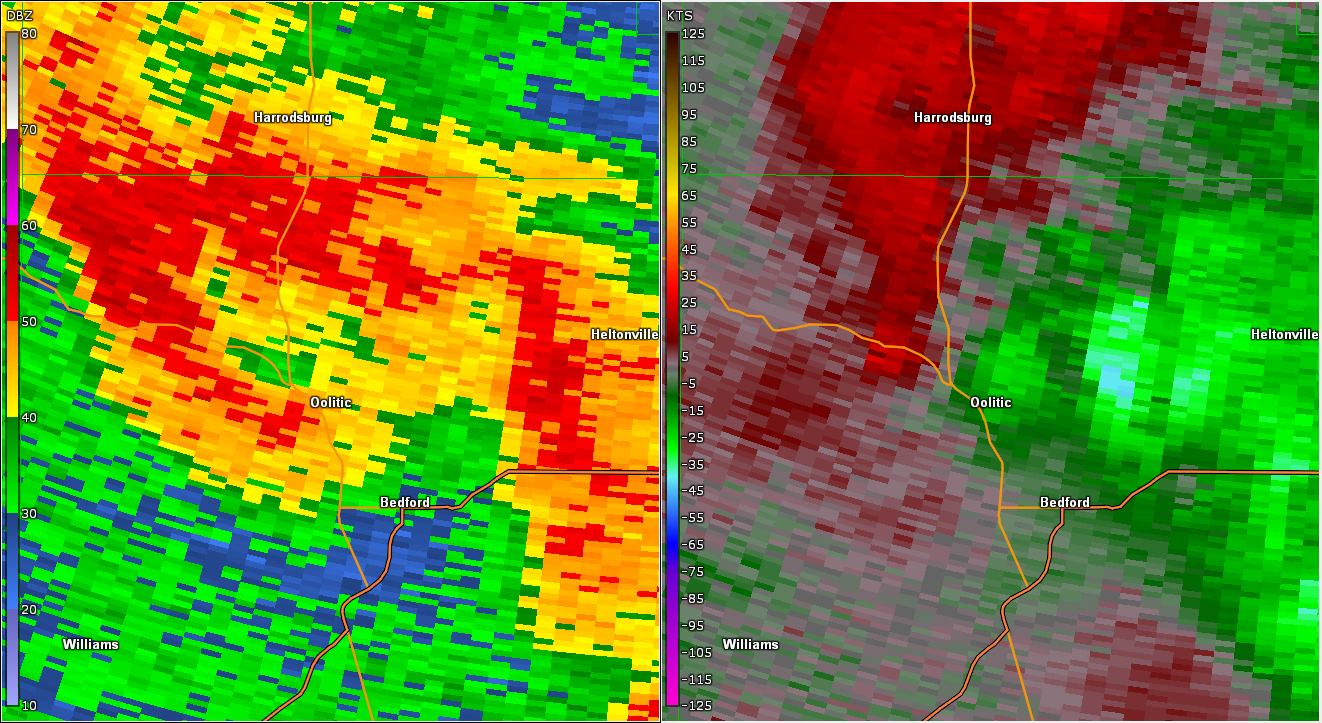
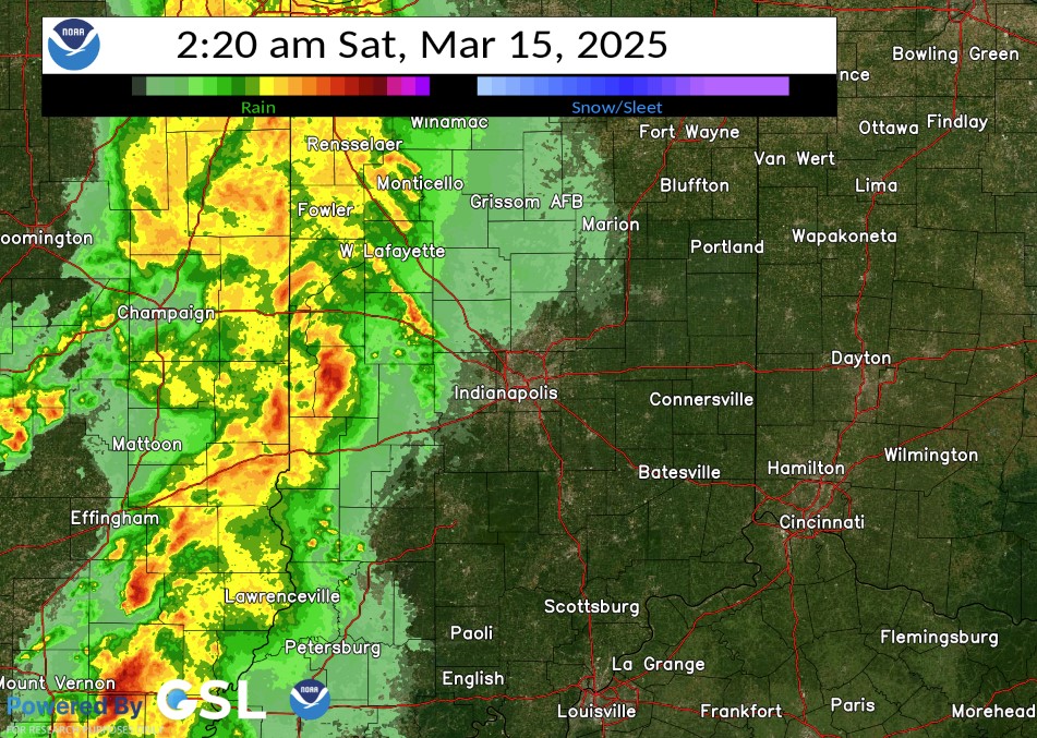
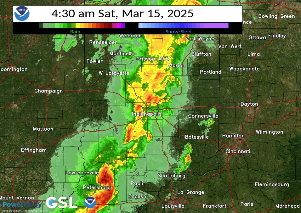
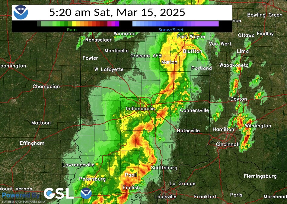
Radar
Selected Images from the Event. A loop is available.
 |
 |
 |
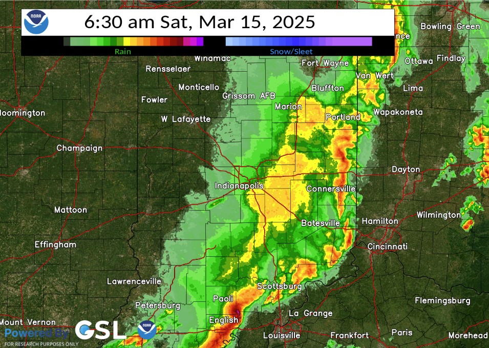 |
| Radar at 2:20 AM EDT | Radar at 4:30 AM EDT | Radar at 5:20 AM EDT | Radar at 6:30 AM EDT |
Storm Reports
Preliminary Local Storm Report...Summary
National Weather Service Indianapolis IN
1008 PM EDT Sat Mar 15 2025

..TIME...   ...EVENT...      ...CITY LOCATION...     ...LAT.LON...
..DATE...   ....MAG....      ..COUNTY LOCATION..ST.. ...SOURCE....
            ..REMARKS..

0214 AM     Tornado          Mecca                   39.73N 87.33W
03/15/2025                   Parke              IN   NWS Storm Survey

            EF-1 tornado with peak wind of 110 MPH, path
            length of 2.66 miles, and a max width of 75
            yards. Destroyed a small garage. Severely
            damaged a 150 year old barn.

0216 AM     Tstm Wnd Dmg     1 NNE Mecca             39.74N 87.32W
03/15/2025                   Parke              IN   Fire Dept/Rescue

            Extensive tree damage, barn damage, road
            shutdown from being impassable.

0217 AM     Tstm Wnd Dmg     3 W Rockville           39.77N 87.28W
03/15/2025                   Parke              IN   Amateur Radio

            reports of tree damage.

0220 AM     Tstm Wnd Dmg     3 E Perrysville         40.05N 87.38W
03/15/2025                   Fountain           IN   911 Call Center

            Late report of thunderstorm winds downed
            dozens of trees and poles across Fountain
            County. Time estimated from radar.

0235 AM     Tstm Wnd Dmg     Alamo                   39.99N 87.06W
03/15/2025                   Montgomery         IN   Public

            Tree limbs downed on State Road 25.

0240 AM     Tstm Wnd Dmg     3 NW Rainsville         40.44N 87.36W
03/15/2025                   Warren             IN   911 Call Center

            Late report of thunderstorm winds downed
            dozens of trees across Warren County. Time
            estimated from radar.

0254 AM     Tstm Wnd Gst     1 SW Purdue University  40.42N 86.93W
03/15/2025  M66 MPH          Tippecanoe         IN   ASOS

            ASOS station KLAF W. Lafayette - Purdue
            Univ. Arpt.

0305 AM     Tstm Wnd Gst     2 S Cagles Mill Lake    39.44N 86.86W
03/15/2025  M53 MPH          Owen               IN   Public


0315 AM     Tstm Wnd Gst     3 WSW Frankfort         40.27N 86.57W
03/15/2025  M60 MPH          Clinton            IN   AWOS

            AWOS station KFKR Frankfort.

0319 AM     Tstm Wnd Dmg     2 NW Farmersburg        39.27N 87.41W
03/15/2025                   Vigo               IN   Public

            Large tree limb down over IN-246.

0330 AM     Tstm Wnd Dmg     Carlisle                38.96N 87.40W
03/15/2025                   Sullivan           IN   Public

            Multiple tree limbs snapped. Relayed via
            social media.

0339 AM     Tstm Wnd Dmg     Bicknell                38.77N 87.30W
03/15/2025                   Knox               IN   Emergency Mngr

            Late report of thunderstorm winds downed an
            old communication tower onto a cable line to
            a utility pole at 108 North Cleveland
            Street. These winds also downed a
            communication line down over New Jersey
            Street. Time estimated from radar.

0349 AM     Tstm Wnd Dmg     1 ESE Indian Heights    40.42N 86.10W
03/15/2025                   Howard             IN   Public

            Tree of unknown size downed over road. Time
            estimated from radar.

0410 AM     Tstm Wnd Dmg     Fillmore                39.67N 86.75W
03/15/2025                   Putnam             IN   911 Call Center

            Late report of thunderstorm winds downed
            several trees in and to the south of
            Fillmore. Time estimated from radar.

0415 AM     Tstm Wnd Dmg     Freedom                 39.21N 86.87W
03/15/2025                   Owen               IN   Public

            Tree snapped.

0419 AM     Tornado          3 W Glendale Fishery    38.54N 87.10W
03/15/2025                   Daviess            IN   NWS Storm Survey

            EF-1 tornado with max wind of 110 MPH, max
            width of 400 yards, and path length in
            central Indiana of 13.63 miles. This tornado
            crossed the East Fork White River into
            southern Daviess County and skipped
            northeast. Significant damage to farm
            outbuildings and grain bins.

0435 AM     Tstm Wnd Dmg     Loogootee               38.67N 86.91W
03/15/2025                   Martin             IN   Emergency Mngr

            Trees and power lines downed. Old masonry
            building leaning towards US231. Possible
            tornado damage near and west of town.

0437 AM     Tstm Wnd Dmg     5 SE Paragon            39.36N 86.49W
03/15/2025                   Morgan             IN   911 Call Center

            Late report of thunderstorm winds downed
            trees along Old Indiana State Route 37 at
            Brehop Lane. Time estimated from radar.

0454 AM     Tstm Wnd Gst     1 SW Indianapolis Int`l 39.72N 86.30W
03/15/2025  M52 MPH          Marion             IN   ASOS

            ASOS station KIND Indianapolis.

0458 AM     Tstm Wnd Gst     3 S Monument Circle     39.72N 86.16W
03/15/2025  E60 MPH          Marion             IN   Public

            Spotter estimated 60 mph winds.

0500 AM     Tstm Wnd Gst     3 WSW Whitehall         39.15N 86.62W
03/15/2025  M64 MPH          Monroe             IN   ASOS

            ASOS station KBMG Bloomington.

0514 AM     Tstm Wnd Dmg     4 ESE Vallonia          38.82N 86.02W
03/15/2025                   Jackson            IN   Public

            Multiple power poles broken, trees down.
            Possible home damage.

0515 AM     Tornado          5 ESE Vallonia          38.81N 86.02W
03/15/2025                   Jackson            IN   Emergency Mngr

            EF-1 Tornado with max winds of 105 mph made
            a roughly 2.2 mile path through far southern
            Jackson Co, IN, significantly damaging a
            mobile home.

0516 AM     Tstm Wnd Gst     1 W Spurgeons Corner    39.07N 86.16W
03/15/2025  M60 MPH          Brown              IN   Public


0518 AM     Tstm Wnd Dmg     5 SE Brownstown         38.82N 85.98W
03/15/2025                   Jackson            IN   Emergency Mngr

            South and west facing walls of two story
            barn/house ripped off and blown into
            neighbors yard. Estimated winds around 80
            mph at the apex of a bow echo. This damage
            occurred right after an EF-1 tornado lifted
            just to the southwest.

0519 AM     Tstm Wnd Dmg     5 SE Brownstown         38.83N 85.98W
03/15/2025                   Jackson            IN   Emergency Mngr

            Newly built pole barn collapsed. Estimated
            winds around 80 mph at the apex of a bow
            echo. This damage occurred right after an
            EF-1 tornado lifted just to the southwest.

0520 AM     Tstm Wnd Dmg     5 NW Crothersville      38.86N 85.90W
03/15/2025                   Jackson            IN   Public

            Damage to home, tree damage around.

0530 AM     Tstm Wnd Dmg     6 E Gnaw Bone           39.19N 86.04W
03/15/2025                   Bartholomew        IN   Emergency Mngr

            Reports of trees and wires down along the
            western portion of Bartholomew Co.

0535 AM     Tstm Wnd Dmg     2 NE Taylorsville       39.32N 85.91W
03/15/2025                   Bartholomew        IN   Trained Spotter

            Late report of thunderstorm winds snapped
            two wooden power poles and a center-pivot
            sprinkler was overturned in the field north
            of County Road 800 North near Baseline Road.
            Time estimated from radar.

0554 AM     Tstm Wnd Dmg     3 NNW Waldron           39.50N 85.70W
03/15/2025                   Shelby             IN   Public

            Late report of thunderstorm winds downed a
            tree at St. Vincent Catholic Church. Time
            estimated from radar.

0558 AM     Tstm Wnd Dmg     Rushville               39.62N 85.45W
03/15/2025                   Rush               IN   Emergency Mngr

            Reports of trees down in Rushville and
            entire town without power due to wind
            damage.

0605 AM     Tstm Wnd Dmg     2 N Rushville           39.65N 85.44W
03/15/2025                   Rush               IN   Emergency Mngr

            *** 3 INJ ***
            Late report of over 50 locations spread
            across Rush County with tress or powerlines
            down with at least two dozen structures
            damaged. Three people were injured north of
            Rushville where winds blew over a security
            trailer. Time estimated from radar.

0249 PM     Flood            Indiana University      39.17N 86.53W
03/15/2025                   Monroe             IN   Trained Spotter

            Spotter Reports Flooding on Roadways,
            impacting Traffic.
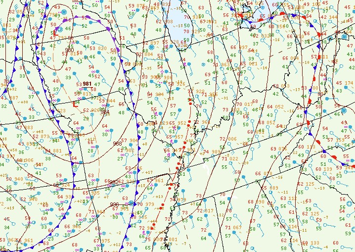
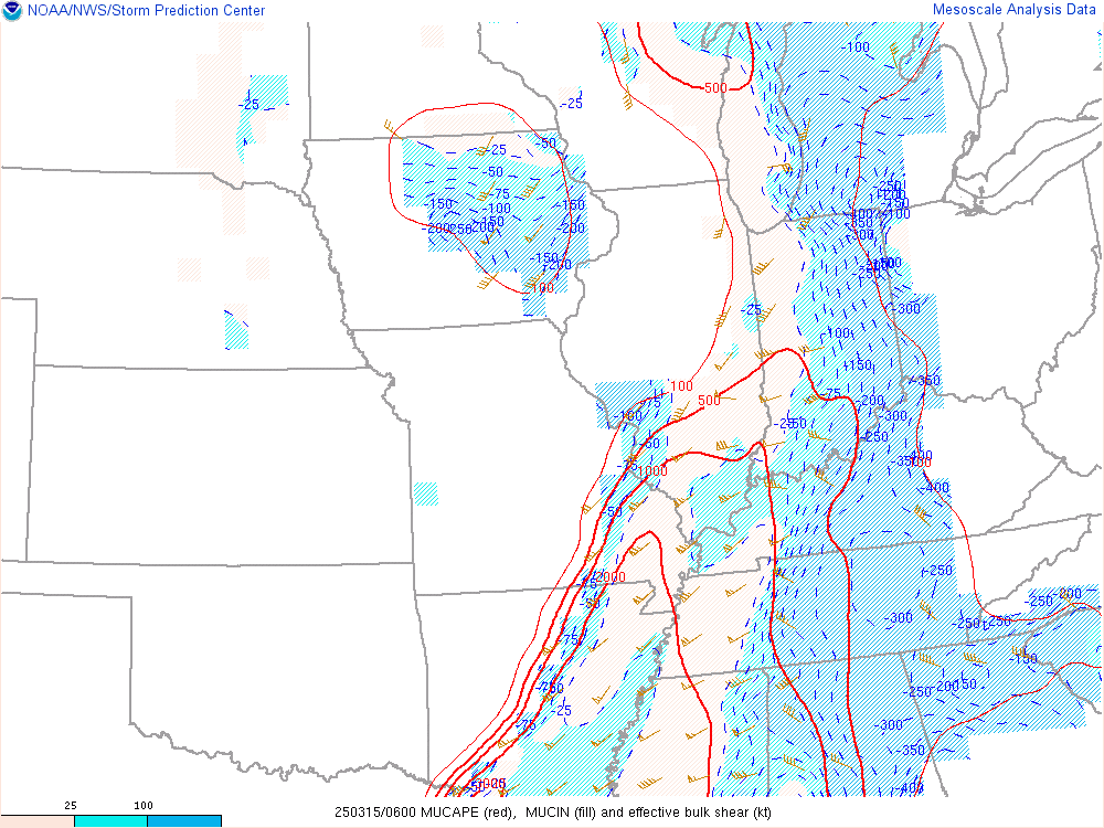
Environment
A strong low pressure system brought a line of storms with widespread wind damage and a few tornadoes to central Indiana. The system had very strong winds not far off the ground, which was then brought down in the storms to cause the damage.
 |
 |
 |
| Figure 1: Surface Map at 2:00 AM EDT | Figure 2: CAPE & Shear at 2:00 AM EDT | Figure 3: 925mb Analysis at 2:00 AM EDT |
Additional Information
The Forecast
 |
 |
 |
|
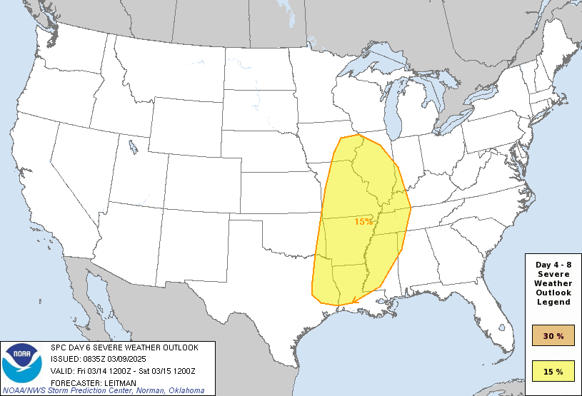
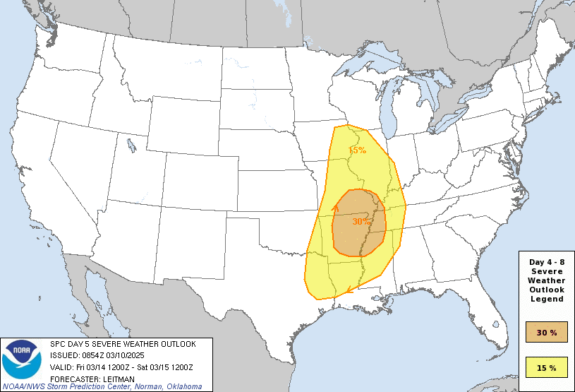
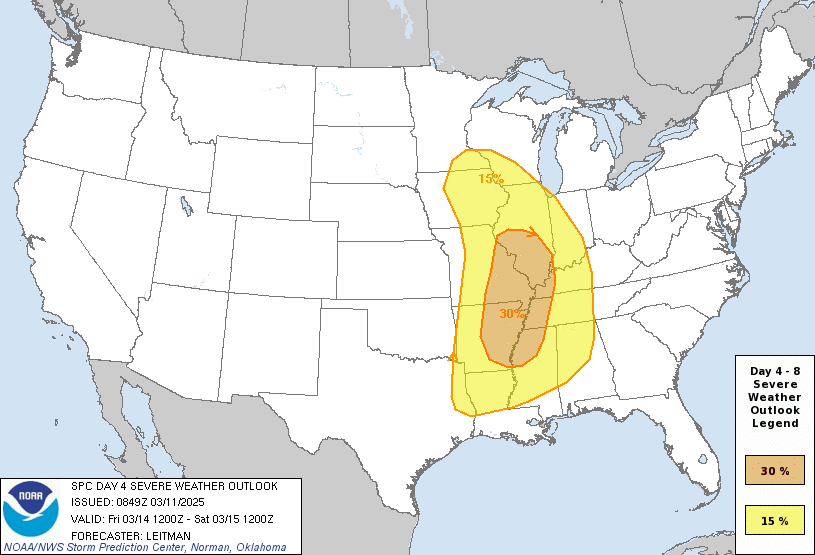
| SPC Day 6 Outlook | SPC Day 5 Outlook | SPC Day 4 Outlook | |
 |
 |
 |
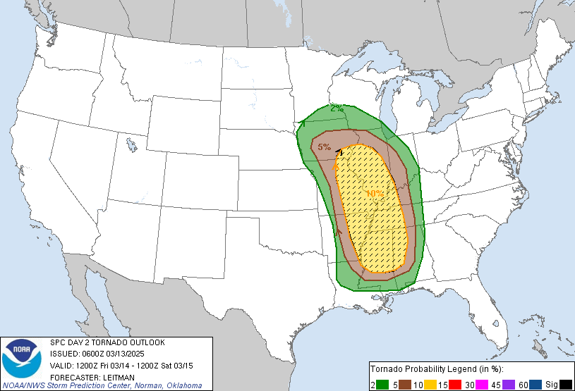 |
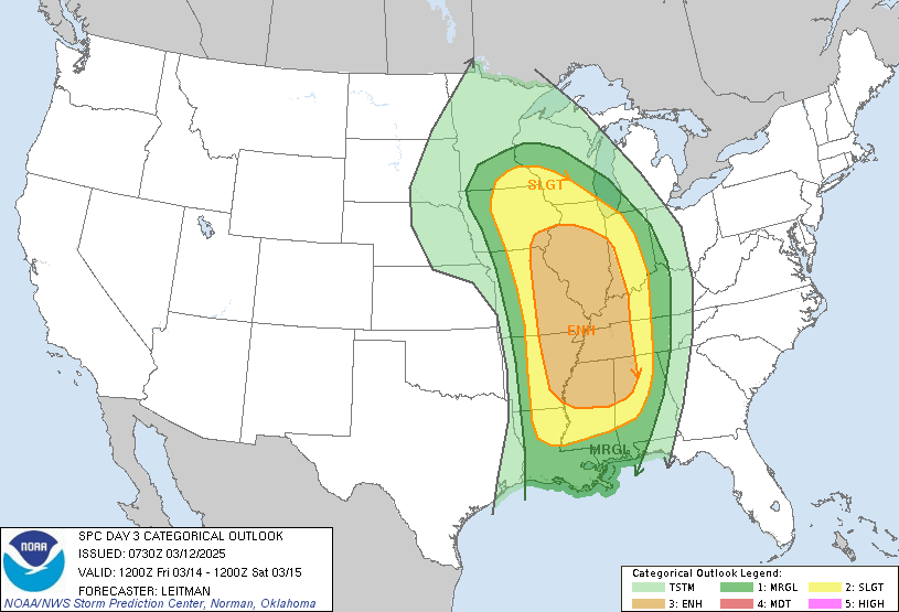
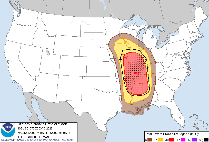
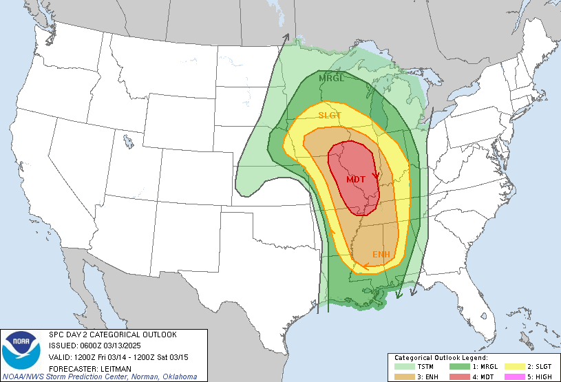
| SPC Day 3 Categorical Outlook | SPC Day 3 Probabilistic Outlook | SPC Day 2 Categorical Outlook | SPC Day 2 Tornado Probabilistic Outlook |
 |
 |
 |
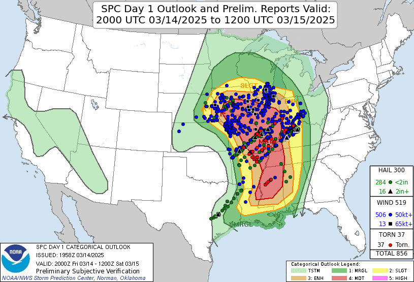 |
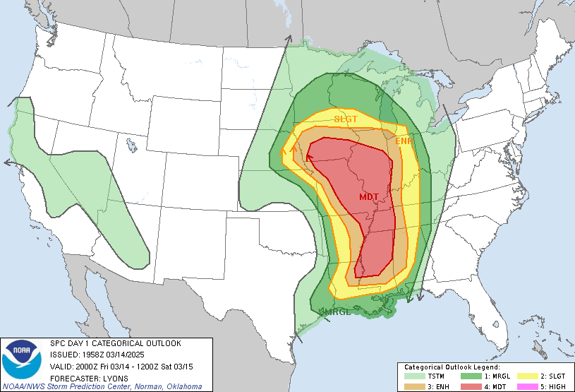
| SPC Day 1 Categorical Outlook | WFO IND Graphic from March 15 (Uses SPC Day 1 Categorical Outlook) | WFO IND Graphic from March 15 (Uses SPC Day 1 Probabilistic Data) | SPC Day 1 Outlook with Storm Reports from the Event Overlaid |
Summaries from other NWS Offices
 |
Media use of NWS Web News Stories is encouraged! Please acknowledge the NWS as the source of any news information accessed from this site. |
|