Overview
The remnants of Tropical Cyclone Beryl moved across Indiana on July 9 into early July 10. The system brought a tornado, heavy rain, and gusty winds to central Indiana.Tornadoes
|
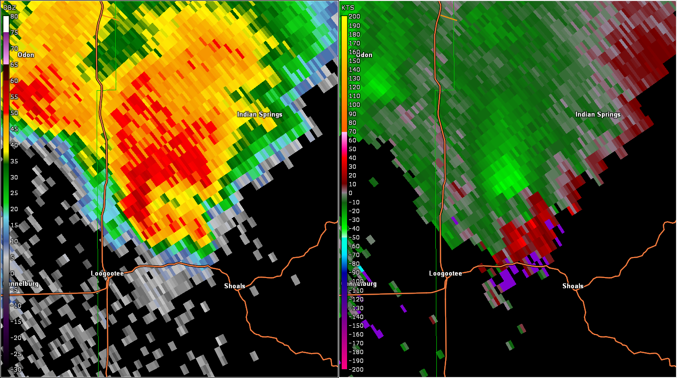
Tornado - Near Shoals
Track Map 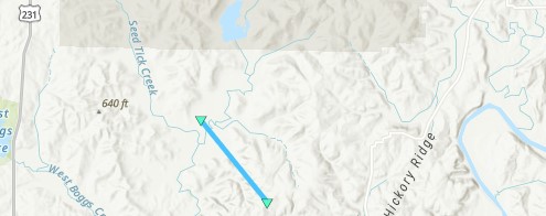 
|
||||||||||||||||
|
||||||||||||||||
The Enhanced Fujita (EF) Scale classifies tornadoes into the following categories:
| EF0 Weak 65-85 mph |
EF1 Moderate 86-110 mph |
EF2 Significant 111-135 mph |
EF3 Severe 136-165 mph |
EF4 Extreme 166-200 mph |
EF5 Catastrophic 200+ mph |
 |
|||||
Radar
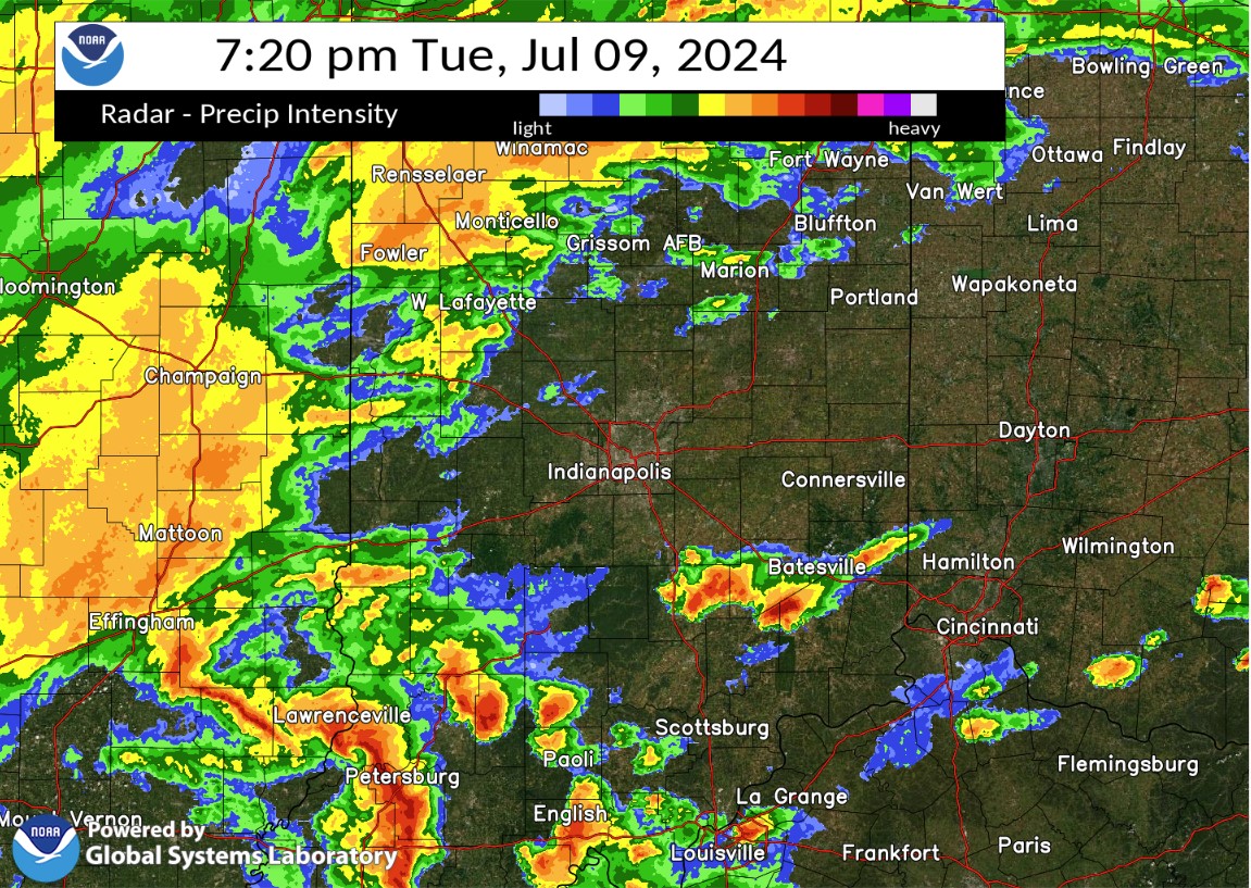
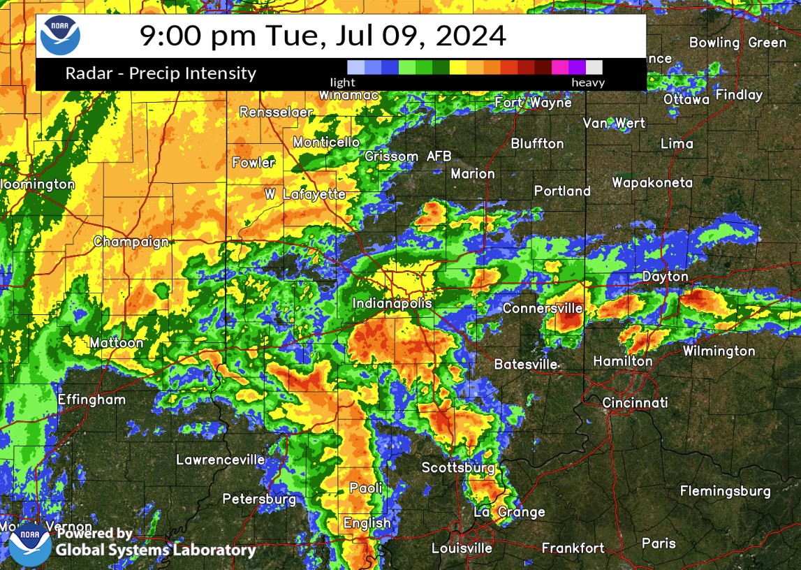
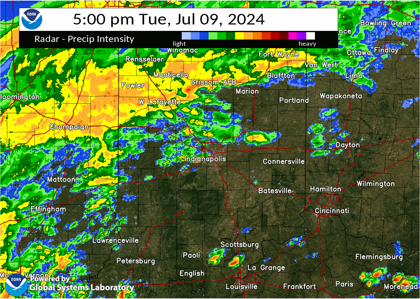
Selected images from the event. A radar loop of the evening radar follows below.
 |
 |
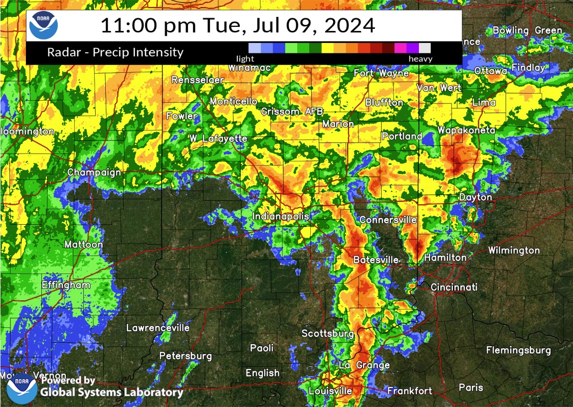 |
| 7:20 PM EDT Radar | 9:00 PM EDT Radar | 11:00 PM EDT Radar |
Rain Reports
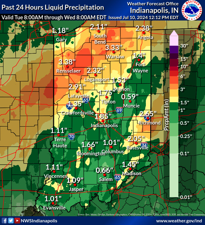
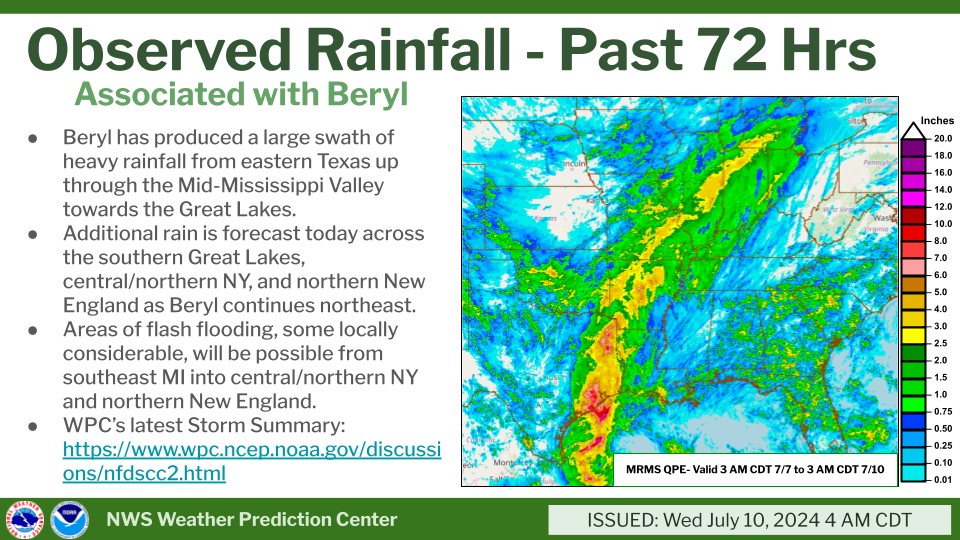
A 24-hour rainfall map for Indiana is below. A regional map of 72-hour rainfall from Tropical Cyclone Beryl and its remnants follows.
Below are the highest wind gusts observed from the afternoon of the 9th through the afternoon of the 10th.
Public Information Statement
National Weather Service Indianapolis IN
519 PM EDT Wed Jul 10 2024

...HIGHEST WIND REPORTS IN PAST 24 HOURS...

Location                     Speed     Time/Date       Provider
W. Lafayette - Purdue Univ.  54 MPH    0506 AM 07/10   ASOS
Kokomo                       48 MPH    0917 AM 07/10   AWOS
Michigantown                 46 MPH    0735 AM 07/10   DAVIS
Muncie                       46 MPH    1102 AM 07/10   ASOS
Indianapolis (Eagle Creek)   45 MPH    0614 AM 07/10   ASOS
Frankfort                    45 MPH    0715 AM 07/10   AWOS
Indianapolis                 45 MPH    0611 AM 07/10   ASOS
Greencastle (WEATHERSTEM)    42 MPH    0500 AM 07/10   MESOWEST
Bloomington                  41 MPH    0910 PM 07/09   ASOS
Indianapolis                 40 MPH    0930 AM 07/10   CWOP
Anderson Municipal Apt       40 MPH    0959 AM 07/10   AWOS
Indianapolis Exc             40 MPH    0855 AM 07/10   AWOS
Sheridan                     39 MPH    0730 AM 07/10   DAVIS
Greencastle                  38 MPH    0435 AM 07/10   AWOS
1 N Castleton                38 MPH    0858 AM 07/10   AWOS
Muncie                       37 MPH    0945 AM 07/10   CWOP
Noblesville                  37 MPH    0805 AM 07/10   CWOP
Indianapolis Reg             37 MPH    0955 AM 07/10   AWOS
Dunlap Family Farm           37 MPH    0810 AM 07/10   MESOWEST
Tipton                       36 MPH    0745 AM 07/10   DAVIS
Tipton                       36 MPH    0845 AM 07/10   CWOP
2 ESE Danville               36 MPH    0555 AM 07/10   AWOS
Muncie                       35 MPH    1145 AM 07/10   DAVIS
Terre Haute                  35 MPH    0409 AM 07/10   ASOS
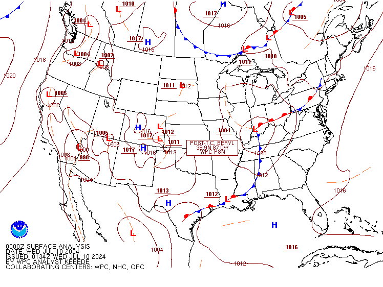
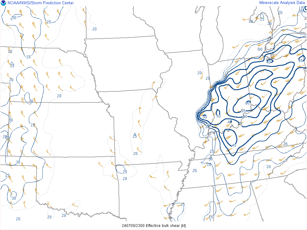
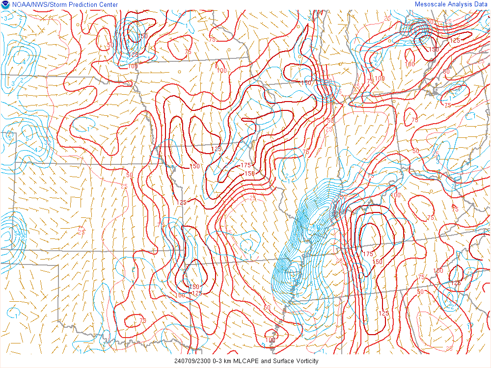
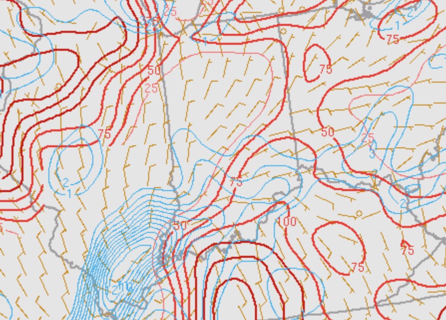
Environment
The remnants of Tropical Cyclone Beryl brought a very moist atmosphere along with plentiful shear to the area. Instability near the surface warm front along with the front itself aided in producing tornadic thunderstorms.
 |
 |
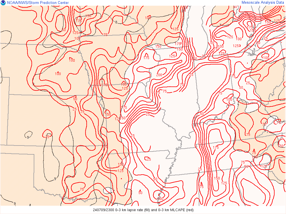 |
| Figure 1: Surface Map at 8:00 PM EDT | Figure 2: Effective Shear at 7:00 PM EDT | Figure 3: Low Level CAPE at 7:00 PM EDT |
 |
 |
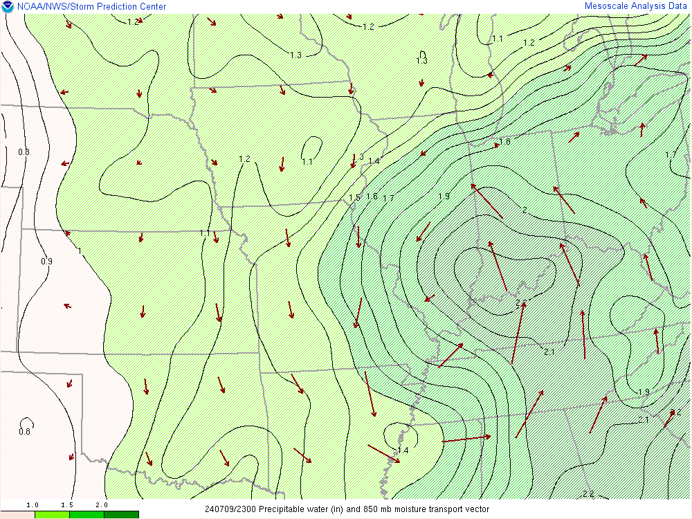 |
| Figure 4: Low Level CAPE and Surface Vorticity at 7:00 PM EDT | Figure 5: Zoomed in view of Figure 4 | Figure 6: Precipitable Water at 7:00 PM EDT |
Links to Nearby Office's Reviews of Beryl Remnants
 |
Media use of NWS Web News Stories is encouraged! Please acknowledge the NWS as the source of any news information accessed from this site. |
|