Overview
A derecho moved from Iowa southeast into Indiana during the evening of July 15 and early morning of July 16. For central Indiana, the derecho brought wind gusts of 75 mph to parts of the area as well as downed trees and power lines. This derecho also produced a small gustnado near Atlanta, IN along the leading edge of strongest winds. The last time a derecho impacted central parts of Indiana was back on June 29, 2023.
Derecho definition: (pronounced deh-REY-cho) is a widespread, long-lived windstorm associated with a band of rapidly moving showers and thunderstorms. A storm is classified as a derecho if wind damage swatch extends more than 240 miles and has wind gusts of at least 58 mph or greater most of the length of the storm's path.
Links to other summaries:
Radar
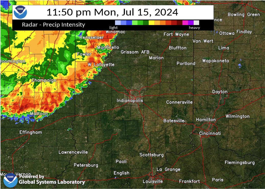
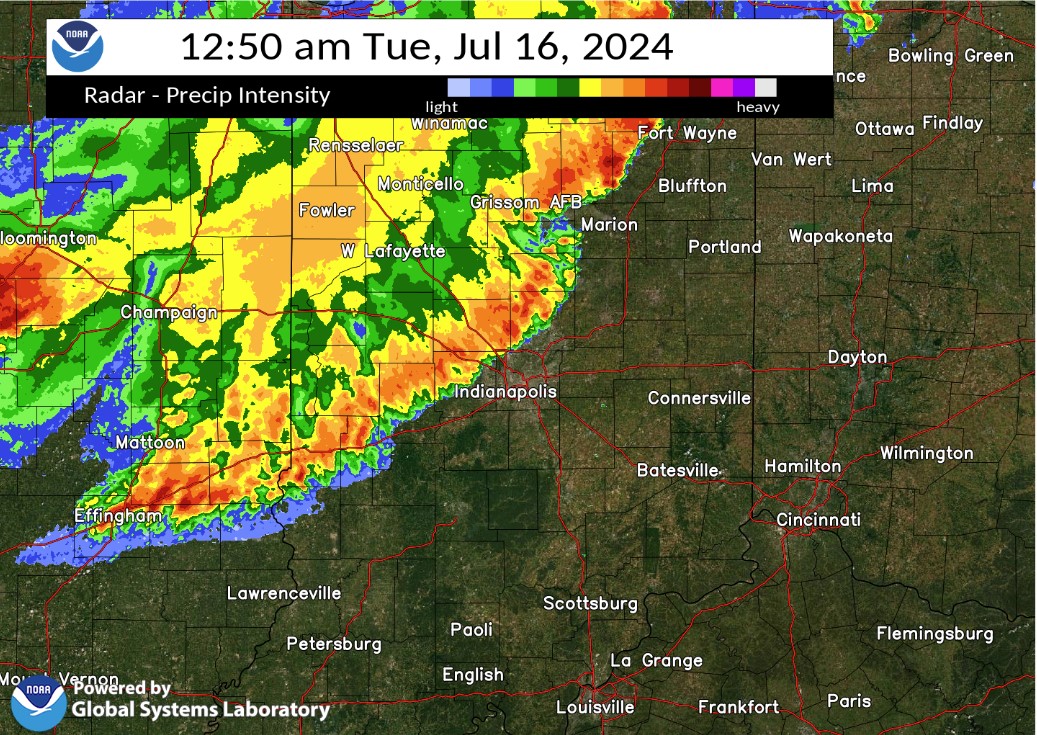
Selected images from the event. A radar loop of the derecho from Iowa to Indiana is below.
 |
 |
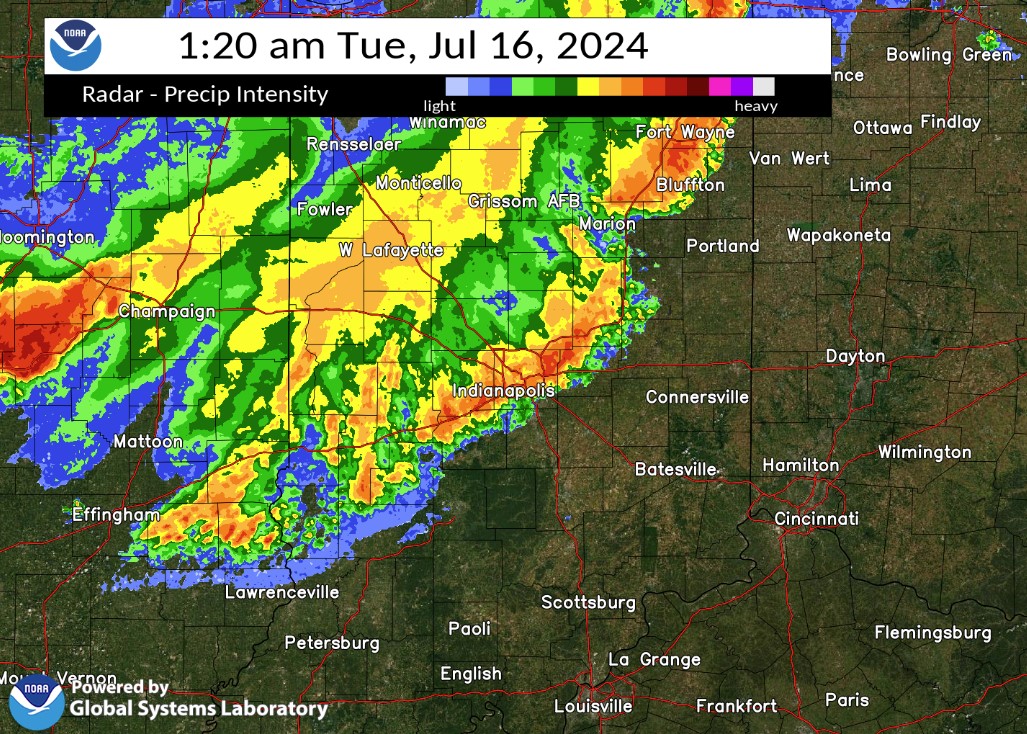 |
| Radar at 11:50 PM EDT | Radar at 12:50 AM EDT | Radar at 1:20 AM EDT |
Radar Loop of the Derecho. Image courtesy of WFO Lincoln, IL. Time on image
is in Central Daylight Time.
Storm Reports
Preliminary Local Storm Report
National Weather Service Indianapolis IN

..TIME...   ...EVENT...      ...CITY LOCATION...     ...LAT.LON...
..DATE...   ....MAG....      ..COUNTY LOCATION..ST.. ...SOURCE....
            ..REMARKS..

1151 PM     Tstm Wnd Gst     1 SW Purdue University  40.42N 86.93W
07/15/2024  M75 MPH          Tippecanoe         IN   ASOS

            ASOS station KLAF W. Lafayette - Purdue
            Univ. Arpt.

1151 PM     Tstm Wnd Dmg     1 NW West Lafayette     40.46N 86.93W
07/15/2024                   Tippecanoe         IN   Public

            Delayed report. Drone photos received of
            tree damage.

1159 PM     Tstm Wnd Dmg     Purdue University       40.43N 86.92W
07/15/2024                   Tippecanoe         IN   Emergency Mngr

            A couple of trees snapped.

1222 AM     Tstm Wnd Dmg     Russiaville             40.42N 86.27W
07/16/2024                   Howard             IN   Public

            Delayed report. Several trees snapped.

1235 AM     Tstm Wnd Dmg     3 W Kokomo              40.47N 86.20W
07/16/2024                   Howard             IN   Public

            Delayed report. Numerous reports of trees
            uprooted or snapped with downed powerlines
            towards the southwest portions of the
            county.

1239 AM     Tstm Wnd Dmg     1 NW Kokomo             40.49N 86.15W
07/16/2024                   Howard             IN   Public

            Report from mPING: 1-inch tree limbs broken;
            Shingles blown off.

1243 AM     Tstm Wnd Gst     Westfield               40.05N 86.13W
07/16/2024  E55 MPH          Hamilton           IN   Amateur Radio

1240 AM     Tstm Wnd Dmg     Tipton                  40.28N 86.04W
07/16/2024                   Tipton             IN   911 Call Center

            Tree on house. Time estimated.

1240 AM     Tstm Wnd Dmg     3 SW Sharpsville        40.35N 86.13W
07/16/2024                   Tipton             IN   911 Call Center

            Semi blown over on US 31. Time estimated
            from radar.

1240 AM     Tstm Wnd Dmg     Atlanta                 40.21N 86.03W
07/16/2024                   Hamilton           IN   Public

            Delayed report. Approximately 2 mile path of downed trees
            and tree limbs with a barn also damaged by gustnado.

1244 AM     Tstm Wnd Dmg     1 SW Cicero             40.11N 86.04W
07/16/2024                   Hamilton           IN   Public

            Delayed report. Tree snapped.


0100 AM     Tstm Wnd Dmg     1 E Carmel              39.97N 86.09W
07/16/2024                   Hamilton           IN   NWS Employee

            At least one large tree down with multiple
            large branches down throughout the nearby
            area. Time estimated from radar.


0104 AM     Tstm Wnd Gst     1 SW Indianapolis Int`l 39.72N 86.30W
07/16/2024  M58 MPH          Marion             IN   ASOS

            ASOS station KIND Indianapolis.

0115 AM     Tstm Wnd Dmg     Indianapolis            39.78N 86.15W
07/16/2024                   Marion             IN   Law Enforcement

            Multiple reports of power lines down in
            Indianapolis.
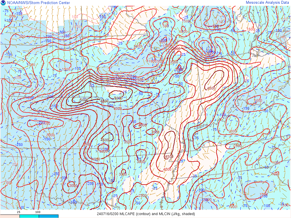
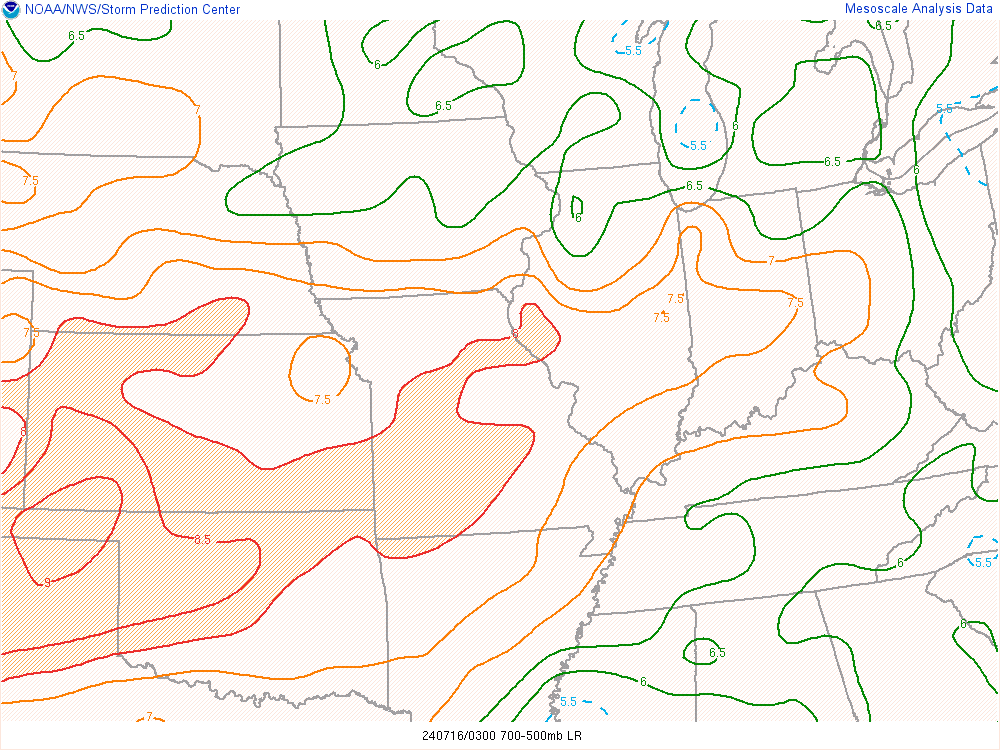
Environment
Insert synoptic summary.
 |
 |
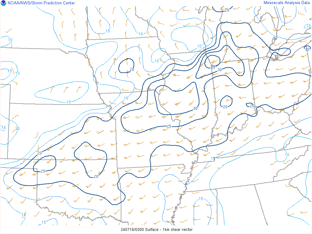 |
| Figure 1: Mixed Layer CAPE at 11:00 PM, showing very high values for the time of day. | Figure 2: Mid Level Lapse Rates at 11:00 PM | Figure 3: 0-1km Shear at 11:00 PM |
Satellite Loop (courtesy of CSU/CIRA):
 |
Media use of NWS Web News Stories is encouraged! Please acknowledge the NWS as the source of any news information accessed from this site. |
|

