A large storm system brought snow at times from Monday January 26 through Wednesday January 28, dropping over a foot of snow across portions of Central Indiana. Much of the snow fell during the night of the 27th and morning of the 28th, when an area of low pressure moved from Tennessee through eastern Kentucky.
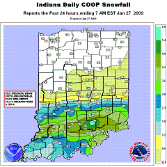
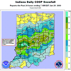
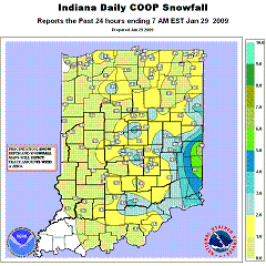
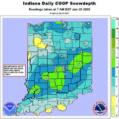
Below are 24 hour snowfall maps for January 27, 28, and 29, along with the snow depth at 7:00 AM January 29. Click any map to enlarge. A list of snowfall reports received from around Central Indiana can be found below.
 |
 |
 |
 |
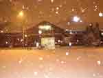
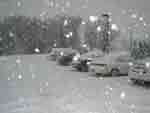
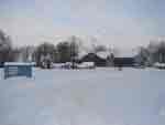
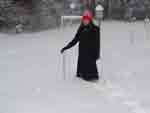
For Indianapolis, the 12.5 inches of snow that fell during the storm produced the 6th largest snow storm for the city at the time. The last time a bigger snowstorm struck the Indianapolis International Airport was when12.8 inches fell in January 1996. A list of the top snow storms to strike Indianapolis can be found below. Here are some pictures taken at the National Weather Service Forecast Office (click any picture to enlarge):
 |
 |
 |
 |
Ice Totals:
0.25 to 0.50 inches of ice accumulated in far southern portions of Central Indiana, including Knox, Daviess, Martin, Lawrence, Jackson, and Jennings Counties. Lighter ice accumulations of 0.10 to 0.25 inches occurred farther north in southern portions of Sullivan, Greene, Monroe, Brown, Bartholomew, and Decatur Counties.
The radar images below are for midnight, 2:00 AM, and 4:00 AM on January 28. Click any image to enlarge. A small size radar loop of images from the top of each hour from midnight to 5:00 AM is also available.
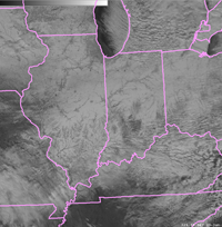
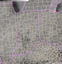
The snow cover across Indiana and nearby areas can be seen on these visible satellite images. Some clouds cover portions of southern Indiana and far northern Indiana, but most of the state is cloud free. Click an image for a larger version.
 |
 |
The following are snow totals collected from across Central Indiana for the storm total. Many thanks to our local law enforcement, broadcast media partners, and to all of our extremely dedicated spotters, cooperative observers, and CoCoRaHS observers! Your timely and accurate reports of snowfall are very appreciated.
For all un-official observations from the CoCoRaHS network visit www.cocorahs.org
|
Snowfall Measurement
|
Time
|
Location
|
County
|
Source
|
| 16.3 | Storm Total | 4.0 WSW Gosport | Owen | CoCoRaHS Observer |
| 13.2 | Storm Total | 3 S Paragon | Morgan | CoCoRaHS Observer |
|
12.8
|
Storm Total
|
6.9 N Bloomington
|
Monroe
|
CoCoRaHS Observer
|
|
12.8
|
Storm Total
|
2.0ESE Muncie
|
Delaware
|
CoCoRaHS Observer
|
| 12.7 | Storm Total | 2 SE Brownsburg | Hendricks | CoCoRaHS Observer |
| 12.7 | Storm Total | 2 ENE Knightstown | Henry | CoCoRaHS Observer |
|
12.5
|
Storm Total
|
1S Castleton
|
Marion
|
Cooperative Observer
|
|
12.5
|
Storm Total
|
Indianapolis Int’l Airport
|
Marion
|
Official NWS Obs
|
| 12.5 | Storm Total | 0.7E Martinsville | Morgan | CoCoRaHS Observer |
|
12.0
|
Storm Total
|
3.3 SW Nashville
|
Brown
|
CoCoRaHS Observer
|
| 12.0 | Storm Total | 1.3S Plainville | Daviess | CoCoRaHS Observer |
|
12.0
|
Storm Total
|
6.5N Spencer
|
Owen
|
Trained Spotter
|
| 12.0 | Storm Total | 2NE Straughn | Henry | Amateur Radio |
| 12.0 | Storm Total | 1.1W Plainfield | Hendricks | CoCoRaHS Observer |
| 11.9 | Storm Total | 4.6 S Brownsburg | Hendricks | CoCoRaHS Observer |
| 11.8 | Storm Total | 4 SSE New Castle | Henry | Cooperative Observer |
| 11.7 | Storm Total | 4.5 NE Indianapolis | Marion | CoCoRaHS Observer |
|
11.5
|
Storm Total
|
1 SE Vincennes
|
Knox
|
CoCoRaHS observer
|
| 11.5 |
Storm Total
|
5 SW Tipton
|
Tipton
|
Cooperative Observer
|
|
11.5
|
Storm Total
|
6.5SE Bedford
|
Lawrence
|
CoCoRaHS Observer
|
|
11.3
|
Storm Total
|
4.1 W Lawrence
|
Marion
|
CoCoRaHS Observer
|
|
11.3
|
Storm Total
|
0.5 NE Brooklyn
|
Morgan
|
NWS Employee
|
| 11.2 | Storm Total | 3 S Odon | Daviess | Broadcast Media |
| 11.1 | Storm Total | 3.9 E Bloomington | Monroe | CoCoRaHS Observer |
| 11.0 | Storm Total | Winchester | Randolph | Dep't of Highways |
| 11.0 | Storm Total | 3.8 SE Odon | Daviess | CoCoRaHS Observer |
| 11.0 | Storm Total | 3.8 ENE Morristown | Rush | CoCoRaHS Observer |
| 11.0 | Storm Total | 0.5 NE Fairland | Shelby | CoCoRaHS Observer |
| 11.0 | Storm Total | Freelandville | Knox | CoCoRaHS Observer |
| 11.0 | Storm Total | 3 S Franklin | Johnson | CoCoRaHS Observer |
| 11.0 | Storm Total | 4.4 W Atlanta | Tipton | CoCoRaHS Observer |
| 10.7 | Storm Total | 0.8NE Avon | Hendricks | NWS Employee |
| 10.6 | Storm Total | 4.8 N Indianapolis | Marion | CoCoRaHS Observer |
| 10.6 | Storm Total | 0.9 ESE Carmel | Hamilton | CoCoRaHS Observer |
| 10.5 | Storm Total | 6.5NW Bloomington | Monroe | CoCoRaHS Observer |
| 10.5 | Storm Total | Loogootee | Martin | Public |
| 10.5 | Storm Total | Medora | Jackson | Cooperative Observer |
| 10.5 | Storm Total | 4 W Acton | Marion | Cooperative Observer |
| 10.4 | Storm Total | 2.6 SW Washington | Daviess | CoCoRaHS Observer |
| 10.3 | Storm Total | Terre Haute | Vigo | Broadcast Media |
| 10.2 | Storm Total | 3.7 N Bedford | Lawrence | CoCoRaHS Observer |
| 10.2 | Storm Total | 0.7 E Cumberland | Hancock | CoCoRaHS Observer |
| 10.2 | Storm Total | Rushville | Rush | Cooperative Observer |
| 10.1 | Storm Total | 7.1 WSW Shelbyville | Shelby | CoCoRaHS Observer |
|
10.0
|
Storm Total
|
8.5 WSW Columbus
|
Bartholomew
|
CoCoRaHS Observer
|
| 10.0 | Storm Total | 3 W Greenwood | Johnson | NWS Employee |
| 10.0 | Storm Total | Alexandria | Madison | Trained Spotter |
| 10.0 | Storm Total | Bloomfield | Greene | Cooperative Observer |
| 10.0 | Storm Total | Brazil | Clay | Dep't of Highways |
| 9.8 | Storm Total | 5.8S Greensburg | Decatur | CoCoRaHS Observer |
| 9.7 | Storm Total | 0.3 WSW Sullivan | Sullivan | CoCoRaHS Observer |
|
9.5
|
Storm Total
|
3 SSE Ridgeville
|
Randolph
|
Cooperative Observer
|
|
9.5
|
Storm Total
|
2 ESE Merom
|
Sullivan
|
Cooperative Observer
|
| 9.5 | Storm Total | 3.1 NNW Filmore | Putnam | CoCoRaHS Observer |
|
9.3
|
Storm Total
|
4 ENE Jasonville
|
Clay
|
CoCoRaHS Observer
|
| 8.7 | Storm Total | 4.1 ENE Atlanta | Tipton | CoCoRaHS Observer |
| 8.6 |
Storm Total
|
7S Spencer
|
Owen
|
CoCoRaHS Observer
|
|
8.4
|
Storm Total
|
6 SE Crawfordsville
|
Montgomery
|
CoCoRaHS Observer
|
| 8.1 | Storm Total | 3.9 WSW Lebanon | Boone | CoCoRaHS Observer |
| 8.1 | Storm Total | 3.8 N Zionsville | Boone | CoCoRaHS Observer |
| 8.0 | Storm Total | 1.6 E Jamestown | Boone | CoCoRaHS Observer |
|
8.0
|
Storm Total
|
4.7 NW Lapel
|
Hamilton
|
CoCoRaHS Observer
|
| 8.0 | Storm Total | 5 NE Seymour | Jackson | Broadcast Media |
| 8.0 | Storm Total | Clinton | Vermillion | Dep't of Highways |
| 7.8 | Storm Total | 4.9 NNW Cicero | Hamilton | CoCoRaHS Observer |
| 7.6 | Storm Total | 1.8 ENE Lewisville | Henry | CoCoRaHS Observer |
| 7.4 | Storm Total | 4.4 W Lebanon | Boone | CoCoRaHS Observer |
|
7.0
|
Storm Total
|
Rockville
|
Parke
|
Dep't of Highways
|
|
7.0
|
Storm Total
|
0.4NNW Covington
|
Fountain
|
CoCoRaHS Observer
|
| 6.8 | Storm Total | 4.5 NNE Lizton | Boone | CoCoRaHS Observer |
| 6.5 | Storm Total | 4.6 ESE Kokomo | Howard | CoCoRaHS Observer |
| 6.0 | Storm Total | Frankfort | Clinton | Dep't of Highways |
| 5.8 | Storm Total | 5 WSW Kokomo | Howard | Cooperative Observer |
| 5.0 | Storm Total | West Lebanon | Warren | Dep't of Highways |
| 4.5 | Storm Total | 4 WNW Perrysville | Vermillion | Cooperative Observer |
| 4.0 | Storm Total | 6 NW West Laf. | Tippecanoe | Cooperative Observer |
|
3.7
|
Storm Total
|
2.3SE Otterbein
|
Tippecanoe
|
CoCoRaHS Observer
|
Table of Top 6 Snow Storms at Indianapolis: (as of January 2009)
|
Date |
Storm Total Snow |
|
2/16-2/18/1910 |
16.1 |
|
1/25-1/27/1978 |
15.5 |
|
2/27-2/29/1984 |
13.2 |
|
12/19-12/21/1973 |
13.0 |
|
1/2-1/4/1996 |
12.8 |
|
1/12-1/14/1968 |
12.5 |
|
2/24-2/26/1965 |
12.5 |
|
1/26-1/28/2009 |
12.5 |
Back to Weather Events Page
NWS IND Home