Overview
|
Two back-to-back systems brought a total of over 2 feet of snow to central Indiana, followed by cold temperatures. |
 Snow at NWS Office |
Summary
Two separate snow storms accompanied by copious amounts of moisture originated in the Central Plains during the week before Christmas 2004. Each system curved southeast across the Texas Panhandle and then lifted northeast across the Ohio Valley. These storms hammered Southern and Central Indiana on December 22 and December 23 bringing record or near record snowfall to parts of South Central and East Central Indiana and significant snowfall to the rest of Central Indiana. The first system brought up to 12 inches of snow across Southern and East Central Indiana on December 22. The snows started falling during the early morning and continued through the early afternoon. The bulk of the snow fell along and south of a line from Randolph County to Southeastern Marion County to Sullivan County. The heaviest snow fell in a band from around Princeton to Loogootee to Paoli to Nashville to Rushville where 10 inches was common. Paoli reported 12 inches by early afternoon on the 22nd.
The second system quickly followed the first with accumulating snows starting in the late afternoon of the 22nd across Southwestern Indiana and across the rest of Central Indiana by evening. The snow continued into the overnight before ending across East Central Indiana just after sunrise. Two-day snowfall totals exceeded 20 inches across most of Southeastern Indiana with Seymour reporting a two-day record of 29 inches. The area bounded by Vincennes, Terre Haute, Muncie and Kokomo saw general 8 to 12 inches with snowfall amounts diminishing to just a few inches northwest towards Lafayette. This epic snow storm closed Interstates 64, 65 and 74 in various locations across the state, and crippled Interstate 70. This stranded hundreds of motorists in their vehicles for hours and some for a few days. A train derailment and collision occurred in southern Indiana as a result of the snow. One hundred National Guardsmen were called out in some areas, especially in those areas where motorists were stranded. Two Blackhawk helicopters and 47 Humvees were used in searching for stranded motorists.
Frigid nighttime temperatures followed through early Christmas morning as clearing skies, arctic air in the wake of the storm systems and the reflection of the snow cover allowed temperatures to fall well below zero.
Thanks so much to all of the snowfall observers kept the National Weather Service continuously updated through the event! We are very grateful for your service!
A poster review of this event is available.
Snow/Ice
Below are images of the two-day storm totals along with the snow depth on the morning of the 23rd. Click the image for a larger version. A text summary is available.


Photos & Video
 |
 |
|
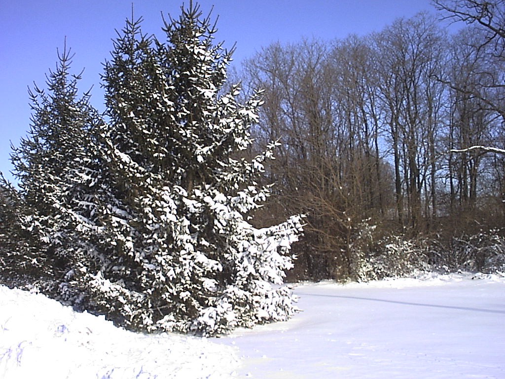 |
| Outside NWS Indy Dec 23 (NWS Photo) |
Outside NWS Indy Dec 23 (NWS Photo) |
Outside NWS Indy Dec 23 (NWS Photo) |
Outside NWS Indy Dec 23 (NWS Photo) |
Environment
 |
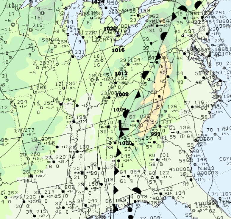 |
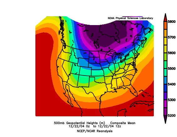
| Figure 1: 500mb Heights | Figure 2: Surface Map at 1 AM EST Dec 23 |
 |
Media use of NWS Web News Stories is encouraged! Please acknowledge the NWS as the source of any news information accessed from this site. |
|

