Indianapolis, IN
Weather Forecast Office
Overview
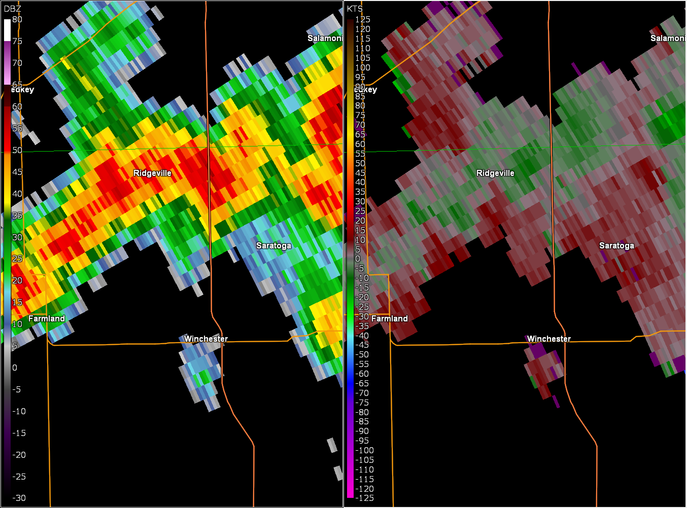
A landspout tornado formed out of a thunderstorm across Randolph County on the afternoon of August 20. A brief touchdown resulted in damage to an outbuilding.Tornadoes
Tornado - Northwest of Winchester
Track Map ![]() ![]()
|
||||||||||||||||
|
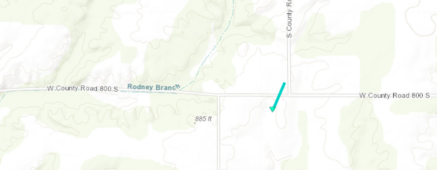
The Enhanced Fujita (EF) Scale classifies tornadoes into the following categories:
EF0 Weak 65-85 mph |
EF1 Moderate 86-110 mph |
EF2 Significant 111-135 mph |
EF3 Severe 136-165 mph |
EF4 Extreme 166-200 mph |
EF5 Catastrophic 200+ mph |
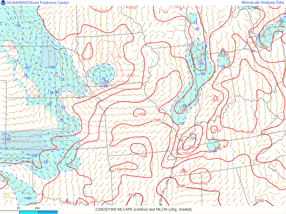
![]() |
Environment
Thunderstorms developed in warm and unstable air during the afternoon of August 20. A surface trough was across northern portions of central Indiana.
![]() |
![]() |
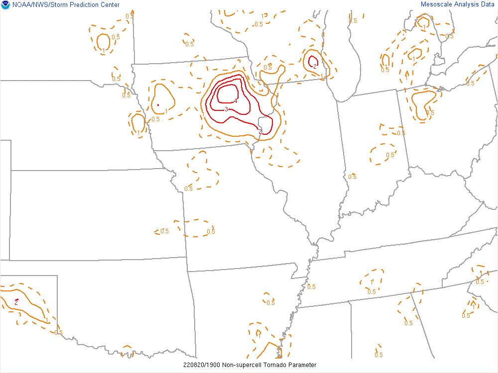
Figure 1: Mixed Layer CAPE at 3:00 PM EDT | Figure 2: Environment - Non-Supercell Tornado Parameter at 3:00 PM EDT |
![]() |
Media use of NWS Web News Stories is encouraged! Please acknowledge the NWS as the source of any news information accessed from this site. |
![]() |
Hazards
Graphical Hazards Outlook
Spotter Information
Outdoor Event Watcher
Hazardous Weather Outlook
Drought Information
NOAA All Hazards Radio
Local forecasts
Local Area
Aviation
Computer Model Forecasts
Fire Weather
Graphical
Precipitation
Air Quality
Text River Forecasts
Area Forecast Discussion
Central Indiana Weather Brief
US Dept of Commerce
National Oceanic and Atmospheric Administration
National Weather Service
Indianapolis, IN
6900 West Hanna Avenue
Indianapolis, IN 46241-9526
317-856-0664
Comments? Questions? Please Contact Us.
Thank you for visiting a National Oceanic and Atmospheric Administration (NOAA) website. The link you have selected will take you to a non-U.S. Government website for additional information.
NOAA is not responsible for the content of any linked website not operated by NOAA. This link is provided solely for your information and convenience, and does not imply any endorsement by NOAA or the U.S. Department of Commerce of the linked website or any information, products, or services contained therein.
You will be redirected to: