Overview
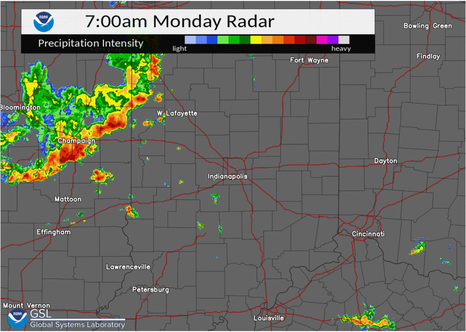
A line of showers and thunderstorms developed out ahead of a cold front and swept across central Indiana during the morning hours of August 1. The storms damaged trees and power lines, and a gustnado brought damage to Anderson.Storm Reports
Below is a list of reports received by NWS Indianapolis. Following the list is information on the Anderson gustnado.
PRELIMINARY LOCAL STORM REPORT...SUMMARY
NATIONAL WEATHER SERVICE INDIANAPOLIS IN
248 PM EDT MON AUG 1 2022

..TIME...   ...EVENT...      ...CITY LOCATION...     ...LAT.LON...
..DATE...   ....MAG....      ..COUNTY LOCATION..ST.. ...SOURCE....
            ..REMARKS..

0750 AM     TSTM WND DMG     NEWPORT                 39.88N 87.41W
08/01/2022                   VERMILLION         IN   PUBLIC

            TREES DOWN AT RESIDENCE. A FEW LARGER
            BRANCHES DOWN ON VEHICLES. TIME ESTIMATED
            FROM RADAR.

0758 AM     TSTM WND DMG     3 WSW BLOOMINGDALE      39.81N 87.29W
08/01/2022                   PARKE              IN   PUBLIC

            TREE DOWN ON A STRUCTURE SOUTHWEST
            BLOOMINGDALE. TIME ESTIMATED VIA RADAR.

0803 AM     TSTM WND DMG     2 WNW FONTANET          39.59N 87.29W
08/01/2022                   VIGO               IN   PUBLIC

            TREES REPORTED DOWN BETWEEN ROSEDALE ROAD
            AND GALLAGHER ROAD IN NORTHERN VIGO COUNTY.
            TIME ESTIMATED VIA RADAR.

0817 AM     TSTM WND DMG     ROACHDALE               39.85N 86.80W
08/01/2022                   PUTNAM             IN   PUBLIC

            1600 WITHOUT POWER DUE TO THUNDERSTORM WIND
            DAMAGE. TIME ESTIMATED VIA RADAR.

0835 AM     TSTM WND DMG     LEBANON                 40.06N 86.48W
08/01/2022                   BOONE              IN   PUBLIC

            NUMEROUS TREES DOWN ON CAMP STREET NEAR THE
            ELEMENTARY SCHOOL. POWERLINES AFFECTED BY
            TREE DAMAGE. TIME ESTIMATED VIA RADAR.

0835 AM     TSTM WND DMG     LEBANON                 40.05N 86.47W
08/01/2022                   BOONE              IN   PUBLIC

            UP TO 900 WITHOUT POWER DUE TO THUNDERSTORM
            WIND DAMAGE. TIME ESTIMATED VIA RADAR.

0852 AM     TSTM WND DMG     2 NNE INDIANAPOLIS INT` 39.75N 86.28W
08/01/2022                   MARION             IN   FIRE DEPT/RESCUE

            FIVE HOMES DAMAGED IN HEATHERWOOD ESTATES
            SUBDIVISION. MULTIPLE TREES DOWN, SOME
            THROUGH THE ROOFS OF HOMES. NO INJURIES
            REPORTED. TIME ESTIMATED VIA RADAR.

0854 AM     TSTM WND DMG     2 NE ZIONSVILLE         39.97N 86.25W
08/01/2022                   BOONE              IN   LAW ENFORCEMENT

            LAW ENFORCEMENT REPORTS A DOWNED TREE IS
            COMPLETELY BLOCKING US421 AT VALLEY MEADOW
            DRIVE. POWER IS OUT IN ZIONSVILLE.

0900 AM     TSTM WND DMG     2 NNW BEECH GROVE       39.74N 86.10W
08/01/2022                   MARION             IN   PUBLIC

            TREES REPORTED DOWN AT THE INTERSECTION OF
            RAYMOND STREET AND SHERMAN DRIVE. TIME
            ESTIMATED VIA RADAR.

0900 AM     TSTM WND DMG     2 S CARMEL              39.94N 86.12W
08/01/2022                   HAMILTON           IN   EMERGENCY MNGR

            EM REPORTS THAT A TREE IS DOWN ON A HOUSE IN
            CARMEL; LOCAL FIRE AND RESCUE RESPONDING.

0903 AM     TSTM WND DMG     1 ESE MORSE RESERVOIR   40.12N 86.05W
08/01/2022                   HAMILTON           IN   PUBLIC

            LARGE TREE DOWN AT BEAR SLIDE GOLF CLUB IN
            CICERO. TIME ESTIMATED VIA RADAR.

0905 AM     TSTM WND DMG     3 NW CARMEL             39.99N 86.15W
08/01/2022                   HAMILTON           IN   EMERGENCY MNGR

            EM REPORTS MULTIPLE TREES DOWN INTO POWER
            LINES.

0909 AM     TSTM WND DMG     3 E SOUTHPORT           39.65N 86.05W
08/01/2022                   MARION             IN   NWS EMPLOYEE

            LARGE TREE LIMBS DOWN AT INTERSECTION OF
            SOUTHPORT AND COMBS. TIME ESTIMATED VIA
            RADAR.

0913 AM     TSTM WND GST     2 NNE FISHERS           39.99N 86.01W
08/01/2022  E70 MPH          HAMILTON           IN   PUBLIC

            RETIRED NWS EMPLOYEE REPORTS 70MPH ESTIMATED
            WIND GUST IN FISHERS.

0917 AM     TSTM WND GST     4 NW FAIRLAND           39.64N 85.90W
08/01/2022  E60 MPH          SHELBY             IN   TRAINED SPOTTER

            TRAINED SPOTTER REPORTS 60 MPH ESTIMATED
            WIND GUST AT LONDON ROAD AND I-74.

0927 AM     TSTM WND DMG     2 ENE COUNTRY CLUB HEIG 40.14N 85.66W
08/01/2022                   MADISON            IN   EMERGENCY MNGR

            EM REPORTS TREES DOWN IN THE AREA OF 200N
            AND ALEXANDRIA PIKE. SOME TREES DOWN ON
            HOUSES. TIME ESTIMATED VIA RADAR.
..STORM DAMAGE SUMMARY FOR ANDERSON...

The information in this statement is preliminary and subject to
change pending final review of the event(s) and publication in NWS
Storm Data.

The National Weather Service in Indianapolis has determined that
straight line winds and a Gustnado occurred near Anderson, IN
around 928 am EDT on August 1, 2022.

A line of strong thunderstorms moving eastward produced straight
line winds of 60 to 70 mph along with a brief gustnado on the
leading edge of the gust front, otherwise known as an outflow
boundary (see gustnado definition below). The gustnado was observed
by a witness who was it form over Aqua Gardens Lake on the leading
edge of the thunderstorm. The feature then moved onto land in a
northeast direction for approximately 1 mile. Straight line winds
also produced damage to the east. A few trees were downed and
larger branches were broken from both the straight line winds and
the circulation associated with the gustnado. A few boards on a
pier were lifted as well.

For reference:
A gustnado is a relatively small whirlwind which forms as an eddy
in the outflow of a thunderstorm. They do not connect with any
cloud-based rotation and are not tornadoes, though damage
associated with them can be similar to weak tornadoes. Gustnadoes
form due to non-tornadic straight line wind features in the
downdraft (outflow) region of a thunderstorm, specifically within
the gust front of strong thunderstorms. Gustnadoes tend to be
visible when the vortices loft sufficient debris or form
condensation clouds, as was the case today.

It is important to note that although not classified as a tornado,
gustnadoes can produce damage consistent with that of an EF0 or
low end EF1 tornado or roughly in the 65-80 mph range.
 |
Media use of NWS Web News Stories is encouraged! Please acknowledge the NWS as the source of any news information accessed from this site. |
|