Indianapolis, IN
Weather Forecast Office
Overview
|
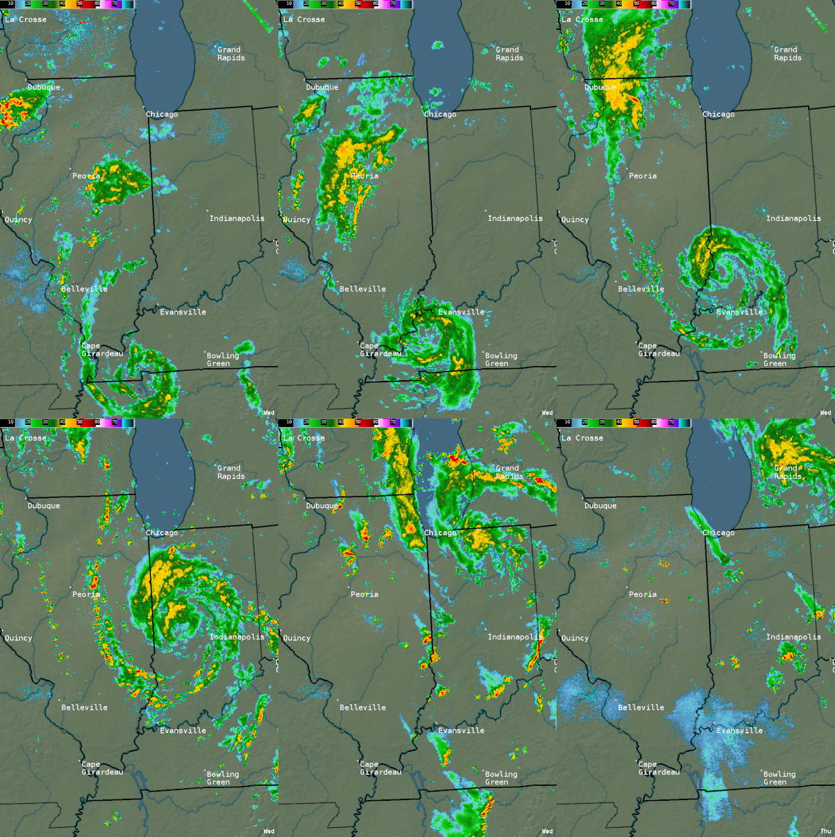
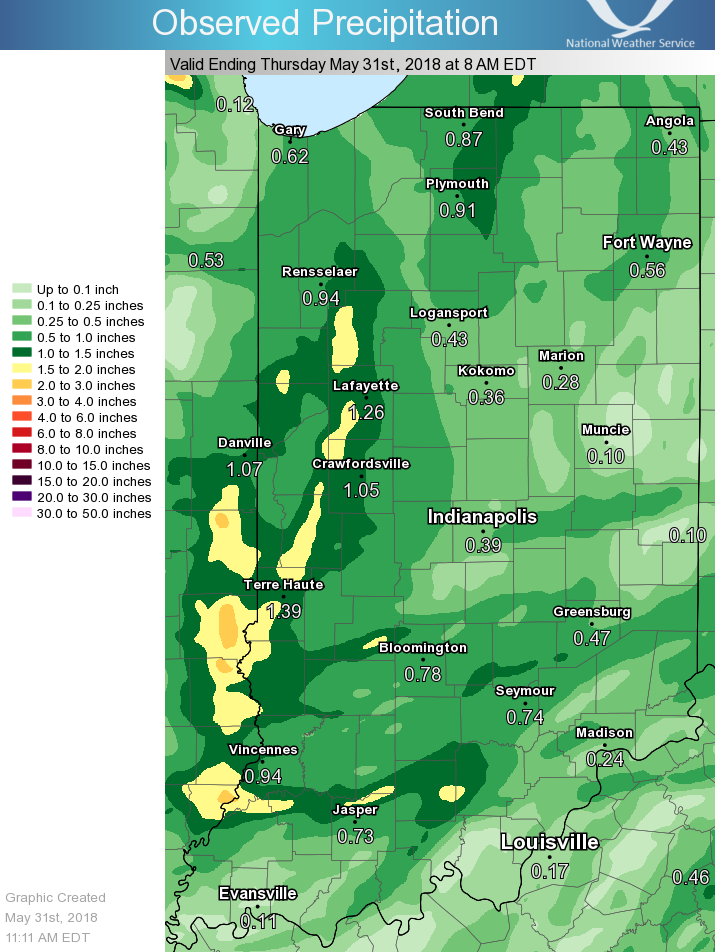
The remnants of subtropical storm Alberto moved into central Indiana on May 30, 2018. The subtropical storm was rare as it formed outside of the typical season. Also, the storm held its shape well inland. Some areas received over an inch of rain with this system, along with wind gusts near 40 mph. |
 Radar Image at 12:30 PM EDT |
Radar & Satellite
 |
 |
 |
 |
| Radar Image at 12:30 PM EDT | Radar Loop | 24 Hour Radar Loop (from NWS Chicago) |
Visible Satellite at 1:00 PM |
Rain Reports

24 Hour Rainfall Map, ending 8:00 AM EDT May 31
 |
Media use of NWS Web News Stories is encouraged! Please acknowledge the NWS as the source of any news information accessed from this site. |
 |
Hazards
Outdoor Event Watcher
Hazardous Weather Outlook
Drought Information
NOAA All Hazards Radio
Graphical Hazards Outlook
Spotter Information
Local forecasts
Local Area
Aviation
Computer Model Forecasts
Fire Weather
Graphical
Precipitation
Air Quality
Text River Forecasts
Area Forecast Discussion
Central Indiana Weather Brief
US Dept of Commerce
National Oceanic and Atmospheric Administration
National Weather Service
Indianapolis, IN
6900 West Hanna Avenue
Indianapolis, IN 46241-9526
317-856-0664
Comments? Questions? Please Contact Us.

