Indianapolis, IN
Weather Forecast Office
A year ago, on August 10, 2020, a line of intense thunderstorms called a “derecho” resulted in four deaths, dozens of injuries, and significant damage across the Midwest, including damage locally across parts of central Indiana. The National Oceanic and Atmospheric Administration (NOAA) estimates that this single day of extreme weather cost over $11 billion, making it the most expensive thunderstorm event in modern U.S. history. A thorough review of this event can be found on the August 10, 2020 Derecho Story Map webpage.
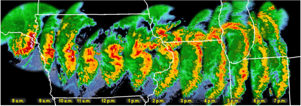
Radar reflectivity of the August 10, 2020 Derecho at one-hour time steps
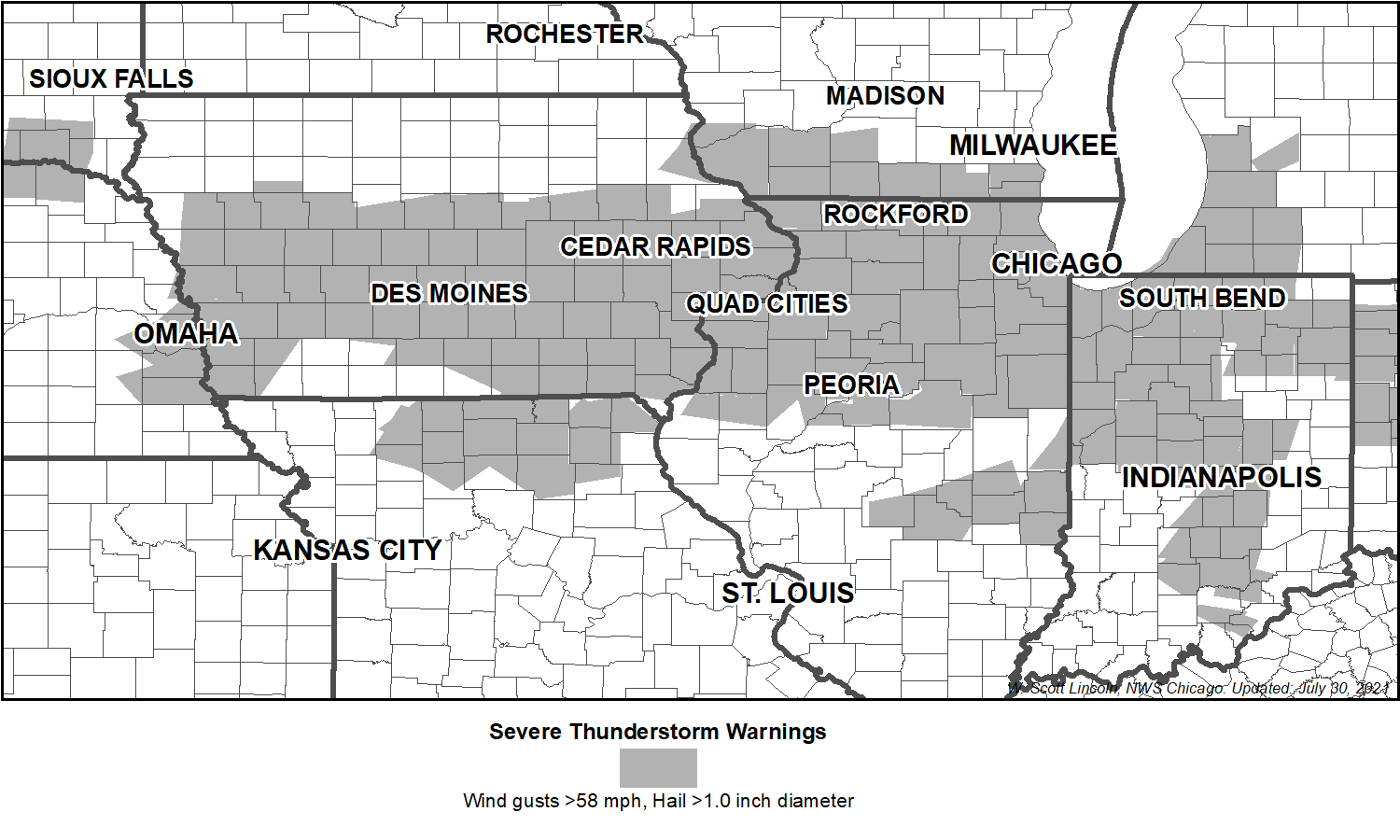
Map of Severe Thunderstorm Warnings issued by the NWS for the derecho event.
Severe Weather Communication Improvement
To better communicate the threat of such a destructive severe thunderstorm, the NWS has begun issuing Severe Thunderstorm Warnings using damage threat categories. Warnings tagged with DESTRUCTIVE will trigger a Wireless Emergency Alert on your smartphone/mobile device. The plans for implementing Wireless Emergency Alerts for severe thunderstorms were underway when the derecho occurred, but the event hastened implementation of this capability, so the public can be warned more directly. Our Webstory contains additional details about this important update.
Additional Information Resources:
Severe Storms of August 10, 2020 (weather.gov) (central Indiana review)
https://www.facebook.com/
https://twitter.com/
Hazards
NOAA All Hazards Radio
Graphical Hazards Outlook
Spotter Information
Outdoor Event Watcher
Hazardous Weather Outlook
Drought Information
Local forecasts
Local Area
Aviation
Computer Model Forecasts
Fire Weather
Graphical
Precipitation
Air Quality
Text River Forecasts
Area Forecast Discussion
Central Indiana Weather Brief
US Dept of Commerce
National Oceanic and Atmospheric Administration
National Weather Service
Indianapolis, IN
6900 West Hanna Avenue
Indianapolis, IN 46241-9526
317-856-0664
Comments? Questions? Please Contact Us.

