Indianapolis, IN
Weather Forecast Office
On May 10, 1994, an annular eclipse of the sun was viewed across central Indiana. An annular eclipse occurs when the moon's apparent size is smaller than the sun, allowing some of the sun to remain visible as the moon crosses it.
 |
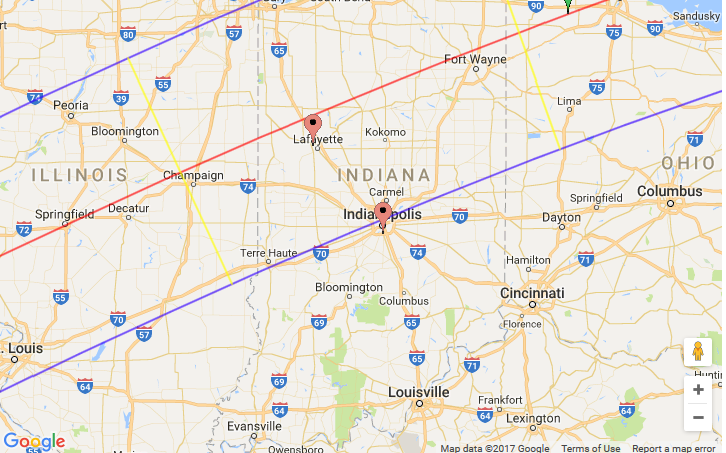 |
| Types of solar eclipse. Click to enlarge | Path of the eclipse. Red line is path of greatest eclipse. Click to enlarge. Map courtesy of NASA. |
Skies were mostly clear across the Lafayette area during much of the eclipse time. Below is a satellite image from a GOES-8 from about 11:30 AM May 10 1994, showing the moon's shadow across parts of the central USA. Image courtesy of NASA & SSEC.

The effect of the eclipse can be seen in the temperature graph for May 10 at the Lafayette Purdue University Airport (KLAF). After rising to 68 degrees at 11 AM EST, the temperature had fallen to 64 degrees at 12 PM, near the peak of the eclipse. The temperature then slowly recovers into early afternoon.

Hazards
Outdoor Event Watcher
Hazardous Weather Outlook
Drought Information
NOAA All Hazards Radio
Graphical Hazards Outlook
Spotter Information
Local forecasts
Local Area
Aviation
Computer Model Forecasts
Fire Weather
Graphical
Precipitation
Air Quality
Text River Forecasts
Area Forecast Discussion
Central Indiana Weather Brief
US Dept of Commerce
National Oceanic and Atmospheric Administration
National Weather Service
Indianapolis, IN
6900 West Hanna Avenue
Indianapolis, IN 46241-9526
317-856-0664
Comments? Questions? Please Contact Us.

