HEADLINE
The coldest air of the winter will arrive later this week...before conditions gradually warm toward early February.
DISCUSSION
The prevailing upper flow across the Northern Hemisphere continues to feature a highly amplified pattern with a pronounced trough of low pressure over central and eastern Canada into the eastern CONUS. The coldest air in the entire hemisphere is focused beneath this trough...with January 20th midday 850mb temperatures of -30 to -35C around Hudson Bay. Models have been consistently showing an upper ridge holding firm over the eastern Pacific for the next several days, resulting in continued downstream troughing. Thanks to anomalously high pressure over the North Pole, the heart of the coldest airmass is progged to pivot southward by the end of the week...sending the coldest airmass of the winter into central Illinois by Friday, January 23rd. Current indications suggest high temperatures will only reach the single digits above zero on Friday, with lows dropping below zero everywhere north of the I-70 corridor Friday night. Gusty northerly winds will create dangerous wind-chill readings of -20 to -30F along and north of a Jacksonville to Danville line Friday into Saturday...with -10 to -20F values further south to the I-64 corridor.
As a short-wave trough currently well off the coast of California gradually shifts eastward and interacts with the Arctic cold front, a prolonged overrunning precipitation event is expected to develop this weekend. Given the presence of a strong 1050mb Canadian high pressure dropping southward into the Midwest, it appears the front and much of its associated wintry precipitation will focus south of central Illinois from Saturday, January 24th through Monday, January 26th. While model solutions still vary at that time range, a significant snow and/or ice event appears likely from Oklahoma and northern Texas eastward across the Deep South and Tennessee River Valley. While the bulk of this system will stay to the south, a period of light snow will be possible as far north as central Illinois Saturday into early Sunday.
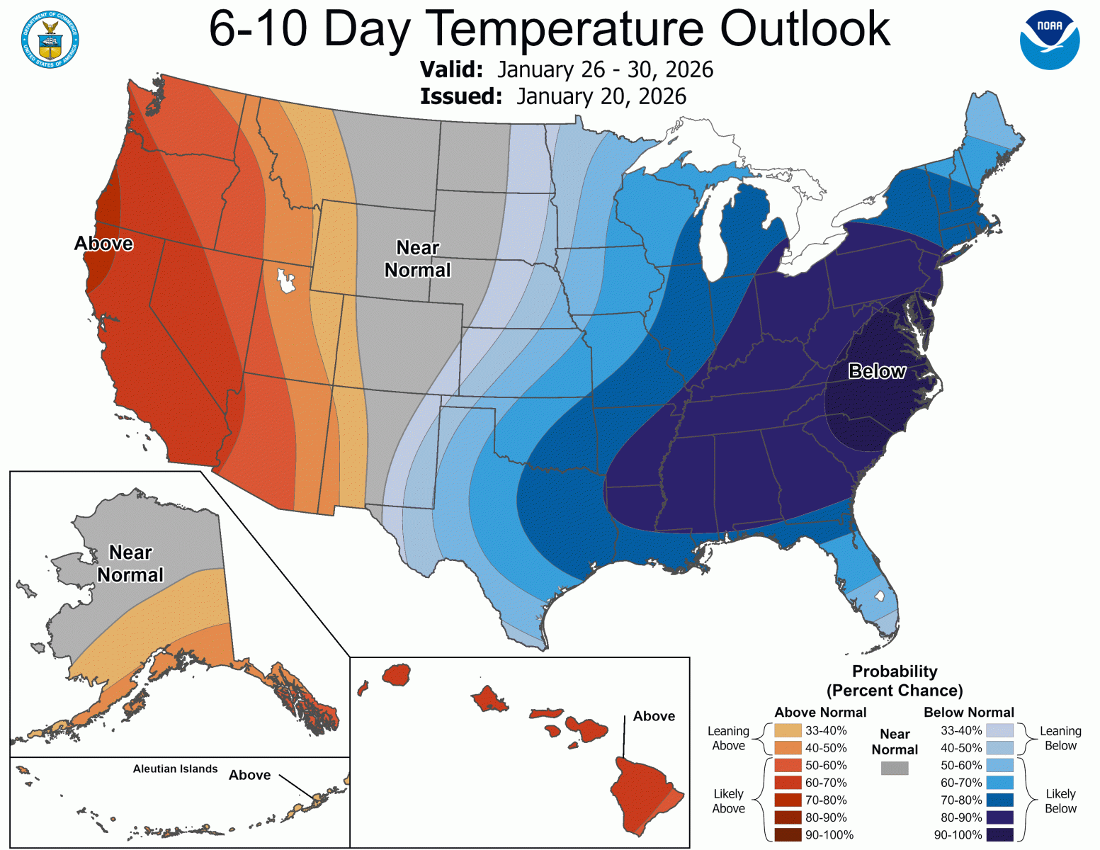
The Eastern Pacific Oscillation (EPO) is currently strongly negative...meaning upper ridging is prevalent over the Gulf of Alaska and the northeastern Pacific. This particular pattern is common during La Nina winters and leads to downstream troughing and cold northwesterly flow across the central and eastern U.S. This is depicted quite clearly in the latest 6-10 day outlooks from CPC. ECMWF Ensemble projections show the EPO gradually becoming weakly positive by the middle and end of next week, suggesting a weakening of the eastern Pacific ridge which would lead to rising upper heights across the Midwest. Both the GFS and ECMWF show this process unfolding...with a flatter more zonal flow bringing milder Pacific-origin air to central Illinois as we approach February 1st.
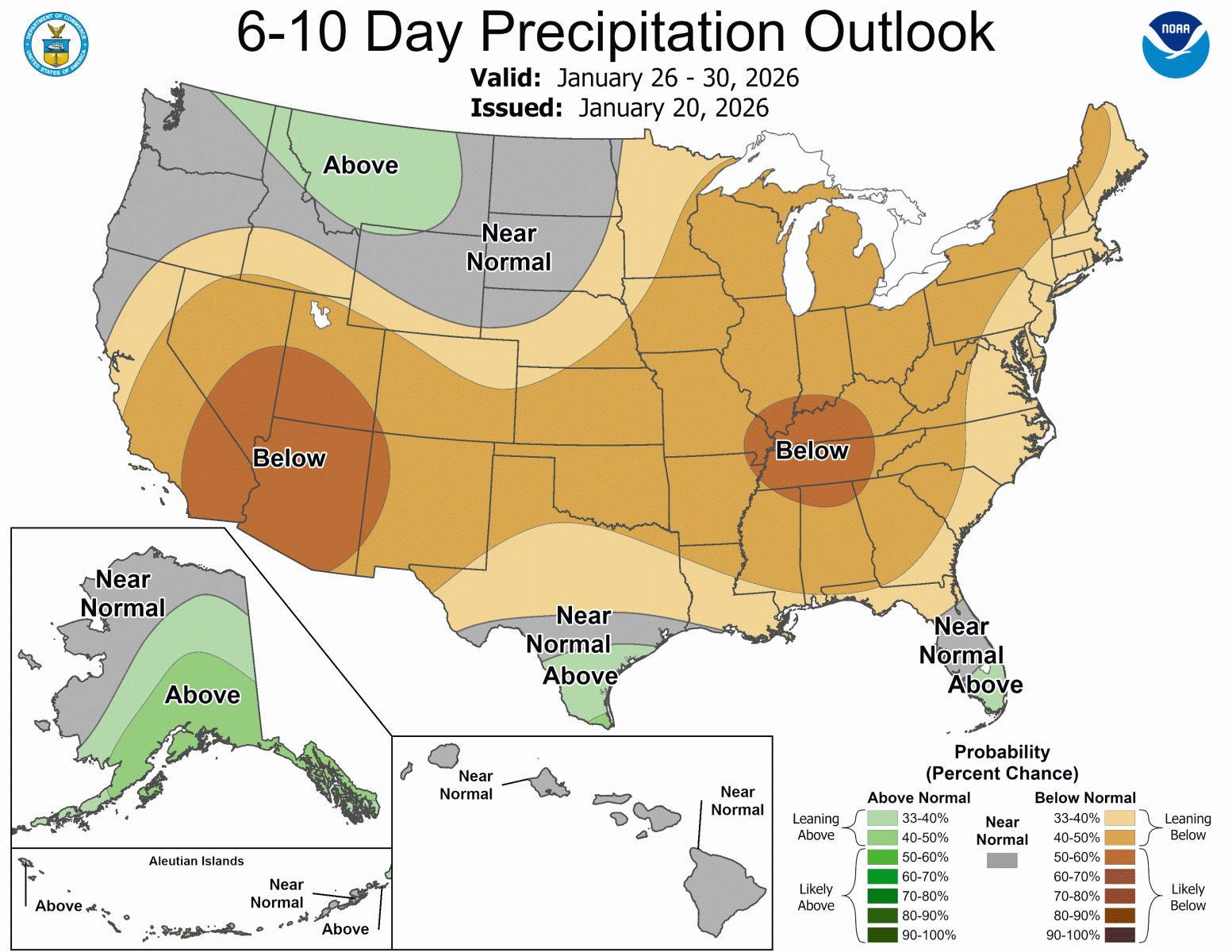
The latest 6-10 day outlooks (Jan 26-30) from the Climate Prediction Center (CPC) suggest BELOW normal temperatures and BELOW normal precipitation across central Illinois.
Issued: 1/20/26

