December 23, 2015
A powerful storm system impacted central Illinois on December 23rd...bringing near record warmth, strong winds, and a few strong to severe thunderstorms. Morning surface analysis showed a 985mb low pressure over eastern Kansas, with a warm frontal boundary extending across northern Missouri into central Illinois. Strong southerly winds south of the warm front had caused a steady rise in temperatures overnight, resulting in 6 am temperatures ranging from around 50 degrees north of the Peoria area to the lower 60s south of I-70.
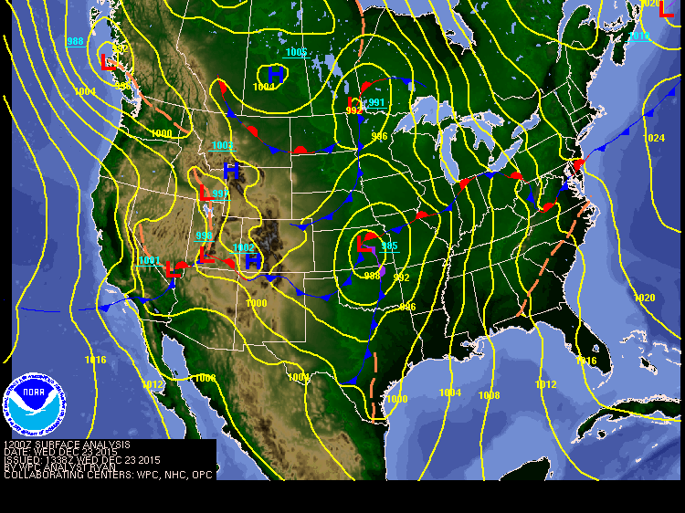
6 am Dec 23rd surface weather map
A vigorous upper level wave tracking eastward out of Oklahoma triggered widespread showers and thunderstorms across Arkansas and southern Missouri overnight, with this convection quickly spreading north into central Illinois by mid-morning. Due to strong low-level wind shear in the vicinity of the warm front, several of the thunderstorm cells began rotating. While no confirmed tornadoes touched down across central Illinois with this initial batch of storms, scattered wind damage reports were received along and east of a Taylorville to Pontiac line. Wind gusts of around 60 mph blew down a couple sheds and tore part of a church's roof off near Oakley in Macon County. Other storms blew a shed down about 3 miles south of Shelbyville and blew a semi off the road between Sullivan and Cadwell in Moultire County. The morning storms lifted to the northeast and diminished in intensity as they pushed into northeast Illinois and northwest Indiana by early afternoon. Meanwhile, the trailing end of the storms began to intensify further south across south-central Illinois, eventually forming into a line from near Vandalia southward to the Ohio River. These storms pushed northeastward producing sporadic wind damage south of the I-70 corridor from southeast Illinois across southern Indiana and northern Kentucky. One storm blew the roof off a barn north of Xenia in Clay County, while another snapped power poles north of Lawrenceville. Once this activity exited the region, a few breaks in the overcast occurred in the wake of the morning storms by mid to late afternoon, raising concerns that the atmosphere would be able to destabilze sufficiently to produce another broken line of convection along a cold front advancing eastward out of Missouri. Due to a limited amount of sunshine and destabilization, only a few thunderstorm cells managed to form along the front during the late afternoon, mainly from the Quad Cities southward toward Quincy. Small hail was reported with the storms, with one cell producing a brief tornado touchdown or two in northern McDonough County just northwest of Macomb. A grain bin was destroyed and a few trees were blown down about a mile north of Sciota in McDonough County, while power poles were toppled near Adair. These cells quickly dissipated toward sunset as daytime instability waned. After that, low pressure continued to deepen to 979mb as it tracked into southwest Wisconsin by evening. Due to a tightening pressure gradient between the low and an approaching high over Kansas, very strong winds gusting to between 40 and 50 mph swept across central Illinois during the evening, mainly along and northwest of a Taylorville to Danville line where a Wind Advisory was issued.
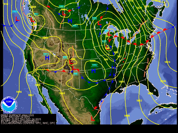
6 pm Dec 23rd surface weather map
Below is a map of all severe weather reports received across central Illinois on December 23rd. NWS Lincoln wishes to thank the SWOP network for their assistance during this unusual December storm system. We appreciate your efforts!
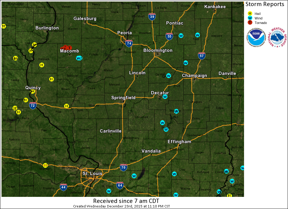
Severe Weather Reports from Dec 23rd

