June 17-18, 2017
An approaching cold front triggered scattered severe thunderstorms across portions of central and southeast Illinois from the evening of June 17th into the early morning of June 18th. The hardest hit locations were north of the I-74 corridor from Toulon in Stark County southeastward to near Danville in Vermilion County. Other areas that experienced severe weather were from near Beardstown in Cass County eastward to Springfield...and across Effingham and Clay counties.
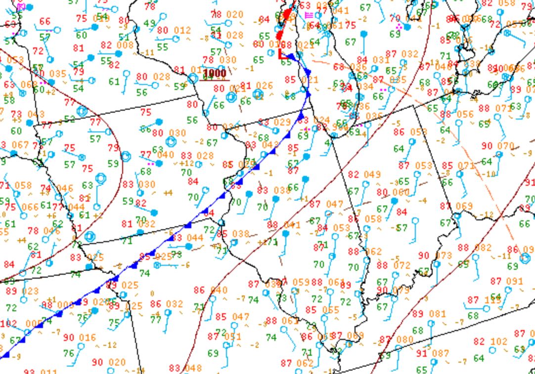
Surface analysis from the afternoon of June 17th showed a cold front extending from southern Lake Michigan southwestward into far northern Missouri. Temperatures ahead of the front were in the middle to upper 80s across central Illinois, while dewpoints were in the upper 60s and lower 70s. Meanwhile behind the boundary, temperatures had cooled into the 70s across western Iowa into the Plains.
Surface Weather Map from 4pm June 17th
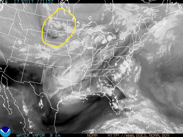
Aloft, a vigorous short-wave trough tracking across the Northern Plains was approaching from the northwest. Note the darkening across eastern Montana into South Dakota on the 4pm water vapor imagery below, indicating descending motion and subsequent drying on the back side of the feature. As the wave neared, wind-shear began to increase markedly during the afternoon and evening...with a corridor of 45-50kt 0-6km bulk shear developing from Iowa across southern Wisconsin and northern Illinois.
Water Vapor Imagery from 4pm June 17th
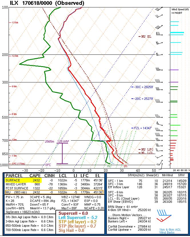
The 00z/7pm upper air balloon launched from NWS Lincoln showed a moderately unstable and moderately sheared environment across central Illinois. Convective Available Potential Energy (CAPE) was calculated at 2432J/kg, which was slightly lower than previously forecast numbers of 3500-4000J/kg. This was due to persistent mid and high cloud cover for a good part of the day that acted to keep temperatures and dewpoints a few degrees lower than they otherwise would have been. The sounding also revealed a moderate 0-6km shear value of 38kt. Winds were southerly at 10kt at the surface, but veered to the west and increased to 40kt at around 11,000ft. The favorable instability and shear profile set the stage for potentially rotating updrafts within the developing storms.
00z/7pm upper air sounding from NWS Lincoln
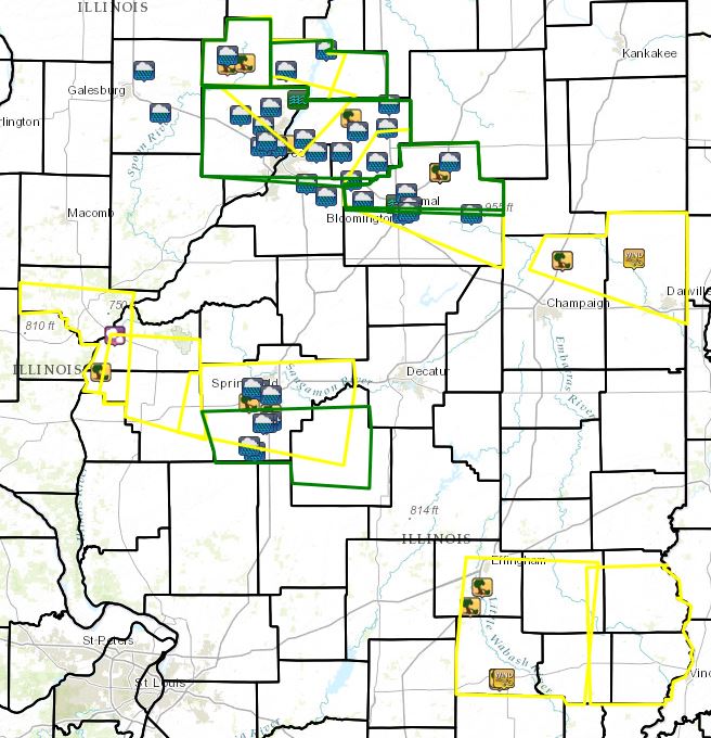
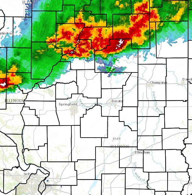
Widely scattered thunderstorms began developing ahead of the cold front shortly after 5pm, but didn't become more widespread and begin reaching severe criteria in the NWS Lincoln County Warning Area(CWA) until around 7:30pm. Thunderstorm cells first impacted Stark and Marshall counties, then spread southeastward across Peoria, Woodford and northern McLean counties...bringing strong winds and torrential rainfall. Trees were blown down in Toulon and Wyoming in Stark County...while a garage was leveled and a barn was damaged northwest of Roanoke in Woodford County. Further southeast, a 75mph wind gust was recorded in Lexington in northern McLean County. In addition to the wind, rainfall rates of over 4 inches per hour caused localized flash flooding. Numerous county roads were flooded...while significant urban flooding occurred on the north side of Peoria and in Normal. The 9:15pm radar image below shows the primary area of storms extending from Peoria eastward to just north of Bloomington-Normal. Note a second area of storms around Quincy, nosing into Schuyler and Brown counties. These cells would eventually spread eastward toward Springfield, dropping quarter-sized hail in Beardstown in Cass County and blowing trees down on the Cass/Morgan County border.
9:15pm radar image
Most of the storms diminished in intensity or moved out of the area by midnight: however, one final surge of convection that developed later in the evening near St. Louis pushed into southeast Illinois between 3 and 4am. These cells produced a 68mph wind gust at the Flora Airport and downed a few trees and powerlines in Flora and in the towns of Watson and Mason in southern Effingham counties. The map below shows all the severe weather reports received by NWS Lincoln during this event. The yellow boxes are the Severe Thunderstorm Warnings that were issued, while the green boxes are Flash Flood Warnings.
Warnings and Reports