May 26, 2024
A broken line of thunderstorms developed in advance of a cold front across eastern portions of Nebraska, Kansas, and Oklahoma during the evening of Saturday, May 25th. The storms tracked eastward overnight and pushed into the Illinois River Valley after 4am on May 26th. Some of the cells produced gusty winds, small hail, and locally heavy downpours: however, severe weather did not materialize with this first wave of convection.
RADAR 635AM CDT MAY 26
After the early morning storms pushed into Indiana by around midday, a prolonged lull in storm coverage persisted through mid-afternoon before new cells began to fire along an outflow boundary left behind by the morning activity from central Missouri northeastward to near Saint Louis. These storms initially dropped very large hail across Missouri...with a few of the largest stones measuring a whopping 4 inches in diameter or roughly the size of a softball. The convection gradually congealed into a linear structure, then began pushing eastward across southern Illinois along and south of the I-70 corridor. At the same time, a few discrete cells continued to develop ahead of the main line...setting up a significant risk for damaging wind gusts and possible tornadoes across the far southeastern National Weather Service Lincoln County Warning Area (CWA) during the evening.
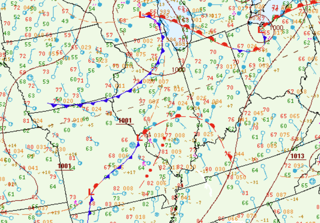
Surface analysis from 7PM CDT May 26th showed a cold front from southern Wisconsin southwestward to the Iowa/Missouri border...with a second frontal boundary/outflow arcing northeastward from the Ozarks into southwest Indiana. Dewpoints across much of central Illinois were generally in the middle 60s: however, richer boundary layer moisture with dewpoints in the lower to middle 70s was noted south of the outflow boundary across southern Missouri, western Kentucky, and southern Illinois.
SURFACE MAP 7PM CDT MAY 26
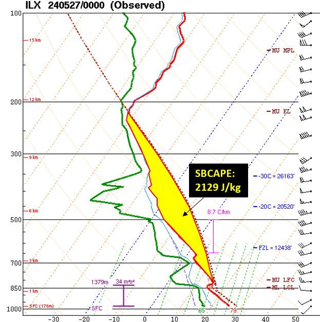
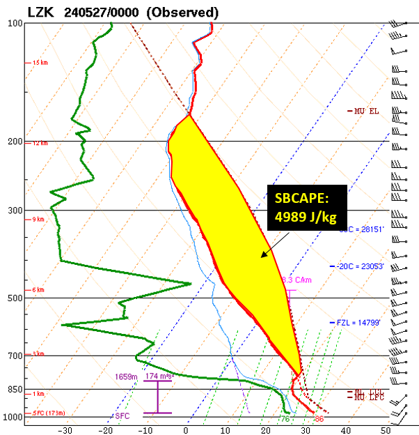
Regional upper air balloon launches during the evening revealed the airmass to the north of the outflow boundary across central Illinois had destabilized since the morning convection: however, Surface-Based Convective Available Potential Energy (SBCAPE) values had only climbed to around 2100J/kg. Meanwhile the upstream environment to the south of the boundary was highly unstable with the sounding from Little Rock, Arkansas showing SBCAPEs in excess of 4000J/kg.
UPPER AIR SOUNDINGS 7PM CDT MAY 26
LINCOLN, IL LITTLE ROCK, AR
 |
 |
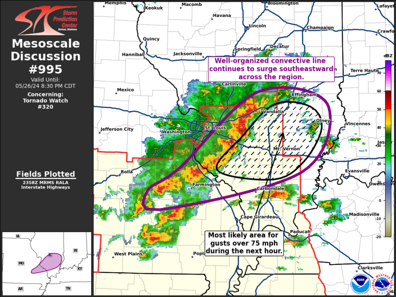
Given the highly unstable upstream airmass and the fact that low-level wind shear was enhanced near the lingering outflow boundary, the Storm Prediction Center (SPC) issued a Mesoscale Convective Discussion (MCD) at 701PM CDT highlighting a corridor of damaging wind gusts potentially in excess of 75mph ahead of the advancing line...impacting locations from Vandalia and Mount Vernon northeastward to Olney.
MESOSCALE CONVECTIVE DISCUSSION 701PM CDT MAY 26
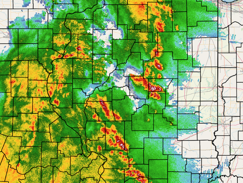
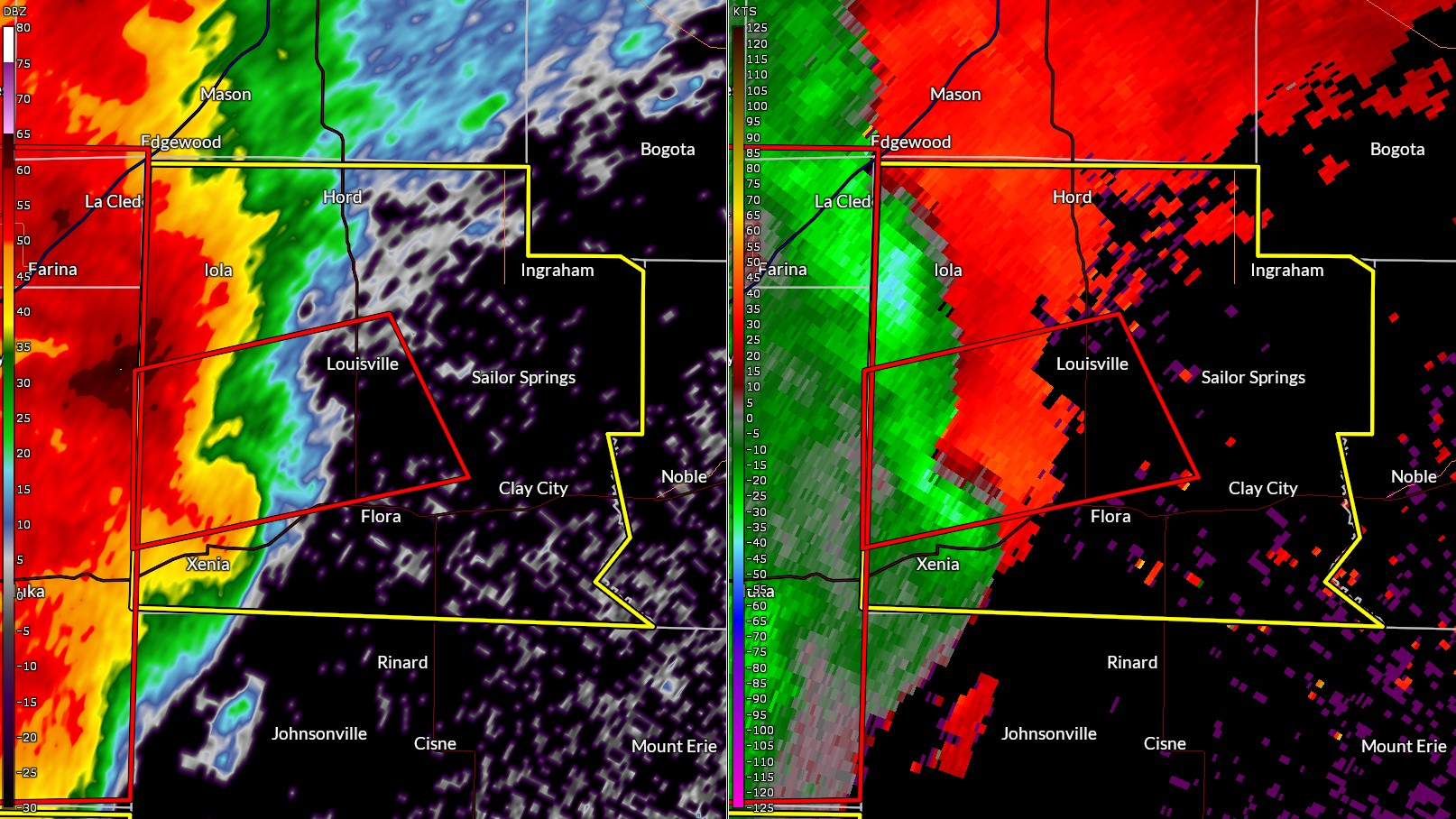
As the line of thunderstorms entered the Lincoln CWA, a suspicious nub-like radar signature prompted forecasters to issue a Tornado Warning for portions of western and central Clay County. The radar imagery below shows the reflectivity signature (left) and the corresponding velocity couplet (right) indicating significant low-level rotation and the high probability of a tornado. This particular feature did in fact produce a tornado...with a damage survey showing the tornado initially touching down south of Stephen Forbes State Park in Marion County, then crossing into Clay County just north of Xenia. The most significant damage rated EF-2 (130mph winds) occurred at a farm north of Xenia where several large farm buildings were completely destroyed.
RADAR 739PM CDT MAY 26
The thunderstorms continued sweeping eastward to the Indiana border, producing wind damage and power outages...primarily along and south of Highway 50 impacting Flora, Clay City, Sumner, and Bridgeport. A damage survey across this area indicated another tornado touched down south of Sumner, with the tornado tracking eastward and dissipating southeast of Bridgeport. Based on mainly tree damage, it was rated EF-1 with peak winds of 105mph.
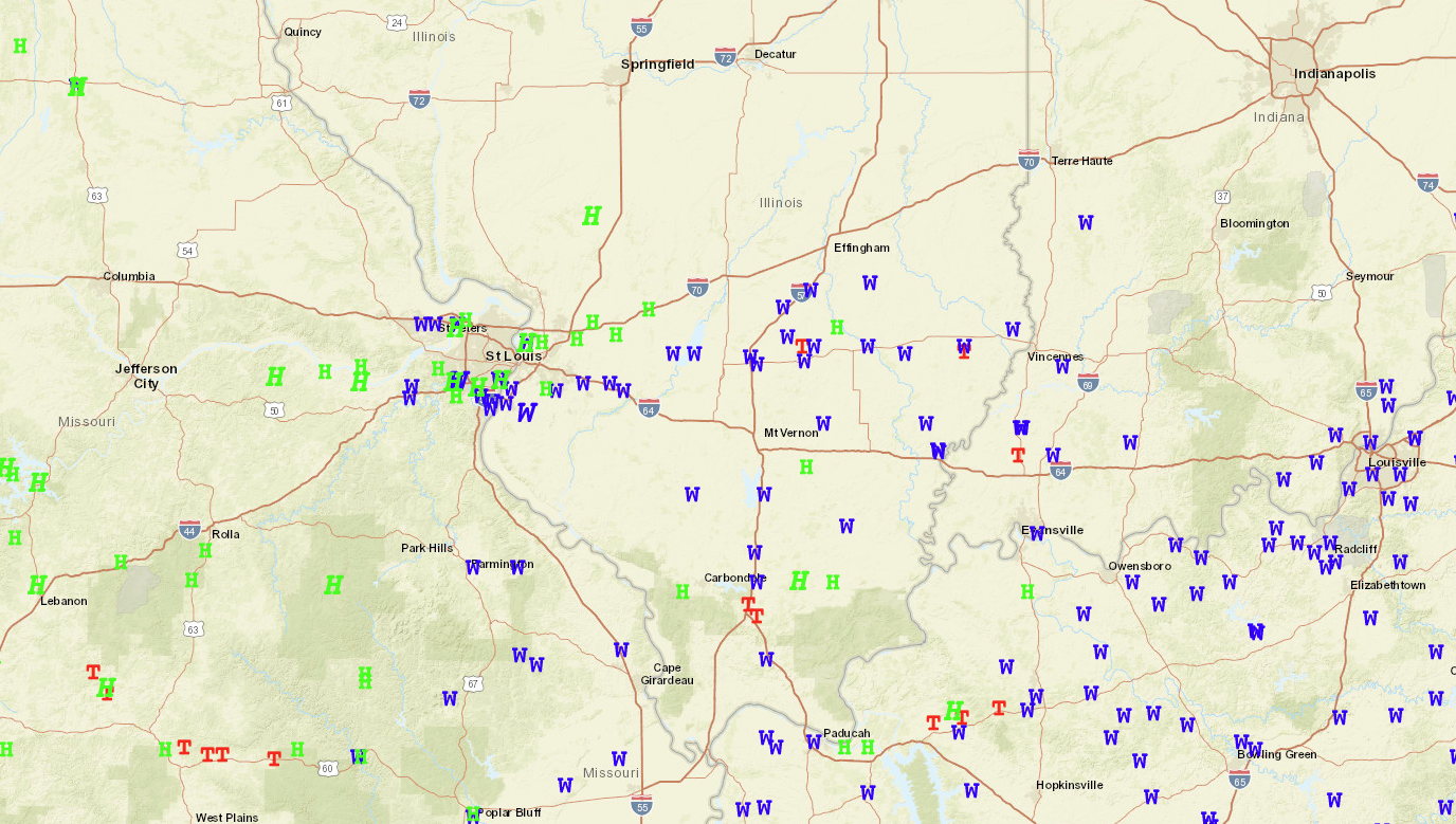
SEVERE WEATHER REPORTS FOR MAY 26, 2024