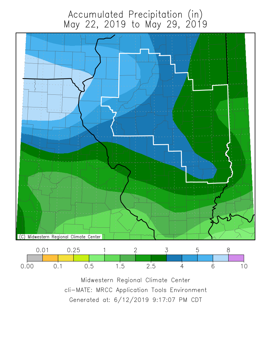
May 22-29, 2019
An active period of weather brought numerous rounds of thunderstorms to central and southeast Illinois from May 22nd through May 29th. Severe weather occurred within National Weather Service Lincoln's County Warning Area (CWA) on each day during that time frame...including damaging wind gusts in excess of 70mph, hail as large as tennis balls, and a total of 19 tornadoes. In addition, heavy rainfall continued to delay planting and aggravate ongoing flooding along the Mississippi and Illinois Rivers as portions of west-central Illinois picked up in excess of 5 inches of rain.
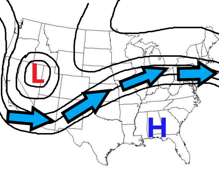
So what exactly caused this near-continuous stretch of nasty weather? To better understand what happened, we first need to examine the prevailing upper air flow during that period. The map below depicts the average atmospheric flow aloft from May 22nd through May 29th. While the pattern exhibited occasional variances, the overall trend remained the same. A deep upper low was positioned west of the Rockies, which kept that part of the country cool and wet. Meanwhile, a strong high dominated the Deep South where record heat and developing drought conditions occurred. The Plains and Midwest remained sandwiched between these two features in a ribbon of fast-moving air called the jet stream. Storm systems that formed over the Desert Southwest tracked northeastward along the route of the jet, traversing central Illinois every couple of days. This ensured a very unsettled period with nearly daily bouts of showers and thunderstorms.
PREVAILING UPPER AIR FLOW PATTERN
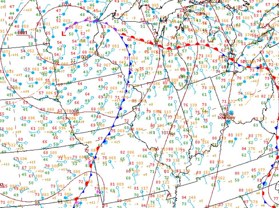
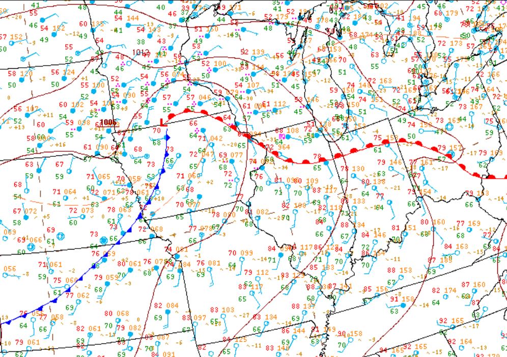
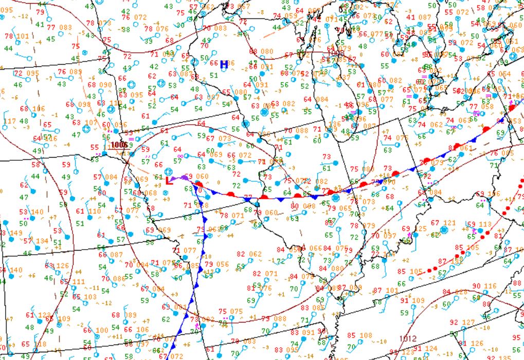
With upper-level winds steady from the southwest, frontal boundaries dropping out of Canada lost their southward momentum as they became parallel to the upper flow. The fronts subsequently stalled over central Illinois, wavering slightly northward or southward as small perturbations rippled through the jet. With a persistent frontal boundary in the vicinity providing a focusing mechanism for convection, the stage was set for numerous rounds of strong to severe thunderstorms. Below are surface weather maps for May 22nd, May 24th, May 27th, and May 29th. Note the approaching cold front across eastern Iowa on the 22nd...then the consistent presence of a boundary on each of the subsequent days.
MAY 22nd MAY 24th
 |
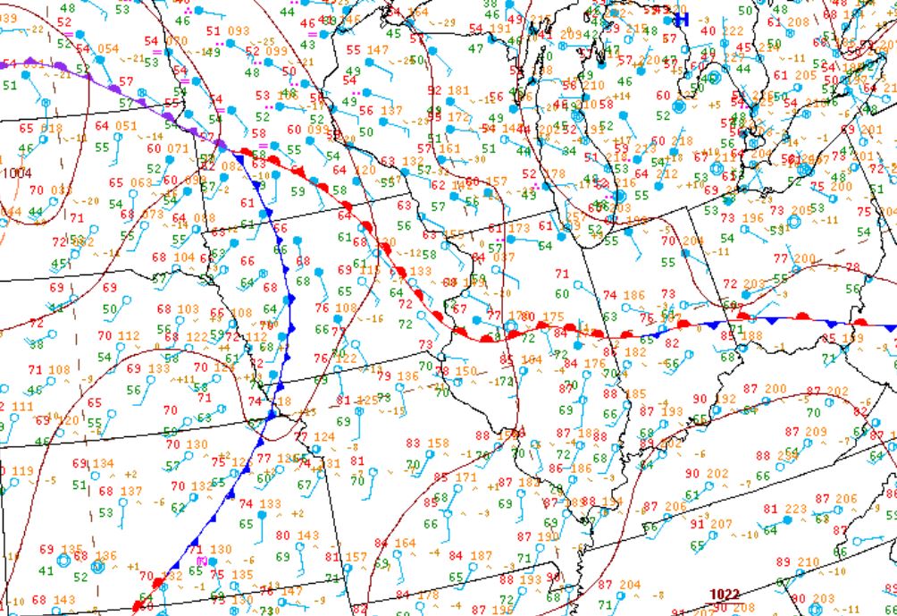 |
MAY 27th MAY 29th
 |
 |
In order for thunderstorms to develop, 3 key ingredients need to be present: moisture, lift, and instability. With surface dewpoints in the upper 60s to around 70 degrees, there was ample atmospheric moisture available through the entire period. The persistent frontal boundary provided the necessary lift, and a pocket of cold air aloft enhanced instability. In addition, a 4th ingredient needed for severe thunderstorm development was also present much of the time...wind shear. With the main branch of the jet stream firmly in place across the region, winds steadily increased with height and created sufficient speed shear to sustain long-lived powerful updrafts.
A FEW SEVERE WEATHER HIGHLIGHTS
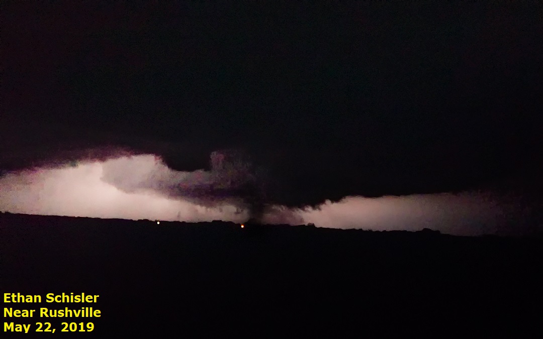
The severe weather got started on May 22nd when a SWOP member reported a tornado touchdown about 2.5 miles east of Rushville in Schuyler County. The tornado tracked to the east-northeast in an open field and dissipated after 3 minutes. No damage was reported: however, our observer sent us the following picture of the tornado:
Another round of severe thunderstorms produced a total of 5 tornadoes on May 23rd...including 4 EF-1 tornadoes with estimated winds in excess of 100mph. These storms occurred well after dark along the leading edge of a squall line and primarily impacted portions of Sangamon, Piatt, and Logan counties. The most significant damage was reported near Cantrall in Sangamon County where a farm was damaged and an outbuilding was destroyed. This particular tornado went on to destroy a large machine shed on the Menard/Logan County line before dissipating about 1 mile west of Broadwell in Logan County.
With the prevailing frontal boundary temporarily lifting northward, most of the severe weather on May 27th was focused across northern Illinois: however, the far northern part of the Lincoln National Weather Service CWA was impacted. In particular, a SWOP member spotted a brief tornado touchdown in a field about 1 mile south of Dahinda in Knox County. Below is the photo he sent us:

During the afternoon of May 28th, a few supercell thunderstorms developed within a very unstable airmass across central Illinois. One cell that formed in DeWitt County then tracked eastward across northern Champaign County produced very large hail early in its life cycle. The largest stones were the size of tennis balls near DeLand in northern Piatt County. Our SWOP member from Lane in DeWitt County didn't experience any hail damage at her residence, but did get some pictures of the hail from neighbors east of town, including the following shot of a large hailstone at the Wagon Wheel Pumpkin Farm:

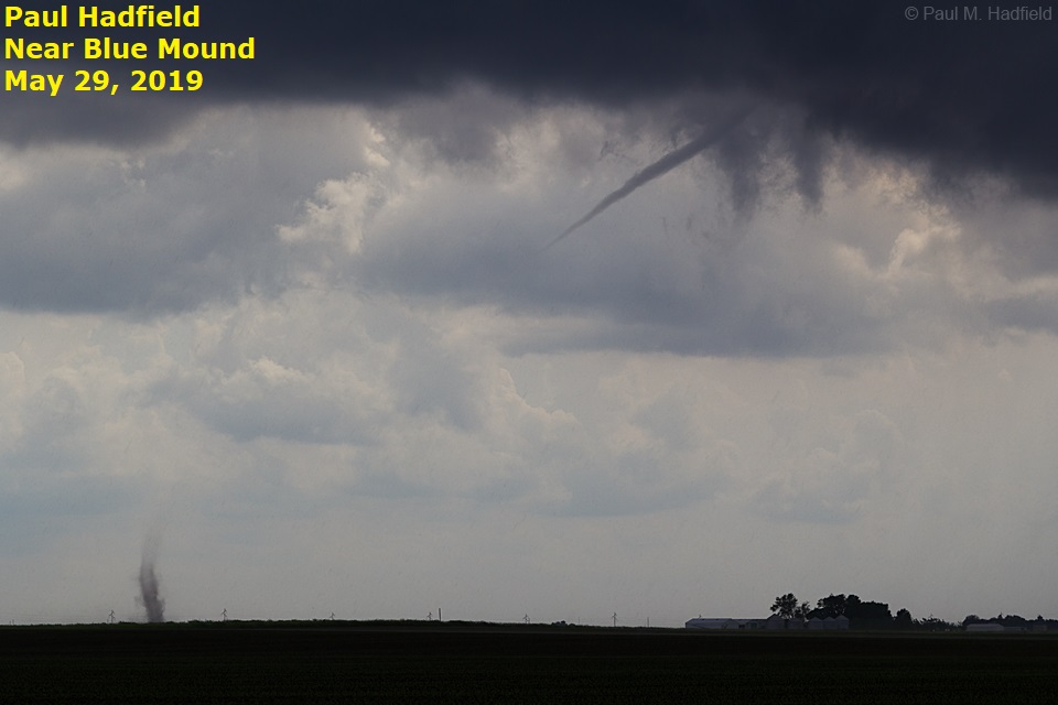
The severe weather concluded on May 29th as a series of weak "landspout" tornadoes developed across portions of Christian and Macon counties. Landspout tornadoes are not associated with supercell thunderstorms and generally cannot be detected by Doppler radar. We therefore rely heavily upon our weather observers to let us know when one these features develop. Luckily one of our SWOP team members was in the area and captured the following image just east of Blue Mound in Macon County:
In addition to the severe weather, copious amounts of rain fell during this active period. In general, 3 to 4 inches of rain occurred across central Illinois...with as much as 5 to 6 inches being reported west of the Illinois River across portions of Knox and Fulton counties.