Flash flooding threatens areas from the Tennessee Valley to the Carolinas as storms repeat along a stalled front. Monsoonal storms may trigger flooding in the Southwest. Dangerous heat expands across the Desert Southwest, Plains, mid-Mississippi Valley and Southern Tier. Critical fire weather for interior Pacific Northwest. Cooler, drier air brings brief relief to the Great Lakes and Northeast. Read More >
May 7-8, 2024
Three rounds of thunderstorms impacted central Illinois on May 7th and 8th as predicted: however, very little severe weather occurred.
ROUND 1: Early Morning of May 7th
Radar imagery 4:50AM CDT May 7
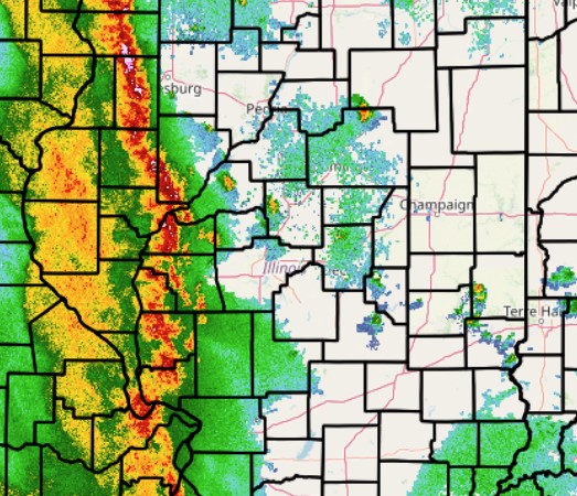
A line of thunderstorms crossed the Mississippi River into west-central Illinois during the early morning of May 7th. While instability was modest with Mixed-Layer Convective Available Potential Energy (MLCAPE) of just 500-1000J/kg, deep layer shear on the order of 30-35kt was enough to sustain the convection as it tracked eastward. Wind gusts along the line were generally around 30mph: however, a few kinks in the line produced enhanced gusts of 50-60mph. As a result, scattered pockets of wind damage occurred. Large air conditioning units were blown off the roof of a restaurant, a house suffered roof and siding damage, and several tree branches and power lines were blown down in Effingham. In addition, the roof was blown off a farm shop on the south edge of Gridley in McLean County and a large tree was blown across State Route 93 in Elmira in Stark County.
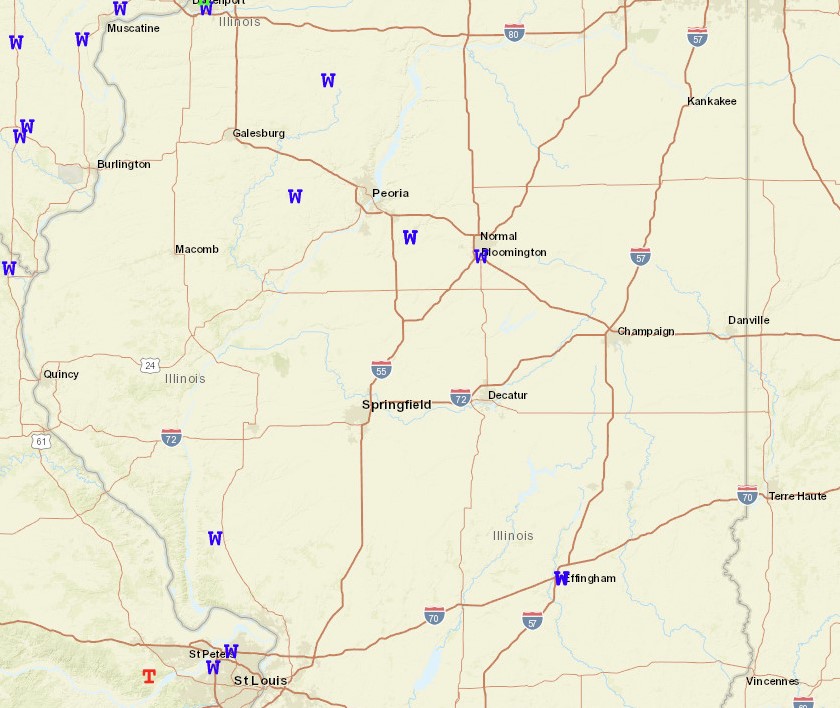
Storm Reports Morning of May 7
ROUND 2: Afternoon and Evening of May 7th
Radar imagery 3:00PM CDT May 7
Scattered thunderstorms developed along an outflow boundary left behind by the morning line of convection during the afternoon of May 7th. The storms generally fired along and east of I-55, then tracked eastward into Indiana by evening. Despite strong instability with MLCAPEs in excess of 2000J/kg, extreme deep-layer shear of 70-80kt acted to prevent vigorous updrafts. In essence, the very strong winds aloft disrupted the updrafts and kept storms from growing high into the atmosphere. One cell produced a 59mph wind gust at the Lawrenceville Airport during the evening...with no other severe reports across central Illinois.
Storm Reports Afternoon and Evening of May 7
ROUND 3: Afternoon and Evening of May 8th
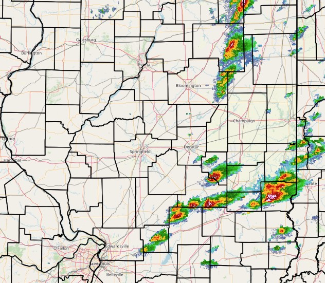
Radar imagery 7:40PM CDT May 8
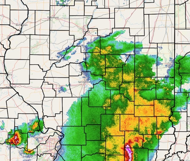
A surge of drier air flowed into central Illinois behind the afternoon/evening storms of May 7th...with surface dewpoints dropping into the lower to middle 50s everywhere north of I-70 by the early morning of May 8th. Thanks to the arrival of the drier, more stable air, the main frontal zone got pushed considerably southward to near the I-64 corridor. As low pressure tracked across central Missouri, thunderstorms initiated W/SW of Saint Louis, then tracked E/SE along the boundary across southern Illinois and western Kentucky during the afternoon of May 8th. Since the boundary was further south than initially forecast 3-4 days ago, central Illinois ended up missing much of the severe weather. One cluster of storms surged eastward and clipped portions of Clay, Richland, and Lawrence counties with strong winds...but no other severe weather occurred across the NWS Lincoln County Warning Area (CWA).
Storm Reports Afternoon and Evening of May 8