May 7, 2023
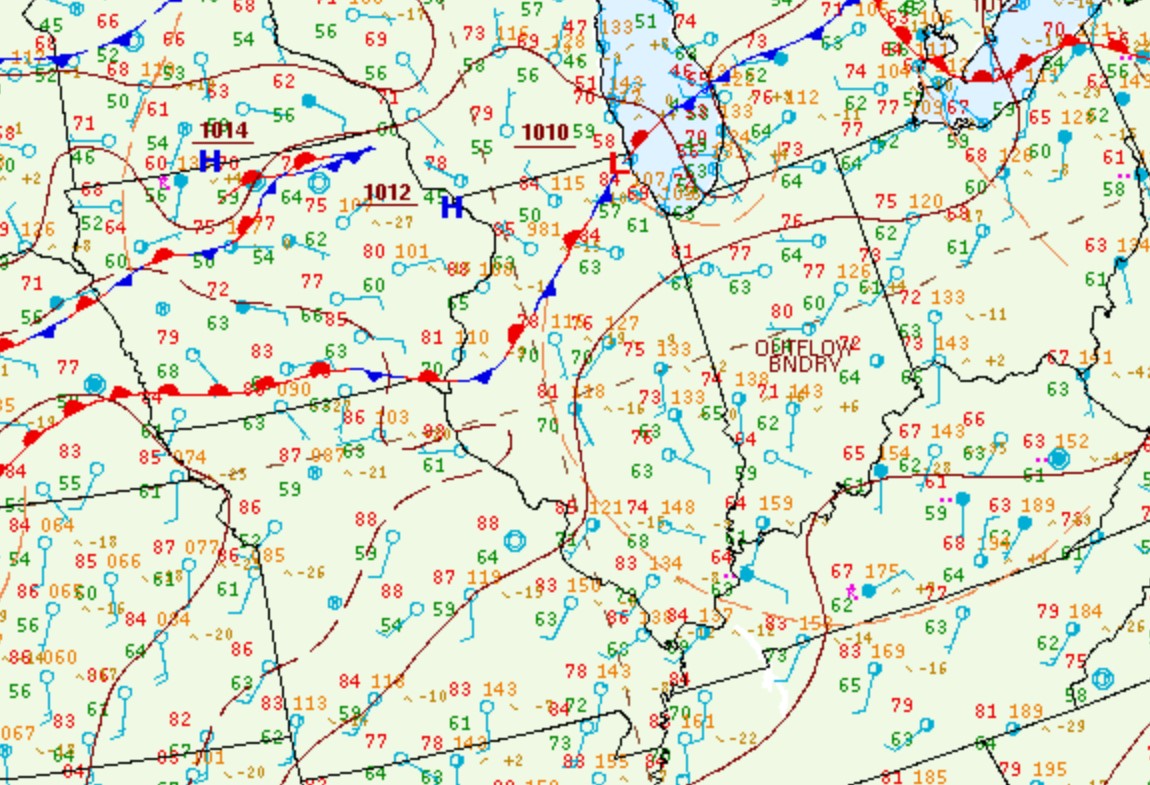
Surface analysis from midday May 7th revealed a stationary frontal boundary draped from southern Michigan to eastern Nebraska...while a prominent outflow boundary from earlier convection extended from near Peoria southward into western Kentucky. Note the southeasterly winds and temperatures in the lower to middle 70s in the rain-cooled airmass across eastern Illinois on the map. Meanwhile further west, winds were southwesterly and readings had soared into the middle to upper 80s across Missouri into western Illinois.
SURFACE WEATHER MAP 1PM CDT MAY 7
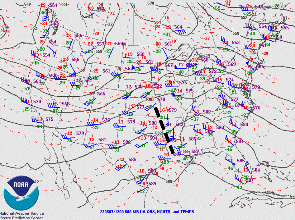
Early morning upper air analysis showed a short-wave trough from eastern Kansas to Louisiana (dashed black line on the map below). This feature would continue to track northeastward and eventually interact with the outflow boundary to produce scattered severe thunderstorms across portions of central Illinois during the afternoon and evening of May 7th.
500MB CHART 7AM CDT MAY 7
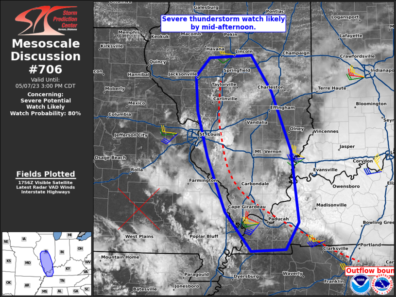
Temperatures across western Illinois warmed well into the 80s and dewpoints pooled in the upper 60s to around 70 degrees near the outflow boundary, resulting in Convective Available Potential Energy (CAPE) values increasing to 2500-3000J/kg. As the short-wave trough approached from the southwest and added the needed synoptic lift to the increasingly unstable environment, vigorous updrafts began to develop along the boundary. This prompted the Storm Prediction Center (SPC) to issue a Mesoscale Convective Discussion (MCD) for south-central Illinois into western Kentucky at 1pm CDT. Given the high degree of instability, they highlighted the threat for very large hail and damaging wind gusts and the high likelihood of a Severe Thunderstorm Watch.
MESOSCALE CONVECTIVE DISCUSSION (MCD) 1PM CDT MAY 7
Thunderstorms rapidly initiated along the outflow boundary...especially immediately ahead of the short-wave where synoptic lift was strongest across southern Illinois. Shortly after 2pm, a severe cell formed over southern Sangamon County.
RADAR IMAGERY 2:35PM CDT MAY 7
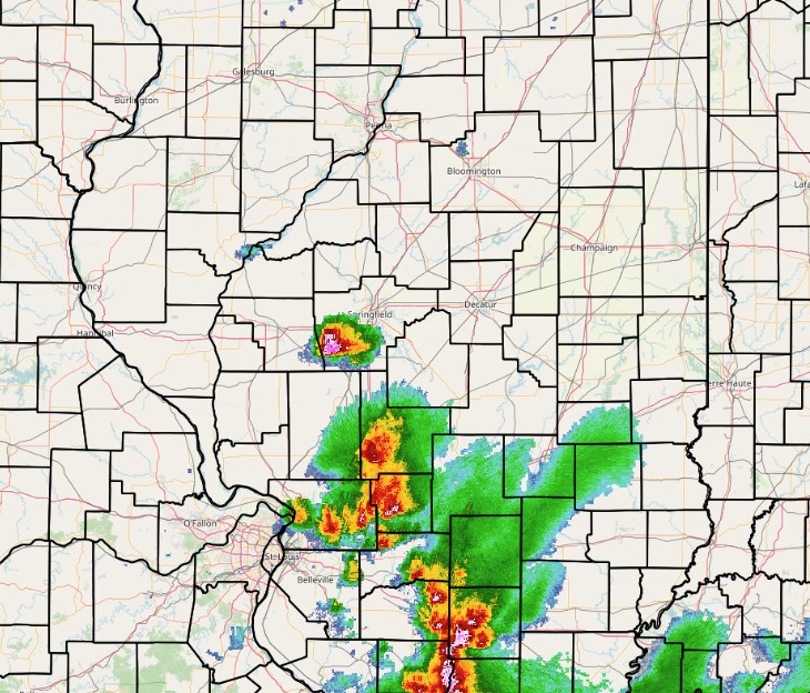
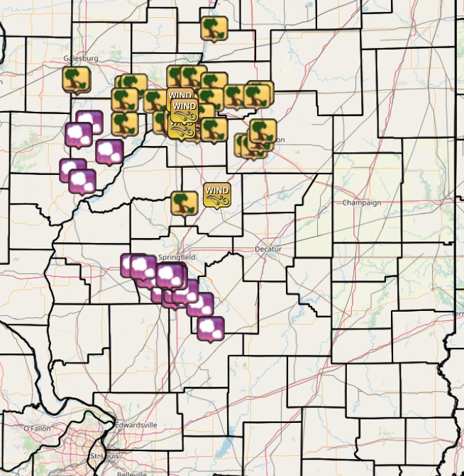
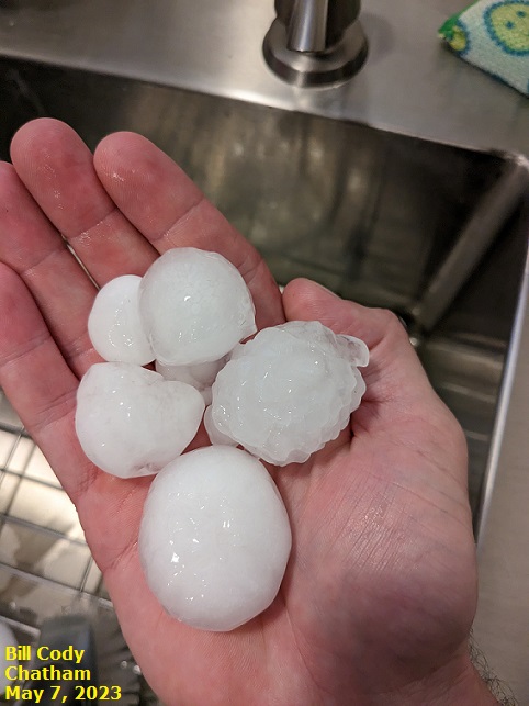
Given weak steering winds aloft, the storm remained nearly stationary...with additional cells re-generating in the same area. With relatively low freezing levels of around 11,000 feet in place and a highly unstable airmass supporting intense updrafts, the storm cluster became a proficient hail-producer. Some locations reported hail lasting for more than 30 minutes. The largest stone which fell in the town of Chatham was a whopping 3.25" in diameter, which is bigger than a baseball! The large hail produced extensive damage to homes and vehicles. Below are photos of hail up to 2.5" in diameter (tennis ball-sized) observed by one of our Chatham SWOP team members.
 |
 |
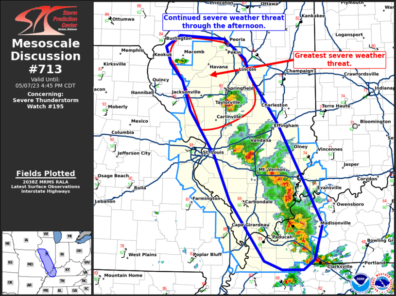
With one large severe storm in place and additional cells beginning to form further north along the outflow boundary, SPC issued another MCD for the western half of the National Weather Service Lincoln County Warning Area (CWA) at 3:40pm. The primary concern was the continued threat for very large hail, although the eastward extent of the severe weather would be limited due to the more stable airmass in place across east-central Illinois.
MESOSCALE CONVECTIVE DISCUSSION (MCD) 3:40PM CDT MAY 7
Another storm cluster developed further north across Fulton County: however, it did not produce hail nearly as large as the Sangamon County cell. Numerous reports of quarter-sized hail were received, with stones as large as golf-balls in the town of Marietta in western Fulton County. As more storms developed and began competing with one another for energy, severe weather temporarily waned by late afternoon: however, flash flooding became a significant concern beneath the larger clusters. In fact, rainfall amounts of 4 to 6 inches were common from southern Sangamon County into southern Christian County...with the highest rainfall of 6.57 being measured just southeast of Chatham in Sangamon County. By early evening, additional storms began focusing further north along the stationary front.
RADAR IMAGERY 7:10PM CDT MAY 7
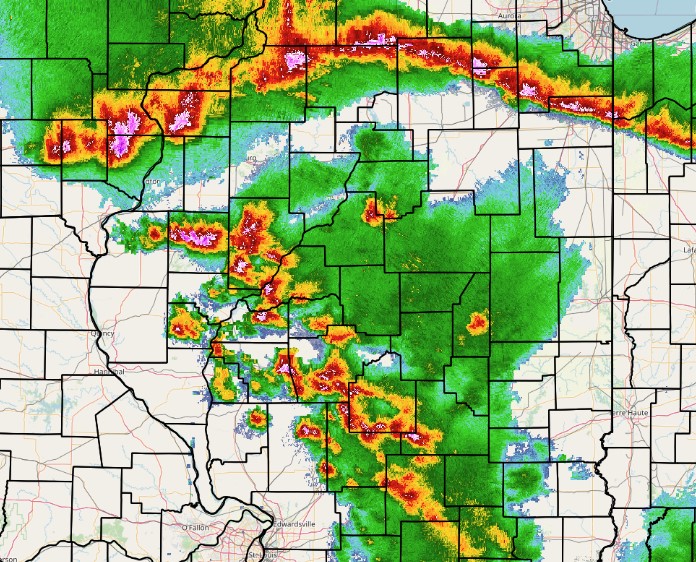
As a line of thunderstorms organized along the stationary front, SPC issued another MCD for much of central Illinois highlighting the threat for damaging wind gusts.
MESOSCALE CONVECTIVE DISCUSSION (MCD) 8:45PM CDT MAY 7
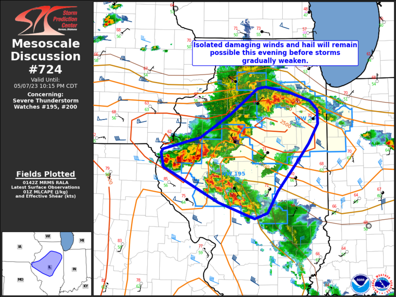
As the line of convection dropped southeastward, wind gusts of 50-60mph created scattered wind damage as far south as Logan and McLean counties before gradually weakening before midnight due to waning instability after dark. Below is a map of all severe weather reports received during the afternoon and evening of May 7th, 2023. Note the hail reports across Fulton, Sangamon, and Christian counties from the afternoon...and the wind damage reports further northeast during the evening.