April 4, 2023
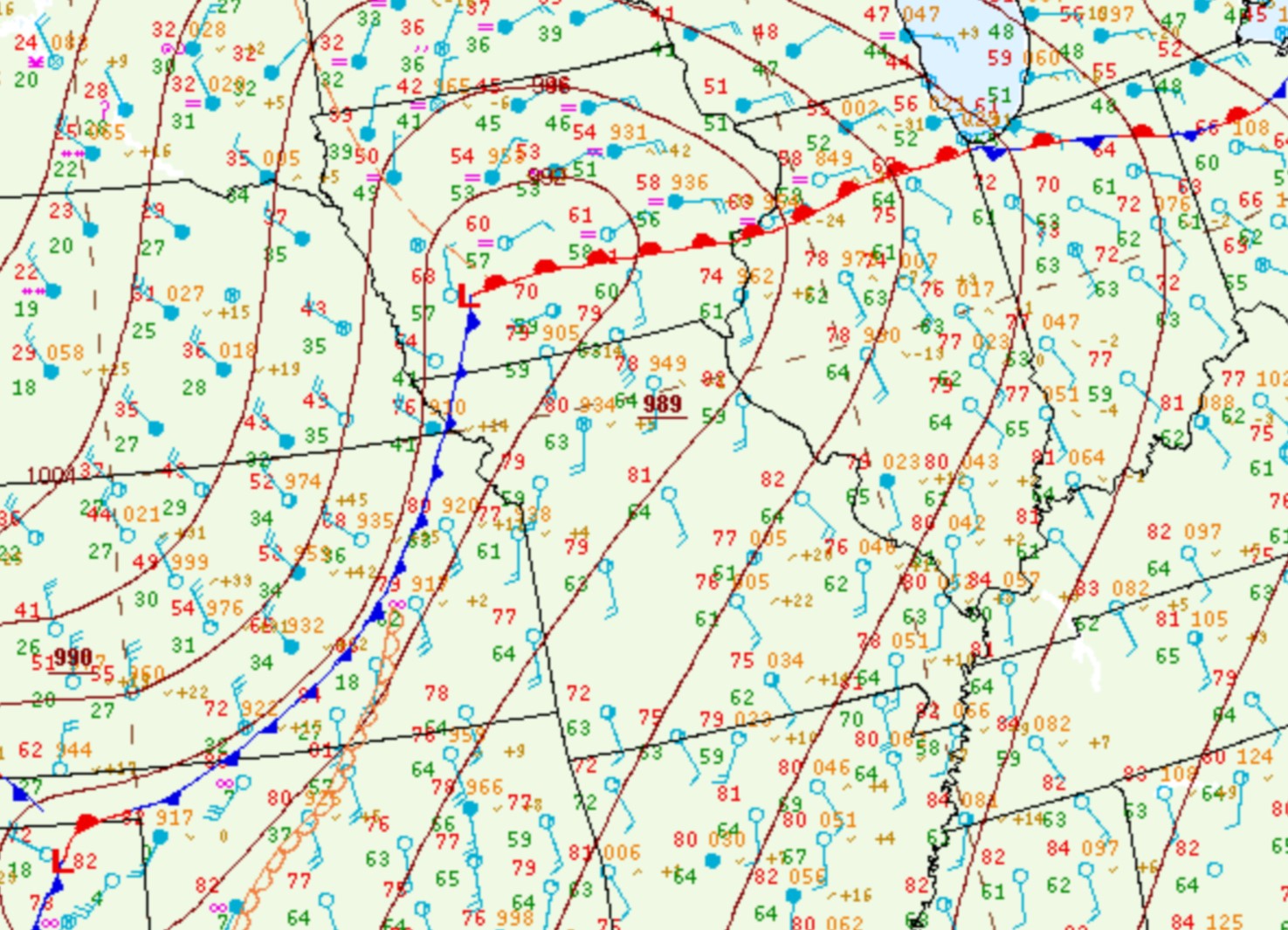
Tuesday, April 4th, 2023 started off cool and damp...as a nearly stationary frontal boundary draped along I-72 led to the development of fog and drizzle during the morning. As an upper-level trough tracked across the Rockies into the Plains, downstream ridging over the Midwest pushed the frontal boundary northward by midday. Once the winds switched to southerly and skies partially cleared, temperatures soared to near record highs in the lower to middle 80s. By early evening, central Illinois was firmly in the warm sector of the system...while a 989mb low was analyzed further west across southwest Iowa.
SURFACE WEATHER MAP 7PM CDT APR 4
Given the potentially volatile situation that was expected to unfold during the evening, National Weather Service Lincoln as well as other regional NWS offices launched weather balloons during the afternoon in order to provide supplemental data to forecasters and to enhance short-term computer model output. The 3pm April 4th sounding from Lincoln showed a highly unstable and sheared environment...with a Surface-Based Convective Available Potential Energy (SBCAPE) value of 3282J/kg and 0-6km bulk shear of 56kt. Note the wind barbs on the sounding below, showing winds from the south at 20kt at ground level, veering to the west and increasing to 60kt at 6km aloft. This degree of both directional and speed shear is more than sufficient to sustain long-lived rotating updrafts. Despite the excellent instability and wind shear, no thunderstorm activity occurred during the afternoon of April 4th. This was due to the lack of a forcing mechanism to get air parcels moving upward...and the fact that a warm layer between 1km and 2km aloft was creating an effective "cap" that prevented updrafts from becoming particularly deep.
UPPER AIR SOUNDING 3PM CDT APR 4

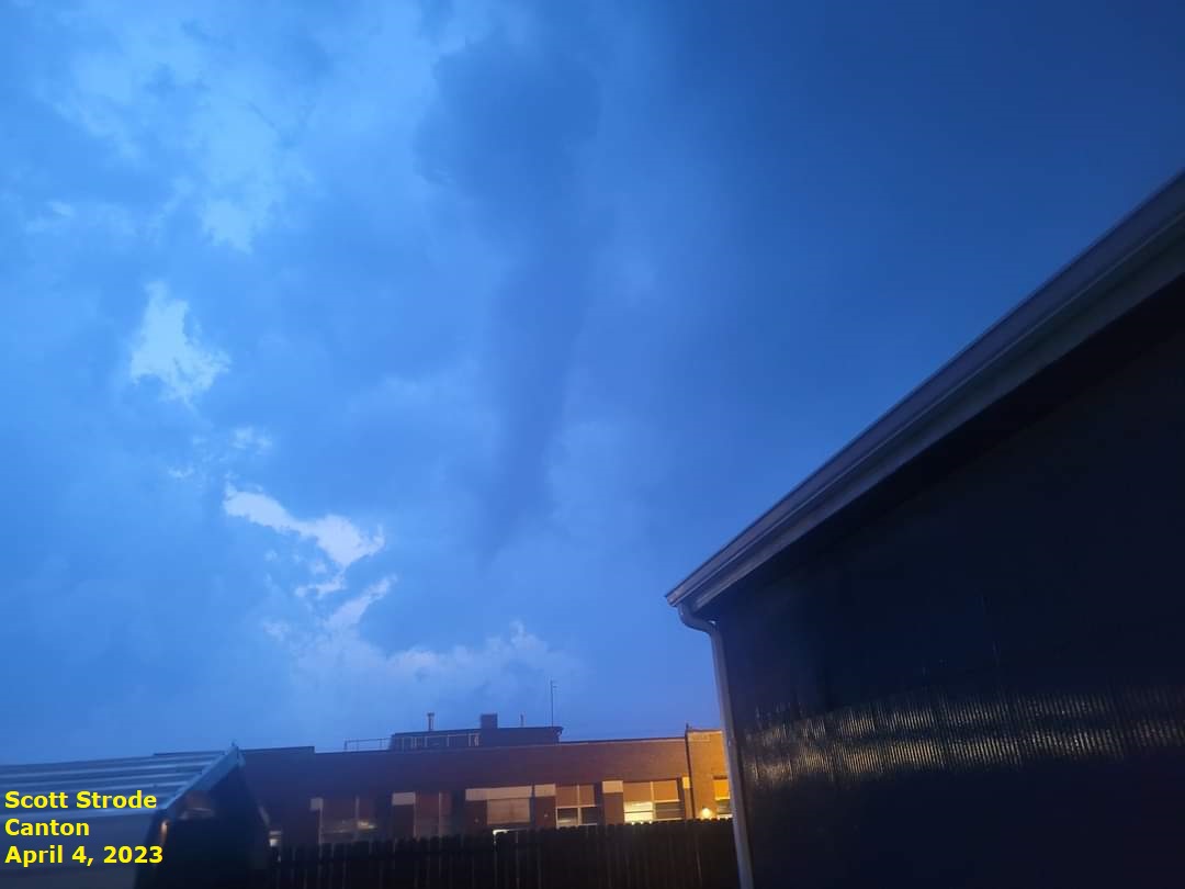
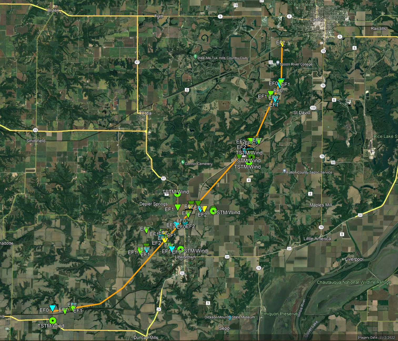
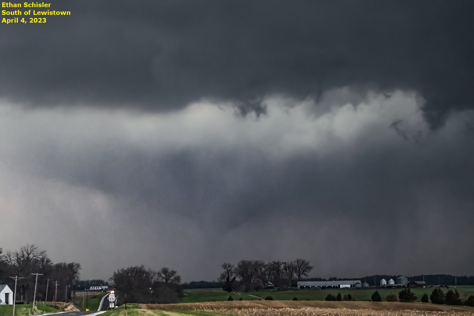
A subtle upper wave approaching from the southwest eventually weakened the cap across northeast Missouri and west-central Illinois by late afternoon. Once this occurred, vigorous updrafts were able to develop and scattered thunderstorms rapidly initiated. Individual cells quickly congealed into one large supercell over southern McDonough County by early evening. With plenty of energy to tap into and deep-layer wind shear in place to sustain the vigorous rotating updraft, the stage was set for significant severe weather across parts of the Illinois River Valley. The supercell initially spawned an EF-1 tornado southeast of the town of Industry in McDonough County. Once that particular tornado dissipated, a second EF-1 tornado touched down in Table Grove in southwestern Fulton County. This cyclic tornado development common with supercells continued as the parent storm tracked further northeastward. The longest tracked tornado associated with the storm touched down east of Ipava...then moved northeastward toward Lewistown before curving more northward past Bryant and eventually dissipating as it came into the southern part of Canton. An NWS survey conducted on April 5th revealed EF-3 damage with maximum winds of around 160mph just northwest of Lewistown. The supercell eventually dissipated as daytime instability waned after dark and it tracked further away from the weakness in the cap. In total, the storm produced 5 tornadoes (4 in the NWS Lincoln County Warning Area) and hail as large as baseballs in the towns of Table Grove and Vermont.
LEWISTOWN/BRYANT/CANTON TORNADO TRACK
TORNADO DEVELOPING EAST OF IPAVA

TORNADO NORTH OF LEWISTOWN (observer south of town looking north)
TORNADO DISSIPATING ON THE SOUTH SIDE OF CANTON