March 23-24, 2018
Low pressure tracking from the Ozarks eastward into the Ohio River Valley brought a swath of heavy snow to north-central Illinois from the late evening of March 23rd through the afternoon of March 24th. The snow was primarily confined to locations along and north of the I-74 corridor in a narrow band measuring only about 75-80 miles wide. Snow totals within the band ranged from 6 to 10 inches. Further south...a mixture of rain, sleet, and snow occurred just south of I-74, with mainly rain across the remainder of central and southeast Illinois.
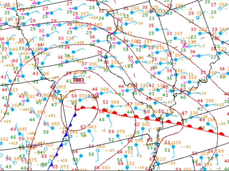
Surface analysis during the early morning of March 24th showed a 1003mb low over west-central Missouri...with a warm front extending eastward into the Tennessee River Valley. Central Illinois was well north of the low in the cool sector of the storm and was experiencing strong easterly winds and temperatures in the lower to middle 30s. Rain was falling across most of the area, with wet snow noted along and north of the I-74 corridor.
SURFACE WEATHER MAP 7AM SATURDAY, MARCH 24
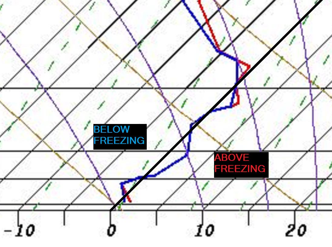
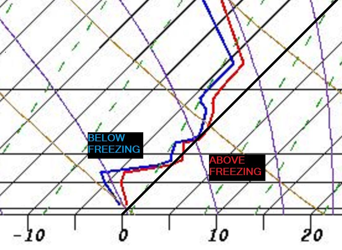
With the low tracking due east and surface temperatures expected to hover in the 30s for the balance of the day, the thermal profile of the entire depth of the atmosphere became an important factor in the precipitation type forecast. Upper air balloons released by NWS Lincoln and NWS Quad Cities during the morning of the 24th revealed a distinct north-south temperature gradient aloft. Below are the upper air soundings from both sites. The red line is the temperature trace as the balloon ascended through the atmosphere and the dark black line represents the freezing line. All temperatures to the right of the black line are above freezing, while all readings to the left are below freezing. As you can see, large portions of the NWS Lincoln sounding were slightly above freezing...meaning snowflakes falling from above would at least partially melt before reaching the ground. Meanwhile, the NWS Quad Cities sounding was almost entirely below freezing...meaning snow would easily be able to reach the ground.
NWS LINCOLN SOUNDING NWS QUAD CITIES SOUNDING
 |
 |
Regional radar imagery from 7am March 24th showed widespread precipitation across Illinois and confirmed what the soundings had suggested. There was a sharp delineation between snow to the north and rain to the south, with the transition line setting up essentially along I-74. Based on radar imagery and corresponding surface reports, the black line on the image below shows the approximate location of the rain/snow line.
REGIONAL RADAR 7AM SATURDAY, MARCH 24

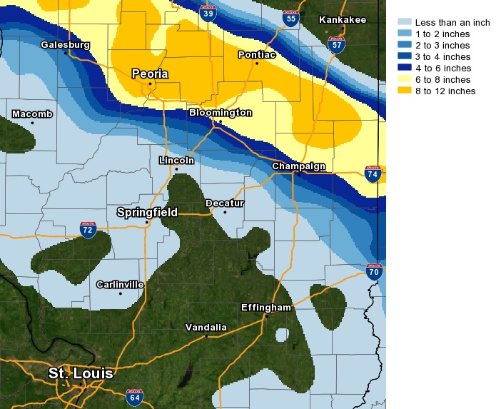
Snow continued to fall through the remainder of the morning and into the afternoon along and north of I-74, with the precipitation gradually coming to an end from west to east further south. Once the snow ended, widespread totals of 6 to 10 inches were observed along and north of a Galva...to Peoria...to Bloomington...to Danville line. The heavy wet snow covered area roadways causing numerous accidents on portions of I-74, I-57, I-55, and I-39. Below is a map of the March 23-34, 2018 snowfall.
MARCH 23-24 SNOWFALL MAP
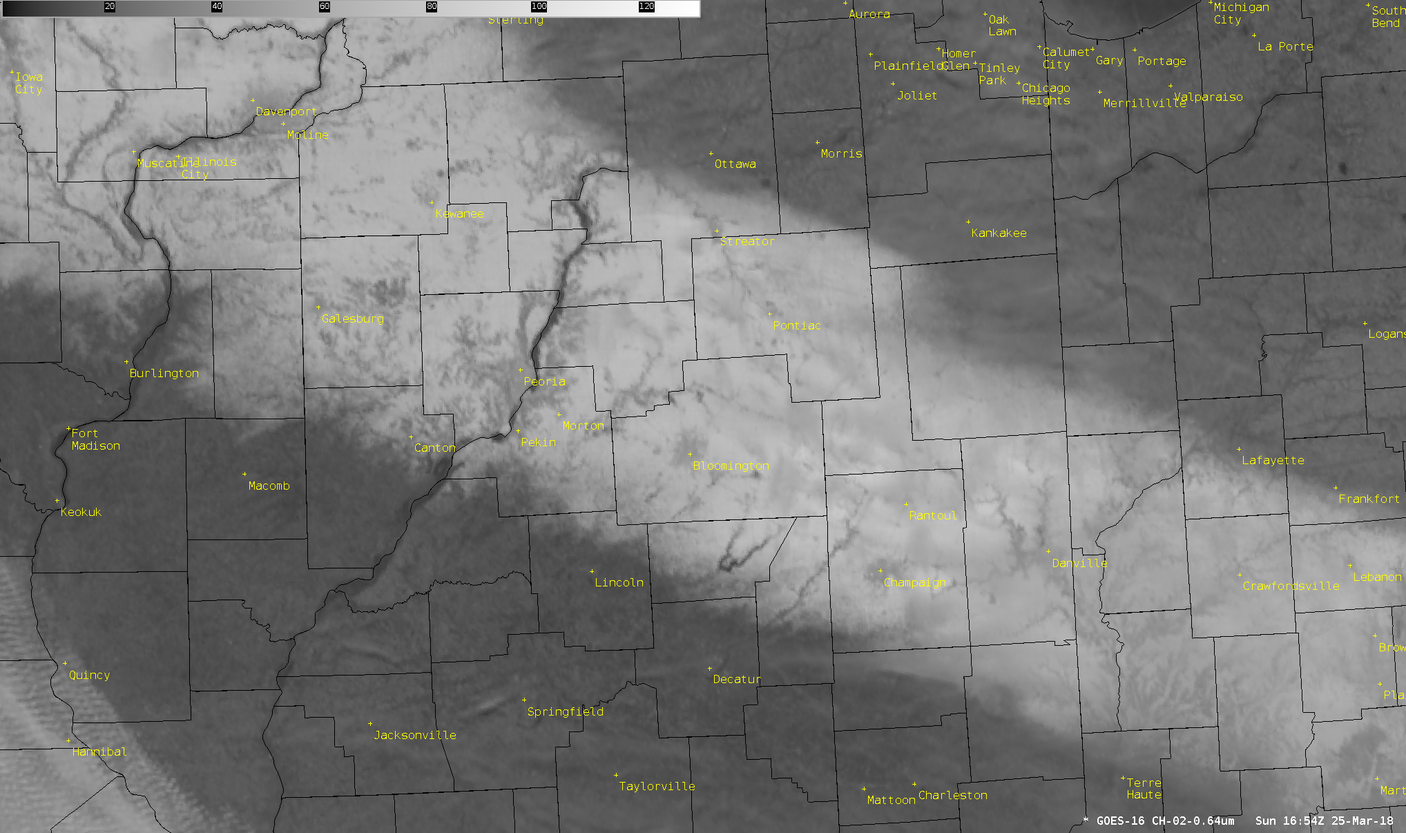
Here is a high-resolution visible satellite picture taken around noon on Sunday, March 25th. Notice the bright white band across north-central Illinois indicating where snow is currently on the ground. Click the image for more detail.
GOES-16 VISIBLE SATELLITE IMAGERY 12PM SUNDAY, MARCH 25