847
FLUS43 KILX 181038
HWOILX
Hazardous Weather Outlook
National Weather Service Lincoln IL
538 AM CDT Fri Apr 18 2025
ILZ027>031-036>038-040>043-047>053-191100-
Knox-Stark-Peoria-Marshall-Woodford-Fulton-Tazewell-McLean-Schuyler-
Mason-Logan-De Witt-Cass-Menard-Scott-Morgan-Sangamon-Christian-
Macon-
538 AM CDT Fri Apr 18 2025
This Hazardous Weather Outlook is for central Illinois and west
central Illinois.
.DAY ONE...Today and tonight.
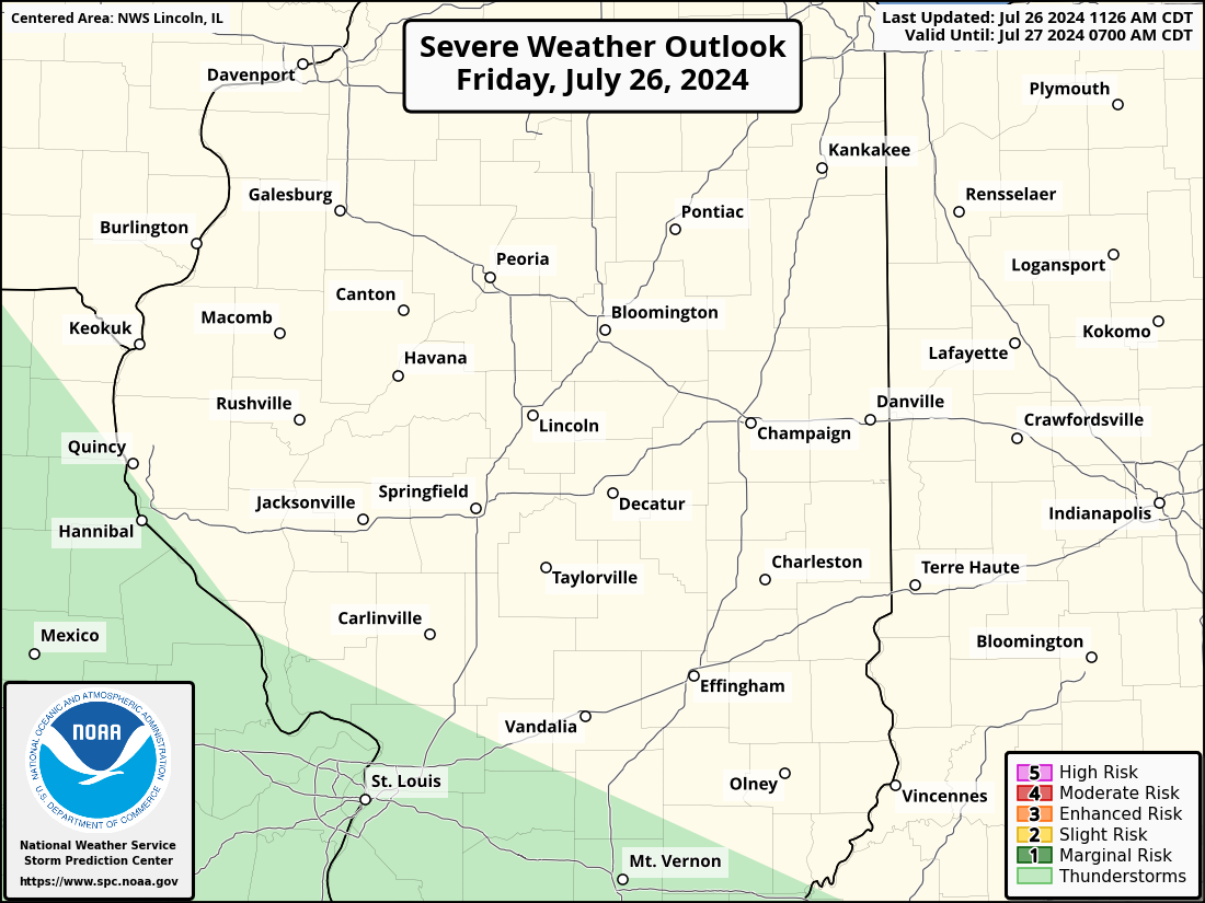
Scattered thunderstorms are expected to develop by mid afternoon near
the Illinois River, spreading eastward and continuing into the
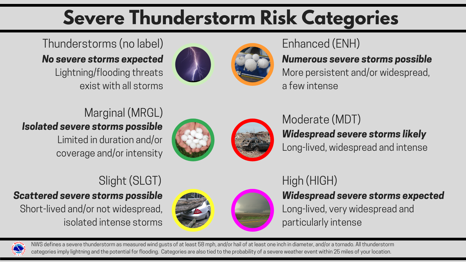
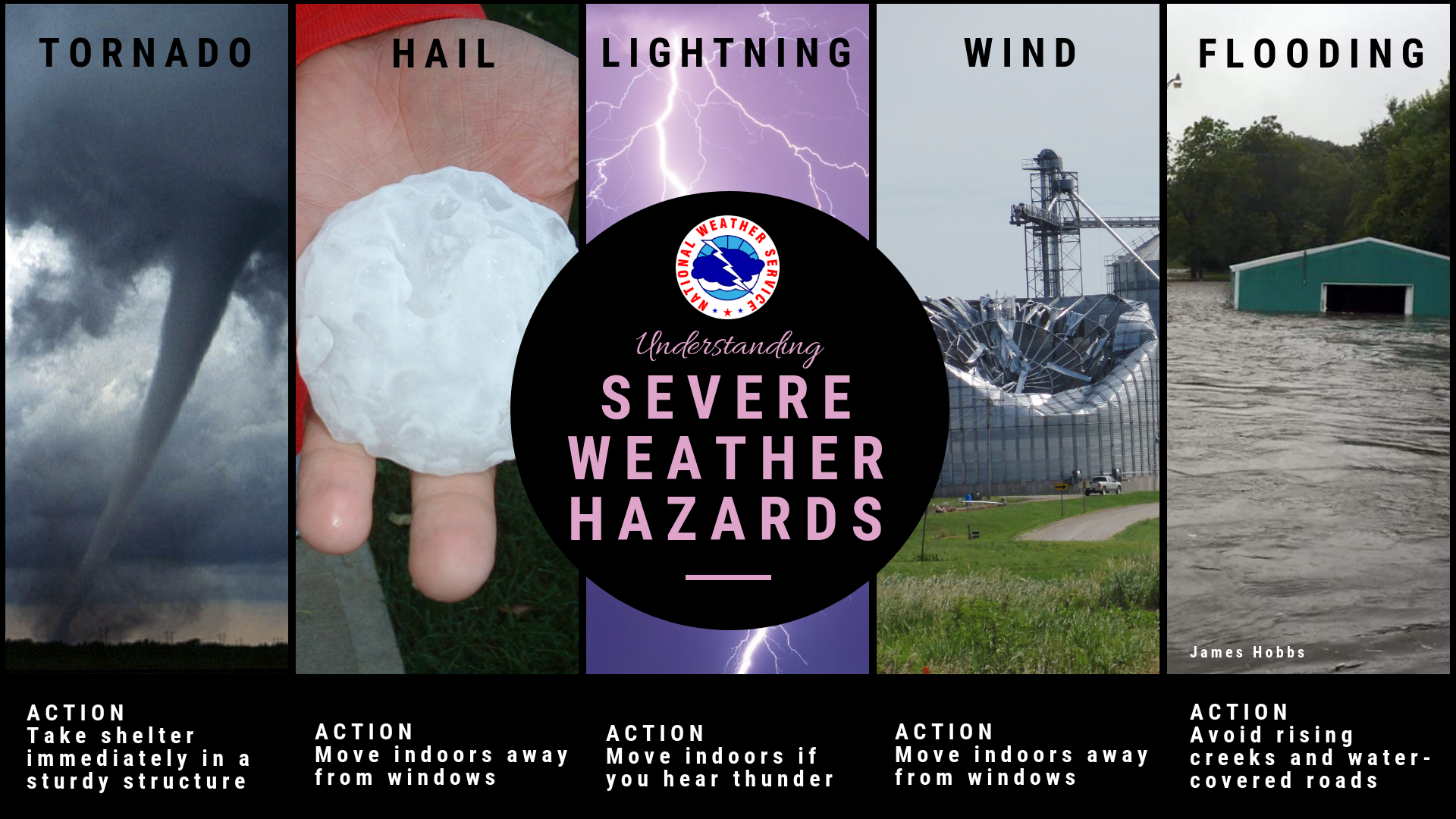
evening. Some of these storms may become severe, with damaging winds
and large hail the main threats.
.DAYS TWO THROUGH SEVEN...Saturday through Thursday.
While a few more storms may occur near I-72 on Saturday, they are
more likely to occur late Sunday afternoon and evening. These late
weekend storms may also be on the strong side, with a few potentially
becoming severe.
.SPOTTER INFORMATION STATEMENT...
Spotter activation may be needed between 4 pm and midnight.
Expected storm motion is toward the east northeast around 45 mph.
$$
ILZ044>046-054>057-061-191100-
Piatt-Champaign-Vermilion-Moultrie-Douglas-Coles-Edgar-Shelby-
538 AM CDT Fri Apr 18 2025
This Hazardous Weather Outlook is for east central Illinois.
.DAY ONE...Today and tonight.
Southwest winds will gust to around 40 mph this afternoon, causing
some difficult travel for high profile vehicles.
Thunderstorms are expected to begin moving into east central Illinois
early this evening, continuing through the night. Some of these
storms may become severe, with damaging winds and large hail the main
threats. Areas of heavy rain are also expected after midnight.
.DAYS TWO THROUGH SEVEN...Saturday through Thursday.
Thunderstorms will be scattered from Saturday through Sunday evening.
A few of the storms Sunday evening may be on the strong side.
However, periods of heavy rain will continue into Saturday.
.SPOTTER INFORMATION STATEMENT...
Spotter activation may be needed between 6 pm and midnight.
Expected storm motion is toward the east northeast around 45 mph.
$$
ILZ062-063-066>068-071>073-191100-
Cumberland-Clark-Effingham-Jasper-Crawford-Clay-Richland-Lawrence-
538 AM CDT Fri Apr 18 2025
This Hazardous Weather Outlook is for southeast Illinois.
.DAY ONE...Today and tonight.
Southwest winds will gust to around 40 mph this afternoon, causing
some difficult travel for high profile vehicles.
Thunderstorms are expected to begin moving into southeast Illinois
early this evening, continuing through the night. Some of these
storms may become severe, with damaging winds and large hail the main
threats. Areas of heavy rain are also expected after midnight.
.DAYS TWO THROUGH SEVEN...Saturday through Thursday.
Thunderstorms will be scattered from Saturday through Sunday evening.
A few of the storms will be strong to locally severe, and periods of
heavy rain will continue into Saturday. This heavy rain may cause
renewed flooding on parts of the Little Wabash and Wabash Rivers
early next week.
.SPOTTER INFORMATION STATEMENT...
Spotter activation may be needed between 7 pm and 2 am.
Expected storm motion is toward the east northeast around 45 mph.
$$
Geelhart
|

|


