
Thunderstorms with severe wind gusts and hail will be possible today across parts of the central Plains, and from the Missouri Valley into the upper Mississippi Valley. Heavy rain associated with the thunderstorms may also produce flash/urban flooding. Critical fire weather conditions expected in the Great Basin and interior Northwest. Dangerous heat continues across the Southwest and Southeast. Read More >
|
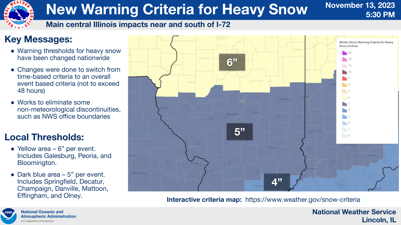
The National Weather Service is implementing new heavy snow criteria. This is being done across the contiguous United States. Changes are being done to eliminate non-meteorological discontinuities such as NWS office boundaries, adjust the length of time from a specific time frame to the overall event (not to exceed 48 hours), and to improve decision support services and communication. An interactive mapping of the criteria is available at this link: |
 |
For central Illinois, the following changes are being made:
Old heavy snow criteria for winter storm watches and warnings: |
|
| All of the Lincoln NWS coverage area | 6 inches in 12 hours, or 8 inches in 24 hours |
New heavy snow criteria for winter storm watches and warnings: |
|
|
Fulton, Knox, Marshall, McLean, Peoria, Stark, Tazewell, and Woodford Counties Includes Galesburg, Peoria, and Bloomington/Normal |
6 inches for an event |
|
Champaign, Christian, Clark, Clay, Coles, Crawford, Cumberland, De Witt, Douglas, Edgar, Effingham, Jasper, Lawrence, Logan, Macon, Mason, Morgan, Moultrie, Piatt, Richland, Sangamon Scott, Schuyler, Shelby, and Vermilion Counties Includes Champaign/Urbana, Danville, Decatur, Effingham, Flora, Havana, Jacksonville, Lincoln, Mattoon, Newton Olney, Paris, Shelbyville, Springfield, and Taylorville |
5 inches for an event |



 Follow us on X
 Follow us on Facebook
 Follow us on YouTube
 ILX RSS Feed