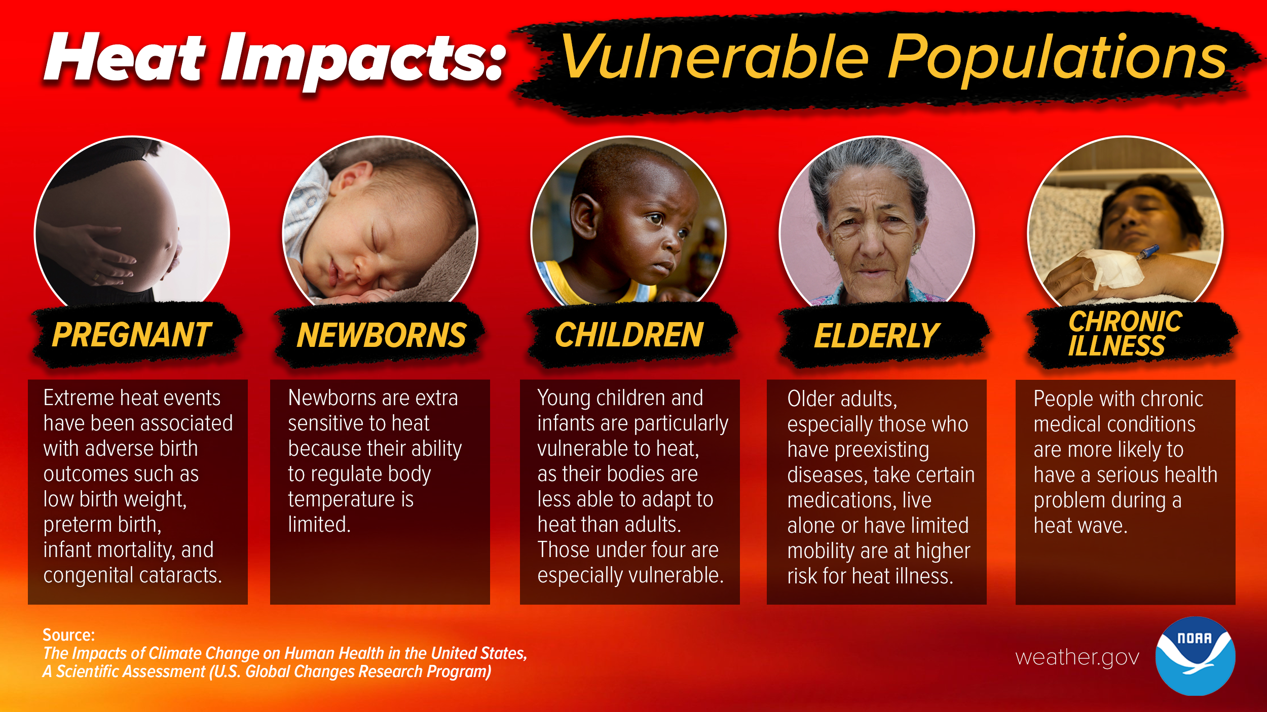
|
130

WWUS73 KILX 132035

NPWILX


URGENT - WEATHER MESSAGE

National Weather Service Lincoln IL

335 PM CDT Thu Mar 13 2025


ILZ027>031-036>038-040>057-061>063-066>068-071>073-141000-

/O.CON.KILX.WI.Y.0004.250314T1800Z-250315T0600Z/

Knox-Stark-Peoria-Marshall-Woodford-Fulton-Tazewell-McLean-

Schuyler-Mason-Logan-De Witt-Piatt-Champaign-Vermilion-Cass-

Menard-Scott-Morgan-Sangamon-Christian-Macon-Moultrie-Douglas-

Coles-Edgar-Shelby-Cumberland-Clark-Effingham-Jasper-Crawford-

Clay-Richland-Lawrence-

Including the cities of Lacon, Sullivan, Effingham, Shelbyville,

Olney, Flora, Toulon, Eureka, Lincoln, Bloomington, Beardstown,

Springfield, Tuscola, Paris, Peoria, Decatur, Danville,

Rushville, Marshall, Jacksonville, Lawrenceville, Newton,

Mattoon, Normal, Petersburg, Robinson, Greenup, Monticello,

Galesburg, Canton, Pekin, Champaign, Havana, Taylorville,

Winchester, Urbana, Charleston, and Clinton

335 PM CDT Thu Mar 13 2025


...WIND ADVISORY REMAINS IN EFFECT FROM 1 PM FRIDAY TO 1 AM CDT

SATURDAY...


* WHAT...South winds 25 to 35 mph with gusts up to 50 mph expected.


* WHERE...Portions of central, east central, southeast, and west

  central Illinois.


* WHEN...From 1 PM Friday to 1 AM CDT Saturday.


* IMPACTS...Gusty winds will blow around unsecured objects. Tree

  limbs could be blown down and a few power outages may result.


PRECAUTIONARY/PREPAREDNESS ACTIONS...


Winds this strong can make driving difficult, especially for high

profile vehicles. Use extra caution.


Secure outdoor objects.


&&


$$


Bumgardner
|

|