Dangerous to record breaking heat will build across the center of the nation and slowly build eastward this week. Wildfire conditions remain critical for the Southwest and portions of the Great Basin through Monday. For the northern Plains and upper Midwest, severe thunderstorms with the potential for large to very large hail and severe winds are the primary hazards. Read More >
Overview
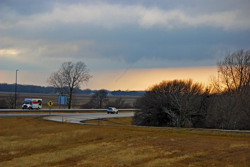
Severe thunderstorms developed over portions of central Illinois during the afternoon hours of Tuesday, January 3, 2023. Several funnel clouds and tornadoes were reported in a narrow zone in between the Interstates 55 and 57 corridors. A few sub-severe hail reports (<1" in size) were received, with one report of 1.5" or ping pong ball sized hail that came in from Farmer City, IL.
Fast Facts:
Summaries from other NWS office:
Tornadoes
|
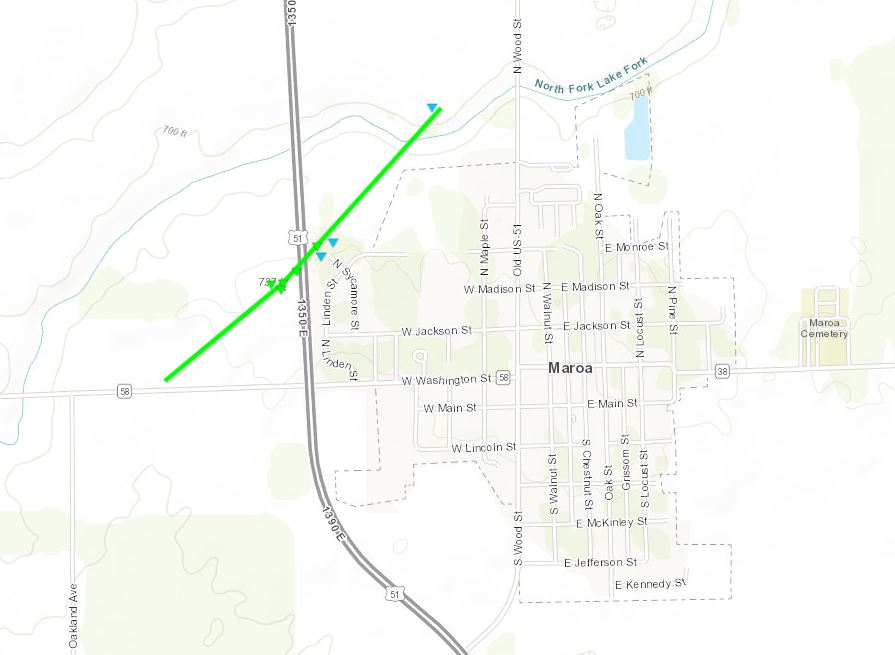
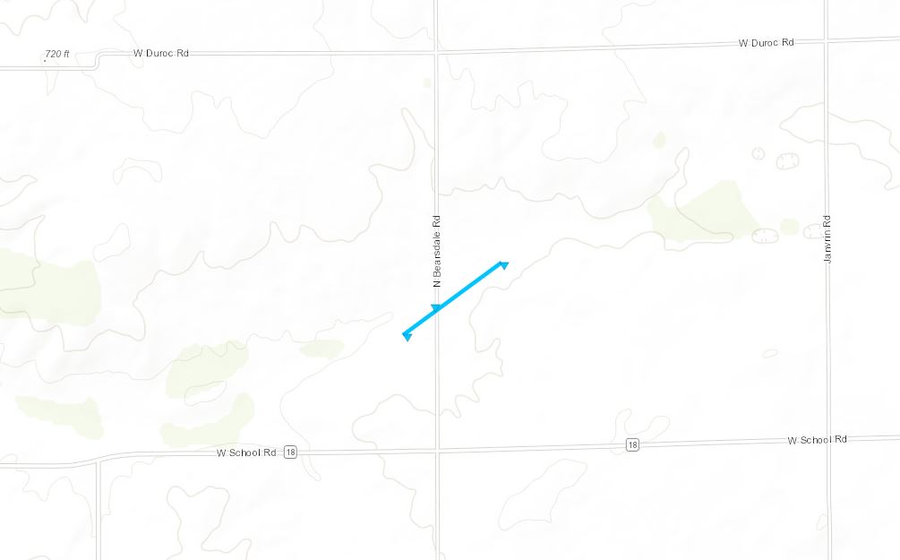
Maroa Tornado
|
||||||||||||||||
|
||||||||||||||||
|
3.5 miles Southwest of Maroa
|
||||||||||||||||
|
||||||||||||||||
|
Northeast side of Decatur
|
||||||||||||||||
|
||||||||||||||||
|
Decatur #2 Tornado
|
||||||||||||||||
|
||||||||||||||||
|
Northwest of Illiopolis
Track Map 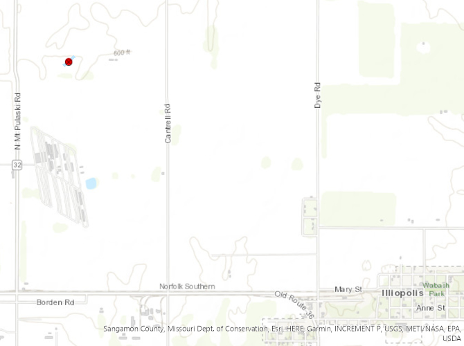 
|
||||||||||||||||
|
||||||||||||||||
|
Southwest of Latham
Track Map 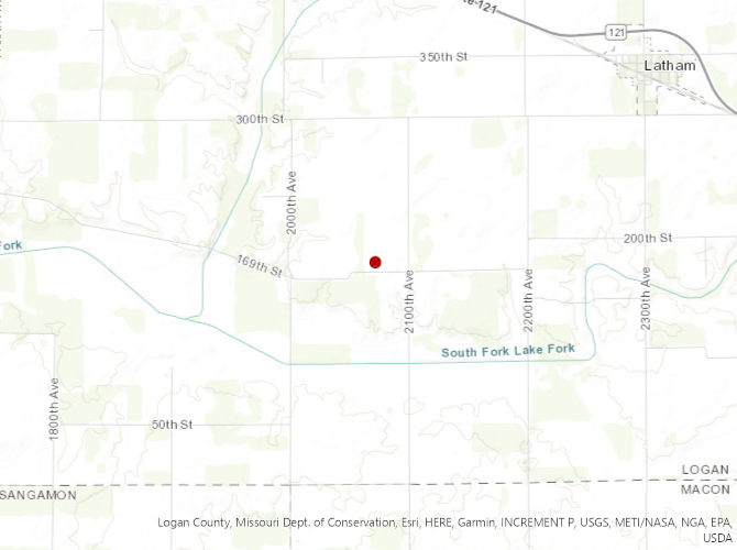
|
||||||||||||||||
|
||||||||||||||||
|
East-Northeast of Mt. Auburn
Track Map 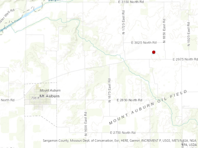
|
||||||||||||||||
|
||||||||||||||||
|
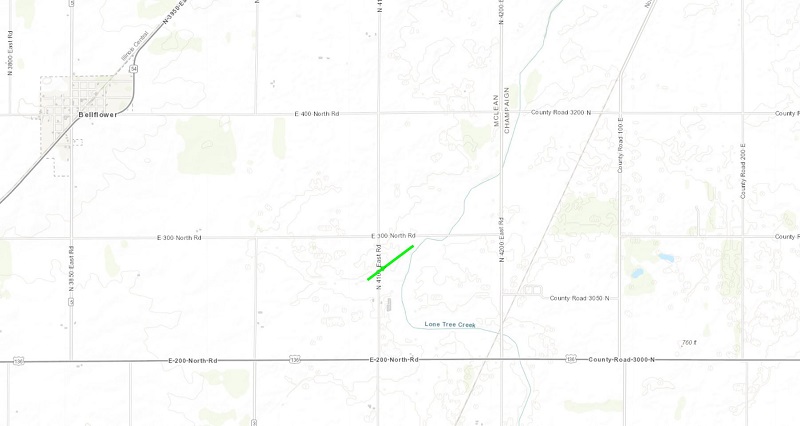
Bellflower Tornado
|
||||||||||||||||
|
||||||||||||||||
The Enhanced Fujita (EF) Scale classifies tornadoes into the following categories:
| EF0 Weak 65-85 mph |
EF1 Moderate 86-110 mph |
EF2 Significant 111-135 mph |
EF3 Severe 136-165 mph |
EF4 Extreme 166-200 mph |
EF5 Catastrophic 200+ mph |
 |
|||||
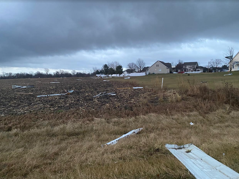
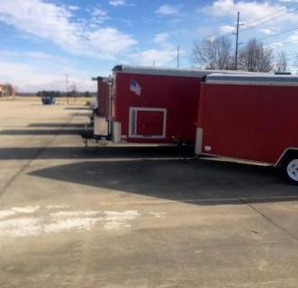
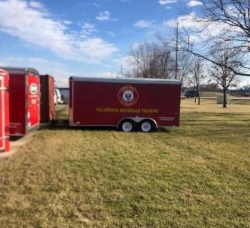
Photos & Video
_JeffFrame_Twitter_small.jpg) |
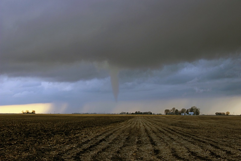 |
_JeffFrame_Twitter_small.jpg) |
 |
| Funnel cloud near Maroa (Jeff Frame) |
Funnel cloud near Niantic (Jeff Frame) |
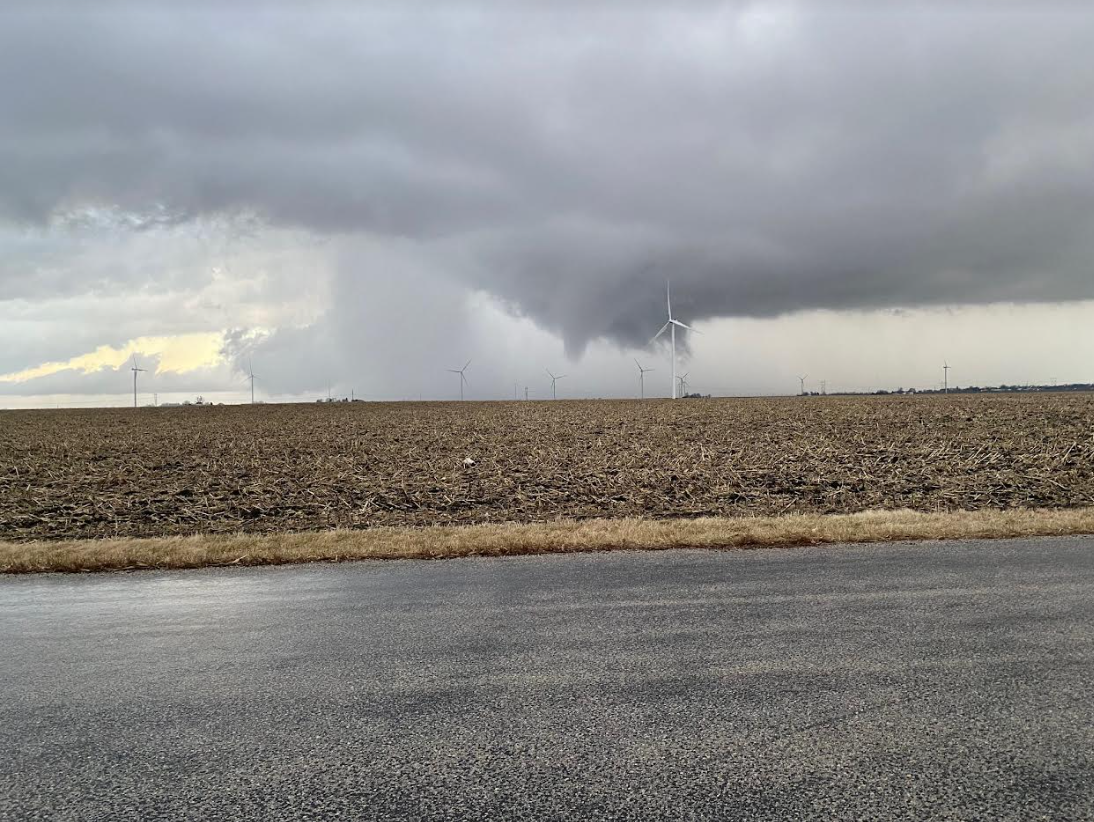
Rope funnel cloud near Illiopolis (Jeff Frame) |
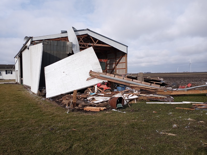
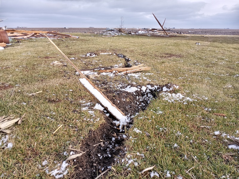
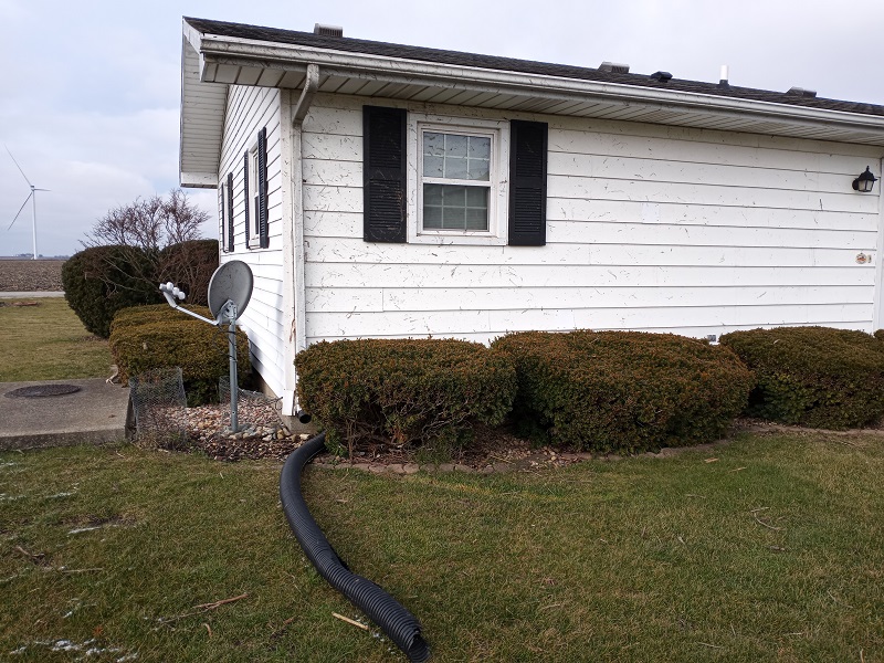
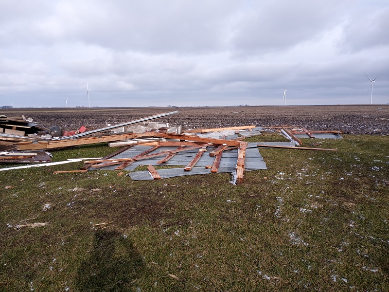
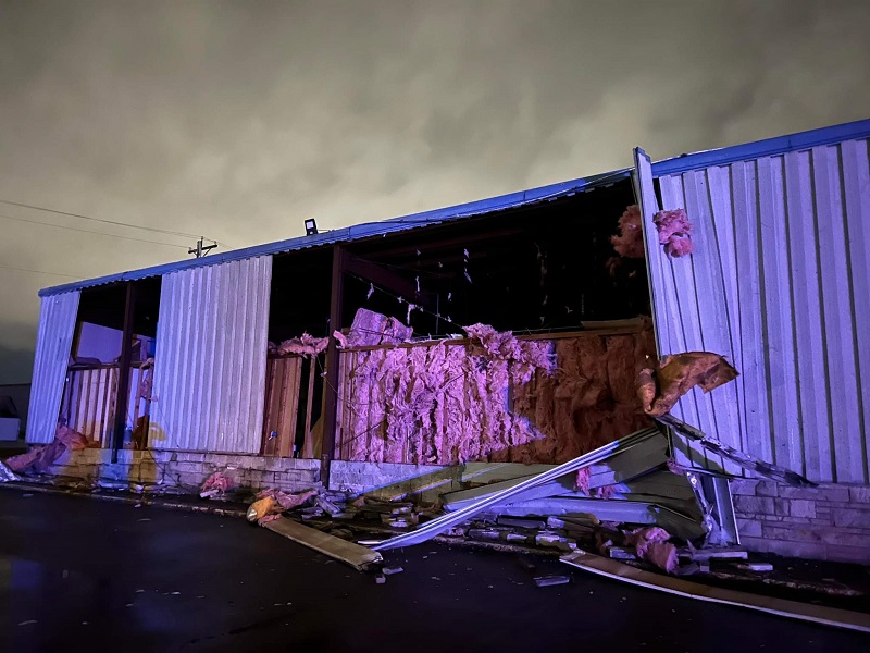
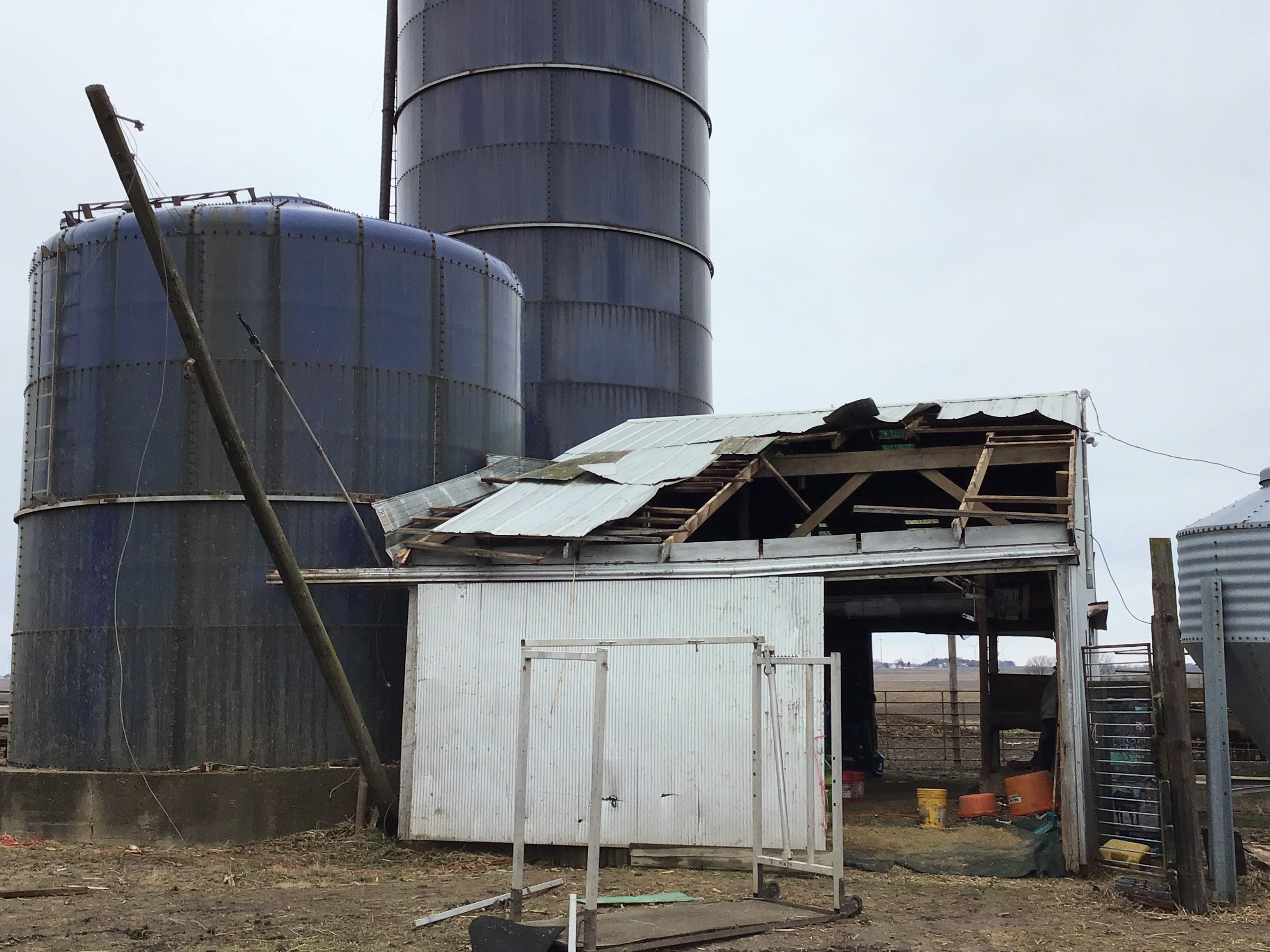
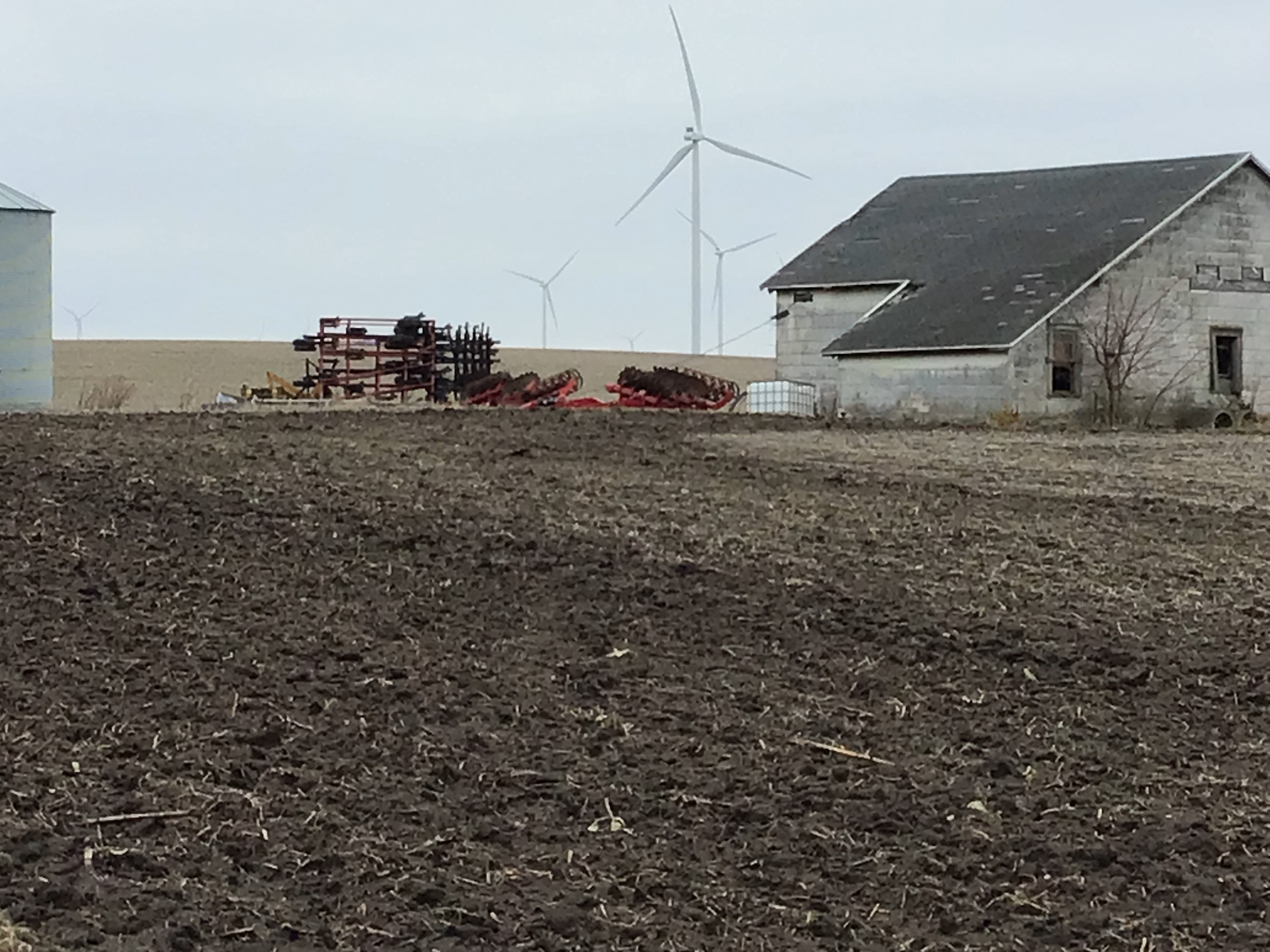
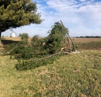
Storm damage near Maroa (Connor King) |
 |
 |
 |
 |
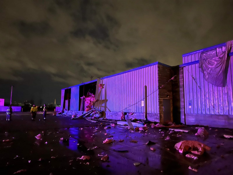
| Decatur damage to a bowling alley (Midwest & Great Lakes Storm Chasers) |
Decatur damage to a bowling alley (Midwest & Great Lakes Storm Chasers) |
Wall cloud 1 mile SW of Maroa (Connor King) |
Storm damage near Maroa (Connor King) |
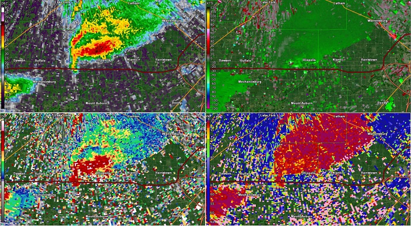
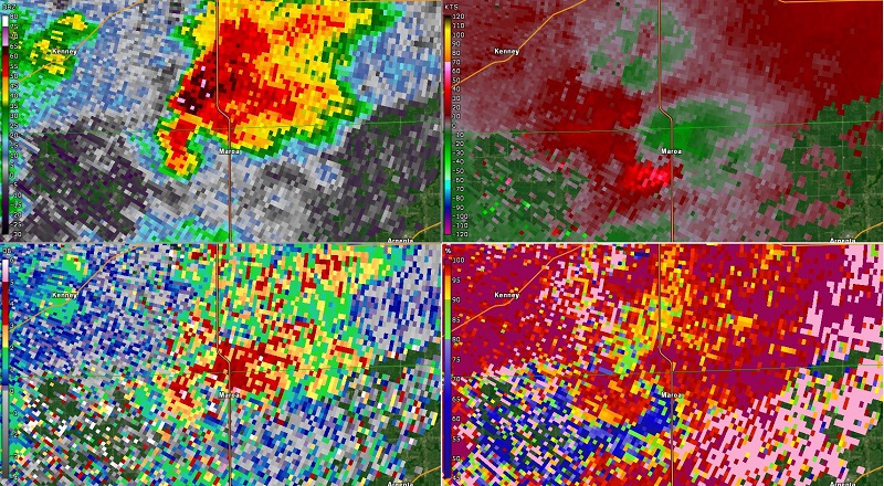
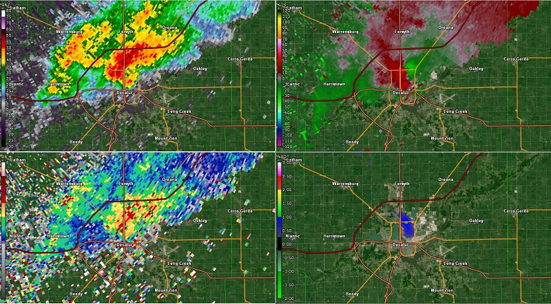
Radar
 |
 |
 |
 |
| 4-panel radar imagery near Illiopolis at 3:48 pm CST (0.5 degree reflectivity, velocity, differential reflectivity, correlation coefficient) | 4-panel radar imagery near Maroa at 2229Z (0.5 degree reflectivity, velocity, differential reflectivity, correlation coefficient) | 4-panel radar imagery near Decatur at 2359Z (0.5 degree reflectivity, velocity, differential reflectivity, low-level rotation tracks) | 4-panel radar imagery near Bellflower at 2340Z (0.5 degree reflectivity, velocity, differential reflectivity, low-level rotation tracks) |
Storm Reports
PRELIMINARY LOCAL STORM REPORT...SUMMARY
NATIONAL WEATHER SERVICE LINCOLN IL
111 AM CST WED JAN 4 2023

..TIME...   ...EVENT...      ...CITY LOCATION...     ...LAT.LON...
..DATE...   ....MAG....      ..COUNTY LOCATION..ST.. ...SOURCE....
            ..REMARKS..

0352 PM     TORNADO          2 WNW ILLIOPOLIS        39.86N 89.28W
01/03/2023                   SANGAMON           IL   TRAINED SPOTTER

            CONFIRMED TORNADO SPOTTED IN RURAL AREA WEST
            NORTHWEST OF ILLIOPOLIS MOVING NORTHEAST.

0405 PM     HAIL             PAWNEE                  39.59N 89.58W
01/03/2023  M0.88 INCH       SANGAMON           IL   PUBLIC

            DIME TO NICKEL SIZE HAIL FOR 45 SECONDS.

0534 PM     HAIL             CENTRAL ILLINOIS AIRPOR 40.48N 88.91W
01/03/2023  M0.88 INCH       MCLEAN             IL   PUBLIC

            REPORT RELAYED BY BROADCAST MEDIA. TIME
            ESTIMATED BY RADAR.

0537 PM     HAIL             2 N NORMAL              40.54N 88.98W
01/03/2023  M0.50 INCH       MCLEAN             IL   PUBLIC

            REPORT FROM MPING: HALF-INCH (0.50 IN.).
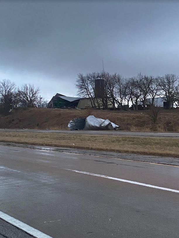
0433 PM     TORNADO          3 WSW MAROA             40.01N 89.01W
01/03/2023                   MACON              IL   NWS STORM SURVEY

            PATH LENGTH 0.3 MILES, WIDTH 25 YARDS. BRIEF
            TOUCHDOWN ALONG BEARSDALE RD. NORTH OF
            SCHOOL RD, CAUSING MINOR DAMAGE.
0436 PM     TORNADO          1 W MAROA               40.04N 88.97W
01/03/2023                   MACON              IL   NWS STORM SURVEY

            PATH LENGTH 0.9 MILES, WIDTH 75 YARDS. BARN
            DESTROYED NEAR THE INTERSECTION OF US-51 AND
            WASHINGTON ST. REMAINS OF A GRAIN BIN WERE
            TOSSED ACROSS THE HIGHWAY. A FENCE WAS
            DESTROYED JUST EAST OF US-51 NEAR THE END OF
            N. SYCAMORE ST.
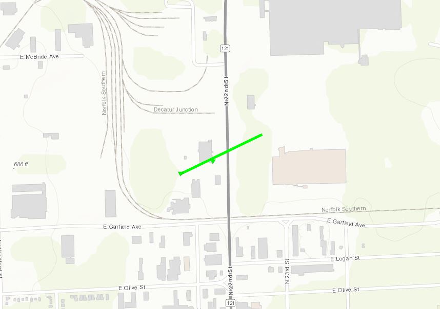
0557 PM     TORNADO          2 NE DECATUR            39.87N 88.93W
01/03/2023                   MACON              IL   TRAINED SPOTTER

            PATH LENGTH 0.2 MILES, WIDTH 25 YARDS.
            DAMAGE OCCURRED TO AN ABANDONED BOWLING
            ALLEY ALONG N. 22ND ST. SPOTTER WATCHED
            TORNADO CROSS ROAD. VIDEO FROM AFTER THE
            STORM PASSED SHOWS DEBRIS SCATTERED ACROSS
            THE ROAD AND ADJACENT FIELD.
0405 PM     TORNADO          3 SW LATHAM             39.94N 89.20W
01/03/2023                   LOGAN              IL   TRAINED SPOTTER


0517 PM     HAIL             FARMER CITY             40.24N 88.64W
01/03/2023  M1.50 INCH       DE WITT            IL   PUBLIC

            DELAYED REPORT. PICTURE OF HAIL JUST UNDER
            GOLF BALL SIZE SHARED ON SOCIAL MEDIA. TIME
            ESTIMATED FROM RADAR.

0505 PM     TORNADO          4 ENE MOUNT AUBURN      39.78N 89.19W
01/03/2023                   CHRISTIAN          IL   LAW ENFORCEMENT
Environment
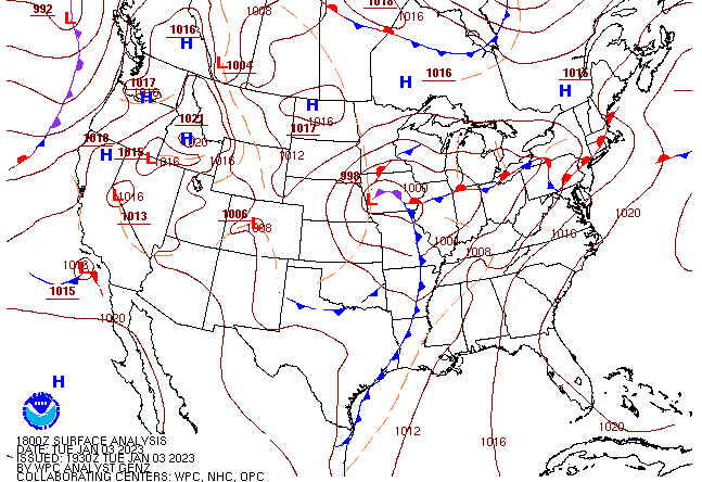
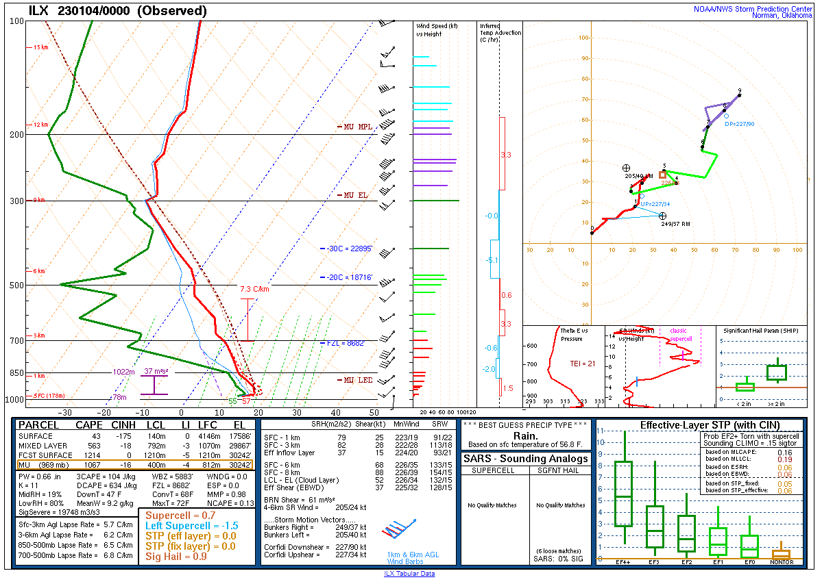
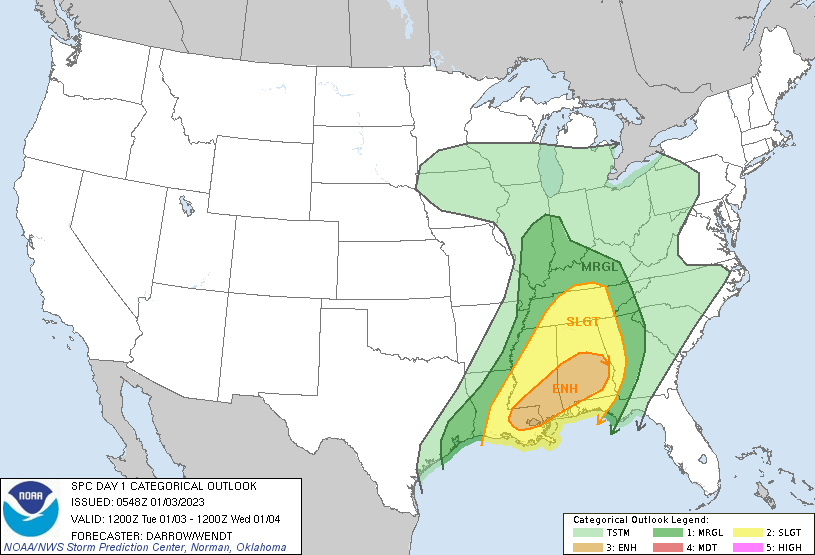
An occluded surface low was positioned over Iowa with a strong warm front stretched across northern Illinois and a cold front located just west of the Mississippi River by midday on Tuesday, January 3. Unseasonably warm, moist air was present in central Illinois south of the warm front with dewpoints well into the 60s (late spring levels) by the afternoon/early evening. Wind shear was modest near and south of the warm front with steep 6-7 degrees C/km lapse rates observed on the KILX January 4 00Z sounding. These ingredients created a favorable environment for rotating supercell storms that produced a handful of severe weather reports, including a few rare January tornadoes.
 |
 |
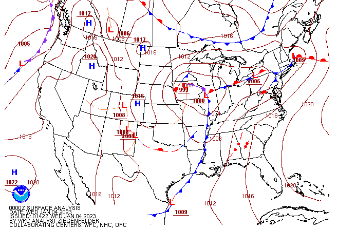 |
| Jan 3 10Z (4 am) surface map | Jan 3 1930Z (1:30 pm) surface map | Jan 4 02Z (8 pm Jan 3) surface map |
 |
 |
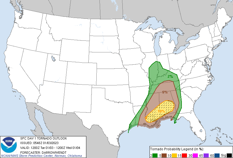 |
| KILX Jan 4 00Z sounding | Jan 3 12Z Thunderstorm Outlook | Jan 3 12Z Tornado Outlook |
 |
Media use of NWS Web News Stories is encouraged! Please acknowledge the NWS as the source of any news information accessed from this site. |
|


.jpg)
.jpg)
.jpg)
.JPG)
.jpg)
.jpg)