Overview

A surface low that deepened over the central Plains states sent a warm front surging through the area on Tuesday, April 4. This largely placed central Illinois in a warm, moist airmass where temperatures climbed into the low to mid 80s and dewpoints in the mid to upper 60s. Plenty of CAPE (convective available potential energy) and wind shear were in place, but a few limiting factors prevented storms from firing during the afternoon hours. These were: 1) no source of lift/frontal boundary and 2) a strong CAP or "lid" was in place, which is a layer of warmer air above the surface that prevents storms from developing.
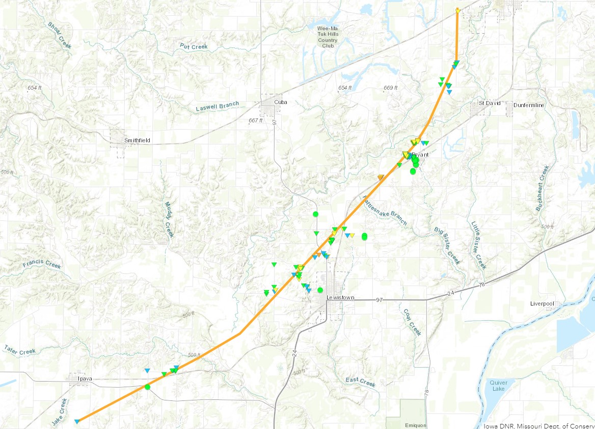
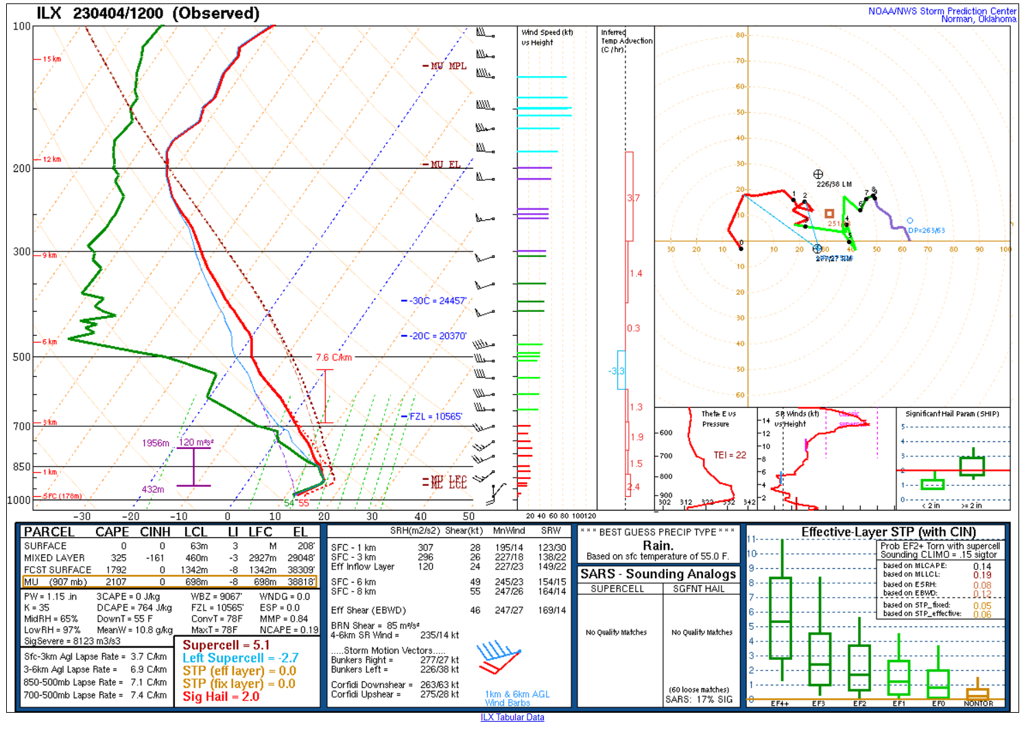
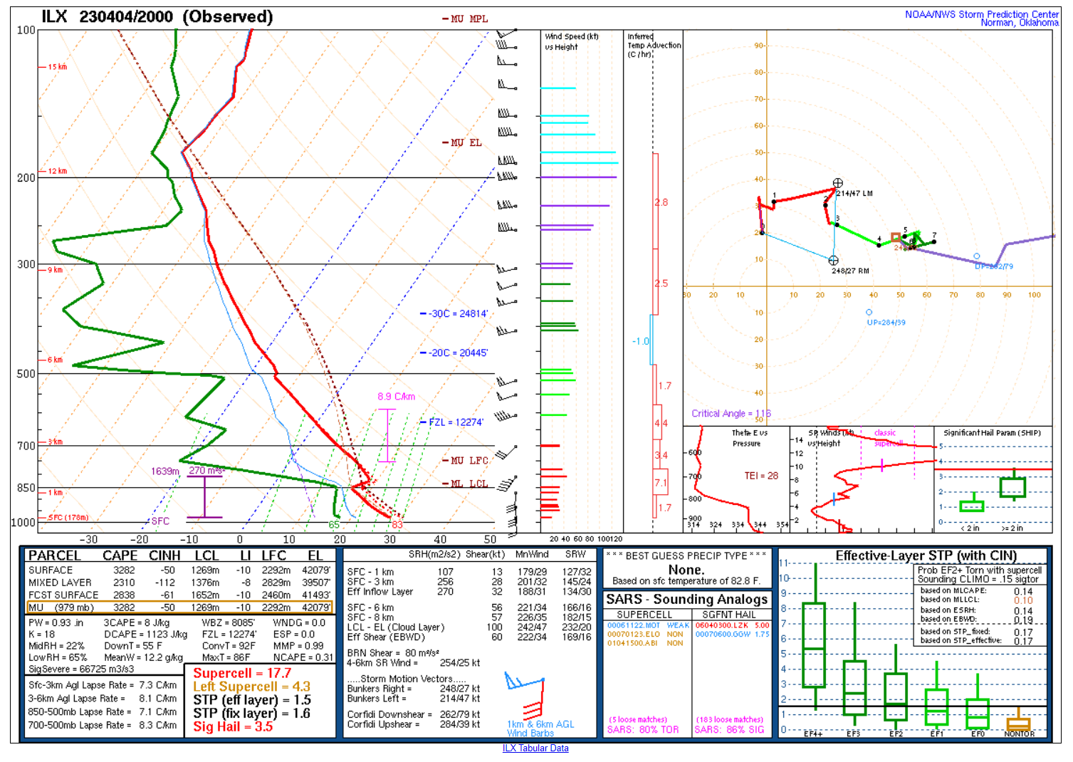
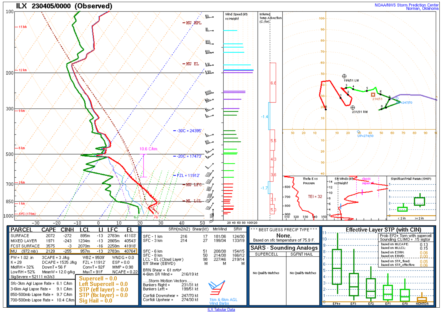
By late afternoon, the CAP started to erode west of the Illinois River as a subtle upper wave approached from the west. A handful of supercell thunderstorms developed over Missouri and tracked northeast, approaching parts of west-central Illinois by the evening hours. The storms were being fueled by strong instability (3000+ J/kg) and wind shear (50+ kt) as seen on a special 3 pm/20z balloon launch we conducted that afternoon. The first supercell entered Schuyler County just after 5 pm, lifting north along the Illinois River Valley toward Peoria before dissipating as it approached a stronger capped environment. A few supercell thunderstorms that tracked between Burlington, IA and Quincy, IL congealed into one massive supercell, strengthening as it entered Fulton County around 7 pm. The supercell went on to produce baseball sized hail and a few tornadoes, one of which was a long-track EF-3 with peak winds estimated near 160 mph near Lewistown and Bryant in Fulton County. The supercell storm weakened as it moved into eastern Tazewell and Peoria counties, eventually dissipating over Woodford County due to the lack of daytime heating, which strengthened the capping inversion.
Tornadoes:
|
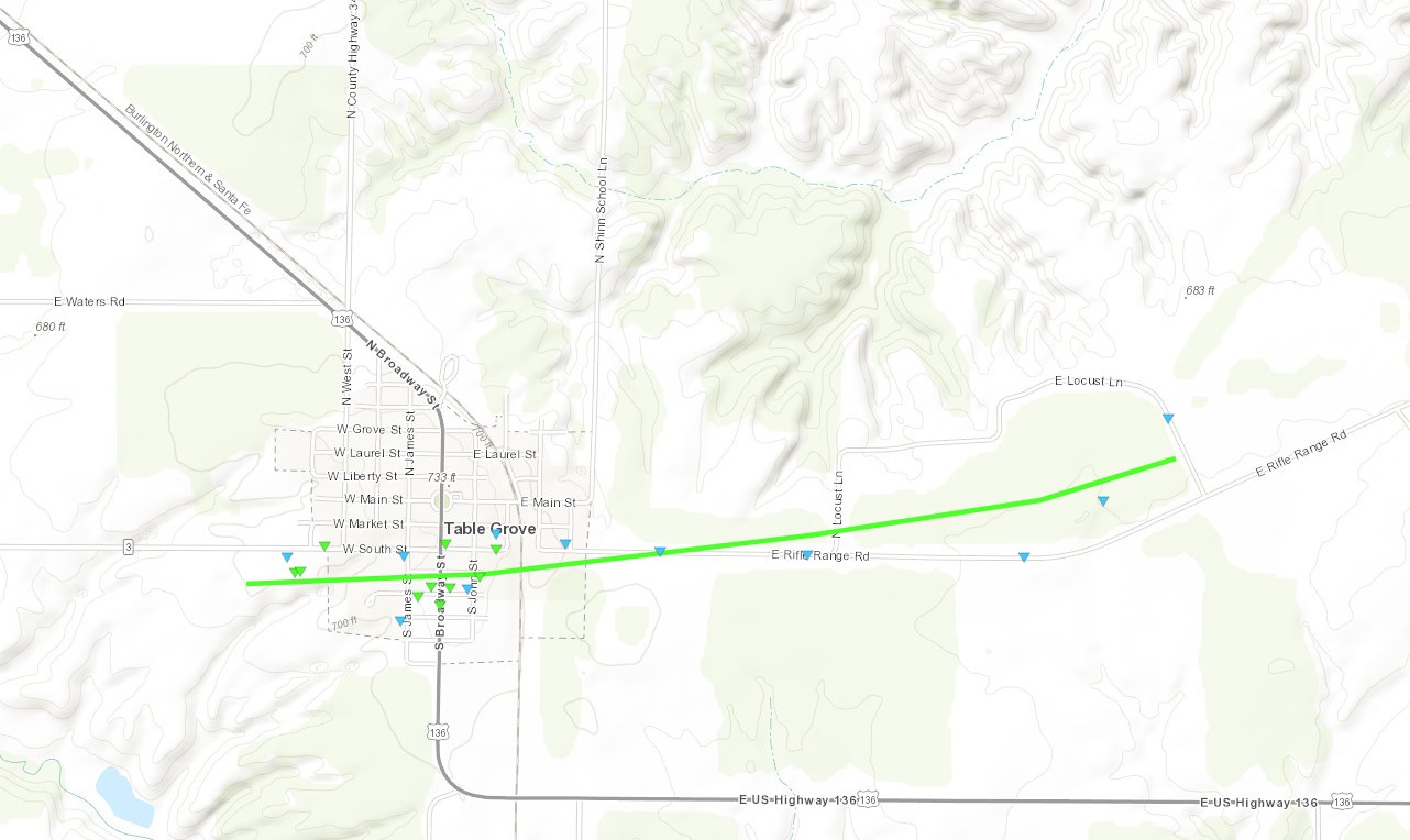
Table Grove Tornado #1
|
||||||||||||||||
|
Lewistown/Bryant/Canton Tornado
|
||||||||||||||||
|
Table Grove Tornado #2
Track Map  
|
||||||||||||||||
|
Lewistown Tornado #2
Track Map 
|
||||||||||||||||
The Enhanced Fujita (EF) Scale classifies tornadoes into the following categories:
| EF0 Weak 65-85 mph |
EF1 Moderate 86-110 mph |
EF2 Significant 111-135 mph |
EF3 Severe 136-165 mph |
EF4 Extreme 166-200 mph |
EF5 Catastrophic 200+ mph |
 |
|||||
Photos & Video
Photos & Videos
 |
 |
 |
 |
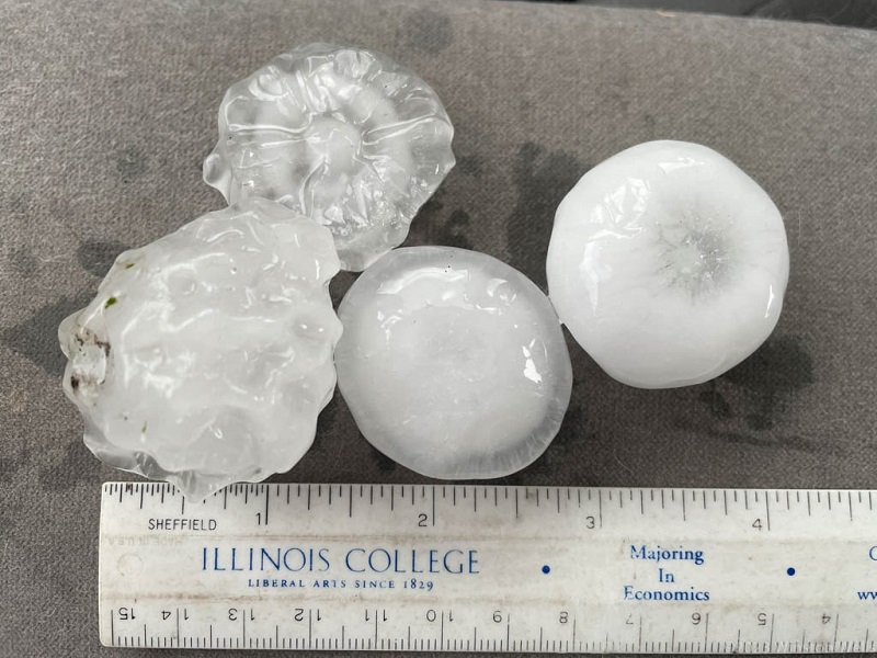
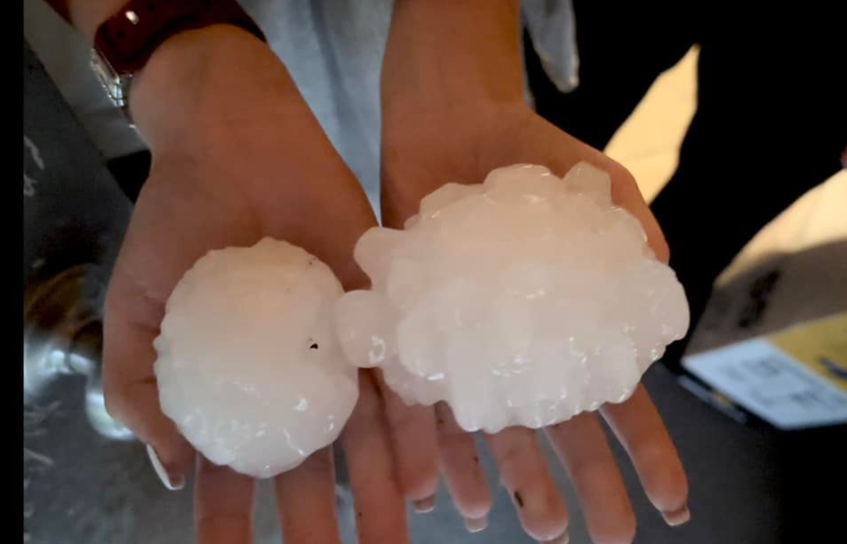
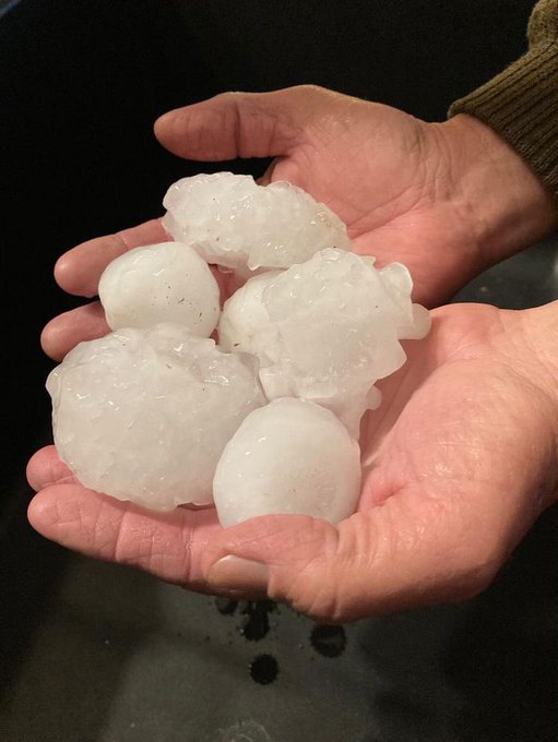
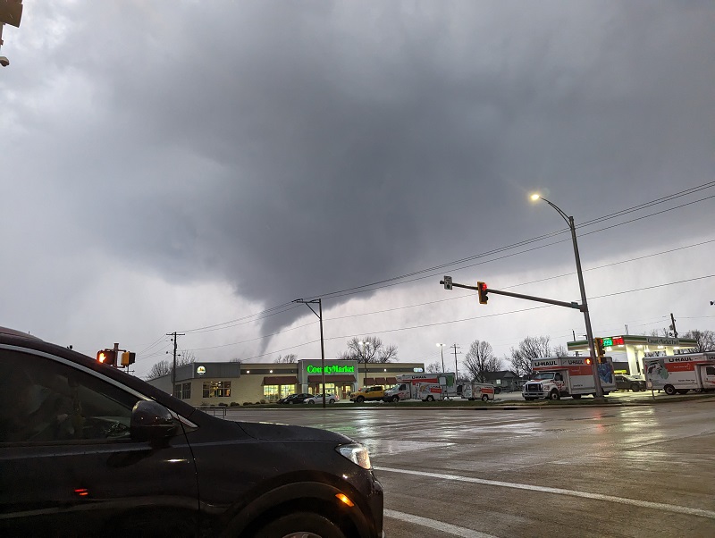
| 3.5 miles SW of Industry, IL near the Schuyler/McDonough county line (Wintston Wells) | Baseball to softball size hail in Bernadotte, IL (Matt Posey) |
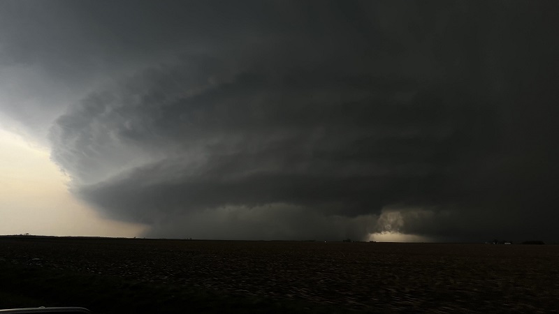
Hail up to the size of baseballs near Vermont, IL (Lisa & Clayton Kendrick) | Textbook supercell structure near Lewiston, IL (Robert Auberg) |
 |
 |
 |
 |
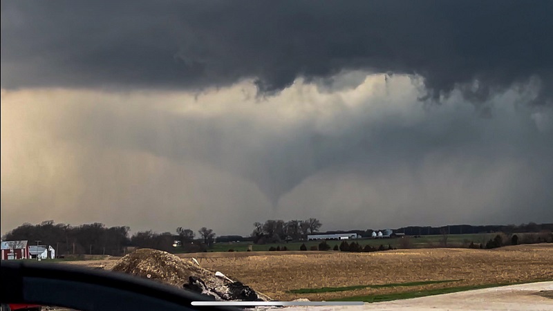
| Tornado near Lewiston, IL (Robert Auberg) |
Tornado WSW of Lewiston, IL just after 7:18 pm on Apr 4 (Brian Hastings) |
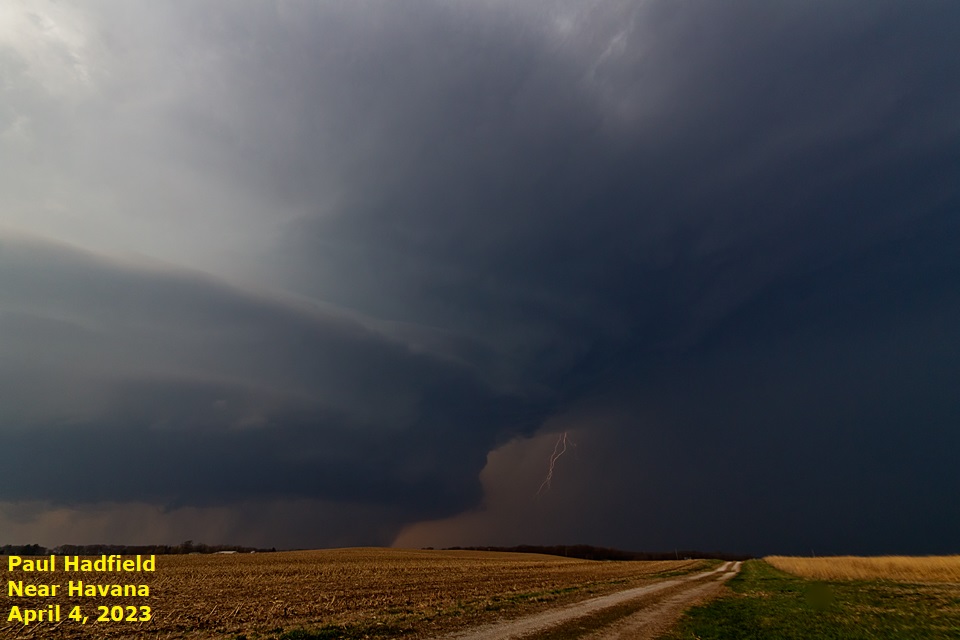
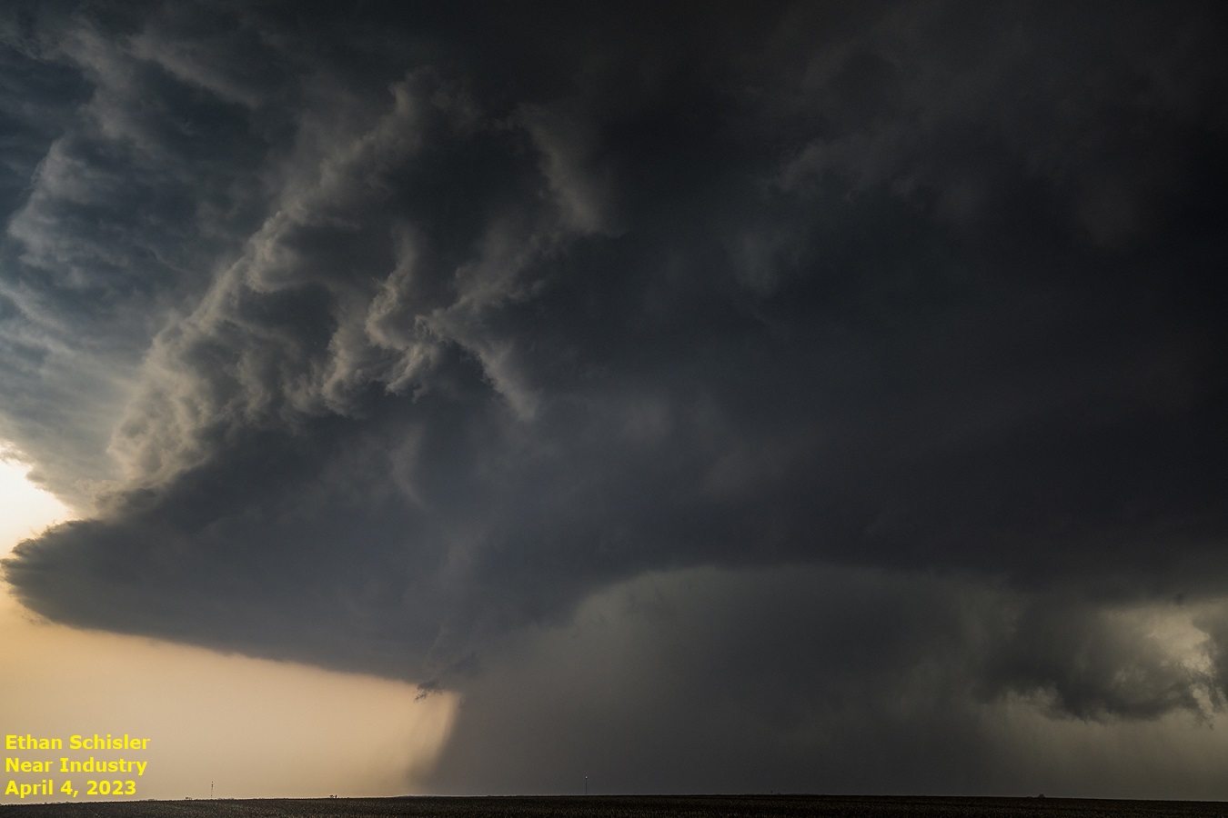
Supercell structure near Havana, IL (Paul Hatfield) | The strong supercell that went on to produce a handful of tornadoes when it was near Industry, IL (Ethan Schisler) |
 |
 |
 |
 |
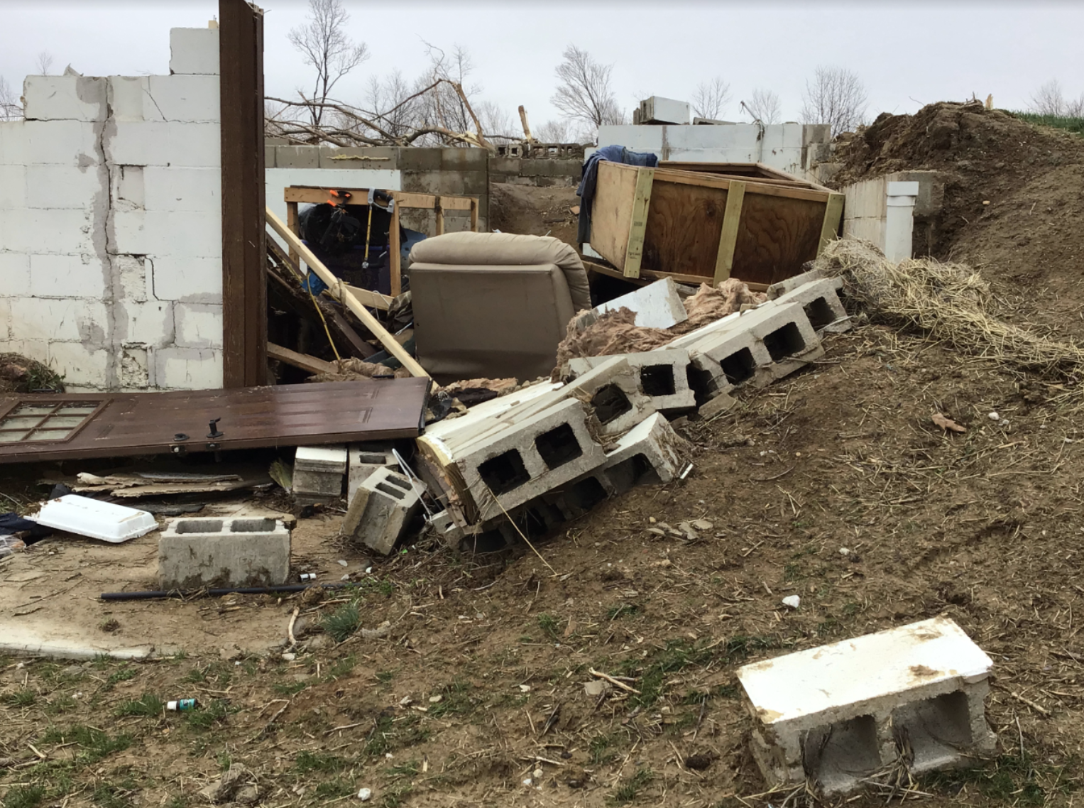
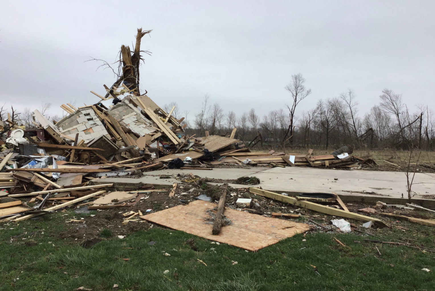
| EF-3 tornado damage north of Bryant, IL (NWS Lincoln) |
EF-3 tornado damage north of Bryant, IL (NWS Lincoln) |
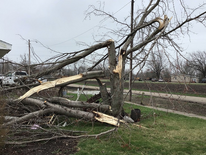
EF-2 tornado damage NW of Lewiston, IL (NWS Lincoln) | Tree twisted & snapped in multiple spots from tornado near Bryant, IL (NWS Lincoln) |
Radar
 |
 |
 |
|
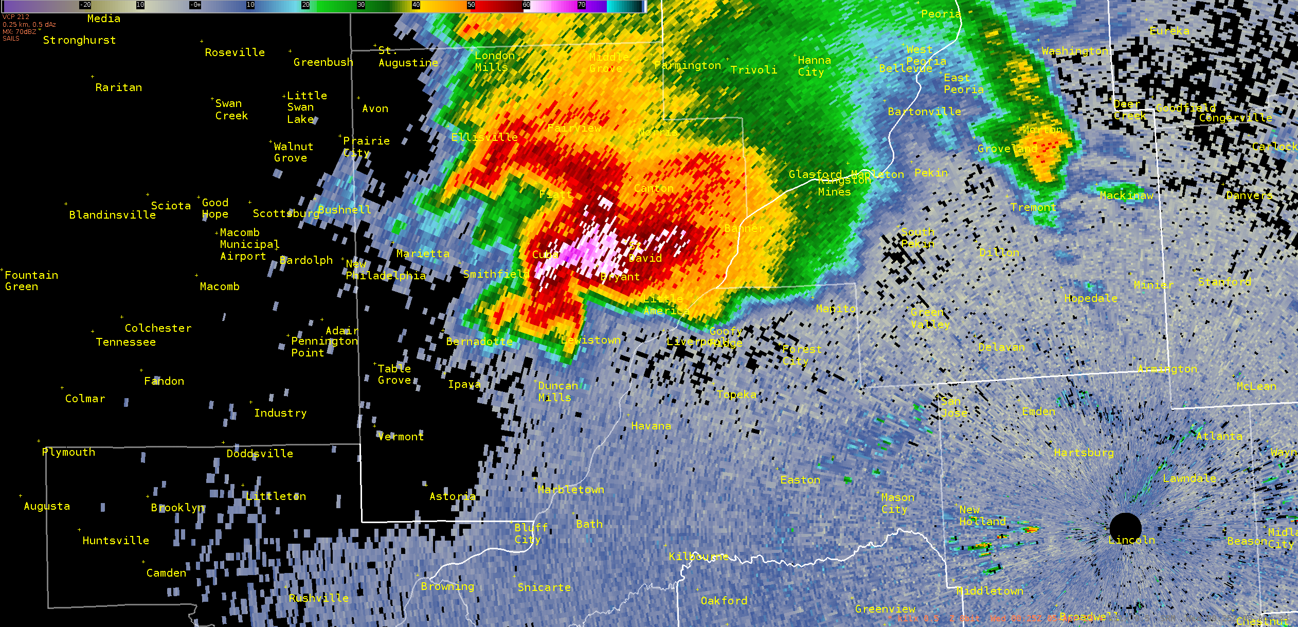
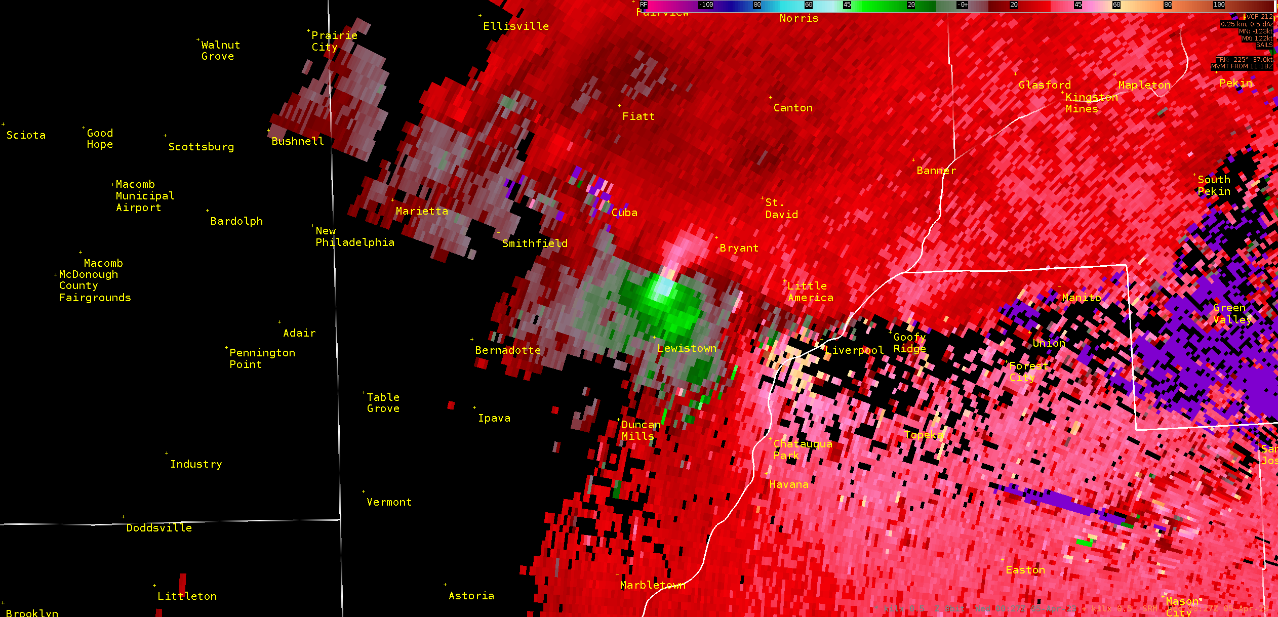
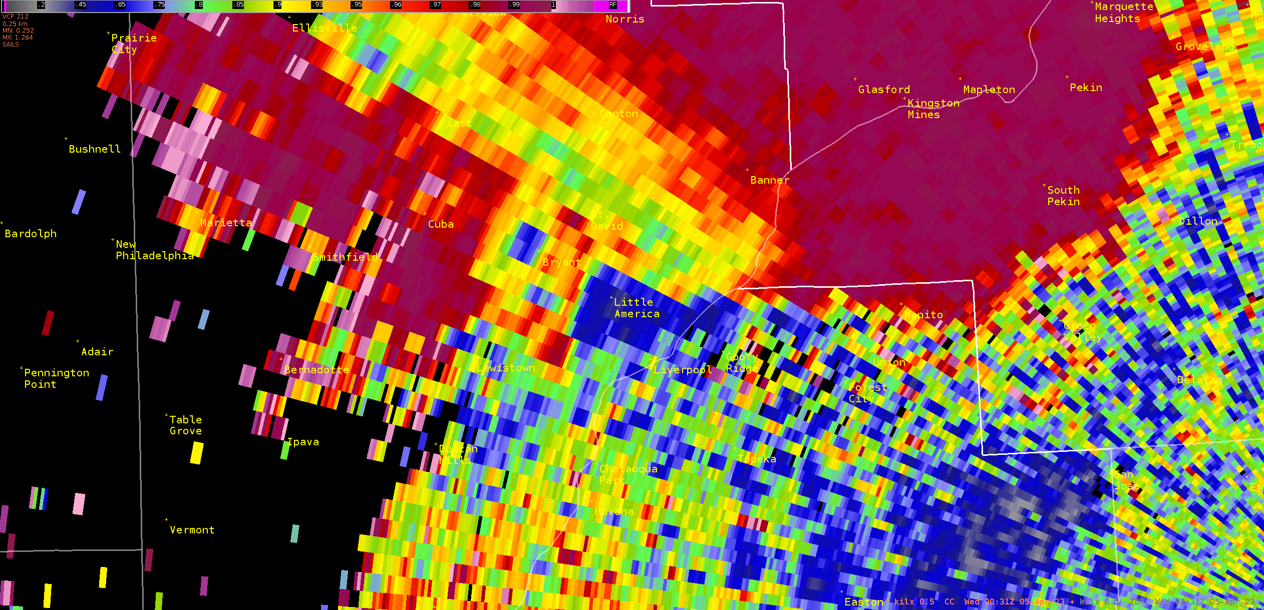
| KILX reflectivity at 7:25 pm when the tornado was near peak intensity between Lewistown and Bryant. | KILX storm relative velocity at 7:25 pm when the tornado was near peak intensity between Lewistown and Bryant. | KILX correlation coefficient at 7:31 pm. Dark blue area on the northwest side of Bryant indicating large size distribution of radar returns (tornado damage aloft). | Caption |
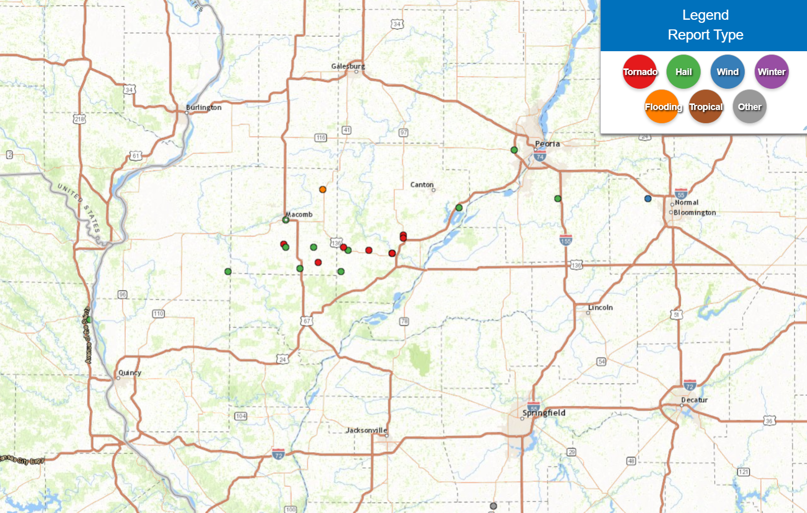
Storm Reports
An interactive webpage with preliminary storm reports can be found below and at this link. Reports are considered preliminary and are subject to change.
PRELIMINARY LOCAL STORM REPORT
NATIONAL WEATHER SERVICE LINCOLN IL
944 PM CDT TUE APR 4 2023
..TIME... ...EVENT... ...CITY LOCATION... ...LAT.LON...
..DATE... ....MAG.... ..COUNTY LOCATION..ST.. ...SOURCE....
..REMARKS..
0808 PM HAIL BELLEVUE 40.69N 89.68W
04/04/2023 M1.50 INCH PEORIA IL AMATEUR RADIO
0703 PM HAIL TABLE GROVE 40.37N 90.42W
04/04/2023 M2.75 INCH FULTON IL PUBLIC
0704 PM TSTM WND DMG VERMONT 40.29N 90.43W
04/04/2023 FULTON IL AMATEUR RADIO
POWERLINES DOWN.
0705 PM HAIL VERMONT 40.29N 90.43W
04/04/2023 M2.75 INCH FULTON IL STORM CHASER
MULTIPLE CHASERS HAVE BUSTED WINDSHIELDS DUE
TO BASEBALL SIZE HAIL NEAR VERMONT.
0707 PM TSTM WND DMG TABLE GROVE 40.37N 90.42W
04/04/2023 FULTON IL PUBLIC
TREES AND POWERLINES DOWN; POSSIBLE TORNADO.
0707 PM TORNADO TABLE GROVE 40.37N 90.42W
04/04/2023 FULTON IL BROADCAST MEDIA
0714 PM TORNADO 1 NE IPAVA 40.36N 90.31W
04/04/2023 FULTON IL PUBLIC
0718 PM TORNADO 1 NW DUNCAN MILLS 40.35N 90.21W
04/04/2023 FULTON IL TRAINED SPOTTER
0724 PM TORNADO 1 N LEWISTOWN 40.41N 90.16W
04/04/2023 FULTON IL AMATEUR RADIO
0725 PM TORNADO LEWISTOWN 40.40N 90.16W
04/04/2023 FULTON IL AMATEUR RADIO
STRUCTURAL DAMAGE ON THE NORTH SIDE OF TOWN.
0725 PM TORNADO LEWISTOWN 40.40N 90.16W
04/04/2023 FULTON IL PUBLIC
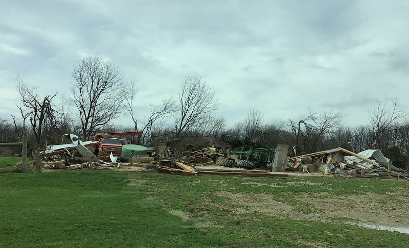
PHOTO FROM SOCIAL MEDIA SHOWS MANGLED FARM
EQUIPMENT IN THE ROAD.
0725 PM TORNADO 1 N LEWISTOWN 40.41N 90.16W
04/04/2023 FULTON IL AMATEUR RADIO
MULTIPLE BUILDINGS DAMAGED, WITH DEBRIS IN
THE ROAD NORTH OF LEWISTOWN.
0725 PM TORNADO 1 N LEWISTOWN 40.41N 90.16W
04/04/2023 FULTON IL EMERGENCY MNGR
0727 PM TORNADO 1 N LEWISTOWN 40.41N 90.16W
04/04/2023 FULTON IL TRAINED SPOTTER
SPOTTER REPORTED LARGE CONE JUST NORTH OF
LEWISTOWN, WITH A SECOND TORNADO FURTHER
EAST.
0741 PM HAIL 1 SW BANNER 40.50N 89.92W
04/04/2023 M1.75 INCH FULTON IL AMATEUR RADIO
Environment
The Forecast
 |
 |
 |
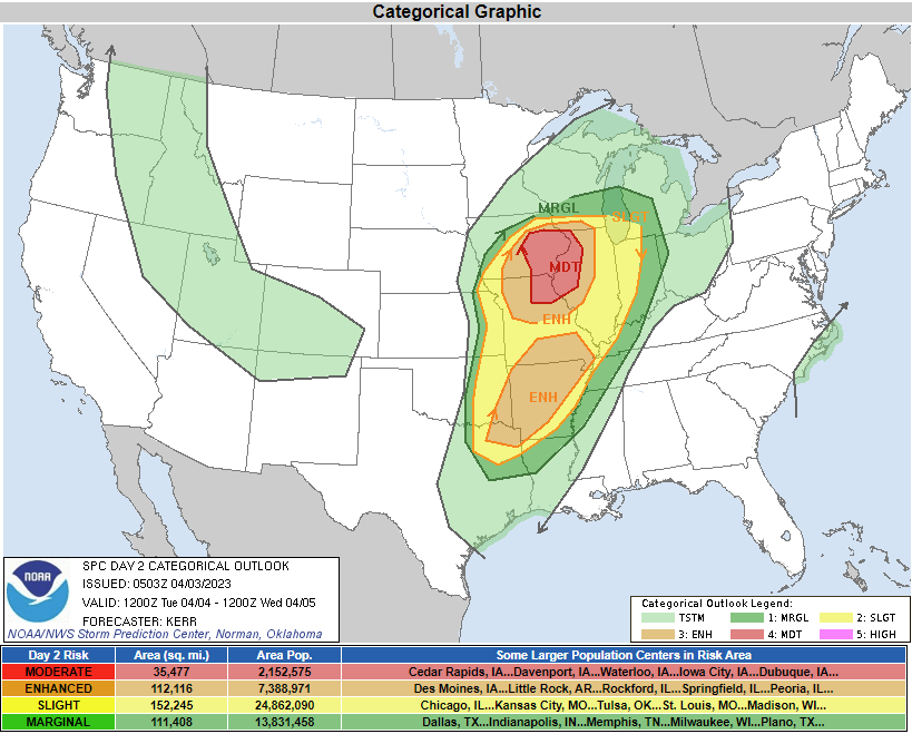 |
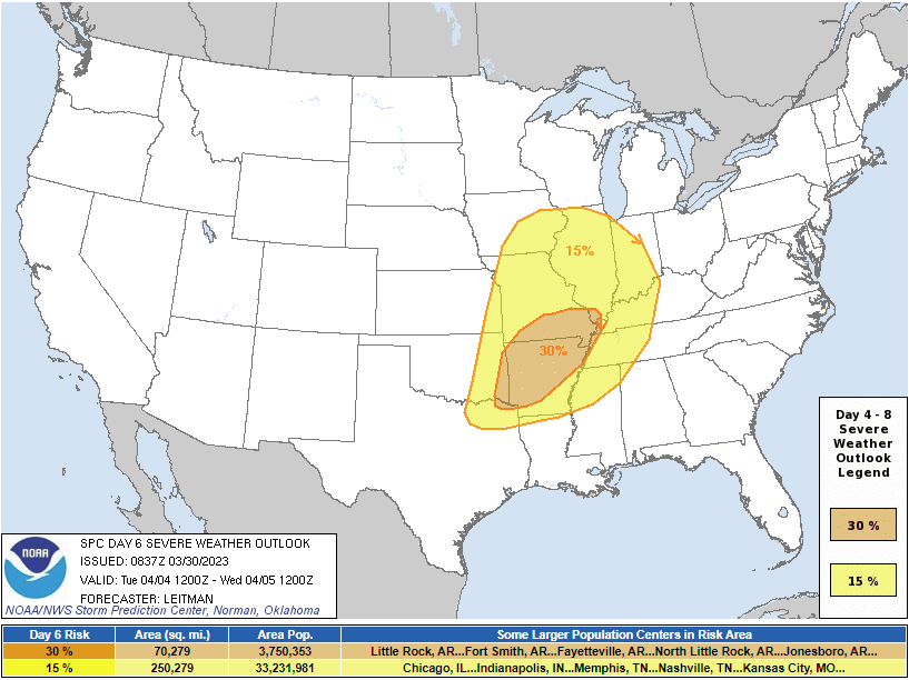
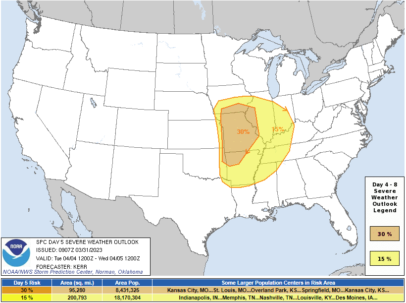
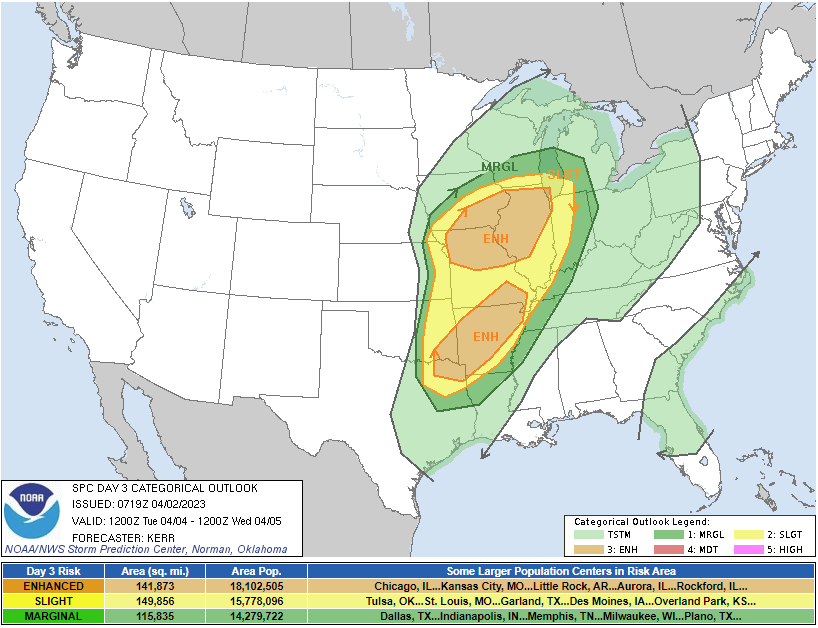
| SPC Day 6 Categorical Outlook | SPC Day 5 Probabilistic Outlook | SPC Day 3 Categorical Outlook | SPC Day 2 Probabilistic Outlook |
 |
 |
 |
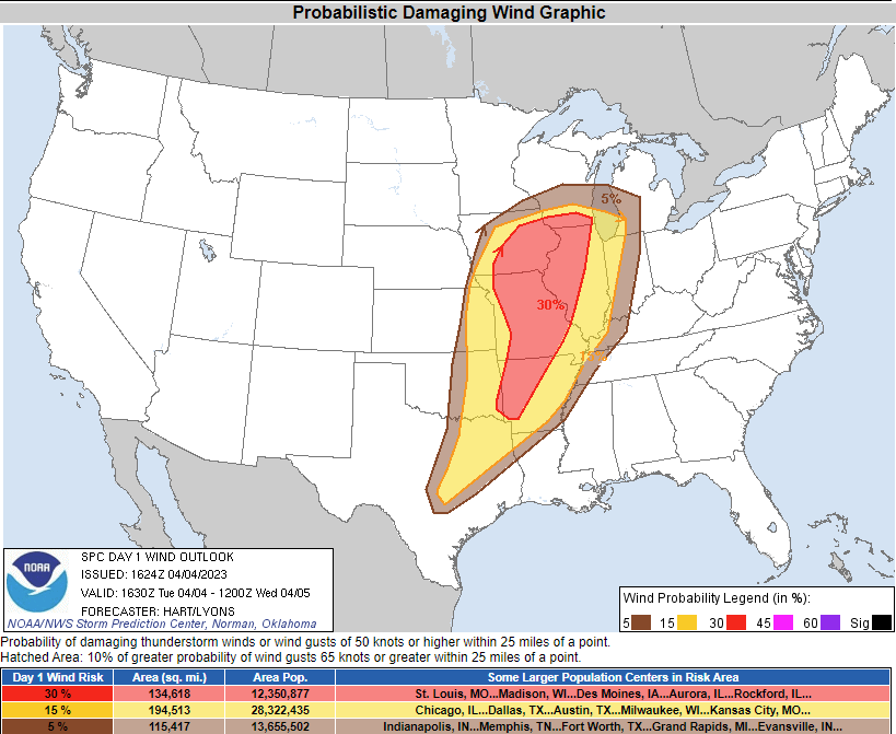 |
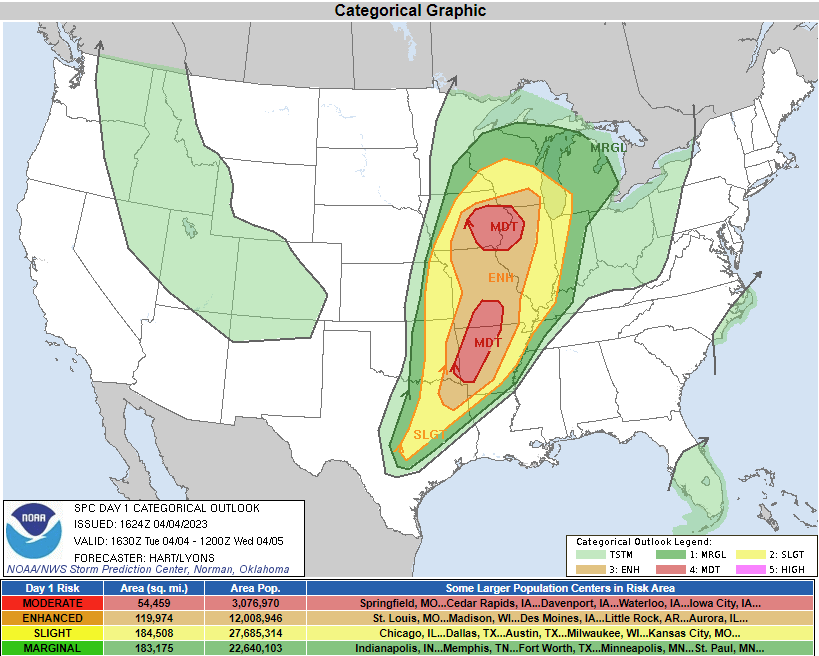
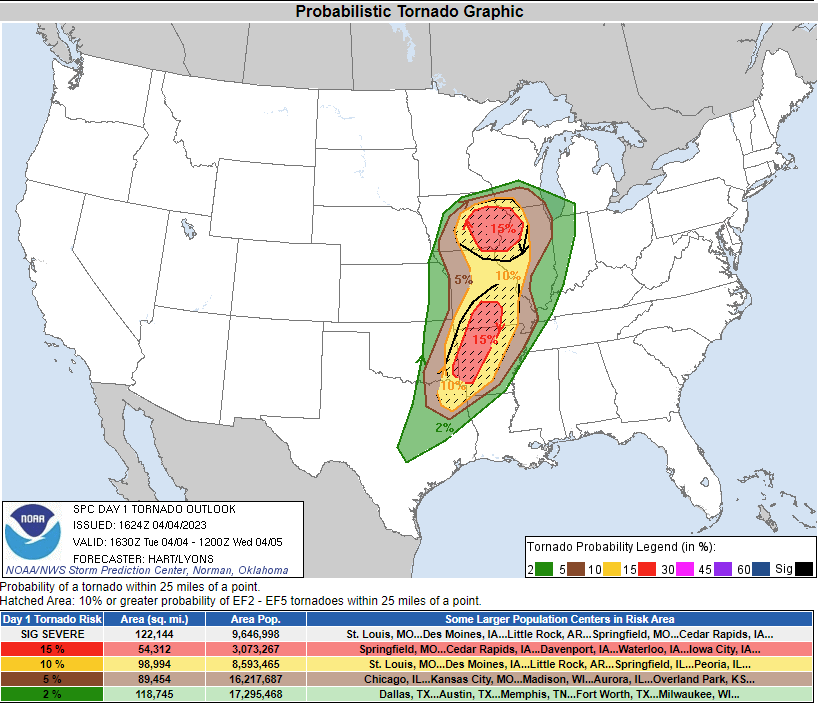
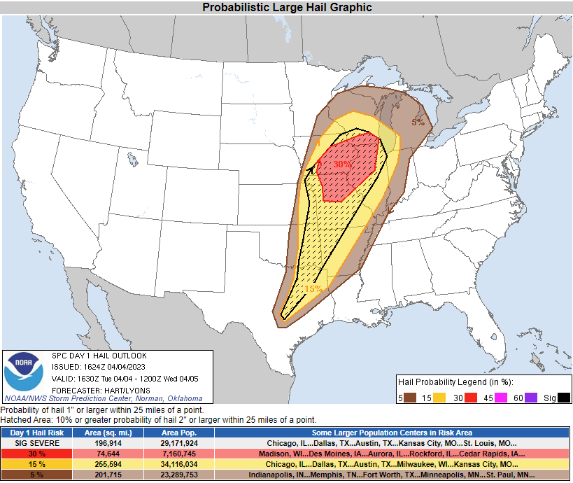
| SPC Day 1 Categorical Outlook | SPC Day 1 Tornado Outlook | SPC Day 1 Hail Outlook | SPC Day 1 Wind Outlook |
 |
 |
 |
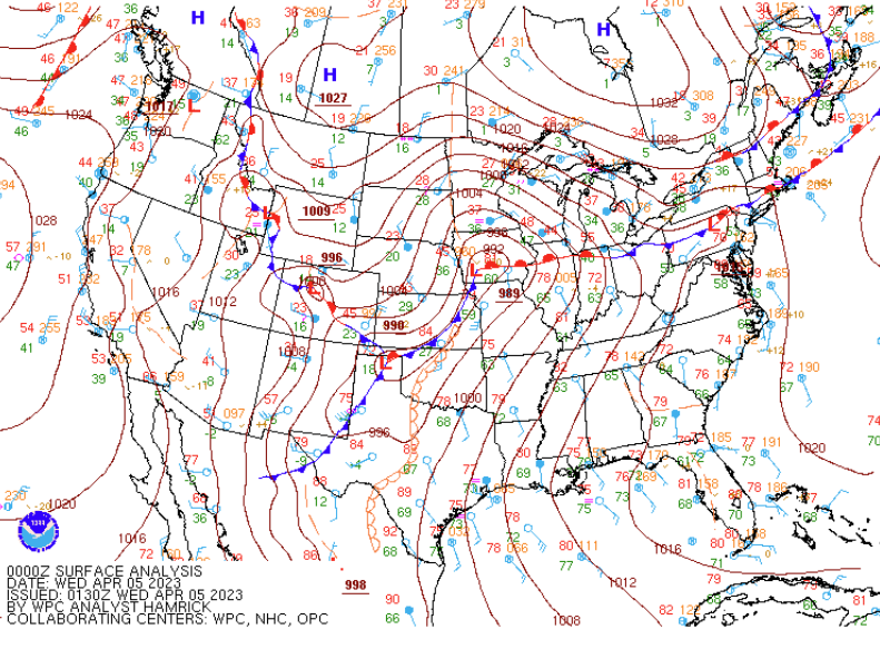 |
| 12z Sounding | 20z Sounding | 00z Sounding | WPC's Surface Analysis |
Warning Lead Time
| Counties & Issuance Time | Lead Time |
Summaries from other NWS Offices
 |
Media use of NWS Web News Stories is encouraged! Please acknowledge the NWS as the source of any news information accessed from this site. |
|