Overview
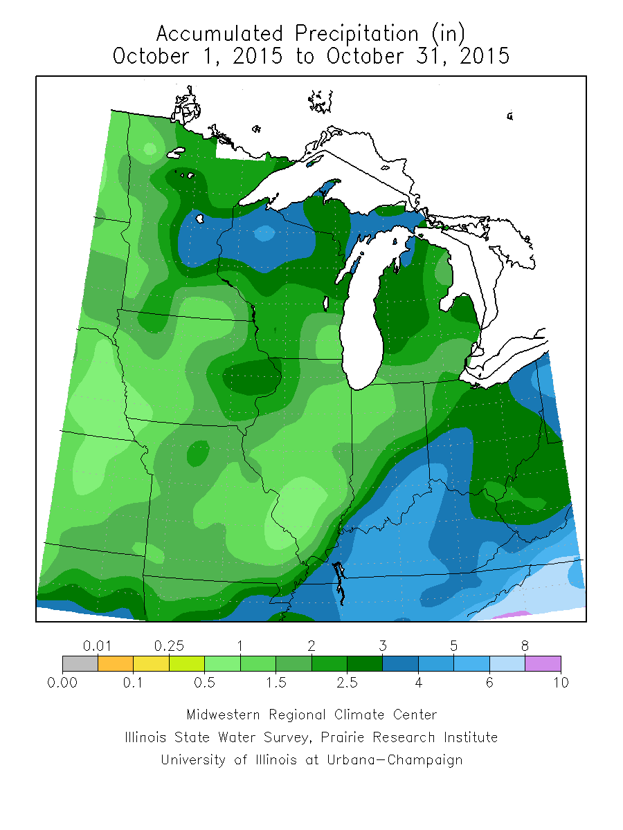
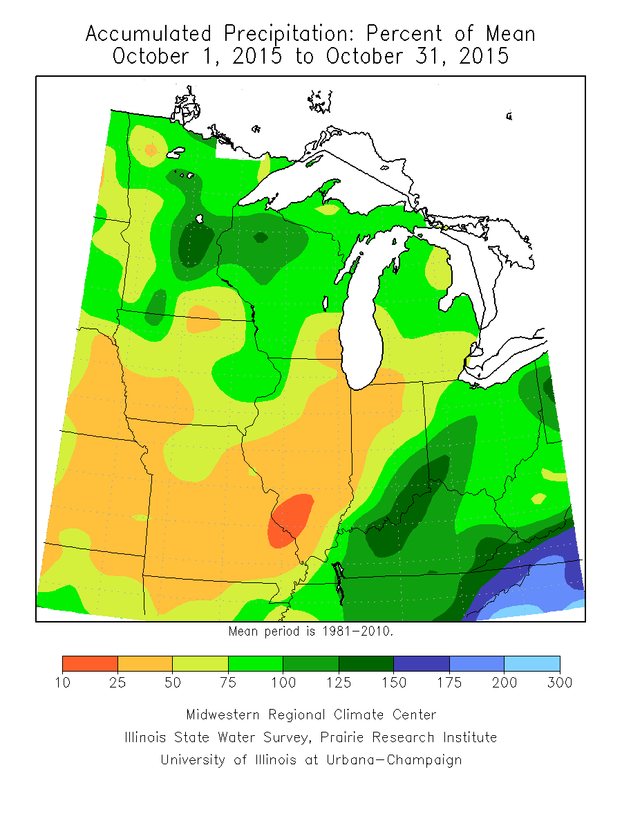
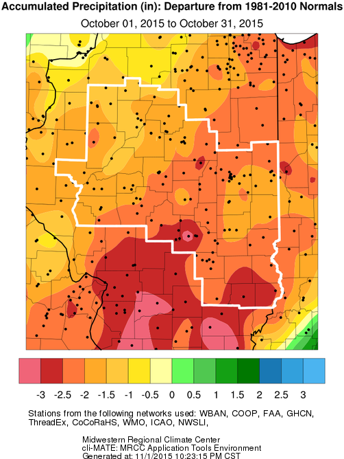
October featured well below normal rainfall, and slightly above normal temperatures across central and southeast Illinois. A stretch of dry weather which began in mid-September, continued into late October for much of the area. With little to no rain falling in many locations for over a month, abnormally dry to moderate drought conditions developed. The worst of the drought conditions extended from west-central Illinois, eastward in a narrow corridor including Springfield, Lincoln, Decatur, Mattoon, and Paris.
Some beneficial rains did occur with a weather system which moved through the area on October 27-28. Rain spread in from the south as low pressure lifted north from Louisiana toward the region. With an upper level disturbance approaching from the west, and rich moisture with both Pacific and Gulf origin, rain spread across the area. The heaviest rain occurred during the late afternoon and evening of the 27th, with another round of heavier rain and even a few thunderstorms across east-central Illinois during the pre-dawn hours of the 28th. Rain totals were generally between one-half and one inch, but several locations along and east of I-57 received in excess of one inch. Another widespread rain occurred on the 31st, when one-quarter to three-quarters of an inch fell ahead of a weak frontal boundary. Even with these rain events, monthly totals were less than half of normal for much of the area.
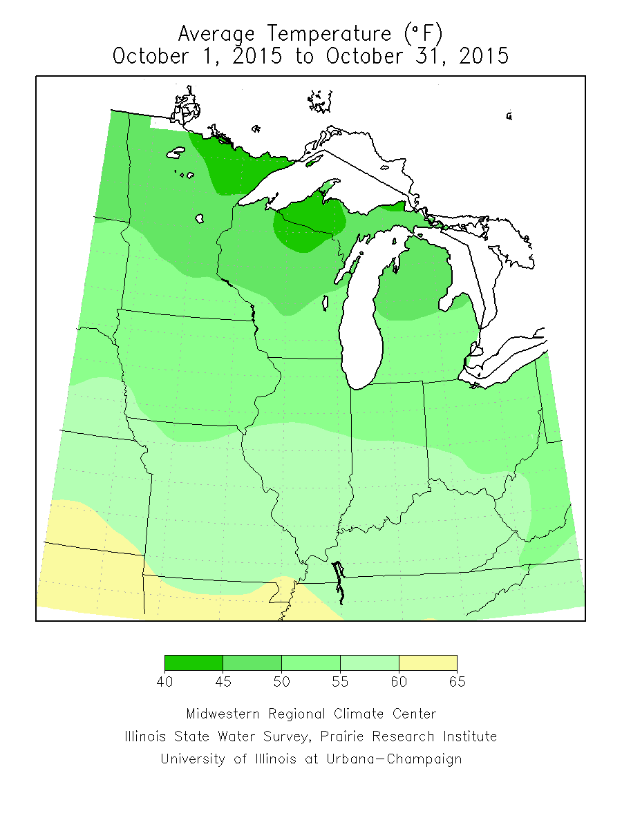
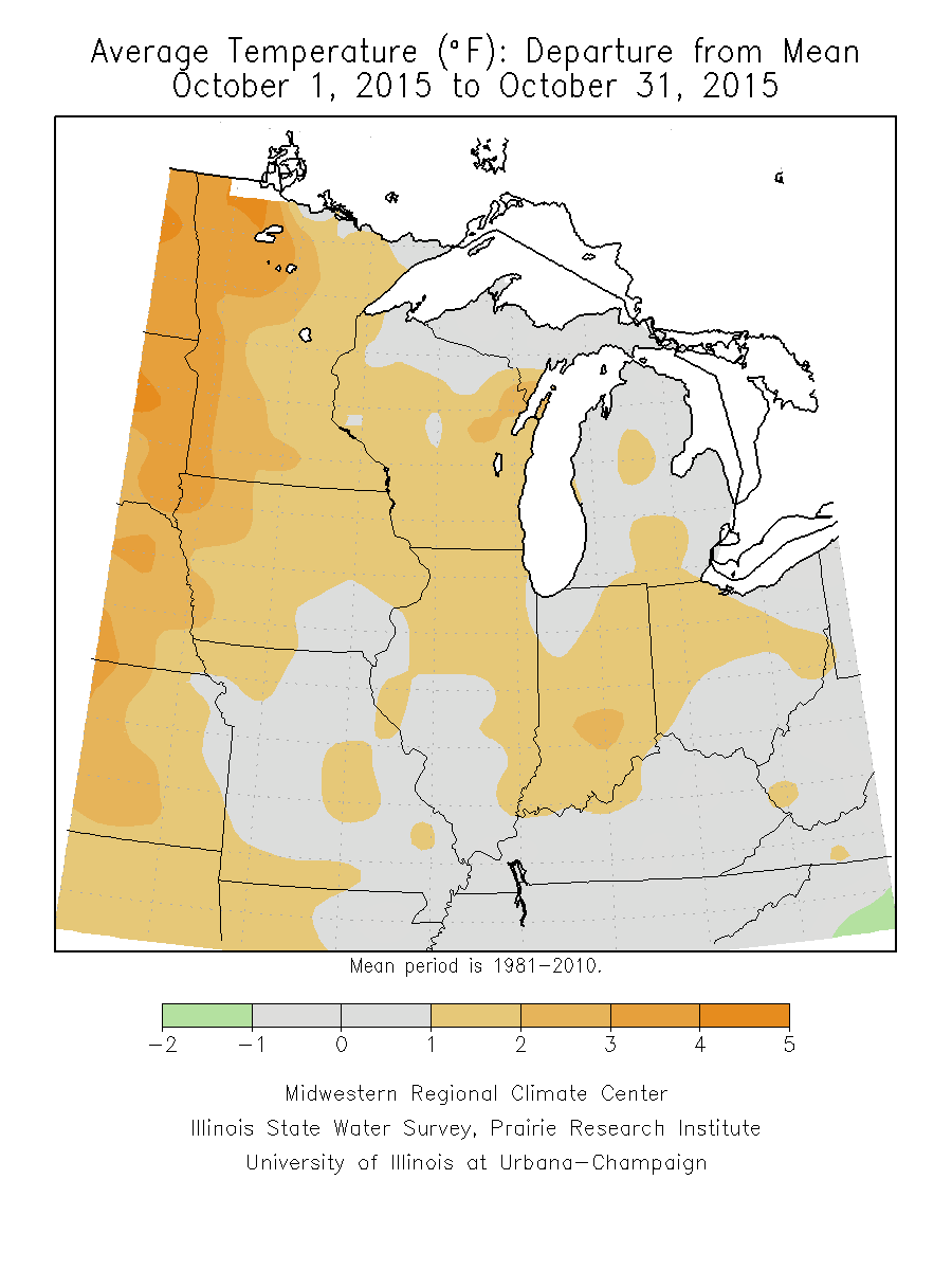
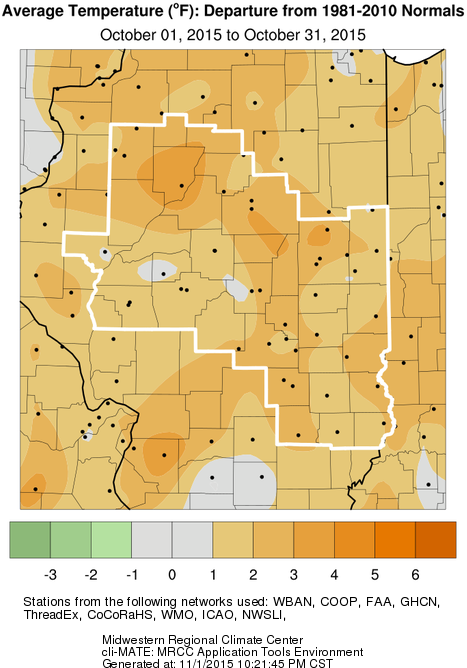
Temperatures were generally a degree or two above normal for the monthly average. The first sub-freezing temperatures of the season were observed on October 17th & 18th, when many locations saw morning lows in the mid to upper 20s. This ended the growing season across the region.
Rainfall
Temperatures
Climate Data
The table below summarizes October rainfall and temperature, and departure from normal for selected cities across central and southeast Illinois. Data from Peoria and Springfield are from ASOS sites, while others are from NWS Cooperative Observers.
| Site |
Rainfall |
Departure from Normal | Average Temperature |
Departure from Normal |
| Danville |
1.81" |
-1.76" | 57.4 | +2.4 |
| Decatur |
1.54" |
-1.71" | 56.7 | +0.5 |
| Effingham |
1.40" |
N/A | 57.8 | N/A |
|
Flora |
1.46" | -2.21" | 58.0 | +2.7 |
| Galesburg |
1.29" |
-1.46" | 54.0 | +1.5 |
|
Jacksonville |
1.21" | -1.80" | 56.3 | +2.1 |
| Lincoln |
1.64" |
-1.44" | 55.0 | +1.2 |
|
Mattoon |
1.27" | -2.29" | N/A | N/A |
|
Normal |
1.43" |
-1.89" | 55.0 | +1.9 |
|
Olney |
0.87" | -3.12 | 57.8 | +1.6 |
|
Paris |
1.43" | -1.95" | 56.9 | +2.1 |
| Peoria |
2.01" |
-0.83" | 58.3 | +4.3 |
| Springfield |
1.47" |
-1.68" | 57.2 | +2.1 |
| Urbana |
2.02" |
-1.24" | 56.2 | +2.3 |
Links below are the monthly climate summaries for area cities. Only the summaries for Peoria, Springfield and Lincoln are considered "official", meaning they are the station of record for their respective locations. The other summaries are "supplemental", meaning another location in the area is the official climate station for that city.
Climate data for other area cities is available at http://www.nws.noaa.gov/climate/xmacis.php?wfo=ilx

