May Precipitation Highlights:
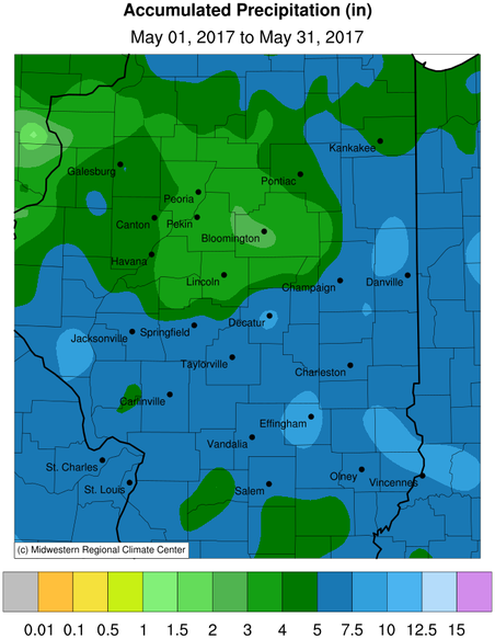
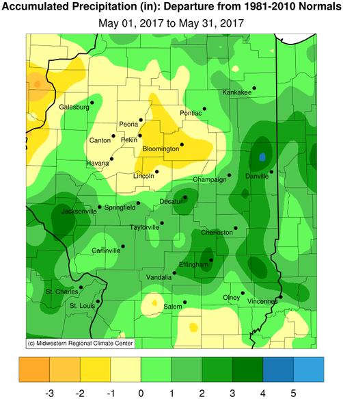
- Rainfall was above to well above normal along and south of a Jacksonville to Danville line. Monthly totals of 5 to 8 inches were common in these areas, with some of the wetter locations including Decatur and Effingham seeing double their normal May rainfall. Farther north over the remainder of central Illinois, conditions were drier with monthly totals around an inch below normal.
May Temperature Highlights:
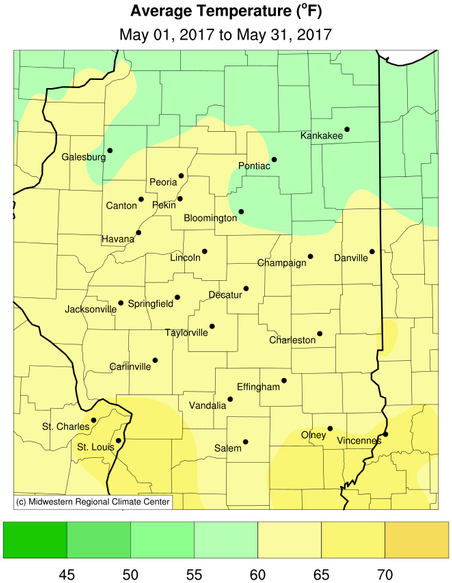
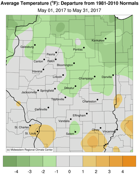
- May 2017 reversed the trend of above normal temperatures across the region. Average temperatures were generally near normal over west central and southeast Illinois, and 1 to 2 degrees below normal along and northeast of the I-74 corridor.
- There was only one notable stretch of above normal temperatures from May 14-18, when readings were 10 to 15 degrees above normal with highs in the mid to upper 80s. The rest of the month saw temperatures near, to several degrees below normal.
May Weather Event Highlights:
- Severe weather events occurred on the 10th and 26th. On the 10th, a line of thunderstorms produced wind damage and locally heavy rain in a corridor from west central Illinois, east-southeast through east central and southeast Illinois during the early evening. On the 26th, mid to late afternoon storms produced large hail and damaging winds north of the I-74 corridor.
- A very rare dust storm affected central Illinois from the mid afternoon through mid evening hours on Wednesday, May 17. Several factors combined to produce significant blowing dust, which reduced visibility to near zero for several hours in open areas. The low visibility caused numerous traffic accidents and closures of interstates including I-72 from Jacksonville to Springfield, and I-74 from McLean to near Bloomington, as well as numerous state routes across the central part of the state.
Rainfall and Temperature Maps:
Climatological Statistics for May and Spring Season:
The following links are the monthly and seasonal climate summaries for area cities. Only the summaries for Peoria, Springfield, and Lincoln are considered "official", meaning they are the station of record for their respective locations. The other summaries are "supplemental", meaning another location in the area is the official climate station for the city.
- Peoria: (May) (Spring) -- Peoria International Airport
- Springfield: (May) (Spring) -- Abraham Lincoln Capital Airport
- Lincoln: (May) (Spring) -- NWS Office
- Champaign: (May) (Spring) -- University of Illinois-Willard Airport
- Decatur: (May) (Spring) -- Decatur Airport
- Lawrenceville: (May) (Spring) -- Lawrenceville-Vincennes International Airport
- Mattoon: (May) (Spring)-- Coles County Memorial Airport
Climate data for other cities is available at https://www.weather.gov/climate/xmacis.php?wfo=ilx
----------------------------------------------------------------------------------------------------------------------------------------------------------------------------
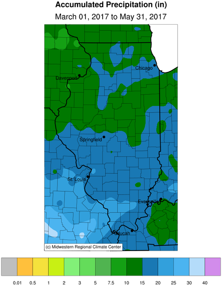
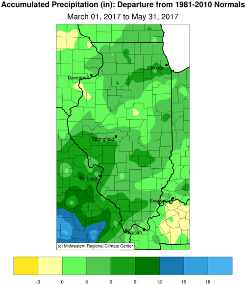
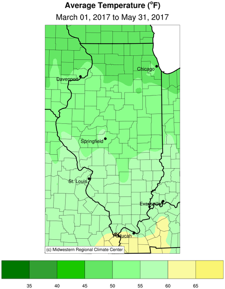
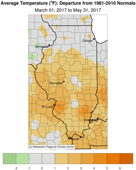
Spring Season (March through May) Key Points:
- The spring season saw above normal precipitation, with most areas receiving between 10 and 16 inches. This was 2 to 6 inches above normal. Peoria recorded its 8th wettest spring, with 15.83".
- Continuing the trend of recent seasons, temperatures were 1 to 3 degrees above normal. Springfield saw its 10th warmest spring, with an average temperatures of 56.4 degrees.
Spring Season Precipitation and Temperature Maps: