Little to no rain has fallen over much of central Illinois this month. In fact, a dry weather pattern has been in place since the last week of May. In addition to the recent dryness, highs in the mid-80s to mid-90s along with low humidity levels and breezy winds have further dried soils. If dry and hot weather persists, the potential exists for drought conditions to quickly develop. Droughts can develop quickly in early summer when the sun angle and temperatures are high. These quick-developing droughts are referred to as flash droughts. In these droughts vegetation becomes stressed in a short time. This occurred in the summer of 2012.
One way dryness can be assessed is through a water balance report, which is available from select stations in the CoCoRaHS network. The chart below shows the water balance deficit for Homer in Champaign Co. this month.
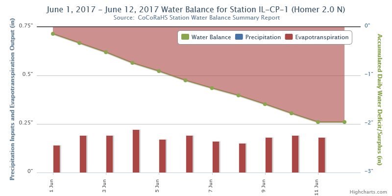
Through the first 11 days of the month, daily evapotranspiration (evaporation from ground plus transpiration from plants) was near 0.20"/day, while no rain fell. This produced a cumulative deficit in the water balance over 2". If these conditions continue, significant losses to soil moisture will occur, which would put additional stress on vegetation.
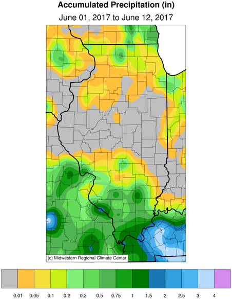
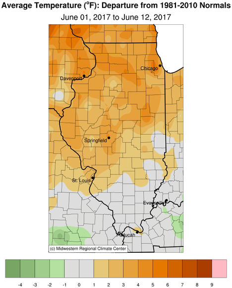
Images below show accumulated rainfall and temperature departure so far in June. No rain has fallen over much of central Illinois, while temperatures have been 2-4 degrees above normal.
Will conditions improve? Rain chances return to the forecast for mid-week and again this weekend. The latest CPC outlooks slightly favor above normal precipitation in the 6-10 day forecast (June 18-22) and near normal precipitation in the 8-14 day outlook (June 20-26). Temperature outlooks for the 1-2 week forecast favor below normal. If these forecasts verify, the prospects for a flash drought would lessen.

